Mushrooms of Finger Lake

During our trek to the Taughannock Falls in the Finger Lake area of New York State, I came across some very interesting mushrooms. Roughly 75 people in North America are poisoned each year by mushrooms, often from eating a poisonous species that resembles an edible species. The advice to all is Don’t eat any mushroom in the wild! Avoid touching them too!!!

This is Russula cystidiosa, an oak-loving red mushroom with a bright red cap, a white stem, and a creamy to yellowish spore print.

Megacollybia Platyphylla is a medium-sized mushroom that grows mainly on coniferous deadwood. It can be identified by its white spore print, brown to gray-brown cap, and a stem base often attached to white cords.

Albomagister – meaning Mr White in Italian – the name comes from its texture – is a genus of fungi in the family Tricholomataceae and this family has only one species. 

Polyporus Squamosus is an edible mushroom and is also known as Pheasants Tail as the pattern on the top of the cap that resembles pheasant’s feathers.

Leucocoprinus is a genus of fungi in the family Agaricaceae, an yellow mushroom with white spore prints.

Powder-puff Bracket (Postia Ptychogaster) is a species of fungus in the family Fomitopsidaceae. The fungus resembles a powdery cushion that grows on stumps and logs of rotting coniferous wood.

Turkey Tail fungus (Trametes versicolor ) grows on dead logs with concentric brown rings akin to a turkey’s tail. The fungus has been used in traditional Chinese medicine for many years to treat pulmonary diseases.

Ramaria Stricta, commonly known as Coral Mushroom. The name Ramaria is derived from Ram– meaning branch –aria meaning furnished with – as these mushrooms are furnished with numerous branches.

Frosted Lichens grows on hardwoods and requires bark with high pH and high moisture holding capacity. The lichen appears to have suffered a dramatic population decline due to air pollution and timber harvest.

Nature alone is antique, and the oldest art a mushroom. – Thomas Carlyle, Scottish essayist, historian, and philosopher

Nature’s Stone Art

‘Art is contemplation. It is the pleasure of the mind which searches into nature and which there divines the spirit of which nature herself is animated.’ –Auguste Rodin (French sculptor)

The trail through the gorges at Finger Lake area is a display of nature’s work of art of stone sculpting by water, snow, wind, natural fractures in the rock, type of bedrock, and winter climate.

In addition to the carving of the gorge by water, much of the erosive forces fractured the rock along joints and natural cracksWater filled these cracks and expanded when it froze. This pried the rock apart, creating massive gorges over thousands of years.

Beginning about two million years ago, glacial periods blanketed New York state in thick Laurentide Ice Sheet . The ice advanced and melted in cycles. The most recent glacial period took place about 21,000 years ago during the Wisconsin Era. This was when ice sculpted the region’s lakes, hills, and other landscape features. The gorges began to flow into the deep trough of Seneca Lake and has been shaping the gorges ever since. While we do not know its exact depth, scientists estimate the Laurentide Ice Sheet was a mile thick.

The long and narrow shape of the gorges is due to the ancient rivers, widened and deepened by glaciers flowing south. Before receding, the glaciers dammed the flow of water with debris, creating the lakes we have today.

Look at the rim of the gorge. Twelve thousand Years ago the river flowed up there. The gorge did not exist. and this chasm was full of solid rock. Since then, the creek has gradually eroded into a canyon.

Since then, thousands of floods have cut the gorge, seeping away fallen rocks, tumbling boulders and prying slabs from stream-bed. Each passing torrent deposited mud, sand and stones at the bottom of the gorge.

Rocks loosened by ice eventually fell from the cliffs, gradually widening the gorge. Over time, floods have washed the rocks of the gorge into the southern end of gorge.

These Fractures tell a story. Look at the cracks, called joints, that run up the walls. They begin from the creek-bed and go up the wall.  These cracks are from the great continental collision that pushed up the Appalachian Mountains in the Finger Lakes region.

The gorge pours over light gray limestone and weaker, dark shale beneath it. As the shale erodes, limestone blocks break off, causing the waterfall to move slowly upstream. The falls in the gorges have eroded nearly a mile into the hillside since the end of the Ice Age.

The waterfalls in the gorges have has crated many natural pools due to erosion.

A sea covered much of New York State during the Devonian Period, long before the dinosaurs. The ancient Acadian Mountains slowly eroded to become sand, silt, and clay that rivers carried to the sea, eventually filling it in. Millions of years of pressure from overlying material and natural cementing eventually hardened the sediments into rocks.

This area formed the bottom of an ancient sea. Marine invertebrates, including species of corals, which once lived here. These rocks were formed at the bottom of an ancient sea 380 million years ago.

The gorge floor is made of light-gray limestone that once was lime mud made from the skeletons and shells of algae and other marine organisms. Above the limestone, the crumbly rock on the gorge’s walls is called shale.  This shale was clay and silt that settled on top of the lime mud and eventually hardened into rock.

These pits are formed by rainwater which is naturally a little acidic. The water in the puddles dissolved the limestone due to chemical weathering.

Physical weathering occurs on the gorge walls when freezing splits shale into thin fragments that eventually fall. It is for the observers to decipher the art from their perspective.

Look deep into nature, and then you will understand everything better.’ – Albert Einstein

Taughannock Falls

On 01 September 2024, we visited the Taughannock Falls in the Finger Lake area of New York State. The falls roars down a hanging valley, drawing thousands of visitors who hike the wide winding canyon to the viewing area at its base. In summer, it dries considerably, offering visitors a less wet experience walking up the creek bed. Behold! This fall is 215 feet – about 33 ft higher than Niagara Falls.

Erosion from water and ice has carved out 400 ft high cliffs over thousands of years. The pool at the base of the falls is deep and littered with gigantic boulders from rock falls akin to the Niagara Falls. This area has recorded many rockfalls which killed and maimed few tourists. This canyon is most active as far as erosion. It is also one of the most beautiful gorges filled with waterfalls.

The name Taughannock comes from Native American language meaning The Great Falls of the Woods.  The Gorge Trail runs from the main park entrance, past the Lower Falls, and along the gorge all the way to Taughannock Falls.

When we visited the area at the end of summer, the water level was low, and it facilitated us to walk in the creek bed. Throughout the trail, there are many information boards placed, some about the history, geology and the landscape.

As we entered the park, the lower falls -19 feet tall falls on average stretch to about 50 feet in width, that tumble over a blocky ledge – welcomed us.  During floods, the creek will swell to cover the entire creek – over 100 feet wide.

We began our hike along the ripple-like pattern on the limestone creek bed which was once an ocean bed. It features symmetrical cracks in the rock, sometimes at very distinct 90-degree angles. The ripple pattern in this area is the result of erosion from acidic rains and abrasive effect of flowing sand. Acidic rain puddles in the creek bed dissolves the limestone and the sand particles will swirl around in these dimples, further carving them out over millions of years.

We walked through the gorge trail, and it culminated about 300 ft from the falls, a perfect distance for photography.

Photography session completed, we set out we commenced our trek to the Upper Taughannock Falls.

As we trekked ahead to the Upper Taughannock Falls, we entered the V-shaped notch in the streambed.

Over the years numerous rock falls have occurred at the falls e. The cliffs surrounding the falls are quite unstable and is prone to rockfalls.

Upper Taughannock Falls is significant in stature, and especially unique in appearance. It is overshadowed and overlooked by its much larger downstream sibling. The Upper Falls marks the point where the creek plunges into Taughannock Gorge, which is considerably narrower here than at the larger falls downstream.

The upper falls drop 58 feet where the creek transitions from sheeting across a broad smooth bedrock shelf, plunging over a small 3-foot ledge which is so uniform that it looks like a dam.

The water then funnels into a booming horsetail type fall, transitioning from a broader breadth at its top to a narrow plunge of water at its base. As we viewed this fall from a bridge looking nearly straight down, it appeared much taller. Thus culminated our long-weekend of adventure.

I go to nature to be soothed and healed, and to have my senses put in order.” – John Burroughs – American naturalist and nature essayist. 

Watkins Glen State Park, New York

For the long weekend of September 2024, we organised a family trip to Watkins Glen State Park on Finger Lakes in New York State.

The park with stunning waterfalls, dramatic flumes, and picturesque potholes combine to make a gorgeous waterscape.  The park’s landscape encompasses stone staircases, arched bridges, and winding tunnels that weave up and through the scenic gorge.

About 400 million years ago (Devonian Period,) this area was covered by a shallow sea. The erosion of the nearby Arcadian Mountain Range filled this sea with layers of sand and silt. This led to the formation of the sandstone and shale bedrock that characterises the Finger Lakes Region.

300 million years ago (Permian Period,) the supercontinent Pangaea was formed causing uplift in the northeast of what is now North America. The inland seas that once covered the area become land. Streams began to cut their way through the newly uplifted bedrock.

2.5 million to 12,000 years ago (Pleistocene Epoch,) deep valleys were cut along what is now the Finger Lakes and Great Lakes. The global climate began to cool, marked by mass extinctions, repeated cycles of glaciations and melt (probably more than 40 times). The five Great Lakes and Finger Lakes are remnants of those massive glacial lakes.

12,000 years ago to date (Holocene Epoch,) the massive lakes that engulfed the present-day Finger Lakes receded. They left large basins and valleys behind, exposing enormous sheer cliffs along its southern half. Some of these cliffs still hang directly over the lake today. Others have receded away from the lake due to erosion.

Watkins Glen State Park comprises of a series of waterfalls and gorges that are too beautiful to be missed. A two-mile hike took us past 19 waterfalls and up over 800 stone steps. There are several small trails leading off the Gorge Trail, a hiker’s dream.

Enroute the trail, such markers are placed to facilitate dealing with any emergency.

We entered the Trail through a tunnel chiseled into the rock face.

The first falls that welcomed us into the gorge was aptly named the Entrance Cascade The falls drop a total of 43 feet in two distinct sections; first down a swishing flume-like slot which drops 17 feet and the second a sheer 26 feet out of the canyon.

Cavern Cascade was the next waterfall we encountered and is the tallest waterfall along Glen Creek and is almost certainly the most unique waterfall in the canyon (52 feet.) The Trail passes behind the falls, and we reached out and touched the falling water.

This is the Triple cascade aka Glen of Pools, a very pretty chain of pothole pools separated from one another by small tumbles ranging from 6 inches to about 3 feet in height.

Central Cascade is the third major waterfall we encountered, halfway up the gorge – hence its name – drops 41 feet in a narrow horsetail-type fall with the stone arch bridge above.

The Triple Cascade with its triple stair-step form is certainly eye-catching. The waters tumble a total of twelve feet in three steps. Adjacent to it is the Rainbow Falls with its stone arch footbridge above.

Rainbow Falls first slides over an angled pitch of moss-covered rock, then plunges over an undercut cliff in dozens of tiny rivulets which bead down onto the stone railing lining the trail as it passes directly beneath the falls.

Pluto Falls is in the Spiral Gorge, where the creek squeezes through and narrows to two feet wide, dancing between potholes with small falls in between.

Jacob’s Ladder was the final ascent of 180 stone steps to the Upper Entrance to the park to the Gorge Trail along Glen Creek. This marked the end of our hike.

Vacation @ Cancun

Selecting an all-inclusive resort, convenient and acceptable to all family members is not easy.  Further, not all resorts are equal. Extensive research is the way out to ensure what is include and what is not in the all-inclusive. A week’s vacation at an all-inclusive resort is to enjoy the stay doing hardly anything. 

For a foodie, the number of restaurants and the type of cuisines served and what is included will be important.  Some restaurants may need additional payment and not included in the package.  Some specialty wines are not included.  So, before you say yes to uncorking that bottle, ensure it is included.

This being a family-vacation, we had to look for a family-friendly resort with amenities catering to all family members – toddlers to seniors – so that everyone enjoys their stay.

Thus, for this year’s vacation, we decided on Grand Fiesta Americana Coral Beach at Cancun, Mexico.  This all-inclusive resort offers upscale amenities like pools, spas, gourmet meals, bars and more. 

It also had a kids’ clubs for the toddlers.

The time of the visit is important, keeping in mind the weather, though there is no guarantee of what the weather will be like.  Rainy days can spoil your stay in a beach-resort. The best time to enjoy a beach-resort in Mexico is during Spring or early Summer, when the temperatures are still warm, but the weather is dry, with a higher chance of sunny days. Our vacation was from 17 June to 23 June 2023.

I recommend taking a travel insurance, especially for the seniors.  I realised its importance while holidaying at Machi-Pichu, Peru five years ago.  I suffered from complications of an enlarged prostate and the travel insurance came handy in getting immediate medical attention. It is better to be prepared for all eventualities like illness, injury, flight cancellations, etc. It is important to ensure that you carry extra prescription medications and a mini first aid kit with aspirin, Pepto, Benadryl, band-aids, etc.

We were provided with a comfortable and spacious suite with a private balcony overlooking the beach and the Caribbean Sea. Inside was two Queen size beds and a spacious bathroom. 

Staying at a beach-resort, ensure that you carry more than adequate sunscreen and use them liberally each hour you are out in the sun.  Investing sun protective clothing with Ultraviolet Protection Factor (UPF) more than 40 is recommended to avoid sun burns.  

Staying well hydrated, especially after too many alcoholic beverages under the hot Mexican sun, is very important. The methodology I adopted was to go in for non-alcoholic drinks and mocktails during the day.

It is important to try out something new each day to make the vacation more enjoyable.  A game of pool volleyball or a stroll along the beach.

Most resorts require reservations for dinner at premium restaurants.  We booked the dinner each morning.  We were entertained by a band playing Mariachi music during our dinner at the La-Joya Restaurant serving Mexican food.

On the third day, it was a lunch at La-Contoy Restaurant serving seafood, with the view of the Caribbean Sea, under an extraordinary Palapa – a traditional Mexican shelter thatched with palm leaves or branches.

Some resorts have a dress code for various activities, such as dinner. At our resort, the dress code was casual for all meals.

Tipping the staff at the resort goes a long way in making connections with the staff and ensuring better services. It can make your stay even more enjoyable.  I carried forty US$1 bills (not Canadian) to tip servers, bartenders, and housekeeping staff.

The resort provided us with a schedule of the activities and entertainment provided during our stay. One evening, it was a Mexican cuisine dinner accompanied by Día de Muertos (The Day of the Dead) performance.  It denotes a time where the dead can come back to life, when their presence is celebrated with joy and a shared sense of generosity. This celebration becomes an endless dance of darkness and light, music and silence, life, and death.

Every vacation must come to an end, no matter how good the time was. During a vacation, time still flies, but we got to get back to our routine life and work. All vacations must end, and a new day begins, charged with the memories of the good times we had as a family.

Wine Tasting and Oak Apples

Once in Sacramento, how can we miss a visit to Napa Valley, America’s most celebrated wine region. Napa is best known as a booming wine region, serving up some of the top vintages and some of the best wines in the world. The rolling hills and sunny skies make the region a picturesque spot for a quick getaway.

Wine and wine tasting is the main draw. The valley with over 400 wineries to explore with rustic architecture – century-old castles to cutting-edge contemporary designs – is a great getaway spot.
We visited Beringer Vinery on September 02, 2022 for wine tasting. Beringer’s history dates to 1869, when Jacob Beringer, reached Napa Valley after sailing from Germany. He became cellar foreman for Charles Krug, one of the first commercial winemakers in Napa Valley. In 1875, Jacob and his brother Frederick, purchased 215 acres, known as Los Hermanos (the brothers), that became the heart of the Beringer estate.
Beringer has some of the most beautiful architecture in Napa Valley. The Rhine House, which Frederick Beringer began construction in 1883, is a 17-room mansion. The design is based on the design of his ancestral home in Germany. It was completed in 1884. There are 41 stained glass panels reflecting coloured light throughout the house, stenciled paint work on the walls, hand-carved wood panels and cabinets, etc. Today, it is the center of hospitality, holding wine tasting.
The Hudson House, built around 1850, was on the property when the Beringer brothers bought the land in 1875. Originally the house stood in the same location the Rhine House today. Frederick had Jacob’s residence, the Hudson House, moved 200 feet north using horses and logs in 1883. where it remains today.
The house was originally built by David Hudson, who was known for his involvement in the Bear Flag Revolt of 1846 in Sonoma, an event that was instrumental in California winning independence from Mexico.
After Frederick’s passing in 1901, then Jacob’s passing in 1915, Jacob’s children, Charles and Bertha Beringer, took over. While most wineries shut their doors at the beginning of Prohibition in 1920, Beringer continued to operate under a federal license that allowed them to make wine for religious purposes. Of course, Beringer went beyond selling sacramental wine to churches, which is the story behind the Whisper Sister label. After Prohibition, Beringer was the first winery to offer public tours, sparking wine tourism in Napa Valley.

In Napa Valley, I was surprised by the giant Oak Trees – not by their sizes and not by the littleness of the small acorns that grew on them, but by the Oak Apples.

The adage that Mighty oaks – from little acorns grow is a 14th Century old English proverb that has so much significance to many aspects of our everyday lives. It inspires us never to give up, and to always remember that great things do indeed come from small beginnings.

That’s what I knew about Mighty Oaks and Little Acorns until my visit to the Napa Valley.  There were Big Oak Apples growing on the Mighty Oaks too. 

An oak apple is not a fruit but a gall. Now what is a Gall?

Plant galls are abnormal outgrowths of plant tissues. They can be caused by various parasites, fungi, and bacteria. Oak apple galls are leaves that have developed into a thin sphere because wasps have laid eggs inside of the leaf.

Oak apple wasps (Amphibolips Confluenta) have a lifespan of over two years that happens on one single oak tree. The mother wasp lays her eggs at the roots of the oak tree. The larvae that emerge feed on roots of the oak tree. They develop into pupae, and then into wingless female wasps. In spring of the second year of the life cycle, the adult female wasps emerge from the ground and climb up the oak tree to the leaves. There they inject an egg into the veins of a newly growing leaf, and the gall begins to form.

As the egg hatches, chemicals and hormones released through fluid alter the leaf’s typical growth and the leaf develops into green round ball to create a secure tiny home for one wasp larva. In summer, the larva turns into a pupa, and then into an adult wasp. The adult wasp exits the gall by making a hole, and the galls turn brown and sometimes drop to the ground. Males and females mate, and females burrow into the ground to lay eggs and the cycle restarts again.

The mighty oak tree, the galls and the oak apple wasps teach us about the complexity of the natural world around us and demonstrate how native tree species support.  There are hundreds of insects that produce galls, even within a single oak tree. Other insects use different species of plants to create galls. And many other organisms sometimes take advantage of a gall one larva has created and repurpose it for their own use.

On September 03, Kumar Bala aka Nandu surprised me with a visit to Sacramento. Kumar and I are from the same batch at Sainik School, Amaravathi Nagar, Thamizh Nadu. He is the Head of Life Sciences Strategy at Oracle with a focus on Medical Device and Pharma sectors. He lives in the Bay Area, about 90 minutes’ drive from Sacramento. We had lunch at Mylapore Restaurant at Folsom, about thirty minutes’ drive from Sacramento. The restaurant served the most authentic Dosa, Uthappam, Idli and other South Indian delicacies. It was indeed a great place to culminate our reunion and my California trip.

California State Railroad Museum

California State Railroad Museum in Old Sacramento is a tribute to the Iron Horses and the people who sacrificed to make it possible in connecting California to the rest of the nation. The museum features restored locomotives and cars, some dating back to 1862. First opened to the public in 1976, the Museum is visited by Over 500,000 annually. 

The Museum displays many meticulously restored locomotives and cars. Numerous exhibits illustrate how railroads have shaped American people’s lives, the economy, and the unique culture of California and the West.
The first steam engine that welcomes you into the museum is Central Pacific (CP) No 1, named Gov. Stanford named in honour of the railroad’s then president, Leland Stanford, who was also Governor of California. This steam engine, built in 1862, hauled the CP’s first excursion train, first revenue freight on 25th March 1864 and first scheduled passenger train on 15th April 1864. It remained in service until retired in 1895. It is now on static display at the museum, restored to its 1864 appearance.
Southern Pacific No1- C P Huntington is named after the company’s vice-president. It was built in 1863 and was used to help build the transcontinental railroad as well as haul passenger trains. It ended its service being used as a weed burner, clearing the tracks.
Virginia and Truckee Railroad (V&TRR) No 18, named the Dayton, was built in 1873 to haul passenger and freight trains. Later, it was employed on snow-plow duty and was retired in 1926. In 1937, the locomotive, minus the plow, was sold to Paramount Pictures who repainted and renumbered for use in the filming of motion pictures.
The VTRR No 13 – The Empire was built in 1873 and saw service as a freight engine. In 1910, it was converted from a wood burner to an oil burner, and was renumbered #15, perhaps due to ‘Triskaidekaphobia‘- the fear of number 13.  The locomotive retired in 1931. In 1978, based on period photographs and original drawings, it was restored to #13 status of 1873.

The Sonoma, a narrow-gauge steam engine, was built in 1876. The engine is believed to have initially pulled both passenger and freight trains, though no photographs or records exist. The Sonoma has been restored to its as-built appearance, utilising available drawings and specifications.
Union Pacific No. 4466 is a Switcher type steam locomotive built in 1920 to perform switching chores and transfer runs – ‘shunting’ in railways parlance. In 1978, it was donated to the museum, and in 1984, it was restored to service and it also pulled the museum excursions. In 1999, new California emissions regulations banned the operation of coal-fired steam locomotives, which caused the 4466 to be put on indefinite static display.
The first California oil burning, cab-forward design engine was built in 1910. The configuration provided the best visibility for locomotive engineers on sharp curves and saved engineers from being asphyxiated by smokestack fumes in numerous long mountain tunnels and snow-sheds. The engine is equipped with two independent sets of driving wheels, enabling it to follow the rails flexibly. 4294 was in service from 1944 to 1956, hauling both freight and passenger trains until replaced by diesel engines. In 1981, it was restored, repainted, and refurbished.
Wooden Combination (Passenger & Baggage) Car No.16 was built in late 1874 for the VTRR. As the small wooden coaches in use until then were crammed beyond capacity and passengers frequently had to stand, in late 1874, VTRR procured two combination cars – cars No 15 and No 16. The car featured elegant interior ash, oak and black walnut woodwork. The Car No 16 served on the VTRR until 1938. The car was gifted to the museum in 1969 who undertook extensive restoration and returned to its 1875 appearance.
This Monterey and Salinas Valley Railroad combination narrow-gauge first-class Car No 1 was built in 1874 for the short-lived Monterey & Salinas Valley Railroad. The car was saved from a scrap heap to be restored with great difficulty as there were hardly any photographs or images available.
This narrow-gauge passenger car built in 1881 was named the Silver State after the Nevada state motto.  The coach saw irregular service as a first-class car until the early 1900s. The car was restored in 1977 with new exterior wood and all colors that matched the original paint. All hardware in the car was re-plated with silver to match the original finish which is typical of an 1880s passenger car.
Experiments with refrigerator cars began in the 1860s and by 1872 meat was being shipped successfully within the Eastern states. The idea of shipping fruit and vegetables as well, quickly caught on. This 1924 built refrigerator car called Reefer needed Icing Stations at regular intervals. The scheduling had to ensure that trains reached the icing stations before the ice melted. This steel-framed wood-sheathed car carried out its duties until retirement in 1962.
Georgia Northern Railway private passenger car No 100 – The Gold Coast – was built in 1905 as Saloon Car No 97. In 1948, it was sold to railroad historian Lucius Beebe and his partner and photographer Charles Clegg, who were one of the first gay couples to have a relationship well known to the public. They refurbished the car and named it The Gold Coast. They made the car their home and during that period wrote three books and entertained many world-renowned guests. Beebe died in 1966, and The Gold Coast was donated to the California State Railroad Museum in 1969. The car also houses many photographs and other works donated by Clegg in memory of Beebe.
This Railway Post Office No 42 was built in 1950. It was in service until 1967 when the Railway Mail service ended. It operated as a US Post Office on wheels with armed postal clerks sorting mails as the train chugged through the Wild-West.

The California State Railroad Museum serves its function is to collect, preserve, interpret, and display objects of artistic, cultural, or scientific significance for study and education of the public. Various restored engines, rolling stock, railroad artwork, and interactive exhibits are sure to delight both rail enthusiasts and first time visitors alike.

Pony Express, Railroad and Steamers

City of Sacramento derives its name from its location near the confluence of the American and Sacramento River.  Thus, water and railroad transportation were vital to the development of the city. During the California Gold Rush (1848–1855,) Sacramento was connected to San Francisco by rail, road, pony mail and ships. 

This is the statue of a Pony Express Rider.  The rider’s clothes were based on the description in Mark Twain’s book Roughing It, published in 1872. Rider’s saddle and Mochilla (what they carried the mail in) were modeled after originals that are in the Santa Barbara Historical Museum. 
The Pony Express was an American Express mail service that used relays of horse-mounted riders. It operated from April 3, 1860, to October 26, 1861. 121 riders rode 650,000 miles with only one rider killed, one schedule not completed and one mail pouch lost. With the advent of Telegraph in 1860, Pony Express went bankrupt in 18 months of its commencement of operations.
Blue Star Memorial Highways are highways in the United States that are marked to pay tribute to the US armed forces. The blue star was used on service flags to denote a service member fighting in the war. Today, it stands as a tribute to the men and women in the armed forces who have served, are presently serving and will serve in the future.
The California Steam Navigation Company was formed in 1854 to consolidate competing steamship companies in California and they enjoyed a near-monopoly. With the advent of the railroad systems which were faster and cheaper, the steamship business was driven to unprofitable levels. in 1871, the company’s assets were purchased by the California Pacific Railroad, and the corporation was dissolved.
The Delta King, a 285-foot riverboat did her daily river voyages between San Francisco and Sacramento from 1927, providing prohibition-era drinking, jazz bands, gambling, and fine dining. In 1940, the boat was recruited into service with the US Navy during World War to serve on San Francisco Bay as a floating barrack, troop transport and hospital ship.
After the war, the ship became a derelict and was partially submerged for 15 months in San Francisco Bay. She was acquired by the present owners and towed to Old Sacramento and was renovated. Today she is a floating luxury hotel with her original 88 staterooms converted to 44 larger luxury suites. It houses the award-winning Pilothouse Restaurant and the ship is a destination wedding too.
Next to the Delta King is the Tower Bridge is a vertical lift bridge across the Sacramento. It has also been known as M Street Bridge. This golden yellow vertical lift bridge was first opened in December of 1935 when it replaced the old Sacramento Northern Railway swing through truss bridge. In June 1976 as part of Bicentennial projects, it was painted a yellow-ochre color to match the gold leafed cupola on the nearby State Capitol.
Western Pacific Passenger Depot is a former railway station in Sacramento that opened in 1910. The station was in operations until 1970. The station was equipped with indoor restrooms, large waiting room with a separate women’s waiting room, an attic storeroom, baggage room, and ticket and telegraph office.
The California State Railroad Museum in Old Sacramento is a tribute to the Iron Horses and the people who sacrificed to make it possible in connecting California to the rest of the nation. The museum features restored locomotives and cars, some dating back to 1862.
Old buildings are witnesses to the aesthetic and cultural history of a city, helping to give people a sense of place and connection to the past. Historic buildings often represent something famous or important to people who live in a city or those visiting.

Sacramento: The Capital of California

During our summer vacation of 2022, we visited our niece Deepti and her family at Sacramento.  While touring California in 2008, I believed that either Los Angeles or San Francisco or San Diego could be the capital of California.  That time Sacramento did not find a place in our destinations.

The city derives its name from its location near the confluence of the American and Sacramento River.  The word Sacramento signifies Sacrament or Lord’s Supper. Sacramento came into prominence during the California Gold Rush (1848–1855).  Then it was a hastily built city with wooden structures covered with canvas.
The California State Legislature officially moved to Sacramento in 1854 and at the 1879 Constitutional Convention, Sacramento was named the permanent State Capital. With its new status and strategic location, the city quickly prospered. Sacramento became a major distribution and transportation point as the western end for both the Pony Express and the First Transcontinental Railroad.

A series of devastating fires prompted a group of citizens to establish the first volunteer fire department in the western United States. Sacramento Fire Department was established and became the first paid professional fire department west of the Mississippi.

The Firehouse No 3 in Sacramento was built in 1893. The existing structure remains the oldest Fire House in California, dating from 1853. When restored in 1959 for occupancy and use as a restaurant and bar, every effort was made to preserve as much as possible of the original building.
During the Gold Rush, Pioneer Square, a two-storied brick building housed Professor LA Lauriet’s Assay Office. If a miner stuck gold, Lauriet determined the authenticity of the gold. The miner could then save it, gamble with it, or spend it at a saloon.
The City’s waterfront location made it extremely vulnerable to flooding. After three seasons of severe flooding, thousands of cubic yards of soil were brought in to raise the entire city one storey. The original street level can still be seen throughout Old Sacramento under boardwalks and in some basements, as in the image above. The street level of Old Sacramento was raised in the 1860s and ’70s as much as 14 feet.
The B.F. Hastings Bank Building was erected in 1853, after the fire of November 2, 1852. This historic site was a banking house and it housed the State Supreme Court and the offices of the State Attorney General and the State Librarian. It also contained the offices of Wells, Fargo & Co., the Alta California Telegraph Company and the Pony Express.
River City Saloon was one of the original houses of ill repute owned by Johanna Heigle. Shortly after that it became Parker French’s Saloon. This saloon was also known as an unruly place at times. During Prohibition, it was continually raided as it insisted it was only serving alcohol for medicinal reasons. In 2007, the saloon was remodeled to its original grandeur and renamed the River City Saloon.
This is all that remains of the original Union Hotel built in 1855 and replacing the Verandah Hotel that occupied the site from 1852 until 1855. The Union Hotel was the social, political and business center of Sacramento until 1870. It housed the headquarters of the stagecoach lines and steamboat lines.
Livingston Low Baker & Robert Muirhead Hamilton came to California in 1849 with the hope of finding gold. Mining for gold was hard work with little rewards, so Baker & Hamilton started selling general supplies, tools and provisions to the miners. In 1850 the pair opened their first store in Sacramento concentrating on agricultural equipment and general merchandise.
The Hall, Luhrs & Company was a wholesale grocery business that operated from 1885 to 1906. It is the largest brick building in Old Sacramento.
In 1855, Collis P. Huntington and Mark Hopkins formed a partnership and opened Huntigton & Hopkins hardware store. The store was demolished and reconstructed at this site in 1970 because of the construction of the Interstate 5 Freeway. The inside of the store is typical of a hardware store of the mid-19th century in that Huntington used the second floor of his original building as his living quarters. In 1861 they conceived a plan for linking the East Coast and the West by a railroad. Thus, the Central Pacific Railroad was incorporated on June 28, 1861.
Built as wholesale and import house by four German immigrants who arrived in 1849 on the ship Lady Adams and started a wholesale business under that name. This is the only building to survive fire of 1852 as it was built with bricks. It was raised to its present level in 1865. In recent years it has been used as a lodging house.
The Mechanics Exchange Hotel catered to that segment of the Sacramento population. It served those connected with the iron works, mills, and railroad activities during the gold rush. In 1854, it was known as the Mechanics’ Saloon and Ball Alley. In 1860, owners replaced it with a brick building. They raised the buildings and added a third story when the city elevated the streets.
Old Town Sacramento brings to life the Wild West we’re used to in Hollywood movies. Many of the streets and buildings, dating from the 1800’s tell the story of gold rush miners, merchants, and madams.

When most cities around the world moved ahead with the times, Sacramento city preserved old buildings which are historically significant and aesthetically appealing.  These buildings have been put to good use for businesses and offices and they also attract a lot of tourists year around.

Special Aircraft for the Indian Cricket Team

During our trip to Alaska, we flew from Toronto to Vancouver.  We boarded the early morning Air Canada flight from Toronto.  The flight duration was of about five hours, but the clock only moved by two hours because the clock had to be set back by three hours as the time zone of Vancouver is three hours behind Toronto.

The five hours flight was made more comfortable than the regular one as the aircraft, an Airbus 319 variant deployed was the special charter plane used to fly various teams of the National Hockey League (NHL). 

The aircraft had only 58 seats, that too all First Class, with all the accessories like comforters, extra legroom, LCD screens, and a private jet-like experience.  Thank you Air Canada.  They neither charged us any premium nor extra for the additional comfort and services rendered on our Economy Class ticket.

Former India cricket captain Kapil Dev has suggested the Board of Control for Cricket in India (BCCI) to buy an airplane for the Indian cricket team in order to reduce travel time and resulting fatigue in an already busy schedule. He had made a similar suggestion to the BCCI a few years ago too.  With the T20 Indian Premier League (IPL) also going great guns, BCCI is making good money.  By owning a plane, could be in partnership with any of the leading carriers, it will save a lot of time and make life easier for Team India and also for various IPL teams.

In the middle of the aircraft were four seats on either side with a large table.  It must be for the team management, the captain, the coach, the physio to hold any meetings in flight to work out strategy for the next game or to evaluate the team’s performance in their previous game.

With a busy schedule ahead, both at home and at international locations, Team India is in for spending a lot of time in air.  The effect of jet-lag travelling across the globe takes a fair share of energy that too sitting in a cramped position, especially after playing a physically and mentally tiring match.  Why, even the practice sessions of today takes the toll.

It could also be feasible for various IPL teams to own their own aircrafts in collaboration with various domestic carriers.  The aircraft could be used on the domestic circuit when the IPL is not in session.  It will be a great draw with the cricket crazy Indian public, to be sitting on a seat usually occupied by their cricketing hero.  Obviously, such seats will go at a premium.  The aircraft can also be chartered for corporate events, tourism packages, pilgrimage and also for weddings.

It would not only generate extra moolah for the airline, but would also help in with their publicity.

Kapil Dev’s suggestion must be taken up by BCCI  and all the IPL franchisees, at least to make  the players enjoy a better and comfortable flight in future.  This becomes all too important in the current pandemic days.

Exploring Downtown Montreal

Early in the morning on August 31, we drove to Mount Royal.  This hill at its 233 meters of altitude and 200 hectares in area, quite literally in typical tactical language of a young subaltern, ‘dominates’ Montreal.  Mount Royal owes its name to Jacques Cartier who then turned the name Mont Royal to name the city Montreal!    Mount Royal is nicknamed the ‘Mountain’ by Montrealers.   The park atop the mountain was created in 1876 and designed by the same landscape architect as the Central Park in New York, Frederick Law Olmsted.

We parked our car at the base of Mount Royal, next to the Notre-Dame-des-Neiges Cemetery and then We took a stroll inside the cemetery.  It stands as a celebration of Montréal’s religious, cultural, historical, architectural and environmental heritage.  It is Canada’s largest Catholic cemetery with over 900,000 people buried there since 1854.  Over the years, it has become not only a natural haven for local flora and fauna but also home to some rare tree species.

With the city thriving, a resting place for the departed had to be established far from the city, for reasons of health and hygiene, as well as for lack of space in the downtown area. In 1852 the first cemetery was created on Mount Royal and was used for burial of   Anglophone Protestants.  The Notre-Dame-des-Neiges Catholic cemetery followed in 1854.

We then trekked our way up the mountain, walking through a pine forest to the summit to the Mount Royal Chalet.  This building was commissioned in 1931 by the then Mayor, Camillien Houde to provide employment during the Great Depression.  It was designed by the Québec architect Aristide Beaugrand-Champagne with a stone facade, large windows and elegant doors.  Inside the chalet, are paintings depicting the history of Montreal.  It also houses a food counter and a souvenir shop.


Kondiaronk Lookout located outside the Mount Royal Chalet is the best-known lookout point on Mount Royal, offering an exceptional view of Montreal and its skyscrapers as well as the St. Lawrence River.

Our trek then continued to the Iron Cross.  It was erected in 1924, the cross atop Mount Royal to commemorate the day of January 6, 1643.  The cross stands 30 metres high and when lit, can be seen from nearly 80 kilometers away, weather permitting.

In December of 1642 Montreal was threatened by a dangerous flood. The city’s founder, Paul de Chomedey de Maisonneuve, prayed to the Virgin Mary, vowing to raise a cross to honour her if the settlement remained safe from the flood.  His prayer was answered and the water receded. He fulfilled his promise, carrying a wooden cross to the top of Mount Royal on January 6, 1643, raising it in the Virgin Mary’s honour.

In 1874 the Saint-Jean-Baptiste Society decided to raise a new metal cross to honor Maisonneuve. The project was funded by public subscription. However, the project ran into financial difficulties and soon came to a grinding halt.  Ultimately the project was completed 50 years later, in September 1924.  After five years, the cross was handed over to Montreal City.

After walking around Mount Royal, we drove to Parc Olympique, one of the most controversial structures in Montreal.  Built for the 1976 Olympic Games, it remained unfinished until the 1980s.  The Olympics cost $1.6 billion to the city (including $1.1bn for the stadium), 13 times over budget, with a string of officials convicted of breach of trust and the greatest white elephant of a stadium ever built.  The city was left with a debt that took 30 years to pay off.

The city had hosted one of the most successful World Fairs ever in 1967 -the Expo 67 – and the city, to add another feather in its cap, bid for the XXI Olympiad.

During the opening ceremony of the Olympics, out of sight of the cameras and the throng inside the stadium, the staff were frantically working to clear away the building debris. In the final scrambling months before the Games, 3,000 labourers had worked in teams 24 hours a day to make it possible for the Olympics to begin at all. They just about succeeded.

On culmination of the Olympics, the City realised that it might cost a lot to tear down the structure and also cost an enormous amount to operate.  It was also the only time in the history of the Olympics that the host nation did not win a single Gold Medal!


We then drove to St James United Church on Sainte-Catherine Street.  It is one of the city’s religious heritage gems built in 1889 by Methodist Loyalists who left New York City in the late 1700s.  The church is characterised by its spectacular stained-glass rose window, massive towers, gargoyles and High Victorian Gothic Revival architecture.

Montreal is a city that quite literally creeps under your skin and into your bloodstream. I had a sense of wanting to stay on and explore a lot more of the city’s history and heritage. But then plans are plans and we decided to stick to our schedule and accordingly, after lunch, we commenced our return journey to Toronto.

Montreal : Expo 67 & 1976 Summer Olympics


(Image Courtesy Google)
After the cruise on Saint Lawrence River, we drove to Saint Helena’s Island  and undertook an electric car ride to explore the island.  This ride traces the history of the island  from 1611 to the present day, highlighting its natural, cultural and military  heritage. City of Montreal came into world prominence with the conduct of Expo 67 and 1976 Summer Olympics.  Let me take you through this trip based on these two events which were mostly held on Saint Helena’s Island, also called Montreal’s baby sister island.


This island was named by Samuel de Champlain – founder of Montreal – in 1611 in honour of his wife, Hélène Boullé.  Located in the Saint Lawrence River, South-East of  the city of Montreal, it was purchased by the British government in 1812.  In 1870, the Canadian government acquired the island and converted into a public park.  Up until the construction of the Jacques-Cartier Bridge in 1930, it was only accessible by ferry.  The island was originally much smaller than it is today. In preparation for Expo 67, the City of Montreal consolidated several of the surrounding islands and enlarged it using earth excavated from the river bed and the construction of the Montreal Metro tunnels.


As a good soldier, let me begin with the Saint Helena’s Island’s buildings of military history value.  Above is the Fort built in 1824 by the British for protection against the United States.  It served as a storage and distribution centre for weapons and ammunition.  Today the Fort is home to the David M. Stewart Museum, where historical artifacts from Canada’s colonial past, particularly that of New France are displayed.


This is the Large powder magazine located in the centre of the Island, protected by a wall.  It had a storage capacity of 5,000 barrels of gun powder.


The Military Cemetery is home to over 1000 fallen soldiers. According to the commemorative plaque in the graveyard, there are a total of 58 known soldiers and many unknown buried here. The plaque says that “several wives and many children were also buried here”, but there is no mention whatsoever of 800 unknown soldiers buried in mass graves.

That was the military history aspect and now let me take you through what unfolded during Expo 67.  The name ‘Expo,’ which is simply an abbreviation of exposition, was coined by Montreal, and world fairs since have continued to call it ‘Expo.’  Expo 67 had pavilions from 62 participating nations.  Among the companies, Kodak and  the telephone industry had their own pavilion.  The pavilion visitors liked the most was that of telephone industry, followed by Czechoslovakia.

From the time of Expo 67, various art works were commissioned on the island.  Let us visit some of the artworks that impressed me.


This is the iconic sculpture ‘L’homme’ (The Man), commissioned in 1967 as a gift from the International Nickel Company, showcasing the theme of Expo 67- ‘Man and His World’.  It took five months to complete at a cost of $135,000.  Today it is  valued between 50 and 200 million Dollars.


The Iris sculpture was done in 1967 by Québec artist Raoul Hunter in conjunction with Expo 67.  It has four curved petals made of aluminum sheets.  All the concave surfaces converge towards each other, creating an enveloping effect.


La Ville Imaginaire is a sculpture made out of white granite.  It was a gift from Portugal in 1997 to commemorate the 30th anniversary of Montreal’s Metro subway system  and Expo 67.  It depicts reflection as to how humans create mythical spaces, both out of necessity and in response to challenges.


This sculpture, l’Arc, next to the Iris, is made of ultra-high performance concrete.  Inaugurated on September 11, 2009, it was built in honour of the Chilean president Salvador Allende, who died in 1973. It depicts a curved tree with its branches touching the ground.  It was designed by Michel de Broin as a complex symbol whose meaning was to be open to individual interpretation.

Main attraction of Expo 67 was that the visitors had to stamp their passports at the entrance to each pavilion.  It encouraged people to visit more pavilions than they would have otherwise, only to get more stamps in their passport.  Let me take you through some of pavilions as they stand today.


Montreal’s famous geodesic ball, the Biosphere, was the US Pavilion during Expo 67. Instead of using bolts, the structure was welded together due to time constraints and covered with an acrylic shell. In 1976, when the structure was being repaired, welding torches set fire to the Biosphere, completely burning off the acrylic shell in less than 30 minutes, leaving behind only the steel skeleton.  During Expo 67, the pavilion trumpeted America’s ‘Race to the Moon,’ and also the American  entertainment industry. The Biosphere was later purchased for $17.5 million and restored to become Canada’s first Ecowatch Centre on World Environment Day June 6, 1995.


French Pavilion from Expo 67 is now home to the Montreal Casino. According to the original Expo 67 description of the pavilion, it featured ‘aluminum sun-breaker strips, providing an attractive sculpture effect’ and ‘a steel arrow.’


Jamaican pavilion, a replica of a 19th century two-story Jamaican country shop was constructed of thick, sand-colored plaster walls with shuttered upper windows and a cedar shingle roof.  It has been completely renovated and is now a very popular wedding destination, surrounded by trees and nature.


Building off the success of the 1967 Expo, Montreal mayor Jean Drapeau wanted to cement Montreal’s place in the world as a truly International City.  Thus the city took on hosting the XXI Olympic Games in 1976.  Montreal Olympics was best known for Nadia Comăneci – the first person to score a perfect 10 at the Olympic Games – and also infamously for Canada becoming the first Olympic hosting nation not to win any Gold Medal.


This is the Olympic Basin which was used for canoeing and rowing competitions during the 1976 Olympic Games.  It extends over 2.2 kilometres in length; it is 110 metres wide and 2.5 metres deep. The Basin’s unique installations and it’s calm waters make it the pride of every rowing enthusiast.  The pavilions of Expo 67 of India,  Germany, Australia, Myanmar, Mexico and Thailand had to be demolished to make way for the Basin.  Today many competitive boating events are held here such as the Canadian Masters Championships and the Montréal International Dragon Boat Race Festival.


Circuit Gilles-Villeneuve is a 4,361-metre long car-racing track which has played host to the Formula 1 Grand Prix du Canada since 1978. The track is well-regarded for its smooth asphalt surface and the meticulous manner in which the track is maintained. These track conditions contribute to the high-calibre racing performances by the F1 cars.  When it is not hosting an event, the Circuit is where cycling, para-cycling, inline skating and running enthusiasts come to train.

From Saint Helena’s Island, we drove to our hotel in Montreal City for a well deserved rest and to explore the city next day.

A Cruise on the Saint Lawrence


After a sumptuous lunch, we walked down to the Vieux Port (Old Port) of Montreal to embark on our cruise boat – Le Beteau Mouche – meaning ‘The Riverboat.’  This 50 passenger boat is 37meter long and 7meter wide with two decks.  The terrace on top as well as the two decks offer a panoramic view of Montreal.  The Old Port stands at the very spot where the City of Montréal was founded.


The Old Port like most ancient docks around the world fell into decay, but today, thanks to the Old Port of Montréal Corporation, one can stroll, cycle, skate, rollerblade and eat along the waterfront.  Today the port is the starting point for many vessels offering a cruise on the Saint Lawrence River.


Our boat cast off from the Old Port at 3 pm on its journey up North, and under the Jacques-Cartier Bridge.  This steel truss cantilever bridge with a five-lane highway is 3,425.6 meter long, across the Saint Lawrence River and allows access to Saint Helena’s Island.  Originally named the Montreal Harbour Bridge (pont du Havre), it was renamed in 1934 to commemorate the 400th anniversary of Jacques Cartier’s first voyage up the Saint Lawrence River.


As the boat cruised away from the port, we could see the Old Montreal’s buildings, mainly Notre-Dame Basilica, Aldred Building, etc.


As we steamed out of the port, we came to the Clock Tower, a 45 metres tall structure.  It marks the entrance to the port and is a memorial to the sailors lost at sea in wartime.  The clock is still said to be extremely precise with its legendary accuracy.  The clock’s mechanism was made in England by Gillett and Johnston and is a replica of Big Ben in London.   The Clock Tower was the port’s time keeper in an era when wrist watches were not common.


Past the Clock tower is the Molson Brewery, a relic of the glorious industrial past of Montreal.  In 1782, at the age of 18, John Molson sailed on a leaking ship from England to Canada, with a thirst for a better beer in a new country. In 1786, he founded the Molson Brewery, the oldest brewery in North America, and subsequently, Canada’s second oldest company (the oldest company is Hudson’s Bay Company established in 1670).  Through expansion and rebuilding after Montreal’s Great Fire of 1852, the facility still stands in its original location.  John Molson who also built the first steamship and the first public railway in Canada, was a president of the Bank of Montreal, and he also established a hospital, a hotel, and a theatre in Montreal.


This is the entrance to the 306-kilometer long Saint Lawrence Seaway between Montreal and Lake Ontario, built in the 1950s.  It stands as a symbol of challenging engineering feats in history.  The seaway consists of seven locks – five Canadian and two US – in order to lift vessels 75 meters above sea level as they transit from Montreal to Lake Ontario.  Opening of the seaway diminished the importance of the Montreal Port as ocean going ships could now traverse through the Great Lakes and there was no requirement of offloading Great Lakes going smaller vessels from ocean going larger ones.


As we touched the Northern tip of Saint Helena’s Island, we saw La Ronde (Round)- Quebec’s biggest amusement park with more than 40 rides and attractions.  It was built as the entertainment complex for Expo 67.  (More about Expo 67 in a subsequent post.)


We then sailed to Habitat 67, a much sought after residential complex in Montreal.  It is considered an architectural landmark and one of the most recognisable and spectacular buildings in Montreal.  This housing complex was designed by Israeli-Canadian architect Moshe Safdie as part of his Master’s thesis in architecture at McGill University and then built as a pavilion for Expo 67.


We then came to Silo Number 5 and the boat took a turn on its return trip.  It was in 1906 that Silo Number 5, formerly known as Elevator B, came into operation.  At that time Montreal Port was known as a hub of the grain trade in North America.  It was built with brick and non-combustible materials to avoid the risk of explosions due to grain dust.  Grain dust which is highly combustible can form explosive clouds.  A fire or an explosion can happen at a large grain-handling facility if accidentally ignited.  The Silo consists of three distinct parts linked together by aerial galleries. Its floating elevators allowed offloading of grain from the holds of smaller lake going ships and the simultaneous loading of trans-Atlantic vessels without ever coming into contact with the quays.  Disused since 1994, the site is today plagued by vandalism and graffiti.


As the boat turned around we could see Bota Bota Spa.  Located on a ship anchored in the Old Port of Montreal, Bota Bota, offers its passengers the healing benefits of a spa while being lulled by the natural movements of the St Lawrence River.  Bota Bota consists of five decks, a floating terrace, restaurant, and a modern garden area which houses the various spa installations.


The Sixty-minute cruise on the Saint Lawrence River was educative and comfortable.  It is surely one of the best ways to learn more about Montreal as an island. Our tour guide gave very many details of all landmarks as we cruised along.  We were amused by many of her fun facts, trivia and anecdotes.


From the church we drove to Saint Helena’s Island, crossing Saint Lawrence River over Jacques-Cartier Bridge.  Our exploration of Saint Helena’s Island is covered in the next post.


Exploring Montreal on a Calèche

From the Place d’Armes square, we embarked on a horse drawn chariot (Calèche) ride with our hostess Sue to explore the area of Old Montreal. The city of Montreal has decreed that Calèches will be off the city’s cobblestone paved pathways from the New Year Day of 2020.   There have been cases of horses being mistreated and horses dying while drawing carriages. The lawmakers felt that the resources employed to ensure safe operations of Calèches were causing a heavy drain on its budget.  The city plans to replace Calèches with electric vehicles.

Sue, an incessant chatterbox, kept us engaged throughout the tour with her commentary on the history of Montreal and the significance of each street and building, while simultaneously cursing motorists who blocked our way.  Most of her ‘constant cacophony’ was historically accurate, but every now and then she came out with something outrageous which indeed needed the proverbial pinch of salt to digest


We rode through Notre-Dame street. On either side were shops selling their wares, mostly to attract tourists.  This is a historic street created in 1672 that runs parallel to the Saint Lawrence River.  The shops have large entry gates – these were meant for the horse-drawn carriages to pass through.


We came to the Old Courthouse, built in 1857, which today houses Montreal’s financial services.


Adjacent to it stood the modern Palais de Justice or Court House inaugurated in 1971.


Opposite to the court houses stood the Ernest-Cormier Building of 1926, from where once the Criminal Court operated.  The building features monumental granite, limestone and an imposing portico of 14 columns. The building now houses the Quebec Court of Appeal.


Next we came to the seat of Montreal’s local government, referred to as the Hôtel de Ville de Montréal – an imposing five-story building, constructed between 1872 and 1878.


We then came to Place Jacques-Cartier.  By the early 1800s Montreal was expanding and it had outgrown the old market square. In 1803 a fire destroyed dozens of buildings. This newly freed-up space became a public market square, Place Jacques-Cartier.  The market operated from here up until the 1950s.


At the North end of the Place Jacques-Cartier stands the Nelson’s Column, about a third of the size of the original.  It was erected by Montreal’s Anglophiles to celebrate Lord Nelson’s defeat of the French at Trafalgar in 1805.  It is also the city’s oldest monument and is the oldest war monument in Canada.  The monument caused plenty of angst and the local government proposed moving Nelson to some far off suburb but newer generations of Anglophiles fought tooth and nail to ensure that the idea was dumped.


Opposite the Nelson Monument is the Francophiles answer to the Nelson’s column, the statue of the French Naval Commander Jean Vauquelin.  He fought many battles in the mid 1750s against the British Navy.  The Francophiles honoured him with a square bang opposite the Nelsons.


The next point that we saw was the Place du Marché – or market place.  Prior to building of the Notre-Dame Basilica and the Place d’Armes square, this was the commercial hub of Montreal and also the gathering spot of the community.


Adjacent to the Place du Marché is the Old Customs House, now part of the Pointe-à-Callière museum. It was called Place du Vieux Marché until 1892.  On the 250th anniversary of Montreal’s foundation, it was renamed Place Royale.


As we rode through the cobblestone paved streets, Sue pointed to this building and said that most buildings in Old Montreal had windows of varying shapes that decrease in size and height with each higher storey.  According to her, it was to avoid the ‘Window Tax‘ being levied by the City of Montreal in those days.  I could not find any reference to any ‘Window Tax’ in Canada, however, a system of window tax, based on the number of windows in a house was in vogue in England and France.  In England this tax was first imposed in 1696, and was repealed in 1851 as it was more of a ‘tax on health, light and air’


This is one of the oldest churches in Montreal, the Notre-Dame-de-Bon-Secours Chapel, also known as the Sailors’ Church, since many sailors prayed here for safe passage.  In 1655, Marguerite Bourgeoys, a teacher, in return for her unpaid work, requested the construction of a new chapel dedicated to Virgin Mary.  The church was completed 13 years later.  This church burned to the ground in 1754 and the present church was built in 1771 over its ruins.


We then rode past one of the first fire stations in Old Montreal, now home to the Museum of Montreal History. The exhibits showcases the history of the building itself and how it transformed from a stable for horse drawn fire equipment to motorised trucks..


Next we came to the Customs House, erected in 1912, is closely associated with the growth of Canadian trade during the first decade of the 20th century. With Its responsibilities enhanced in 1916 with the introduction of direct taxation, this building gained prominence.


This building caught my attention, more for Sue’s commentary.  The inscription ‘Grand Trunk‘ and the accompanying GT monogram on this five-storied building indicates that it belonged to the Grand Trunk Pacific Railroad Company.   The building was built in 1902 by Charles Hays, the President of the company.  Unfortunately, he was aboard the Titanic that sank on 15 April 1912, with his wife, Clara, daughter Orian and son-in-law Thornton Davidson.   The materials used are grey granite, beige limestone and chamois sandstone from India.

Sue commented that after the Grand Trunk Company closed down its Canadian operations in 1923 after its acquisition by the Canadian Government, the company moved its operations to India.  Again, I could not find any reference to this claim, but possibly the name ‘Grand Trunk’ being a proprietary trade name, could not have been used by the British-Indian Railway, unless the Grand Trunk Company had some association with it. So, Sue may have a point here.  The Grant Trunk Express, the legendary train in India may provide the link if any.


Thanking Sue and tipping her well for her ‘stories’, we alighted from her carriage and walked to Place Jacques-Cartier for lunch.  While waiting for the lunch to be served, I booked tickets for a boat cruise along Saint Lawrence River, for a story that follows.

Montreal : The Canadian Paris


When my eldest brother and sister-in-law came calling, how could we miss a trip to the great city of Montreal – even though it was my third trip to the city.  Montreal, a Canadian city in Quebec province is the third largest French speaking city.  The first would surely be Paris, but the second, you would not guess it in your wildest dreams!  It is Kinshasa, the capital city of the Democratic Republic of Congo.  It seems virtually everyone speaks French in Kinshasa.


In 1603, explorer Champlain made his first of many voyages across the Atlantic to the St. Lawrence and planted the French flag here in 1603. Then the British and French fought over this land with the British victory in the 1760’s, Montreal was under British control. The French and Brits lived together but anger and warring was never far from the surface.

French was declared as  Québec’s only official language in 1974 when Charter of the French Language, commonly known as Bill 101 was passed by Canadian Parliament.  The primary purpose of the bill  was to encourage non-French-speaking immigrants to integrate into the francophone community.  For a traveller it gets trickier to read the road signs as they are only in French and most staff at hotels and restaurants tend to speak only French.  These were two handicaps I suffer whenever I travel to Quebec province, but has still not managed to learn French.


We set off from Toronto early morning and after seven hours of drive reached  Montreal’s old town, Vieux-Montreal.  Driving through the narrow cobblestone streets with lot of pedestrians, spotted with Victorian lamp posts, accompanied by horse-drawn carriages transported us into a different world, but driving through these narrow roads was bit uncomfortable for me being used to multi-lane roads of suburban Toronto.. Once Montreal’s financial hub, Vieux-Montreal is now home to hotels, restaurants, pavement cafes and art galleries.


How did these Scottish cobblestones came to be paved on Montreal’s streets?  They came over as ballast in the late 1700s in ships that returned to Montreal after unloading its cargo of fur and blubber.


We parked our car and set off on foot to explore Vieux-Montreal like most tourists.  We headed straight to the Place d’Armes square -said to be the heart of the city, though it mostly consists of office buildings.


The square is always bustling with activity, with musicians playing.   The monument in the center of the square is dedicated to Paul de Chomedey, founder of Montreal


In the Place d’Armes square, two tall bronze sculptors caught my attention.  These sculptors have been inspired by two snobs in the novel ‘Two Solitudes’ by Hugh Mac Lennon.  The two snobs depict the cultural distance between English and Francophone Canadians.  On the left is an Englishman holding his pug, staring at the Notre-Dame Basilica, a symbol of religious influence on Canadians.  On the right, two hundred feet away, stands a French lady with her poodle in her hand, giving an offended look at the Head Office building of Bank of Montreal, symbol of English financial power.


On the Eastern side of the Place d’Armes is the majestic Notre-Dame Basilica – built between 1824 and 1829 with two  towers reminiscent of Notre-Dame-de-Paris.  At that time,  the church was the largest in North America and remained so for over fifty years.


Entry into the church costs $5 – a token to help maintain the Basilica in pristine condition.  You will not repent paying $5 for a glimpse inside.  The interior of the church, based on Gothic Revival architecture. is decorated with golden stars, reds, purples, silver, and gold – all on a blue background.  It is filled with intricate wooden carvings and several religious statues.


The stained glass windows along the walls of the sanctuary do not depict paintings from the religious history of Montreal.


Rear top of the church houses a pipe organ, built in 1891.  The organ comprises four keyboards, 7000 individual pipes and a pedal board.


Adjacent to the Basalica is the Saint-Sulpice Seminary, a U-shaped building.  The building was completed in 1687and the clock added in 1713.


As we walked out of the Basilica, on our front left, across the Place d’Armes square, stood the Head Office building of Bank of Montreal,  Canada’s first bank –  Bank of Montreal  was founded in 1817.  This building was built in 1847, designed by British architect John Wells, resembling the Pantheon. On the bottom left,you can see the French lady with her poodle.  The building is in operation today as BMO’s main Montréal branch.


On to our right stood two classical buildings.  The white building called the Aldred Building built in 1931, designed by Ernest Isbell Barott, with a height of 96 metres or 23 storeys.  The building’s setbacks at the 8th, 13th, and 16th floors to allow more light on the square and create a cathedral-like effect, like the adjacent Notre-Dame Basilica.

The red building with a clock tower is Montreal’s New York Life Insurance Building (also known as the Quebec Bank Building) and was built in 1887. It was the tallest commercial building in Montreal at the time.


We now set out to explore Old Montreal on a horse-drawn carriage ride (calèche).  In recent years calèche has drawn the ire of animal rights activists and lobby groups.  The calèche will not be there with the turn of next year as the city has banned them from 2020.

Lavender: The Flower of Purity


On August 07 we visited Terre Bleu lavender farm in Milton, Ontario with my brother and sister-in-law.  Terre Bleu farm was started by Ian and Isabelle Baird who were enchanted by the spectacular fields of purple and the fragrant air that swirled all around, while vacationing in Quebec.  They moved from downtown Toronto, with their young children William and Madeline, to rural Milton and began farming organic lavender.


In 2011 the Bairds planted their first 10,000 lavender plants. After years of careful planning and cultivation the farm opened to the visiting public in 2014. Today, this is the largest lavender farm in Ontario and is home to over 50,000 lavender plants and many other herbs and flowers spread over 160 acres. Thousands of visitors throng Terre Bleu every summer to share the experience of sustainable organic farming.


Lavender is believed to have originated from the Mediterranean, dating back some 2500 years. It is a flowering plant of the mint family known for its beauty, fragrance and its multiple uses.  Today Lavender is cultivated across Europe, Australia, New Zealand, North and South America.

Lavender is amongst the world’s most ancient documented plants. Hieroglyphic texts from Ancient Egypt mentions the use of lavender in embalming and cosmetics.  When the tomb of Tutankhamen was opened, jars filled with ointments resembling lavender were found.


The ancient Greeks called Lavender Nardus (commonly called Nard), after the Syrian city of Naarda. Nard, or ‘Spikenard,’ its Greek name, is referenced throughout the Bible.

“While the king sitteth at his table, my spikenard sendeth forth the smell thereof” (Song of Solomon 1.12)


Lavender derives its name from the Latin ‘lavare’ meaning ‘to wash’. The Romans used lavender to scent their baths, beds, clothes and even hair. They also discovered its medicinal properties.  In ancient times, bundles of dried lavender were given to women in labour for squeezing during contractions as the fragrance released was known to alleviate the pain and facilitate an unencumbered birth.


On reaching the farm we embarked on a farm tour.  Our tour guide was a smart enthusiastic young lady pursuing her university degree in life sciences.  She said she loved working on the lavender farm for the fresh scented air she could breathe as it rejuvenated her and also that she could put into practice what she learned at school.  Obviously, it did provide her monetary benefits, especially during her summer vacation.


Walking through the farm we saw women harvesting lavender flowers.  At Terre Bleu, they harvest the flowers manually.  Here they grow the French and English lavenders. Both are lookalikes with the French lavenders a bit taller than their English counterparts.  English lavender in comparison produces less oil, but is more in demand due to its aroma.  French lavender has more camphor in its oil which has a soapy taste. Hence, English lavender oil is preferred over French lavender oil in cooking.


Enjoying the aroma filled air of the farm as we walked a few minutes, we entered the distillation plant.   Lavender oil is distilled here by steam distillation.  This copper still (pot) distillation plant was imported from Portugal to facilitate distillation through the age old European traditions.  The still is packed with lavender flowers to the top avoiding air pockets between the lavender and water at the bottom.  The top of the still is connected to a condenser.  The still is heated and the water boils to form steam.  The steam rises and passes through the still stuffed with lavender flowers.  As the steam passes through the lavender, the pressure inside the sealed kettle along with the high temperature of steam causes the buds of the lavender to release its oils.  The lavender buds hold most of the oil and not the actual flowers.

In the condenser, the steam gradually cools down and turns to liquid that drips out.  As oil and water do not mix, oil floats on water because water is denser.  Oil is drained out from the top spout of the condenser and lavender hydrosol (mixture of oil and water) is removed from the bottom spout.  Hydrosol is used for removing makeup, and in the manufacture of body sprays, deodorants, linen sprays etc.


We then walked to the Apiary being maintained by the farm. The relationship between flowers and bees is only too well known.  Terre Bleu promotes organic cultivation, free from pesticides that are harmful to the bees.  This ensures many healthy bee colonies in the farm.


Lavender is definitely more than just a pretty purple bloom. It has many health and wellness benefits.  Lavender is a good sleep aid and can calm your stress and anxiety.  It is naturally anti-inflammatory, antiseptic and anti-bacterial and can cure dandruff.  It fights congestion and can relieve sore muscles and headaches.

Our farm tour ended at the farm-store where we enjoyed lavender flavoured ice-cream.

An Evening in Lisbon


After a sumptuous lunch and enjoying some Japanese cultural events, we set out to visit the Monastery of St. Jerome.  The monastery was populated by monks of the Order of Saint Jerome, whose spiritual job was to give guidance to sailors and pray for the king’s soul and success of many explorations the Portuguese explorers undertook.

Commissioned by King Manuel I in 1501, to celebrate Portuguese voyages around the world and in particular to commemorate Vasco Da Gama’s voyage and give thanks to the Virgin Mary for its success.  The decorative style of stonework that incorporates maritime motifs such as twisted rope and the armillary sphere (a spherical framework of rings, centred on Earth or the Sun, that represent lines of celestial longitude and latitude and other astronomically important features).

The monastery lies on the site of a former chapel built by Prince Henry the Navigator and dedicated to St Mary where Vasco da Gama is thought to have prayed in 1497 before his epic voyage to India. Construction of this building took a century to complete.


We entered the monastery through the 32-meter high door in the center of the façade of the stunning and exuberant South portal.  The ornate stonework contains over 40 statues set into the pillars that flank the door which includes the twelve Apostles of Christ.


At the centre of the portal, between the two doors, on a pedestal stands the statue of Henry the Navigator.


The Madonna (St Mary) is on a pedestal on top of the arch doorway, surmounted by the archangels.


The Church is made up of three halls with a width of 30 meters of the same height united by a single vaulted ceiling supported by six pillars with a circular base.  This design enabled the church roof to withstand the 1755 earthquake which brought down many buildings in Lisbon.


Hailing from Kerala,  this was what I was in search of during my explorations of Lisbon city – the Tomb of Vasco da Gama.

Vasco da Gama, discovered the sea route from Europe to India, circumnavigating Cape of Good Hope and landed at Kappad near Kozhikode (Calicut), in 1498.  He died at Cochin (Kochi) in 1524, on the Christmas day during his third voyage.  He was buried at the St Francis Church. Kochi (at that time the church was called St Anthony’s.)  In 1538 Vasco Da Gama’s remains were taken to Goa and then to Portugal. This tomb in the monastery is the final resting place of Vasco Da Gama.


From the church, we walked into an open lawn in the centre of the monastery, covered from all sides by the two level of cloisters.. These covered halls of the cloisters were architectural masterpieces and full of so many sculptural details.


The cloisters are magnificent, with each column and arch differently carved with coils of rope, sea monsters, coral, and other sea motifs, representing Portuguese exploration at sea.


From the monastery, we walked on the road that ran along the river.  Here we came across this crane.  This crane is installed at the very site of the Air Base from where the Seaplanes operated to patrol Portuguese coast during World War II.  This was also the base from where two pilots Gago Coutinho and Sacdura Cabral departed in their Seaplane on March 30, 1922 on their first successful trans-South-Atlantic flight to Rio-de-Janerio.


As we walked another hundred meters from the crane, there stood a steel replica of the Seaplane ‘Santa Croz’ which flew the last leg of the trans-South-Atlantic flight.


We continued our walk along the river front to reach Belem Tower.  This tower was constructed between 1514 and 1520 as part of the Tagus estuary defence system. Years later, it was transformed into a lighthouse and customs house.  The tower has two distinct parts – the taller one a keep tower and the other with two artillery levels to house cannons.  There were pits in the lower level where the prisoners were thrown into.


On the western façade of the Tower of Belém, is a rhinoceros head.  How did this rhino find a place on a tower in Lisbon?.

In 1514 Afonso de Albuquerque, the Governor of Portuguese India wanted to build a fortress in Diu, governed by Sultan Muzafar.  The Sultan did not grant his wish, instead gifted a rhinoceros. Albuquerque decided to gift the rhino to King Manuel I.  The animal was shipped to Lisbon and it roused curiosity in entire Europe. It was the first live rhinoceros to be seen in Europe since the 13th century.  The King wanted to gift the rhino to the Pope.  A ship carrying the rhino left Lisbon in December 1515 but sailed into a violent storm and sank, killing the entire crew.  As the rhino was tied up it also died, however, its body was recovered.  The King ordered the rhino to be stuffed and sent to the Pope, as if nothing had happened.


How to convert a tuk-tuk into a piece of art?  A bird skimming on water, standing in front of Modern and Contemporary Art Museum.  This artwork caught my attention as we walked to catch a tuk-tuk from the Belem Tower.


We got into a tuk-tuk on our journey through Lisbon to Kerala Restaurant we chose for dinner.  Lisbonites advice that in case you wish to have a smooth ride, select tuk-tuk driven by a woman.  This ride did prove the saying.


We passed by Monsanto Forest Park, a municipal protected forest in the middle of  Lisbon covering 10 km2.  It offers a well diversified tree-covered area to the Portuguese capital and also acts as the city’s ‘air purifier.’


We then drove through the Alcantara valley passing by the Aqueduct.  Built in 1746 to supply clean drinking water.  This 58 km aqueduct is made up of 109 stone arches, which were the tallest stone arches in the world when they were built. Luckily, it too survived the 1755 earthquake.


We landed at the Kerala Restaurant and we were in for many surprises.  We were ushered in by Thrineesha, co-owner and wife of Chef Vijeesh Rajan.  She is an IT Professional who works during the day, pursuing her higher studies and assists her husband in the restaurant in the evenings.  Every aspect of the restaurant – from decor to the food being served – had her signature.


It was in fact after a long time that we from North America had authentic Kerala food – we had to travel all the way to Portugal for it.  We really enjoyed our dinner and bid goodbye to Thrineesha and Vijesh.

We returned to pack up our belongings and prepare for our return flight to Canada.

The only impossible journey is the one you never begin.”  Tony Robbins, American author, philanthropist, and life coach.


Discovering the City of Discoverers


On the morning of June 22 we decided to explore the Tagus River front of Lisbon.  We walked to the Vasco da Gama Garden on the Northern bank of Tagus River. The garden is a lovely green space situated in one of the noble areas of cosmopolitan Lisbon.  The garden features a wave-shaped lake on the lower level of the garden and a fountain with waterspouts.


The most prominent landmark visible from the garden is the 25th April Bridge, the longest suspension bridge in Europe. The 2277 meter long bridge has two levels, the top level with six lanes is for cars and the lower, which was added in 1999 carries double electrified railway tracks.  The bridge was inaugurated on 06 August 1966 and was named Salazar Bridge, after António de Oliveira Salazar, dictator of Portugal until 1974. After the Carnation Revolution that took place on 25 April 1974, Salazar’s regime was overturned, the Bridge was named 25th April Bridge.


On the Southern bank of the river is the municipality of Almada and there stands Cristo Rei, one of Lisbon’s most iconic monuments. This statue depicts Christ with open arms raised, blessing the city.  Its construction commenced in 1950 in reverence for Portugal being saved from the horrors of World War II.  Lisbon’s Cristo Rei has many similarities to the Christ the Redeemer statue in Rio, and the Brazilian statue was the original inspiration.


In the centre of the garden stands the Monument to the Discoveries, originally built for the 1940 World Exhibition.  It commemorates the achievements of explorers during the Age of Discoveries and the creation of Portugal’s empire.  The monument was only built as a temporary structure and it was demolished a couple of years after the closure of the exhibition.  The monument of today is an exact replica of the original one. It was built in 1960 on the occasion of the 500th anniversary of Henry the Navigator’s death.  Henry the Navigator was a driving force behind the overseas exploration and he financed many of the Portuguese expeditions.

The fifty meter tall monument, shaped like a ship’s bow, stands where in 1493 a storm forced Christopher Columbus to anchor here on his way back to Spain after his discovery of the Americas and in1497 Vasco da Gama embarked on his voyage to India.  The monument has thirty-three statues of people who played an important role in the Portuguese Age of Discovery.  Each statue is designed to show movement towards the front (the unknown sea), projecting a direct or indirect synthesis of their participation in the events after Henry the Navigator.


At the tip of the bow stands Henry the Navigator holding a model of a Caravel.  The Caravel was a small, highly manoeuvrable sailing ship developed in the 15th century by the Portuguese to explore along the West African coast and into the Atlantic Ocean.

On the port side of the ship, behind Henry are King Afonso V who supported the exploration and colonization of Africa  and the explorers Afonso Baldaia who explored the coast of Western Sahara, Vasco da Gama, Pedro Álvares Cabral (discoverer of Brazil) and Ferdinand Magellan (the first explorer to circumnavigate the world). They are followed by navigators, writers, missionaries, a mathematician, a cartographer and other figures from the era of the discoveries.


On the starboard side, Henry is followed by Prince Fernando, brother of Henry, and explorers João Gonçalves Zarco who established settlements on the Madeira Islands, in the Atlantic Ocean, South-West of Portugal.  They are followed by a Queen, a writer, a poet, a painter,  chroniclers and pilots of Caravels.


We entered the monument, and purchased the entry tickets.  The monument houses a museum, exhibition halls and other rooms spread over seven floors.  An elevator leads to the rooftop, but I climbed to the rooftop through the stairs.  The rooftop offered a stunning view of the city and Tagus River.


At the foot of the Monument to the Discoveries is a giant 14 meter wide marble wind rose embedded in the pavement – the Mappa Mundi – a gift from South Africa in 1960.  A map of the world at the center of the wind rose charts the Portuguese explorations.  The map shows the most important dates in the history of the discoveries and ships mark the locations where Portuguese explorers first set foot on land.


I was more interested in the exploration of India.  Calicut (Kozhikode), Goa and Daman find a place on the map so is Ceylon (Sri Lanka).  Portuguese led by Vasco da Gama were the first to land at Kozhikode, sailing from Europe, circumventing the Cape of Good Hope in search of spices.  I was fascinated more by the spellings of various places on this map.


We climbed down the stairs of the Monument to the Discoveries and walked to the East end of the Vasco da Gama Garden where the Japanese Festival was being held.  The Portuguese were the first Europeans to arrive in Japan in 1543.  Now more than 400 years past that first sparkle of friendship, this event is held in June to celebrate the friendship between two countries and their cultures.  This annual festival is organised by the Japanese embassy and Japanese Trading Commission among others.

We enjoyed various cultural performances by Japanese artists while savouring authentic Japanese dumplings and sushi for lunch.

After lunch, we continued with our explorations of the city of Lisbon.

Quinta da Regaleira : A Mysterious Palace

After exploring the Moors Castle, we set out to the Quinta da Regaleira, an extravagant neo-gothic mansion – also a UNESCO World Heritage protected landscape. There is more to Quinta da Regaleira than its architecture. However, let us understand what is meant by Gothic and Neo Gothic in Architecture. Gothic architecture is from the later Middle Ages characterised by pointed arches, elongated vertical windows, and flying buttresses — the pillars or other supports outside the building to give its walls further lateral support and allow for greater height and larger windows. It originated in France in the 11th century and spread across Western Europe and subsequently petered out by the 17th century, when it was replaced by other styles. Neo-Gothic, also called Gothic Revival, is a resumption of the Gothic style, from the 19th century to the early 20th. It tries to imitate and idealize original Gothic architecture, or more correctly a highly romanticized version of it. The movement was in keeping with a general trend towards romanticism, as a reaction against the intervening centuries of the renaissance or enlightenment which celebrated Reason, science and logic.

The Quinta da Regaleira was constructed in 1910 by Carvalho Monteiro, an eccentric millionaire who made his wealth in Brazil exporting coffee.  The property consists of a romantic palace and chapel, and a luxurious park. Carvalho was fascinated by secret cults and mysticism, and filled the densely forested grounds of his mansion with symbolic religious icons. This includes the 27m deep Initiation Well, which was used for Knights Templar or Tarot initiation rites

Below the grounds are a series of grottos (a small cave or artificial cave mostly used for religious purposes) and passages, which symbolise a hidden underworld, and there is even a cave entrance concealed behind a waterfall.


The exterior of the mansion is equally intriguing, with creepy wells, ornate pinnacles and gothic architecture.


The Quinta da Regaleira – a decorative 20th century residence is a grand house, split over five floors and has an ornate Gothic façade. The real ‘spooky’ attraction is to the rear with the enchanting gardens.


First, a bit of history. The property originally belonged to Francisco Alberto Guimarães de Castro, who bought it in 1715 when the Regaleira tower was all that occupied the land. In 1800, João António Lopes Fernandes acquired the land and owned it until 1830, when it was transferred to Manuel Bernardo.  A year later Ermelinda Allen Monteiro de Almeida, a wealthy Portuguese businessman bought the property and named the estate Quinta da Regaleira after she received the designation of First Viscountess of Regaleira. The estate was sold to Carvalho Monteiro, a wealthy Brazilian and heir to a successful coffee trade business who already owned land adjacent to the property.


The palace was constructed in 1904 by Carvalho Monteiro, which gave its local name ‘Palace of the Monteiro Millionaire’. The construction of the current estate commenced in 1904 and much of it was completed by 1910.  On the death of Carvalho Monteiro, the house was purchased by Waldemar d’Orey.  It stayed within the family until 1987, when it was bought by Aoki Corporation of Japan for private functions.  Sintra local government reclaimed this monument it 1997 and opened it to the public in 1998.


After purchasing the entrance tickets, we commenced our long trek to the hill top through a walkway adorned with many stone archways.  After about ten minutes of climb we reached one of the most fascinating features located in the area – a pair of wells known as the ‘Initiation Wells’ or ‘Inverted Towers’, spiraling deep down the earth.


The main well contains nine platforms, which are said to be reminiscent of the Divine Comedy by Dante and the nine circles of Hell, the nine sections of Purgatory and the nine skies which constitute Paradise.  At the bottom of the well is a compass over a Knights Templar cross.  Very little is known about how the wells were used and what exactly went on there, though it is evident that great effort went into its planning and construction.


We climbed down the stairs of the well and from the bottom of the well, we walked through a secret tunnel and arrived at the middle of the spiral staircase underground.  We were now at the bottom of a smaller well, called the ‘Unfinished Well.’  It all appeared to be a mysterious place that we thought could only exist in fairy tales.  Looking up we could see a patch of perfect circular sky through the well.


This well contained a set of straight staircases, connecting the ring-shaped floors to one another.  The wells were never used, nor intended for water collection. Instead, these wells were used for secretive initiation rites.  The wells left us bewildered about the events that must have transpired there. For a while we were transported to an ancient spiritual world of mystery and intrigue. One could literally sense restless souls moving about in the dark corners.


Walking through a tunnel from the unfinished well, we landed at the Cascade Lake in the middle of a garden.


From the lake we walked to the Portal of the Guardians, a highly dynamic structure composed of twin towers flanking a central pavilion under which is hidden one of the underground ways to the Initiation Well through the mouth of the Cascade Lake.


We were now greeted by main gate of the entrance of Quinta da Regaleira.


Next to the entrance is the Chapel of the Holy Trinity or the Regaleira Chapel.  It is a Roman Catholic Chapel that stands in front of the palace’s main façade. The interior of the chapel is richly decorated with frescoes, stained glass windows and lavish stuccoes  surrounded by pentagrams. Despite its relatively small size, the chapel has several floors.


Fresco above the altar in the Chapel depicts Jesus Christ crowning the Virgin Mary.  The Chapel is also adorned by scenes of the life of Jesus Christ.  The crypt is linked to the Palace through a tunnel.


We entered the palace through a grand archway with wooden double doors.  We were allowed entry into the first floor of the palace to explore.


The first room we entered past the main portal was the octagonal Dining Room.  A  massive fireplace that supports a statue of a woodsman was the main attraction. The mantelpiece depicts well carved hunting scenes.  Thus the room is also called the ‘Hunting Room.’


We crossed over the corridor to the Renaissance Hall, the drawing room of the palace.  The design of the room was inspired by the Urbino Palace of Italy.  Intricate wooden ceiling caught our attention.


This Music Room designed for social and personal gatherings.  The paintings depict that it was more appropriate for a feminine type of elegant living.


Now we entered the Kings Room, formerly the billiards room.  Its ceiling is decorated with the portraits of 20 Kings and four Queens of Portugal and the Coats-of-Arms of Four Portuguese cities – Lisbon, Porto, Coimbra and Braga.

We bid goodbye to Sintra in the evening to catch the train to Lisbon.

Sintra – A Portuguese Fairytale City


On June 21, early morning we walked from our hotel to Rossio Railway station to catch a train to Sintra, a picturesque town that boasts of extravagant palaces, ancient castles and stunning scenery. Located about 25km West of Lisbon, is connected by a regular train service.


The trains to Sintra are operated by the national train company of Portugal –  Comboios de Portugal (CP).  The train passes through non-descript residential housing areas that surround Lisbon


As we alighted from the train and exited the station, we were swarmed by touts selling tuk-tuk tours, guided tours, and other means of transport to explore the hills of Sintra.  We opted to catch the 434-tourist bus.

From where the bus dropped us, we could visit the Pena Palace and Moors Castle, but we decided to visit only the castle as we had planned to visit Quinta da Regaleira.


Pena Palace boasts of painted terraces, decorative battlements and mythological statues.  The restored palace reflects its decor of 1910, when the Portuguese nobility fled to Brazil to escape the revolution. The palace sits atop a rocky outcrop surrounded by forested grounds. The base structure of the palace is formed around an abandoned monastery, and remnants of the original structure is still visible.  In 1996 the palace underwent an extensive restoration and its exterior walls were restored to its original colours.


Moors Castle is located atop the hills of the Serra de Sintra and is a very challenging up-hill hike to reach its top.  It is a classic ruined castle with high fortified stone walls, treacherous ramparts and massive battlements.


The vantage points of the castle offers wonderful panoramic views over the hills of the Serra De Sintra and the plains stretching West to the Atlantic Ocean.

The castle dates back to the 8th century and was built by the invading Muslim Moors from North Africa. The castle dominated the area as it provided a suitable vantage point over the River Tagus and offered protection to the town of Sintra.

During the Crusades in 1903, King Alfonso VI managed to capture the castle, but held on to it for a year only.  The castle flourished between the first and second Christian crusade and this was regarded as the high point of the castle’s history.  The fortifications of the castle were greatly enhanced but were not tough enough to repel the second much larger Christian crusade of 1147.


Significance and importance of the Sintra castle reduced over the centuries and by the 15th Century the Jewish settlers were the only inhabitants. When the Jews were expelled from Portugal,  the castle was completely abandoned. In 1636 a lightning bolt caused a massive fire that wrecked the central keep while in 1755 the devastating earthquake leveled much of the walls and battlements. The Moors castle in this era was so insignificant that it was not even considered in the plans to rebuild after the earthquake.

King Ferdinand II, King of Portugal, obsessed by art, drama and the good life, transformed the entire Sintra region.  The castle was reconstructed in 1840 so that he could view it from his beloved Pena Palace.


As we climbed up the pathway to the castle, out first stop was at the Silos.  These are secret caves cut into the rocks to store grains and pulses.  These silos were built by the Moors who built the castle.


We then stopped at the site of Islamic Houses.  These remains are of the foundation of houses and silos on the South-Eastern slopes of the hill occupied by the Muslims.  During excavations, typical artifacts from 10th to 12th Century Islamic culture were discovered.  Some remains of Neolithic (5000 BC) occupation were also identified during the excavation.


We then climbed up to the Church of St Pedro.  This was the first parish church of Sintra constructed by King Afonso Henriques on recapturing the castle in 1147.  In 1840, King Ferdinand II transformed this church into a romantic ruin.  It now houses the Interpretation Centre of History of the Castle and houses artifacts recovered during the archeological excavations.


In the process of transforming the church in 1840, the cemetery was damaged.  King Ferdinand II built this tomb to lay the remains that had been unearthed.  Its headstone bore the engravings of a Cross and a Crescent with an epitaph ‘What man has assembled only God can set apart‘ meaning that it was impossible to distinguish whether the human remains were that of a Christian or a Muslim.


We then climbed up to another excavation site.  This was a Christian tomb excavated from granite alongside a Muslim silo.


Our next halt was at the Cistern of the castle.  This vaulted reservoir had a storage capacity of 600 cubic meters of waters.  The masonry signs on the granite blocks indicate that construction commenced in the 13th Century.  The water in this cistern has not dried up ever as per records.  The myth has it that a Moorish King is buried underneath this cistern.


We then moved to the Castle Keep, the strategic centre of the castle.  As it stands on one of the high points, it is visible from the surrounding plains and also from the Atlantic Ocean.


We walked  to the Door of Betrayal – a small gate that allowed discreet access to the exterior during a conflict or to be used as an escape route.


After five minutes of steep uphill climb, we reached the Royal Tower.  This tower offered a privileged view of Pena Palace and would have been one of the favourite locations of the art-lover King Ferdinand II.


From the Royal Tower we commenced our descent to the base of the hill.  On our way  we came across the Second Circle of Walls, much below the main castle walls.  As the castle offered security to the locals from invaders, many settled on the slopes of the hill.  In order to protect the people, their animals and crops, this second wall of defence was built.  The extent of the wall indicates that a sizeable population inhabited these hill slopes.

From the second wall we walked 15 minutes to the bus stop to take the bus to Sintara and further to Quinta da Regaleira Palace.

Lisbon: Lisboa – Meaning a ‘Safe Harbour’


On June 20 we landed at Lisbon Airport and drove off to our hotel.  After lunch we decided to explore various landmarks of Lisbon on foot.  Our first stop was Rossio Square.


On reaching Rossio Square we were greeted by Tuk-Tuk (Auto-Rickshaw) drivers who carry passengers through the cobblestone paved narrow twisting alleys of Lisbon.  From 2017, by law, all Tuk-Tuks had to be electric and could operate only until 9 PM.  Obviously, they are unpopular with the city’s taxi drivers who see them as a threat to their livelihood.


Rossio is the liveliest square in the city, where people stop to sit and relax, or for a drink at the several cafés with outdoor seating.  The Praça dom Pedro IV is the official name of the square after the inauguration of the statue of Dom Pedro IV in 1874 but Lisbon’s residents have never taken to the name and still refer to the square as Rossio meaning ‘common land.’


On either side of the square are two baroque fountains, and in the center is a 27 meters high monument.  It consists of a pedestal with marble allegories of Justice, Wisdom, Strength, and Moderation – qualities attributed to Dom Pedro IV – whose statue stands on top of the monument.   It is widely believed that the statue in the centre of Rossio is of Dom Pedro IV but legend has it that the statue is that of Emperor Maximilian of Mexico. Maximilian was assassinated soon after completion of the statue and the unwanted statue was sold to Lisbon at a fraction of the cost as both Dom Pedro IV and Maximilian were near lookalikes.


On the North side of the square is the Dona Maria II National Theater, a monumental neoclassical building built in the 1840s. The portico has six Ionic columns (originally from the Church of St. Francis, destroyed in the 1755 earthquake), and crowning the pediment is a statue of playwright Gil Vicente.  The theatre was built in 1846 on the site of the old Palácio dos Estaus palace, initially constructed in 1450 and was used by the Portuguese royal family to host foreign dignitaries.

The wave pattern stone paving was added to Rossio during the 19th century and was designed to resemble the oceans but more often disorientates late night revelers. The two baroque fountains, imported from France, were installed at the same time as the statue of King Pedro IV (1870).


From Rossio we walked to Praça do Comércio, (Commerce Square), Lisbon’s central point. It was built on the site where the old Royal Palace destroyed by the 1755 earthquake stod.  It is said that one of the motivations for the monumental sculpture’s prominent location was to honour King Joseph’s reconstruction efforts after the earthquake of 1755.

The 14-meter-high monument consisting of a bronze equestrian statue that depicts King Joseph I riding his horse, with several snakes at its feet on a large, richly decorated, lime stone pedestal.  The statue is the first cast bronze statue in Portugal and is the oldest public statue of Portugal.


The King’s statue stands on a pediment, flanked by sculptures of Triumph and Fame, which symbolise the submission of four continents to the Portuguese.  On the left is Fame driving an elephant – representing  Asia – over a human figure – representing Africa.  On the right is Triumph, leading a horse – depicting Europe –  over a human figure – depicting America. The depiction is strongly suggestive of Portuguese domination of the world during the middle ages.

The southern end of the plaza is open and looks out onto the Tagus River. The other three sides have yellow-coloured buildings with arcades all along the façade. When the square was first built,  commercial ships would unload their goods directly onto this square, as it was considered the ‘door’ to Lisbon.


Our next destination was Santa Maria Maior or Se Cathedral, a twelfth century Cathedral.  Surprisingly it survived the 1755 earthquake, which left only a part of it in ruins. The solid and imposing Se Cathedral is Lisbon’s most important and iconic religious building. The exterior of the grand old church resembles more that of a military fortress than that of a church, with massive solid walls and two imposing clock towers.

Inside Gothic arches extend to the faulted ceilings and medieval statues and decorative altars fill the alcoves. To the rear  are the ancient cloisters, which were constructed directly on top of a ruined mosque built by Arabs, dating back to the period of the Crusades.


Every year in June, Lisbon honours St. Anthony of Padua, the city’s patron saint.  Lisbon almost entirely shuts down for one month, with locals decorating the street and plazas in bright colours.  In rest of Portugal however, he is considered the ‘matchmaker’ – a patron saint for singles.  Some people also call it the Festival of Sardines.

In the month of June, the smoky scent of grilled sardines fills the Lisbon air and in every corner one will find someone cooking a batch of sardines on a grill.  People also gift pots of basil to their beloveds.

We were lucky to witness the horse parade of over fifty well manicured horses, with men and women riders dressed in traditional Portuguese attire.


Our final destination for the evening was The Miradouro de Santa Luzia (Saint Lucia’s Viewpoint), one of the best places to view the city on a clear day.  We enjoyed the view caressed by a cool breeze from the Tagus River. Shady trellises and bougainvillea  provide protection from the intense sun.


The red-tiled roofs of the old downtown area below us, in the backdrop of the Tagus River meeting the Atlantic Ocean and visiting cruise ships provide a picturesque setting.


Near the viewpoint is the Church of Santa Luzia with blue pictorial tiles depicting the city’s Praça do Comerçio (Commerce Square) dating back to the 1755 earthquake.

From Saint Lucia’s Viewpoint, we walked for about 25 minutes to reach our hotel for a much deserved rest and dinner and also to prepare for a long journey to Sintra, a UNESCO World Heritage Site, about 30 km North-West of Lisbon.

The Journey of Port


In this travel episode let me take you into the intricacies of the fascinating world of Port Wine. Let me submerge you in wine as it were. For the wine buffs amongst you, it would be particularly interesting.

On reaching Pinhão, we drove straight to Croft Winery founded in 1588.  It is the oldest firm still active today as a Port wine producer. The company is renowned for its Vintage Ports as well as for its range of wood aged wines.


We were ushered into one of the Lagares where a Croft Associate briefed us about Port and how it is bottled from grapes that grow on their vines. A lagar is simply a wine press.

The grapes are harvested by hand in the second half of September.  They are carried to the winery where they are crushed to allow the fermentation to start. Fermentation is the process whereby the sugar in the grape juice is converted into alcohol by yeast.


Once fermentation is under way, care is taken to ensure that the grape skins are kept in contact with the fermenting juice so that their colour, tannin and flavour are released into the wine.  Traditionally this is achieved by treading the wine by foot in wide granite tanks called Lagares.  Foot stomping to tread wine is employed nowadays only by some wineries like Croft. In most others, foot treading has been replaced by mechanical methods.


Foot stomping ensures that the grape seeds do not get crushed.  Pressure from human foot is gentle enough so that the seeds do not break, which can adversely affect the taste of the wine.  In the most wineries around the world, foot stomping grapes for wine production is not resorted to as they do not seem to like mixing feet with wine. However, during various festivals, foot stomping of grapes is resorted to, but the end product is not used for wine production.   When about half of the natural sugar in the grape juice has been turned into alcohol, the treading stops and the skins are allowed to float to the surface of the lagar.

The fermenting wine is then drawn from under the skins into a vat.  As the fermenting wine runs into the vat, grape spirit – a colourless, neutral spirit distilled from wine – is added to it. This raises the strength of the wine and stops fermentation. As a result, much of the natural grape sugar is preserved in the finished Port.   This technique of adding a small amount of grape spirit at some point in the wine making process is called fortification.  Hence, Port is a fortified wine. When you want the wine sweet, the spirit is added earlier and when the desired product is required to be dry the spirit is added later so that there is little or no residual sugar.


Port houses own cool dark ageing warehouses called Lodges.  In Pinhão, the temperate climate of the coast ensures that the wines age slowly and harmoniously. One of the unique properties of Port is its ability to gain in richness and flavour over very long periods of ageing in wood. This is partly because it is fortified and partly because it is a wine of extraordinary concentration and aromatic potential.


Broadly, Port falls into two categories: Wood-aged and Bottle-aged. The vast majority of Ports are wood-aged, meaning that they are fully matured in oak casks or vats and are ready to drink when bottled. Bottle-aged Ports, are those that spend only a short time in wood and then continue to age in bottle. Vintage Port is by far the most important category of bottle-aged Port, as it represents only the finest wines of the best years and the amount produced is very limited.


Vintage Port is the finest and rarest of all Ports, the most sought after by wine lovers, collectors and investors. It is a selection of the very best wine from a single exceptional year and represents only a very small proportion of the crop. A bottle of Vintage Port must always be stored lying down so that the cork is in contact with the wine and does not dry out.

Port is declared a ‘Vintage’ by the wine regulator Instituto dos Vinhos do Douro e Porto (IVDP) when they feel that the wines which were produced in a given harvest year possess the characteristics of a Vintage Port.  IVDP ensures that the wine is produced, aged and bottled according to the regulations which define Vintage Port.

Vintage port remains in wood for only two years, usually in a large vat. It is then bottled and continues to age for many years or decades in bottle, gradually developing the aromas which are the hallmark of a great mature Vintage Port.

During the ageing process a sediment or crust will form in the bottle. Before serving a Vintage Port it is often necessary to decant it to separate the wine from the crust. Decanting also brings the wine in contact with the air, allowing the aromas of the wine to open out after the long period during which the wine has been enclosed in the bottle.


The tradition of ‘laying down’, or putting away some bottles of Vintage Port for a child when it is born derives from the fact that a declared Vintage will last for the child’s entire lifetime, reaching maturity when the child is old enough to appreciate and enjoy it.

A bottle of wood aged Port must be stored upright in a dark, cool place, if possible away from direct light.  There is no need to decant a wood aged Port. It will remain in good condition for six weeks or more after the bottle has been uncorked for the first time.


After the briefing, we were ushered outside to the egg shaped concrete vats.  These vats provide temperature consistency for fermentation.  Fermenting grape juice in concrete is a pretty ancient practice.  The minuscule little air pockets across the surface of concrete allows the fermenting juice to breathe much in the same way that oak does, but without borrowing any flavors.


We were then taken to the wine tasting gallery to devour three special Port wines: Croft Pink, Ruby Reserve and a Ten-Year-Old Tawny.  Even though none of us were wine connoisseurs, we learnt a lot about wine and had lots of fun.


We then drove to the jetty on Douro River for a cruise in a small boat.  The boat sailed under Pinhão’s famous bridge, designed by renowned French architect Alexandre Gustave Eiffel, best known for the world-famous Eiffel Tower.  We sailed along admiring the patterns weaved by the vineyards on the terraced hill slopes.

We returned to Porto by late evening, had dinner and retreated to our hotel room to prepare for our early morning flight out of Porto to Lisbon, the capital city of Portugal.

Vineyards of Douro Valley


Day 2 of our Portugal trip, June 19, early morning we set out from Porto to visit Douro Valley, in Northern Portugal,  It is the first demarcated and regulated wine region in the world (1756), known mainly for Port.  The name Port is obviously derived from their homeland Portugal.  Port is a sweet, red, fortified wine most commonly enjoyed as a dessert wine because it is rich and sweet. Wine production in Douro Valley is regulated by Instituto dos Vinhos do Douro e Porto (IVDP).  They control the quality and quantity of Port wines, regulating the production process.  This region also produces some of the best wines in the world, other than Port, and also olives.


On our drive to Douro Valley, we halted at picturesque Amarante town, on the banks of River Tâmega, known for the São Gonçalo  (Saint Gonzalo) Church.  Amar in Portuguese means ‘to love.’

The granite bridge above was built over the Tâmega River in the late 18th Century. The original bridge, believed to have been built in the 13th Century, collapsed in a flood in 1763.  The present one was completed in 1790. A plaque on one of the obelisks (in Greek meaning a tall, four-sided, narrow tapering monument which ends in a pyramid-like shape at the top) guarding the bridge entrance on the left bank commemorates the victorious resistance of General Silveirea, on the 2 May 1809, when he confronted Napoleon’s troops led by General Loison.


This Church, built in 1540 houses the tomb of São Gonçalo who died in 1259.  São Gonçalo, the patron saint of Amarante, is believed to be a wedding facilitator for older women. As per legend, in order to find the love of one’s  life, one must touch the statue of São Gonçalo on New Year’s Eve.


This lady was selling ‘Doces Falicos‘ or ‘phallic sweets’, a sugar  glazed phallus shaped cake, also known as ‘Little Gonzalves.’  This phallus cake originated in from pre-Catholic times, with roots in pagan fertility rituals. The cakes are handed out together with locally-harvested dried figs at ceremonies held each January (on the anniversary of São Gonçalo’s death) to usher in a ‘fertile and favorable’ year.  It is also used in June street parties, by local singletons who believe that it could bring them true love and a happy family.   The cakes are much sought after by old spinsters in search of a husband, where the ‘old spinster’ are often single woman in their late twenties or early thirties, keen to settle down and start a family.

In the 1930s, Portugal’s fascist Second Republic outlawed the cakes as being obscene, but the villagers of Amarante continued to make and exchange them secretly. After the dictatorship fell in 1974, the Bolos de São Gonçalo came back out of the closet.

From Amarante we drove crossing the Marão ranges through a tunnel to Douro Valley.,


The Douro Valley lies about 100 kilometres inland from the coast and is protected from the influence of the Atlantic winds by the Marão mountain ranges.  The oldest vineyards are planted on traditional terraces supported by dry stone walls. These walls were built by hand on the steep hillsides and then filled with soil.  Most of them are narrow, often bearing only one or two rows of vines.  These historic walled terraces rise up the rocky slopes like the steps of the Pyramids.  Today, they form one of the world’s most dramatic and inspiring vineyard landscapes.  A vineyard estate in Portugal is known as a ‘Quinta’.

Vines of Douro Valley are not artificially irrigated.  The vineyard soil is very stony and is rich in nutrients but is free draining.  The roots sink deep down in to the soil in search of water and the grapes produced by such vines is said to be of better quality to produce Port.


The art of creating a terrace has died down due to hard work and costly labour involved and also availability of earth moving equipment.  The cost of terracing has become prohibitive and they are no longer built today. Only the old vines grow on terraces.  These wines are planted in closer rows as no tractors are used.


Patamares
are modern terraces cut into the mountainsides using earth moving equipment.  They are not supported by walls but are separated by tall earth banks.  Near the vines, they grow lavenders and roses.  The health of the flowers of these plants are indicators of the quality of grapes growing on the vines.


Relatively inexpensive and quick to build, Patamares may cause soil erosion.  Many vineyards plant olive trees to bind the soil.  The vines are planted in rows with a wider gap to allow tractors to move between the rows.


In places where the gradient allows, terracing is replaced by vertical rows of vines running perpendicularly up the hillside.  Vertical planting also provides better leaf canopy exposure.


After about thirty minutes, we reached Pinhão, a small sleepy town near Spanish border, the heart of Port wine country on the banks of Douro River.  From here we set out to visit Croft Winery followed by a cruise on Douro River.

Portugal: A Land of Explorers

But Portugal has a peaceful feel about it. I sit on the terrace overlooking the vineyard there and I feel cut off from the world. You need that sort of thing. – Cliff Richard

Physical Location Map of the Area around 39° 30' 19" N, 7° 34' 30" W

It was Vasco da Gama, a Portuguese explorer who first sailed from Europe to Kozhikode (Calicut) in Kerala in 1498.  Under the leadership of Prince Henry, the Navigator, the Portuguese accumulated a wealth of knowledge about navigation, geography of the Atlantic Ocean and had monopoly on spice trade with Kerala, during the 15th and 16th centuries.

Christopher Columbus who inadvertently discovered a new continent was neither Portuguese-born nor sponsored, but was Portuguese trained. He married a Portuguese woman; obtained navigation charts and related information from his father-in-law, Bartholomew Perestrelo.  He also collected maritime intelligence from returning explorers and sailors.

Ferdinand Magellan, a Portuguese born explorer, is known to be the first to first circumnavigate the globe, an exploration sponsored by Spain. He sailed around South America, discovering the Strait of Magellan, and across the Pacific.


On June 18, we flew into the Northern city of Porto – home to Port wine and a beautiful old city centre which UNESCO recognised as a World Heritage Site.  It was a rainy and cloudy summer day and in the evening we set out on foot to explore the city.

Clérigos Tower and Sé Catedral do Porto are the two prominent buildings on the Porto skyline, a must-see location for all those who visit the city of Porto.


From our hotel we walked to Sé Catedral do Porto (Porto Cathedral), built in Romanesque style construction which began in the twelfth century.   The paintings by Nasoni, the carved gilded wood altarpiece and the silver altar of the Blessed Sacrament are all worth a glimpse.


The beautiful blue (azulejo) tiles that cover its galleries, as well as the chapel are from the Gothic period.


The church offers a panoramic view of Ribeiro, is one of the most popular neighbourhoods in Porto. True to its name, the district is situated on the riverbank (Ribeira in Portuguese stems from the word river).


Clérigos Tower is considered a National Monument since 1910. The Tower built in the 18th century, is now a museum, open to the public.


From the church, we walked to the Ribeira, a riverside historic neighbourhood that retains all its medieval charm.  Its colourful and wonderfully decorated façades and many restaurants that line up will please any visitor.


Walking through the Ribeira, along the Douro River, we reached Dom Luis bridge, dating from 1886.  The upper level is used by metro-rail and the lower level by automobiles.  We walked along the walkways on the lower level and reached the wine lodges of Porto.  On one end of the bridge is the former Monastery of Serra do Pilar, characterised by its circular church and cloister.


Port Wine Lodges are located in Vila Nova de Gaia, on the opposite side of the Douro River.  Sandeman’s and Croft’s are two of the best well-known lodges.  Most buildings had red tiled roof, akin to old building’s roof of Kerala, which must be from Portuguese influence.


Below the monastery we found many love locks which couples lock to a steel bridge, and throw away the keys into the river, to symbolise their unbreakable love.  The city authorities are not pleased by such display of love as they consider them as vandalism due to the damage they cause and the cost of removing them.


From the Ribeira, we walked through the rain to São Bento Station, made of glass and wrought iron.  Built in 1900, this beautiful station was named after a Benedictine monastery that once occupied this space in the 16th century.


Inside, twenty thousand azulejos (hand-painted Portuguese blue tiles) cover the grand entrance hall depicting Portugal’s history, its royalty, its wars, and its transportation history. The blue and white tiles were placed over a period of 11 years (1905–1916) by artist Jorge Colaço.


Next to the station stood the Santo Antonio dos Congregates Church built between 1662 and 1680.  During the Siege of Porto (1832-33) by the Liberals, this church became a military hospital and army storage facility.


Our next stop was at the Praça da Liberdade, the commercial hub of Porto, built in 1920s. At the top of the square is the Câmara Municipal (City Hall), with its distinctive clock tower.


Walking through Rua Santa Catarina, a cobblestone paved pedestrian only shopping street, packed on either side with international stores and numerous restaurants, street vendors and coffee shops, we came to a shopping plaza.  My eyes caught on to the Indian made Bajaj Scooter on display in a clothing store.


We continued walking along Rua Santa Catarina and reached the Chapel of Santa Catarina, also called Chapel of Souls. This unique shrine dates back to the 18th century and is completely covered in the typical blue Portuguese tiles.

A bit tired after a long walk through the rain with jet-lag hanging on our eyelids, we dined at a roadside restaurant with entrée being Bacalhau (salted cod fish).  It is the most popular base commodity in Portuguese cooking.  Traditionally there are more than 365 different dishes, one for each day of the year, and the country has a love affair with the pungent smelling fish.

We then returned to our hotel to prepare for the Wine Tour of Douro Valley for the next day

Arequipa – The White City of Peru


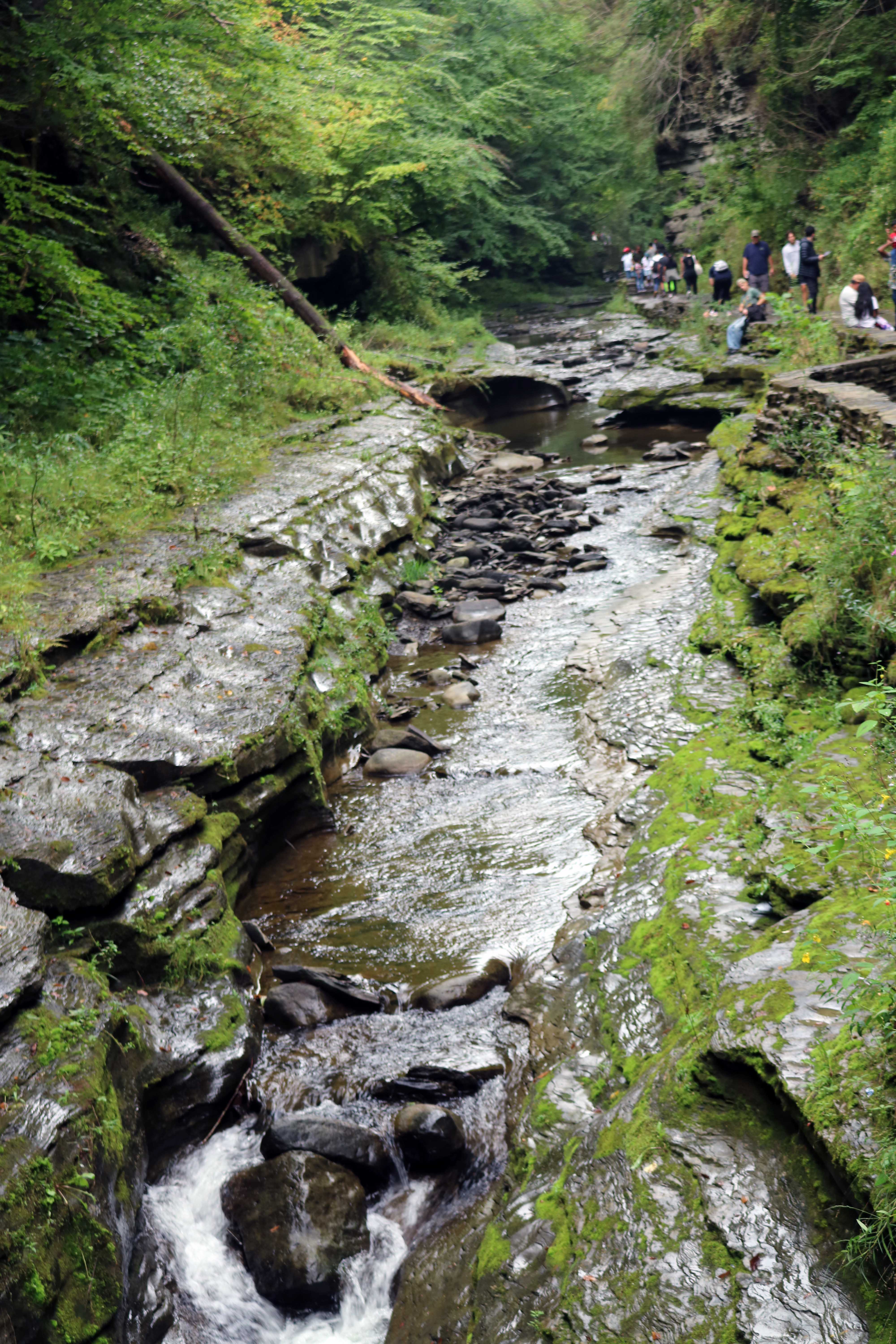
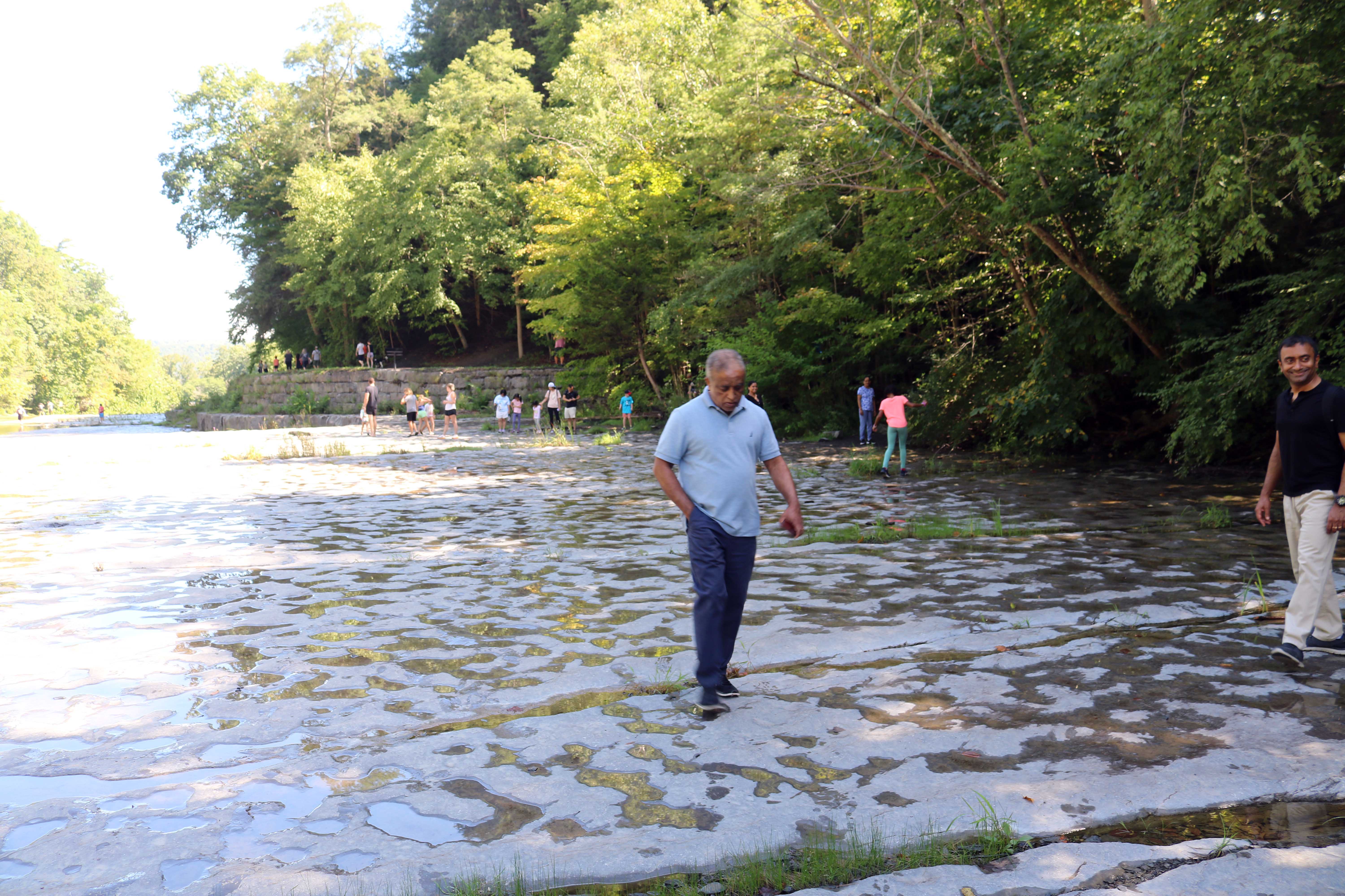
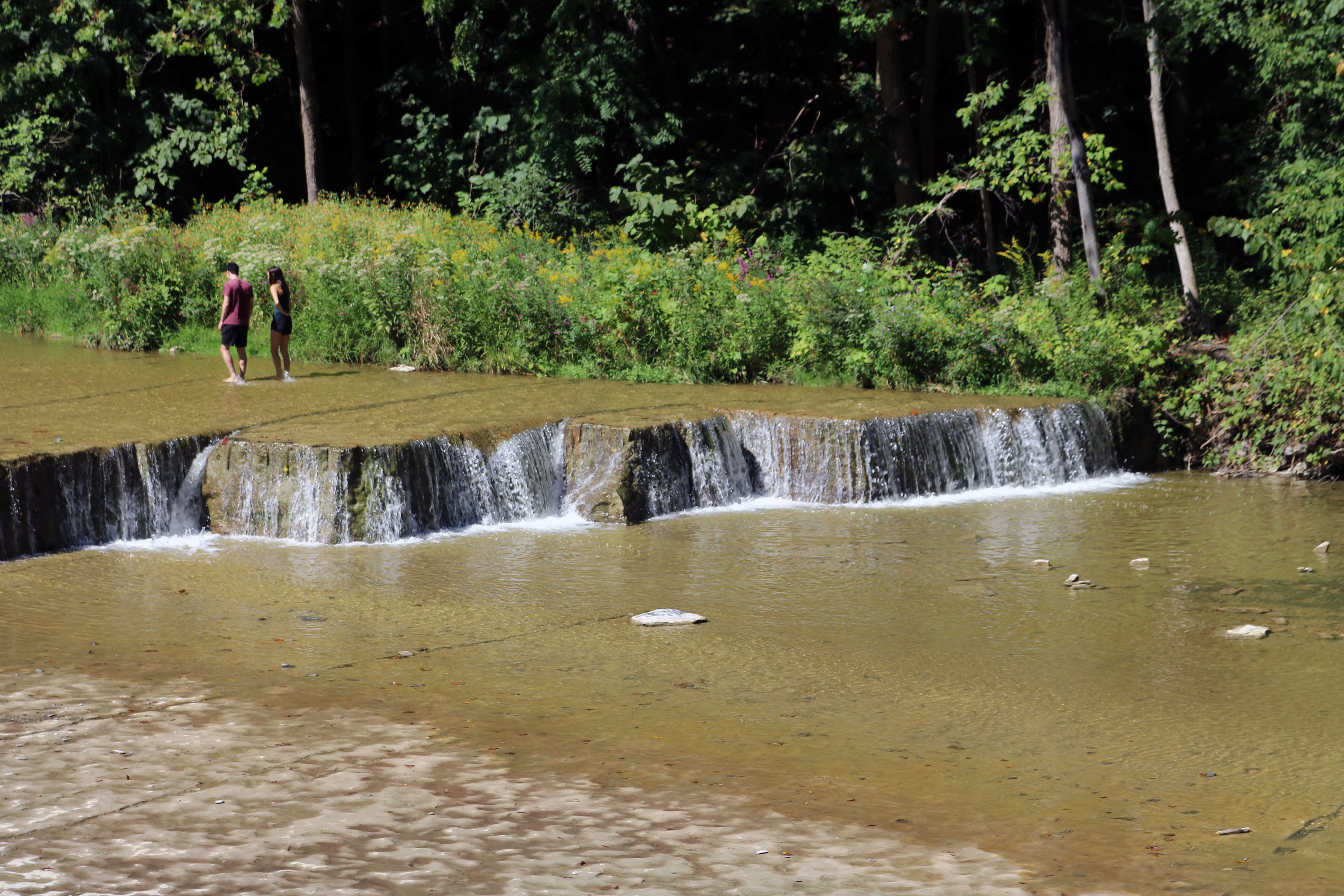
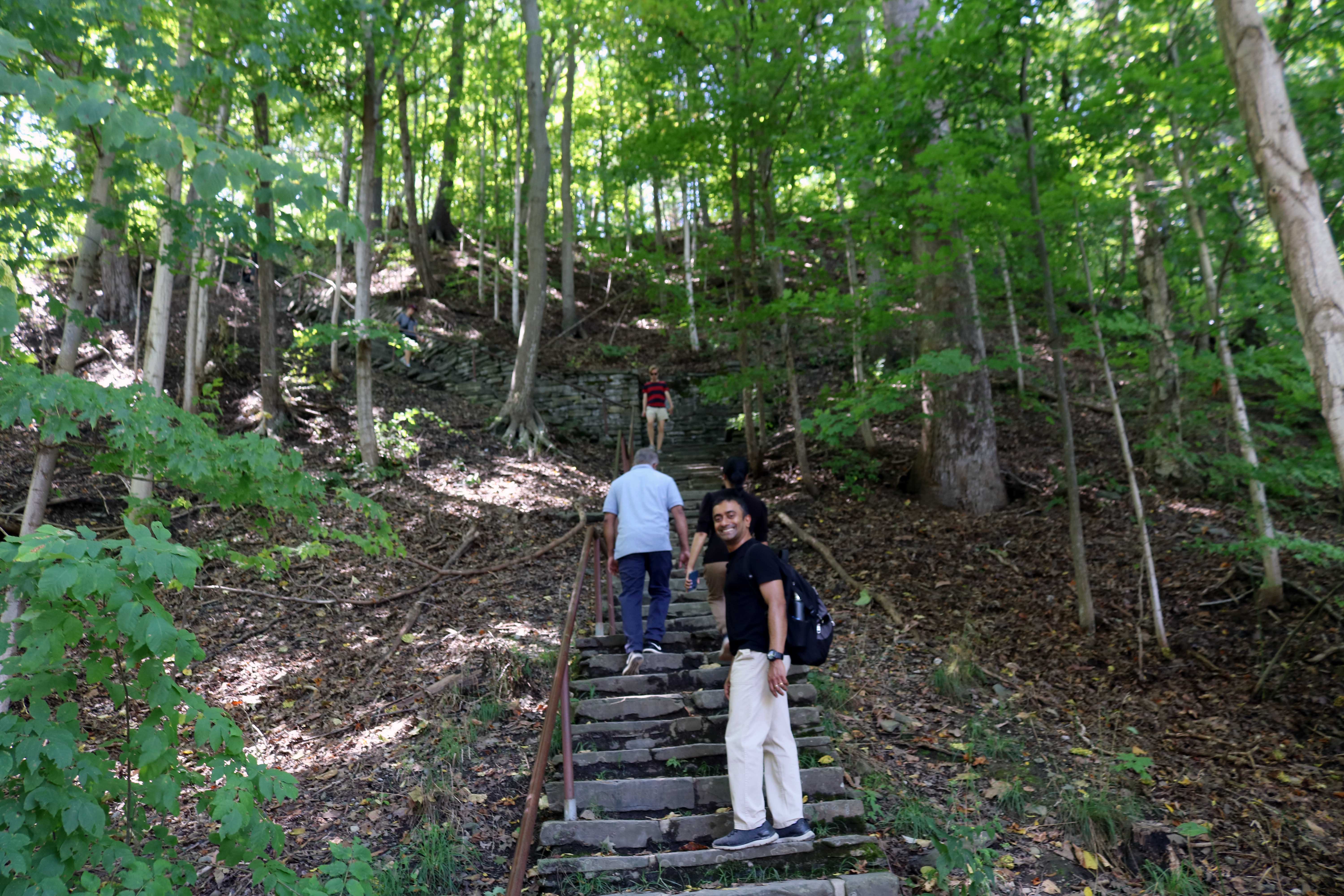
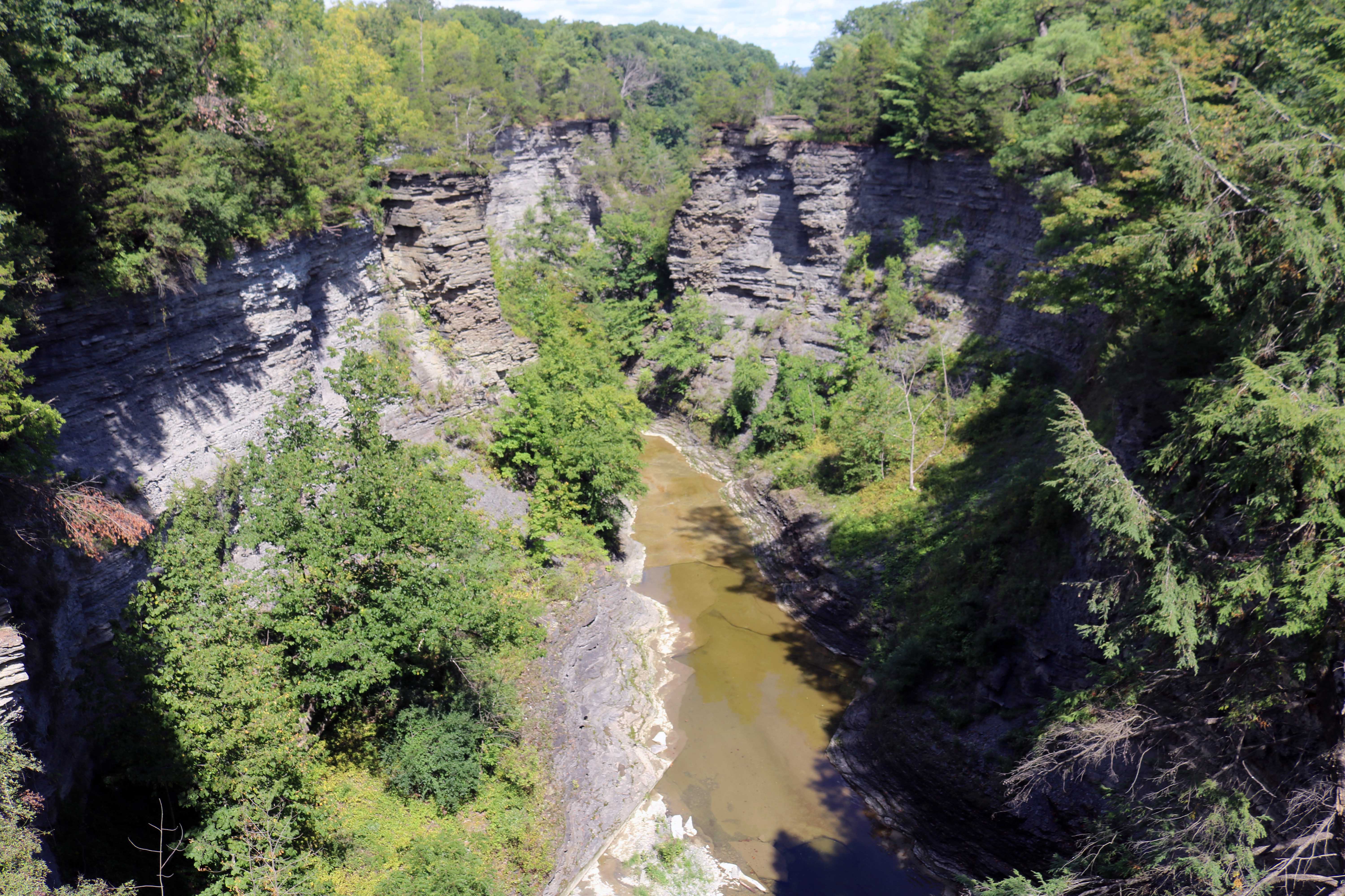
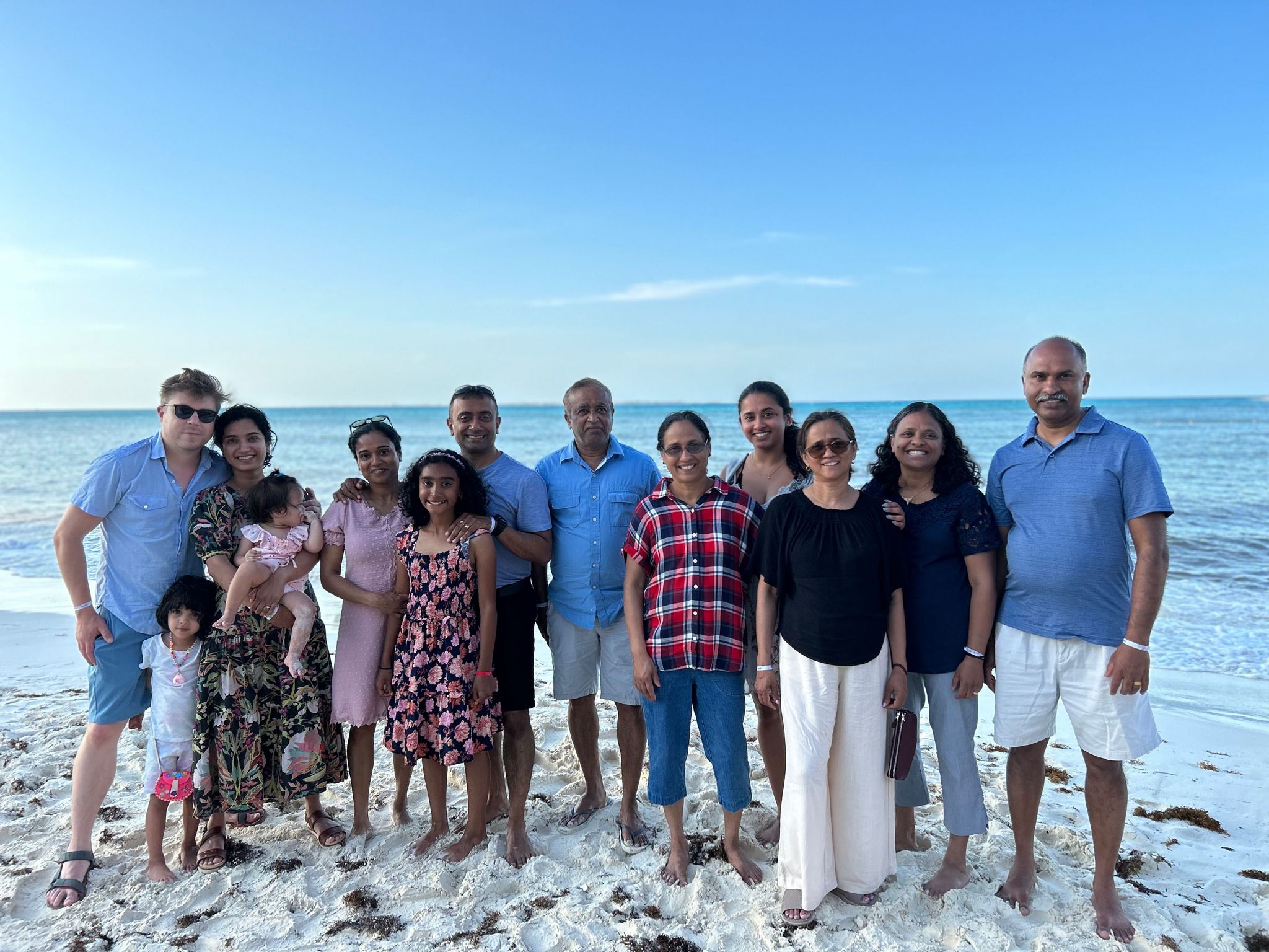
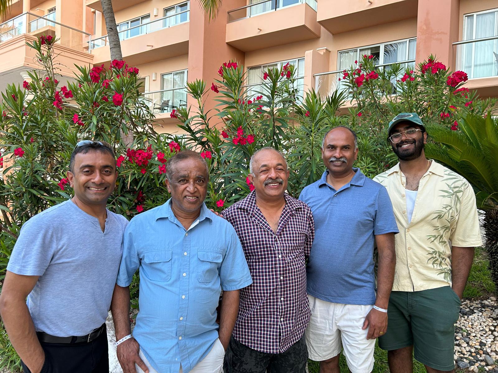
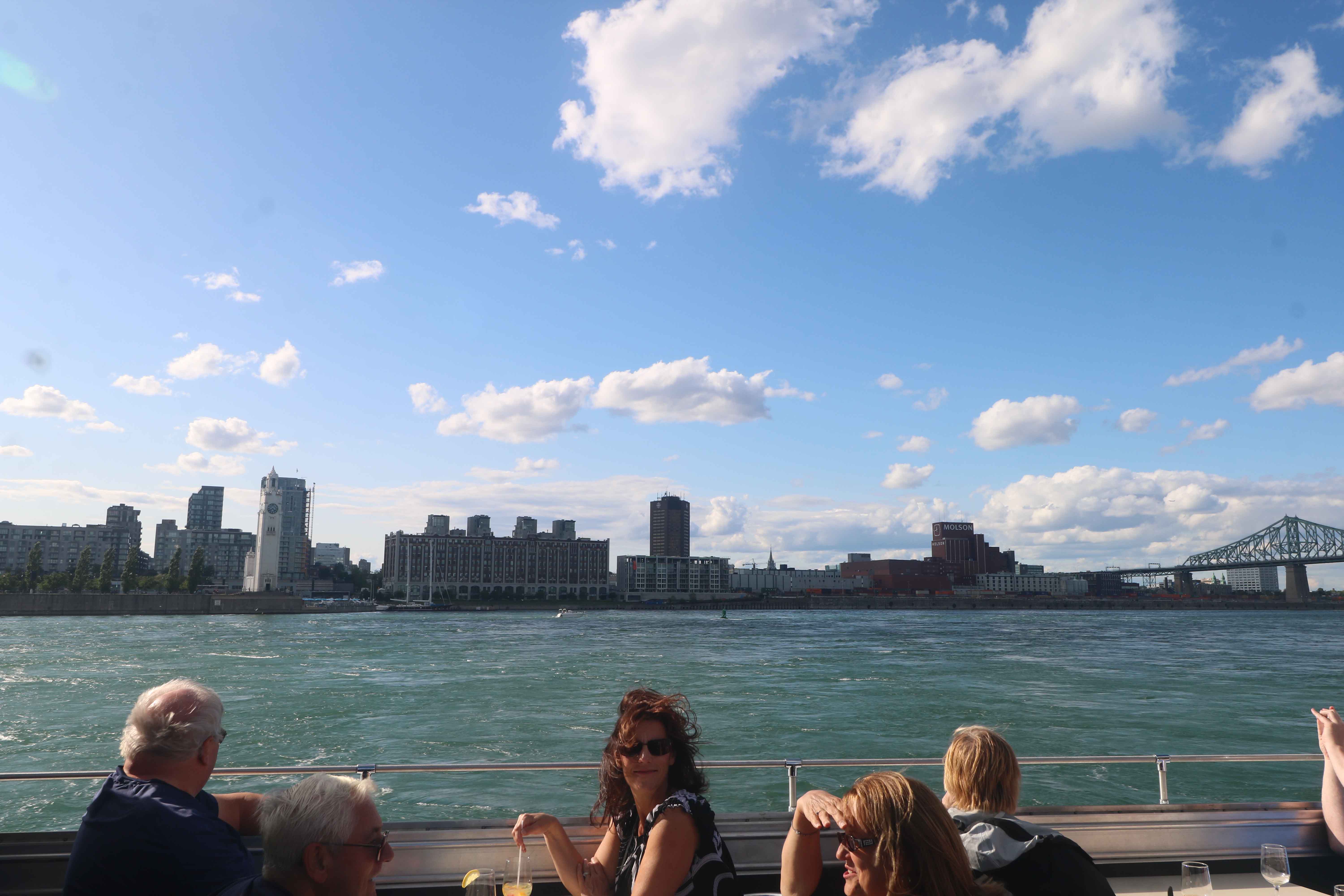
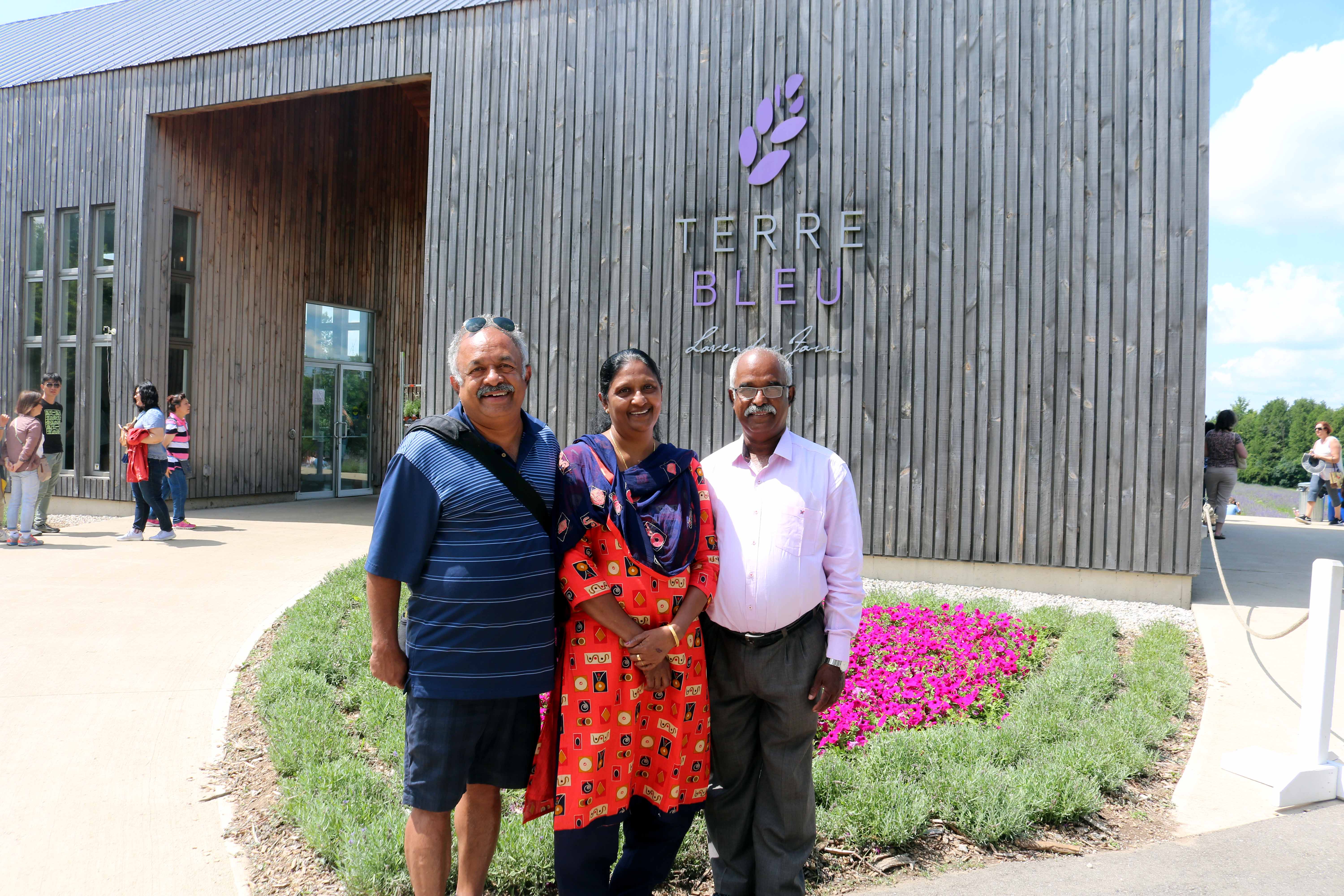
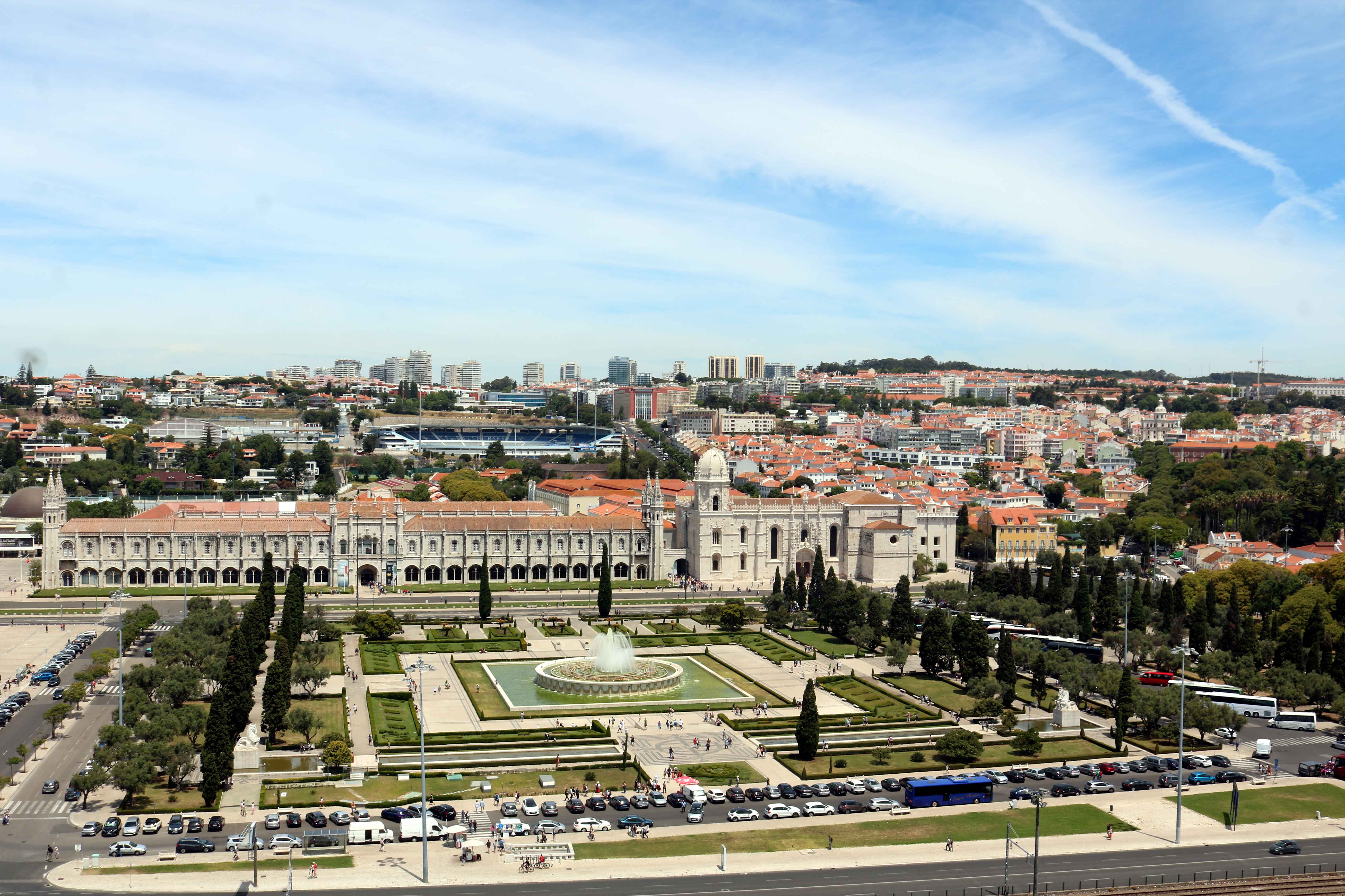
After the wedding at Piura, Peru, we flew to Lima, early morning on January 06.  We were joined by Stephens, our travel companions.  The party consisted of Vijas, Ranga, Aravazhi with their better-halves and Mrs. Anita Chandramouli.  Our trip was organised by JourneYou, a travel company founded in 2011 by a team of travel professionals.  Their agent received us at Lima Airport and facilitated our check-in for the Arequipa flight. After an hour, we landed at Rodriguez Ballon International Airport at Arequipa.


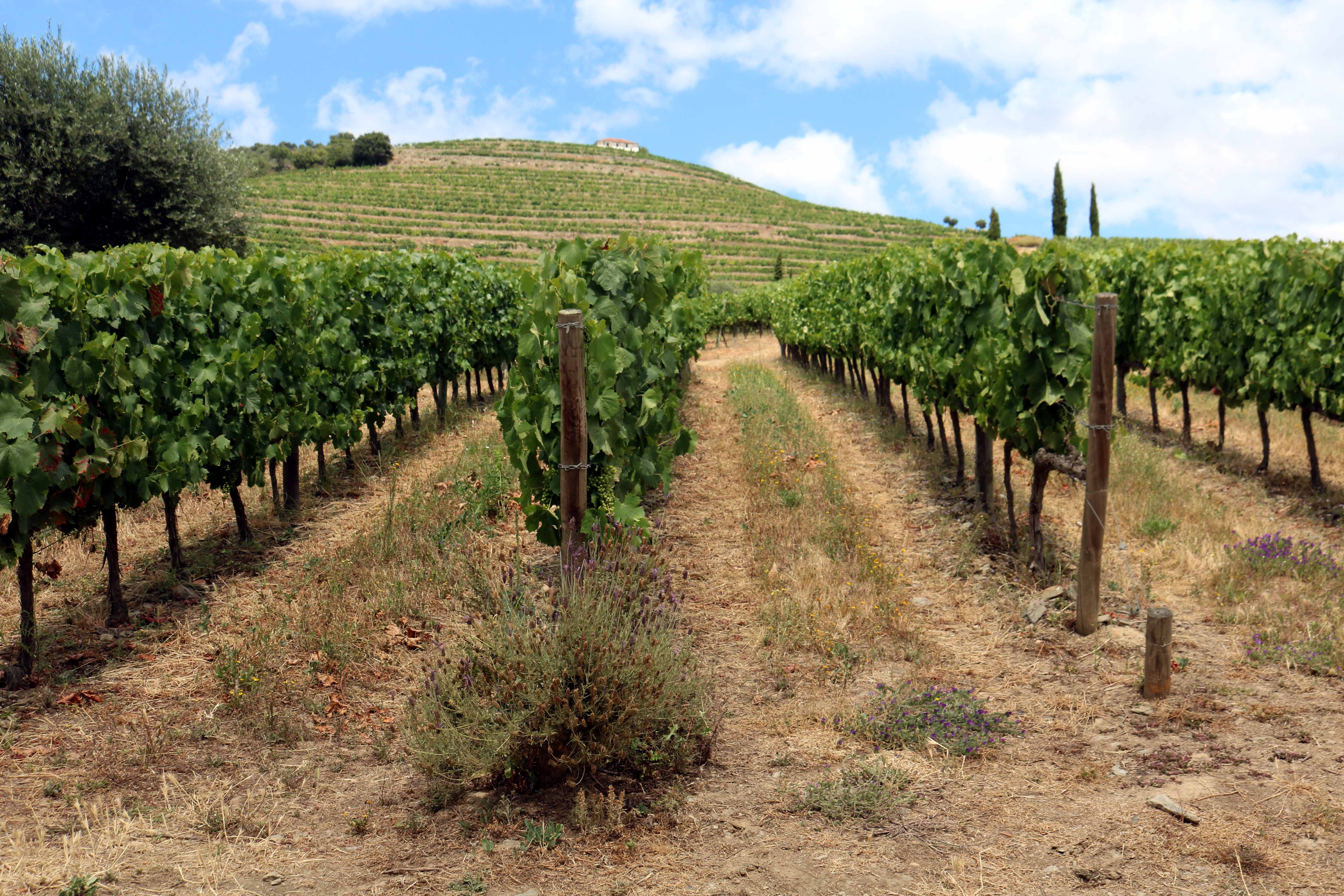
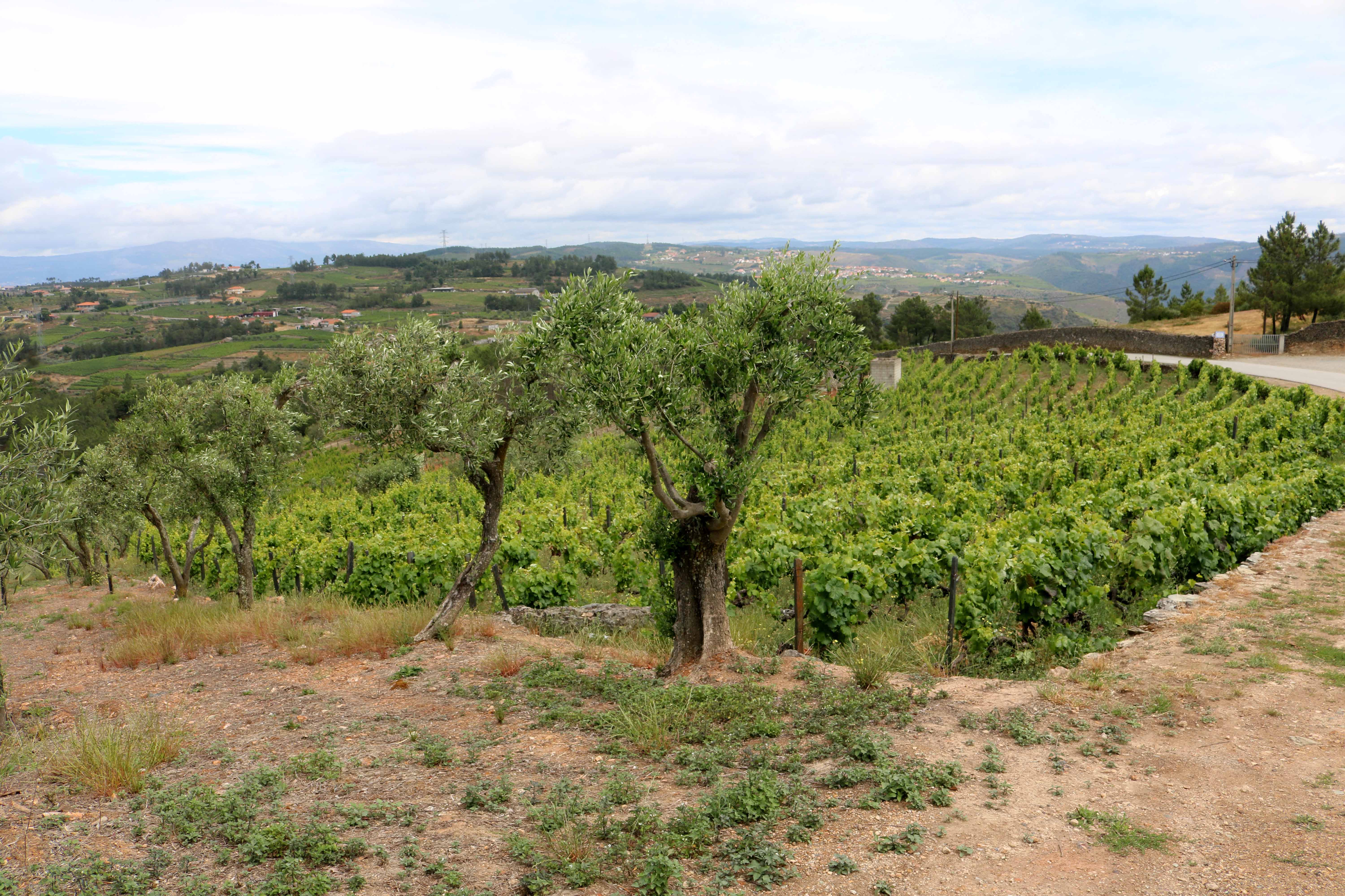
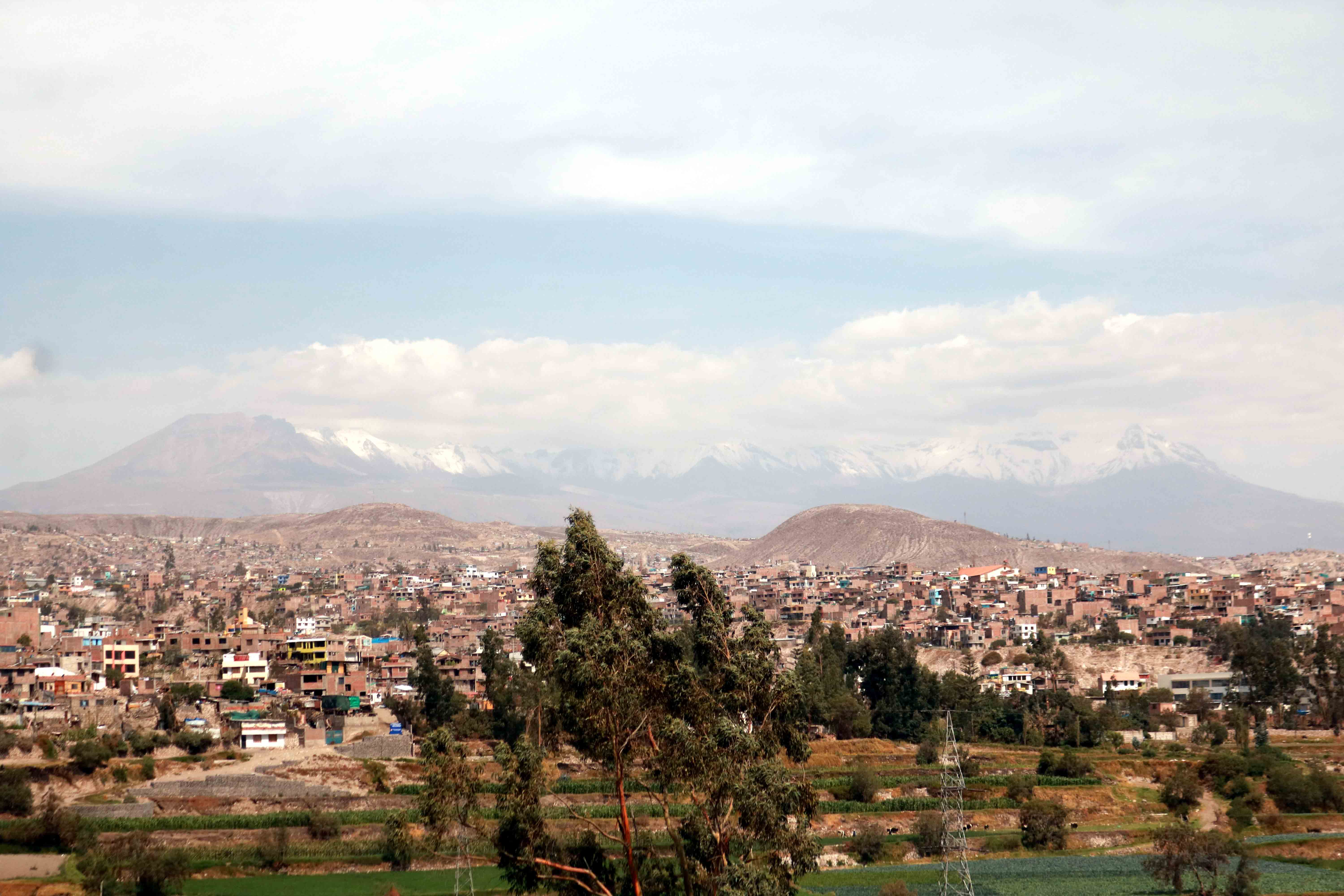
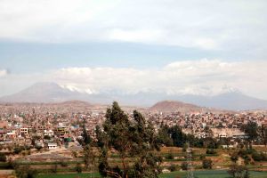
Arequipa in Southern Peru is the second most populated city in Peru. It is considered one of the most fascinating areas in the country, due to its architecture, varied gastronomy, impressive landscapes, imposing volcanoes, and the deepest canyon in the world. The most prominent feature of the landscape of Arequipa is undoubtedly the majestic Misti volcano, which sits at 5,825m above sea level. ‘El Misti’ comes from the Quechua language (language of Incan Empire), meaning ‘The Gentleman.’

Prior to exiting Arequipa Airport, all our baggage was thoroughly scanned by Animal and Plant Health Service of Peru to detect if we were in possession of any fruit – a rare inspection, that too when flying within the country!  It is to ensure that no fruit flies, its larvae or eggs are brought into this region.  Passengers who were in possession of any fruit had to either consume it or discard it there.

Southern Peru has managed to eradicate fruit flies by means of the area-wide integrated application of the Sterile Insect Technique (SIT), a nuclear technology package developed by a joint division of the United Nations Food and Agriculture Organization (FAO) and the International Atomic Energy Agency (IAEA).  These pests used to cause annual losses of up to US$12 million to the farmers and fruit growers in Peru.


Arequipa is named the “White City” (Ciudad Blanca) due to the whiteness of the houses and buildings made using white ashlar, a volcanic stone abundantly found in the area. In the background of the photograph above is the Misti Volcano on the Left and Pichu Pichu Volcano (5,669m) to the Right.

On arrival at the Airport, we were greeted by our travel guide from JourneYou, who escorted us to our hotel.  After lunch we set out to explore the city with our travel guide.  Our first stop was Santa Catalina Monastery.


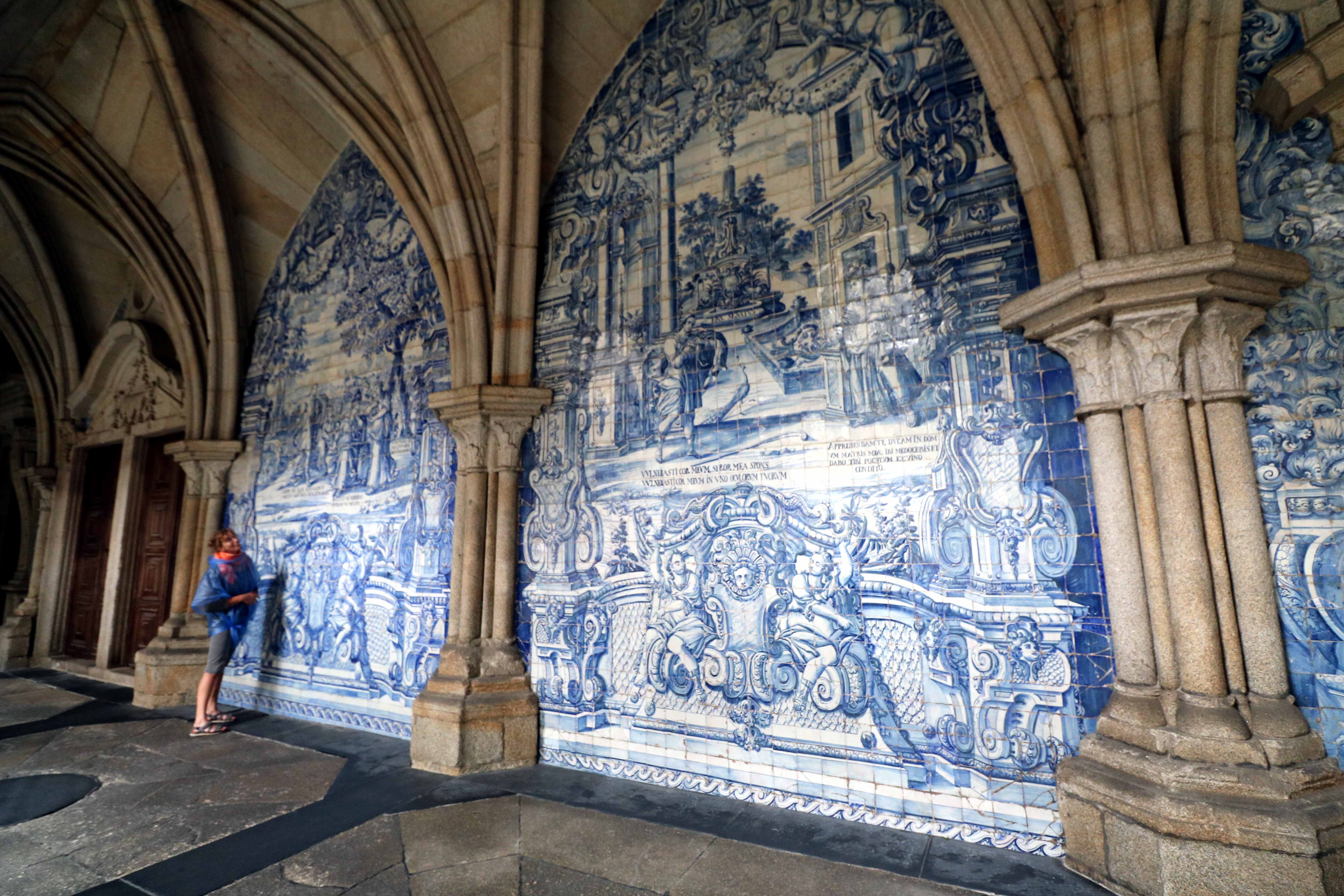
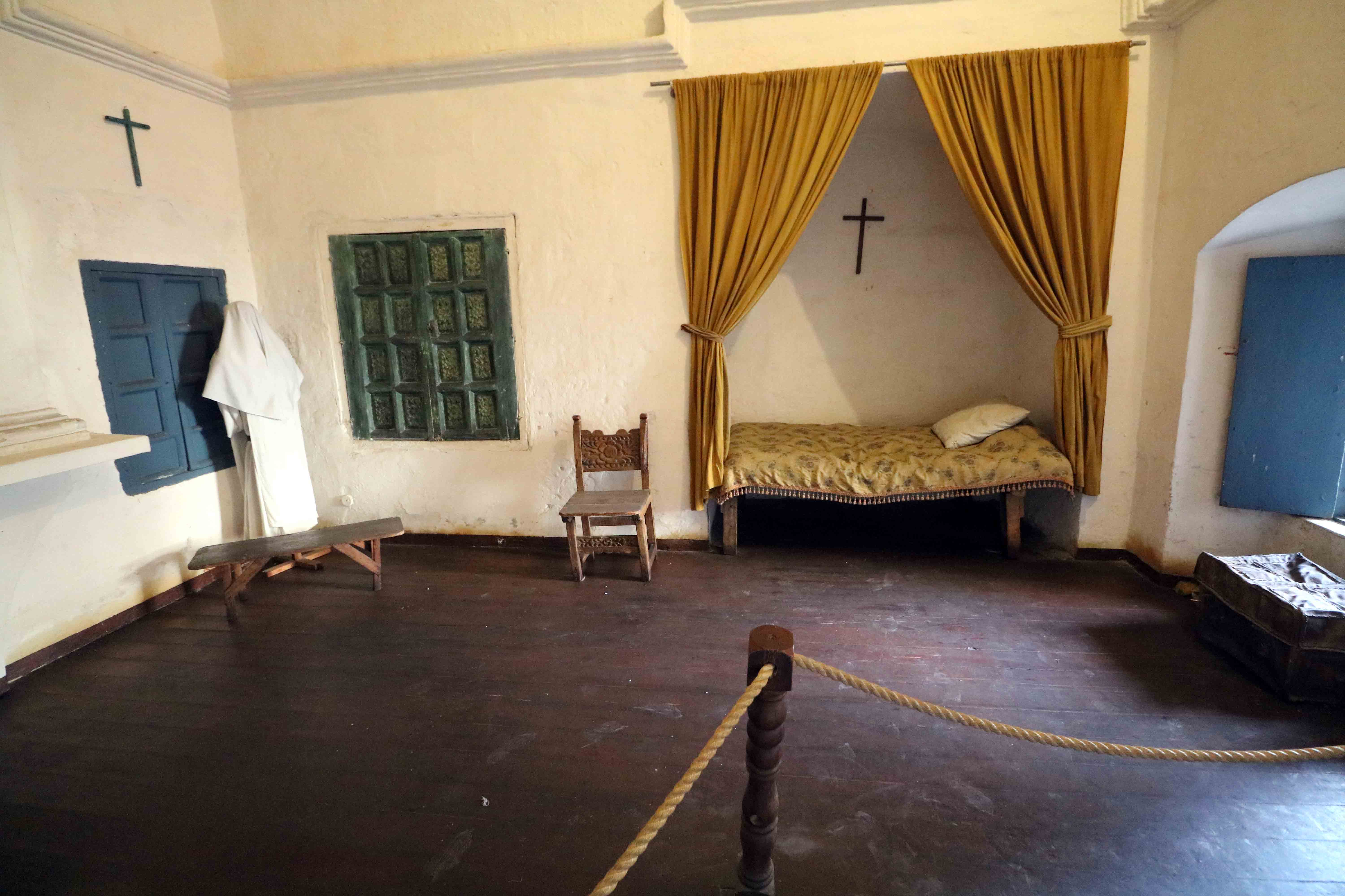
Convent of Santa Catalina de Siena was built in 1579 and it served as a cloister for Dominican nuns from the sixteenth to the eighteenth centuries, and it still houses a small religious community today. The complex is built from volcanic Sillar stone and is organized into cloisters, living quarters, a plaza, a gallery, and a chapel.  The Monastery was founded by Maria de Guzman, a rich widow, who only accepted nuns from the rich Spanish families. Traditionally, the second daughter of upper-class families entered a nunnery, supposedly to live in poverty and renounce the material world.  They had to pay a dowry on entry and they lived in luxury with servants or slaves.


In addition to the dowry, the nuns also had to bring 25 listed items which included a statue, a painting, a lamp and clothes. In the case of the wealthiest nuns, these included the finest English china and wonderful silk curtains and rugs.


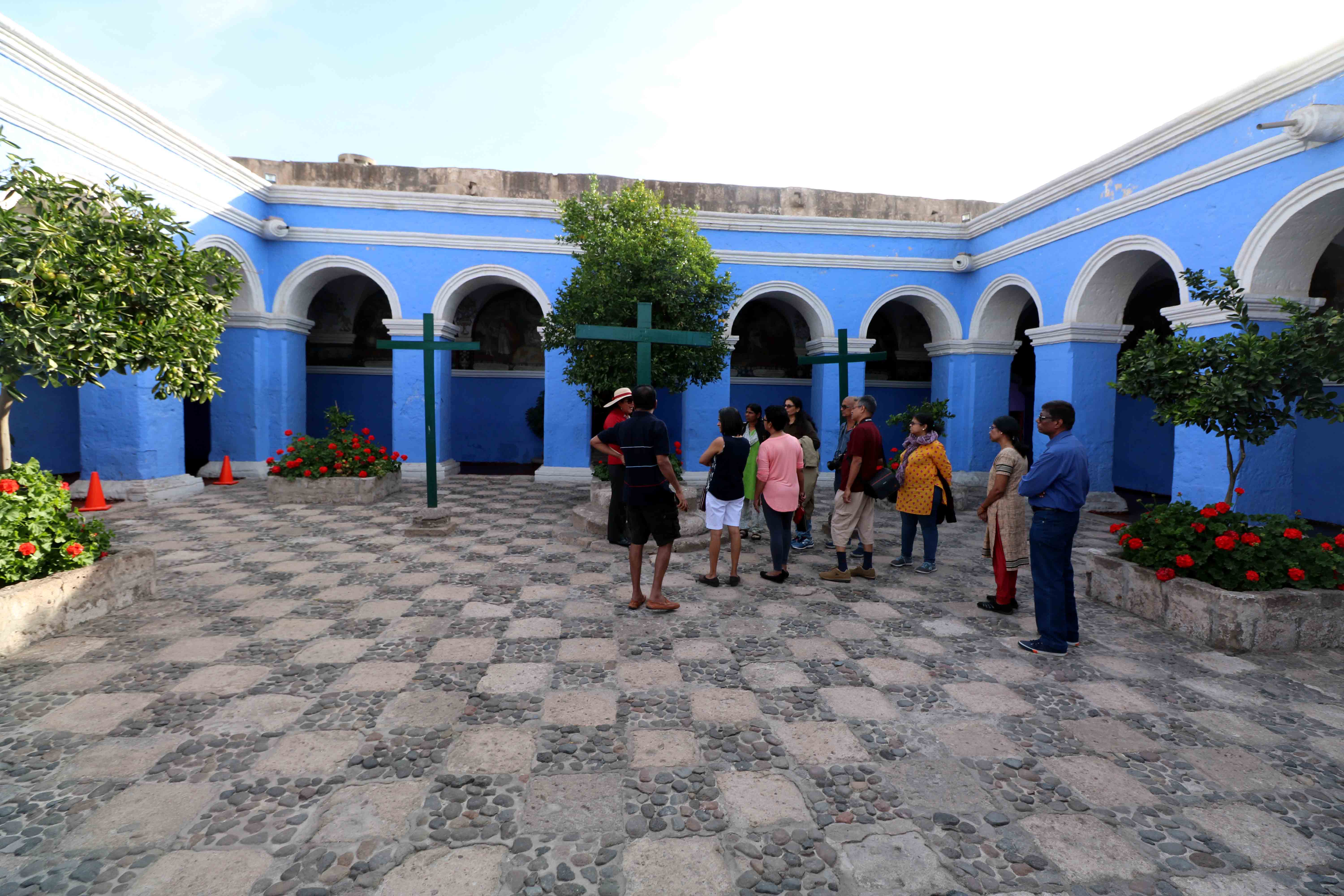
The Orange Tree Cloister (Claustro los Naranjos) in the Monastery have three crosses set among the orange trees and these constitute the center of the Passion of the Christ ceremonies, a dramatic presentation of the trial, suffering and death of Jesus Christ, carried out during Lent.


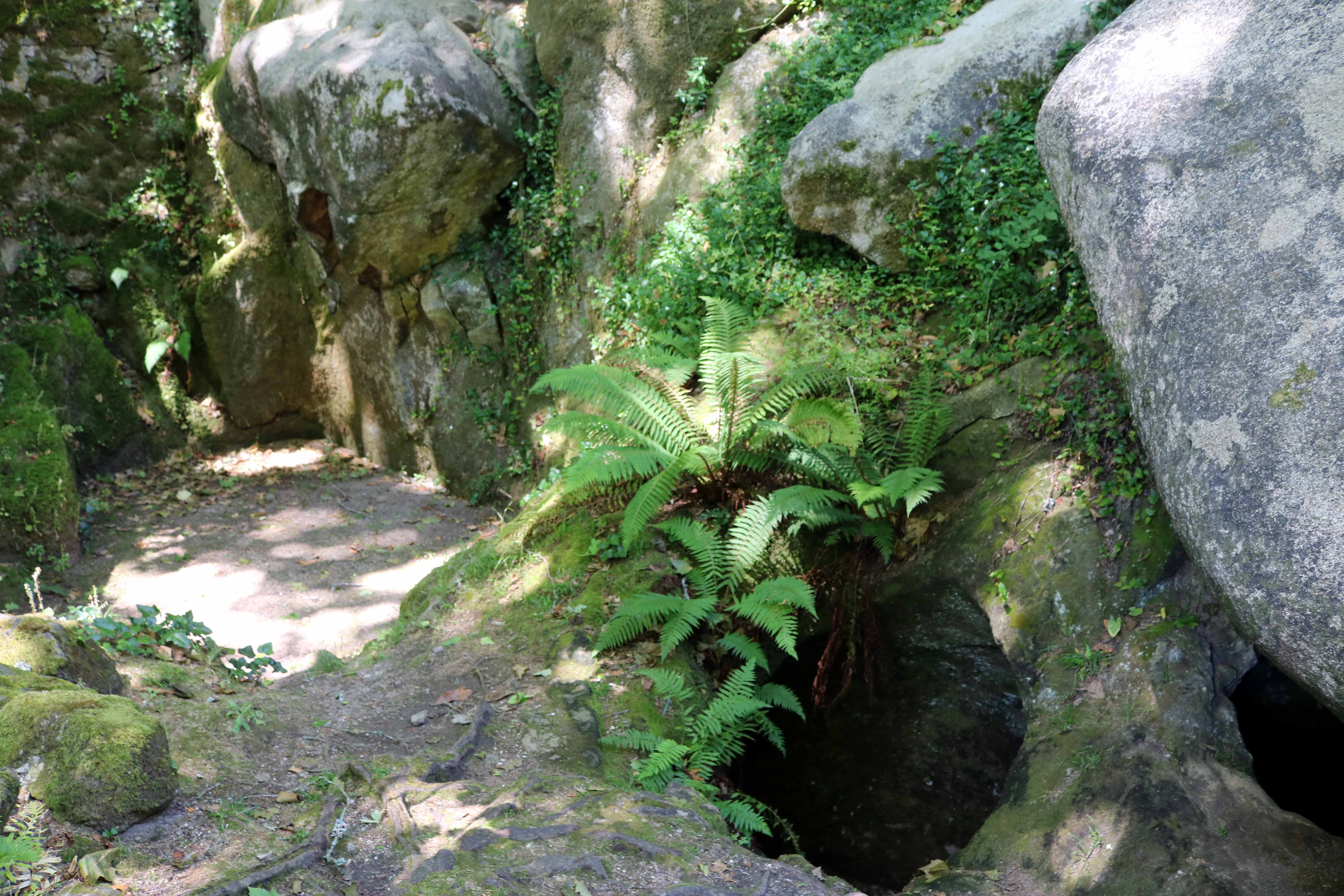
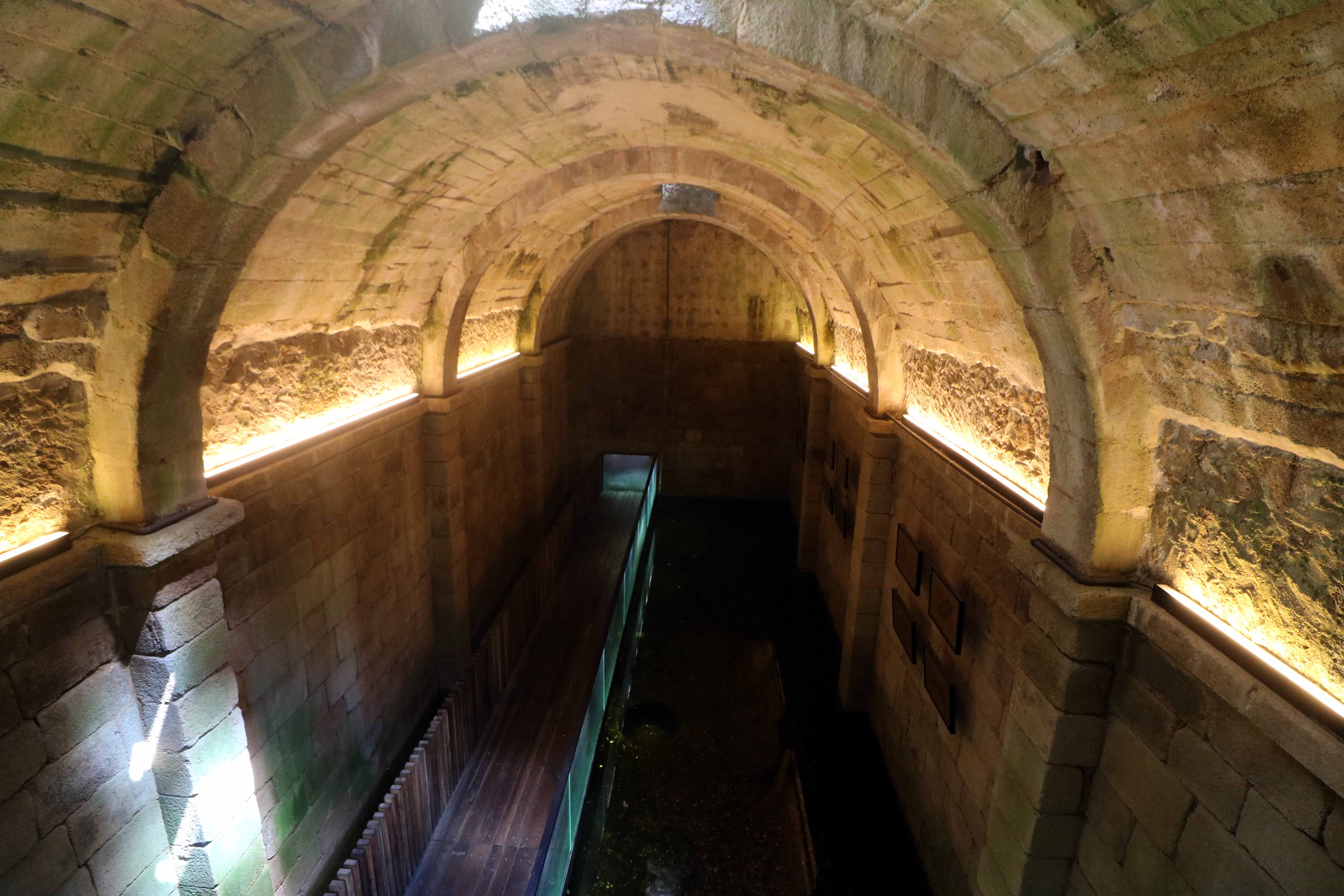
Apart from daily prayer and meals, the nuns took time to bake (mostly bread) which was then either eaten communally or sold to the public.  This photograph depicts what was once their kitchen with a stone water filter on the Right.


We then visited an old chapel, now converted into an art museum with over 400 restored paintings.


This is Calle Toledo, a long boulevard with a communal laundry at its end, where the nuns (probably their servants) washed their clothes in halved earthenware shell like basins.  The laundry area is surrounded by a colourful garden.  Water was diverted from the channel in the center to the washing pot by blocking it with the hand.  Everyone tried their hand at this.


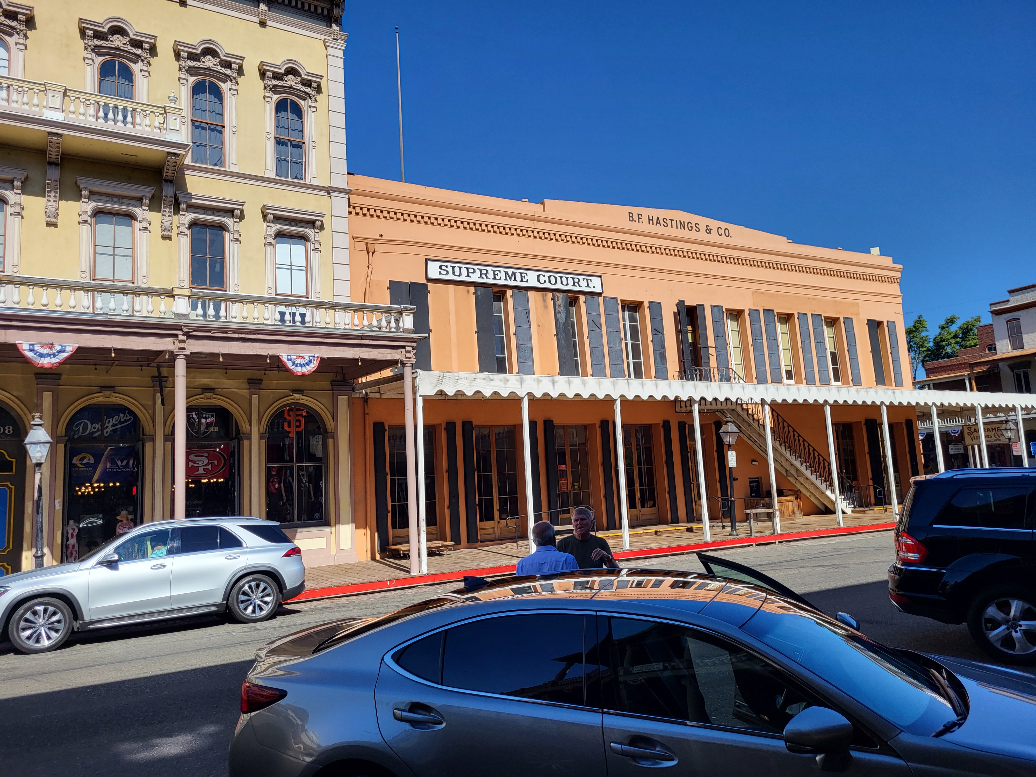
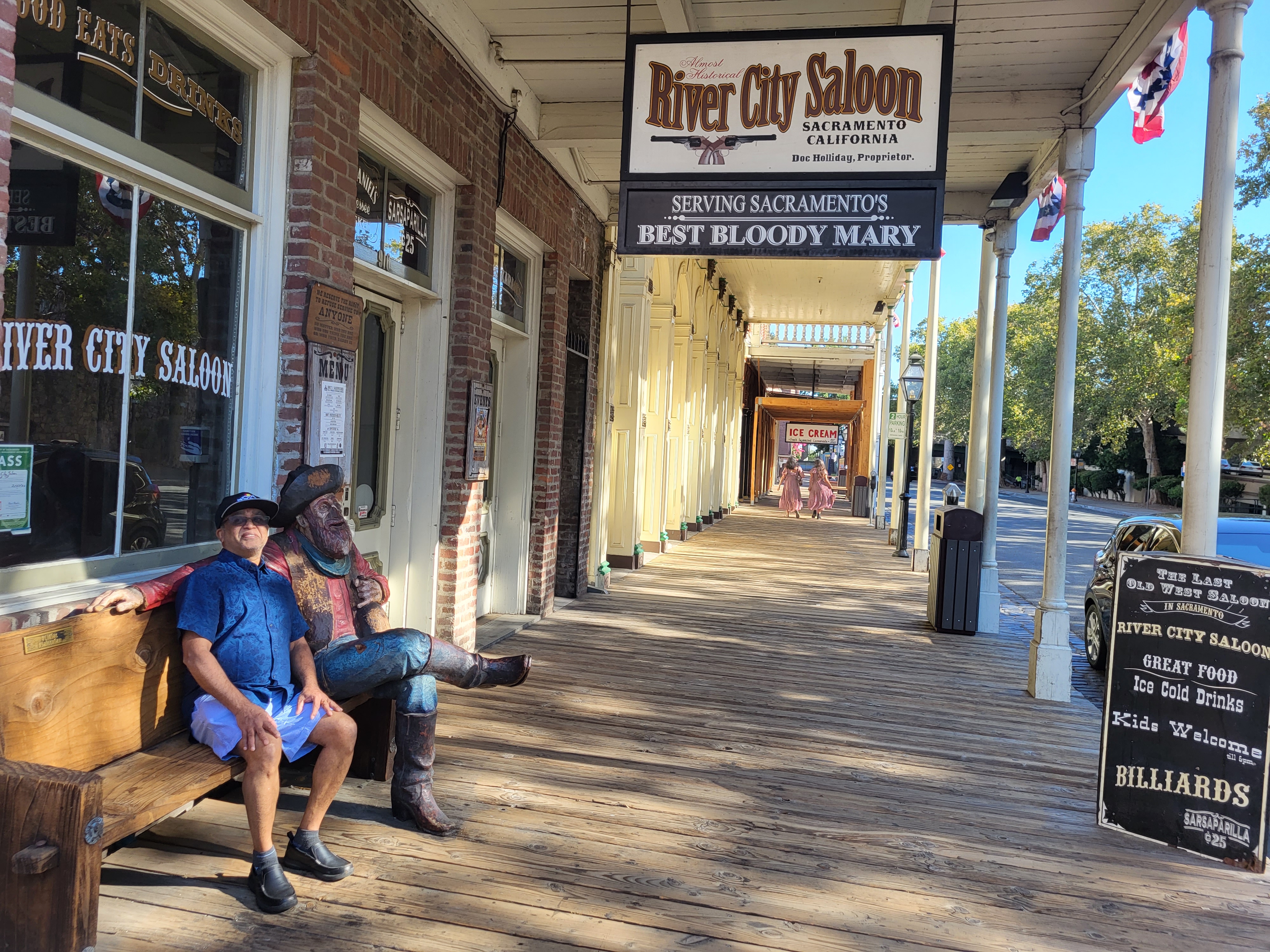
Walking out from the convent through its lanes and by-lanes, we headed straight to the city-center.


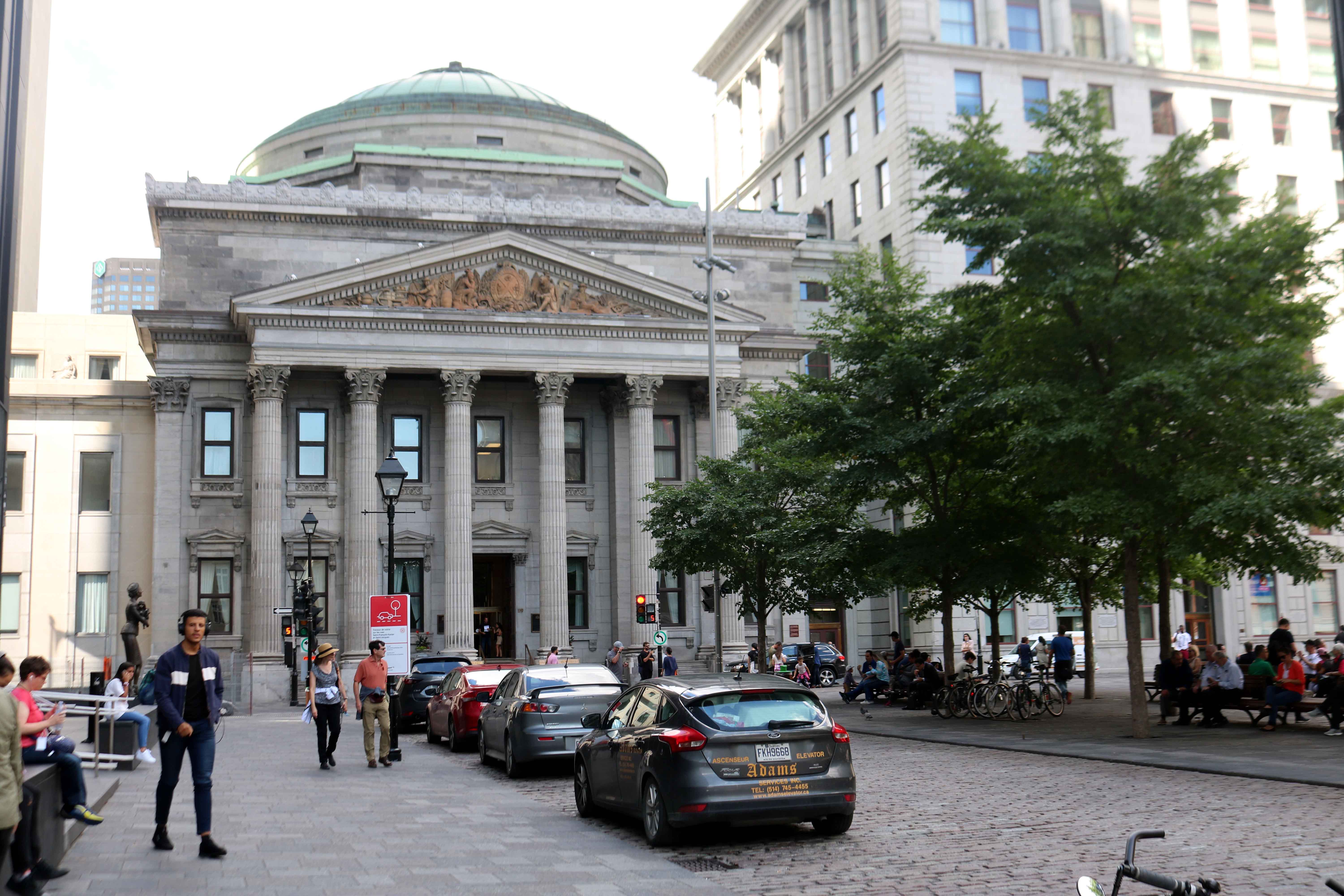
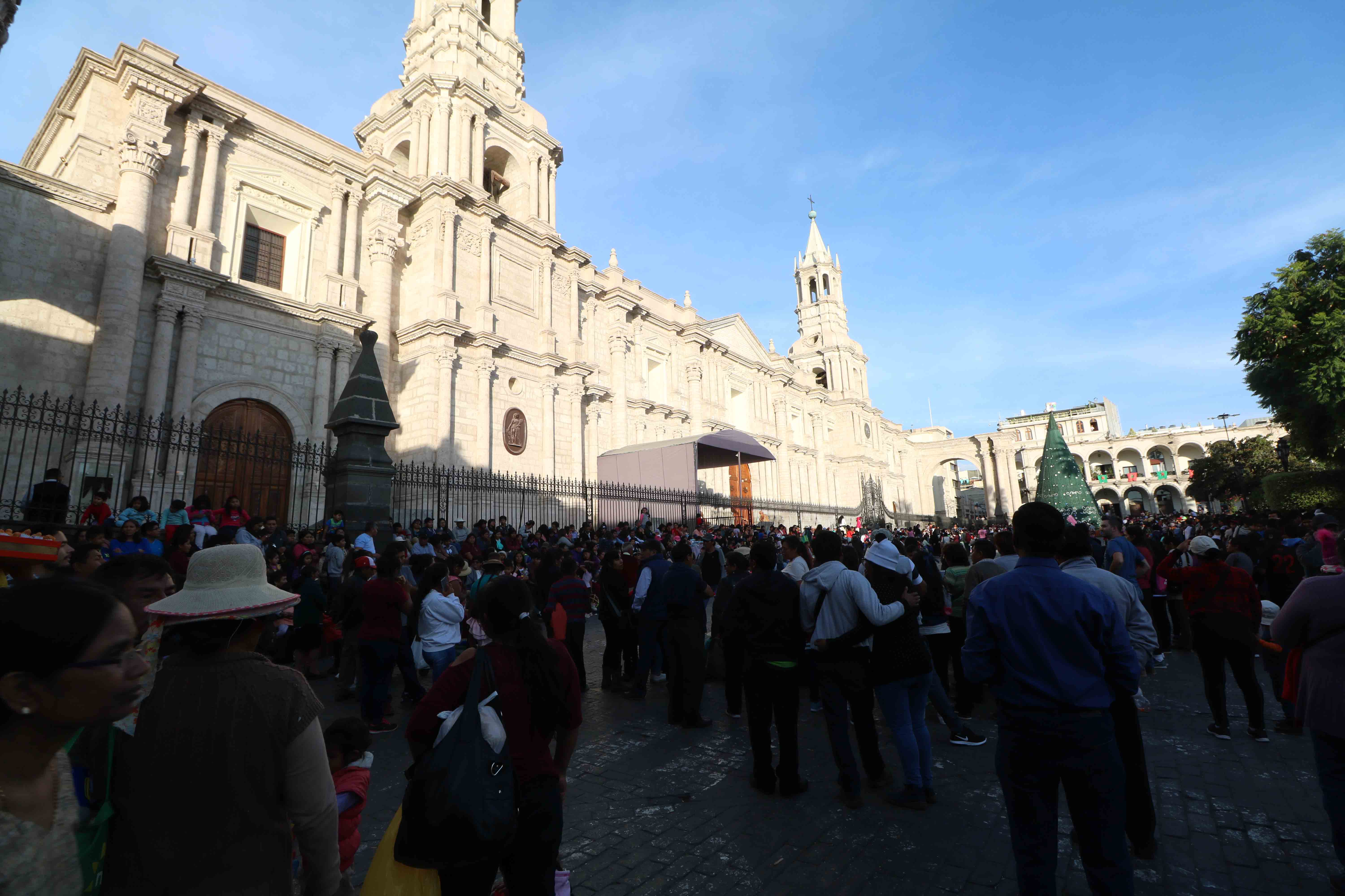
When the city was founded in 1540, it all begun with the square – Plaza de Armas.  Surrounded by the Cathedral and various portals.  In the center is a fountain with a beautiful bronze statue of a soldier.


On the Northern side of the Square is the majestic Basilica Cathedral of Arequipa, the most important Catholic church of the city.  Its construction started in 1540, the same year that the city of Arequipa was founded, built in ashlars (white volcanic stone) and brick vaults.  Throughout its history the church was destroyed many times by fire, earthquakes and volcanic explosions, restored after each destruction, the latest in 2001.


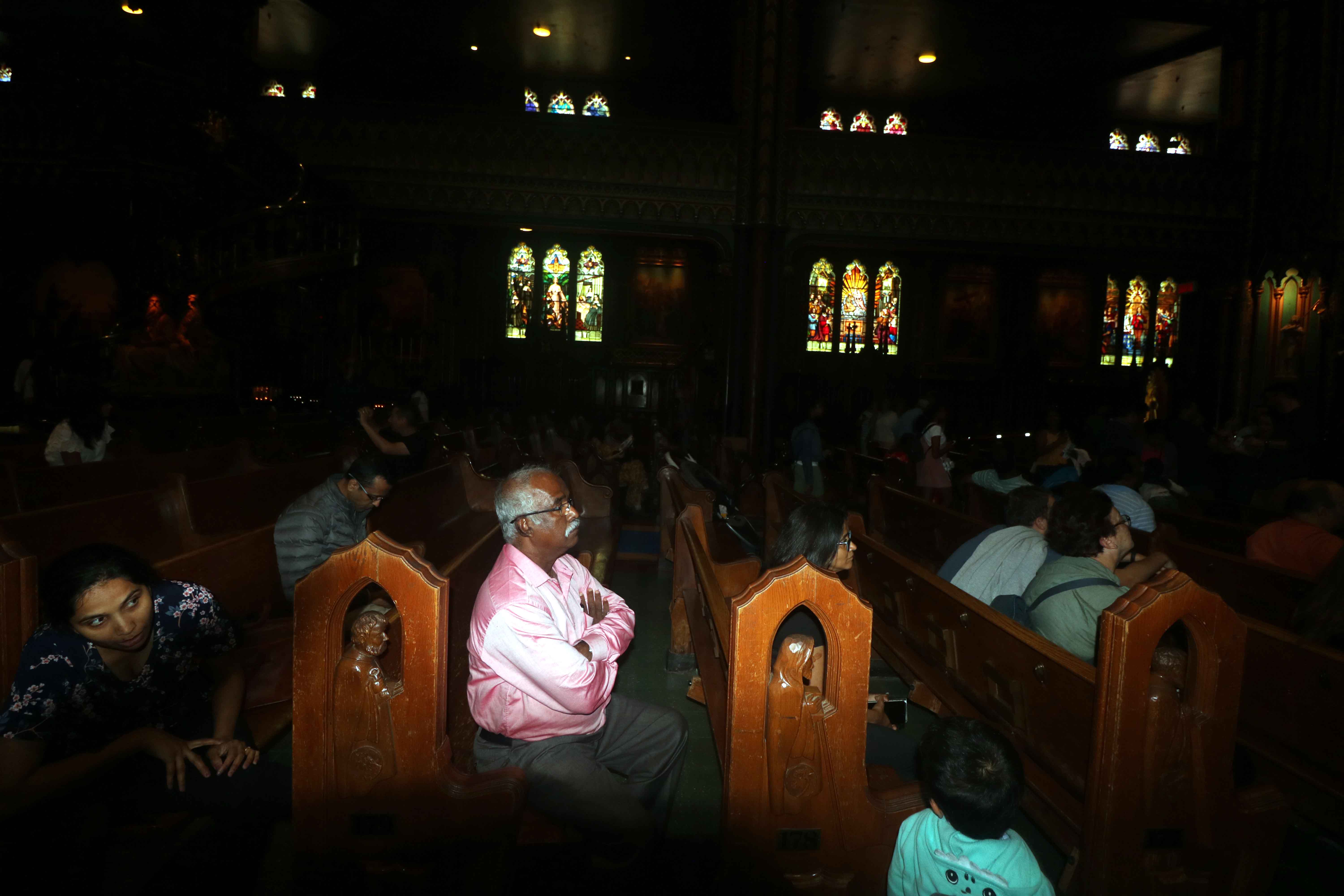
On January 6 Peruvians, just as many other Christians, commemorate the arrival of the Three Wise Men or Three Kings at Jesus’ manger bearing gifts of gold, frankincense and myrrh.  A large crowd had assembled at the Cathedral, with many occupying the roads  to celebrate the event.  Thus we decided not to get into the church.


Our next stop was Jesuit Church of Company, located on the South-East corner of the Square.  Its facade is an intricately carved masterpiece in ashlars.  The design of the church is Spanish, but the carvings in these stones are filled with relief and the motifs which are mostly Incan.  Construction of this church commenced in 1578, but was destroyed many times over due to various earthquakes.


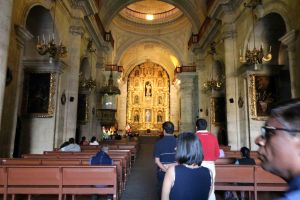
Inside the church is the high altar which houses a painting of Mother Mary with child Jesus by Italian painter Bernardo Bitti, who had come to Peru in 1575.


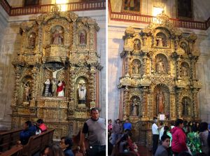
On the either sides of the main alter there are two more beautiful altars, carved with gilded wood. It is called the “Altar of the Founders,” as it holds many images of several founders of the Jesuit order.

After the long and tiring walking tour of Arequipa city, we had dinner and returned to our hotel for a well deserved rest.