Welland Canal

NiagWELLANDCNL10

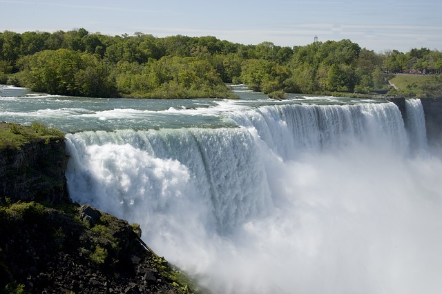
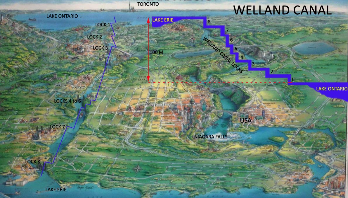
Visitors to one of the greatest natural wonders of the world, the Niagara Falls are often unaware of an amazing man-made wonder of the world, the Welland Canal, located close by, on the Canadian side. The Welland Canal is a navigational canal, 43.5 km long, crossing the Niagara Peninsula, from Port Weller on Lake Ontario to Port Colborne on Lake Erie. It overcomes a height difference of 100 m between the two lakes and bypasses the turbulent Niagara River and Niagara Falls.   On average, about 37 million tons of cargo is handled each year through the canal, mainly iron ore, wheat, corn, soyabean, steel and cement.

The first Welland Canal opened in 1829, costing 8 million dollars, under the management of William Hamilton Merritt. It was originally built to solve summer water shortages that affected the operation of a mill owned by Merritt and later converted for passage of ships. It was 2.4 meters deep and consisted of 40 wooden locks. The operation of the canal required a great deal of physical labour as horses, mules and oxen were used to tow the ships from one lock to another.

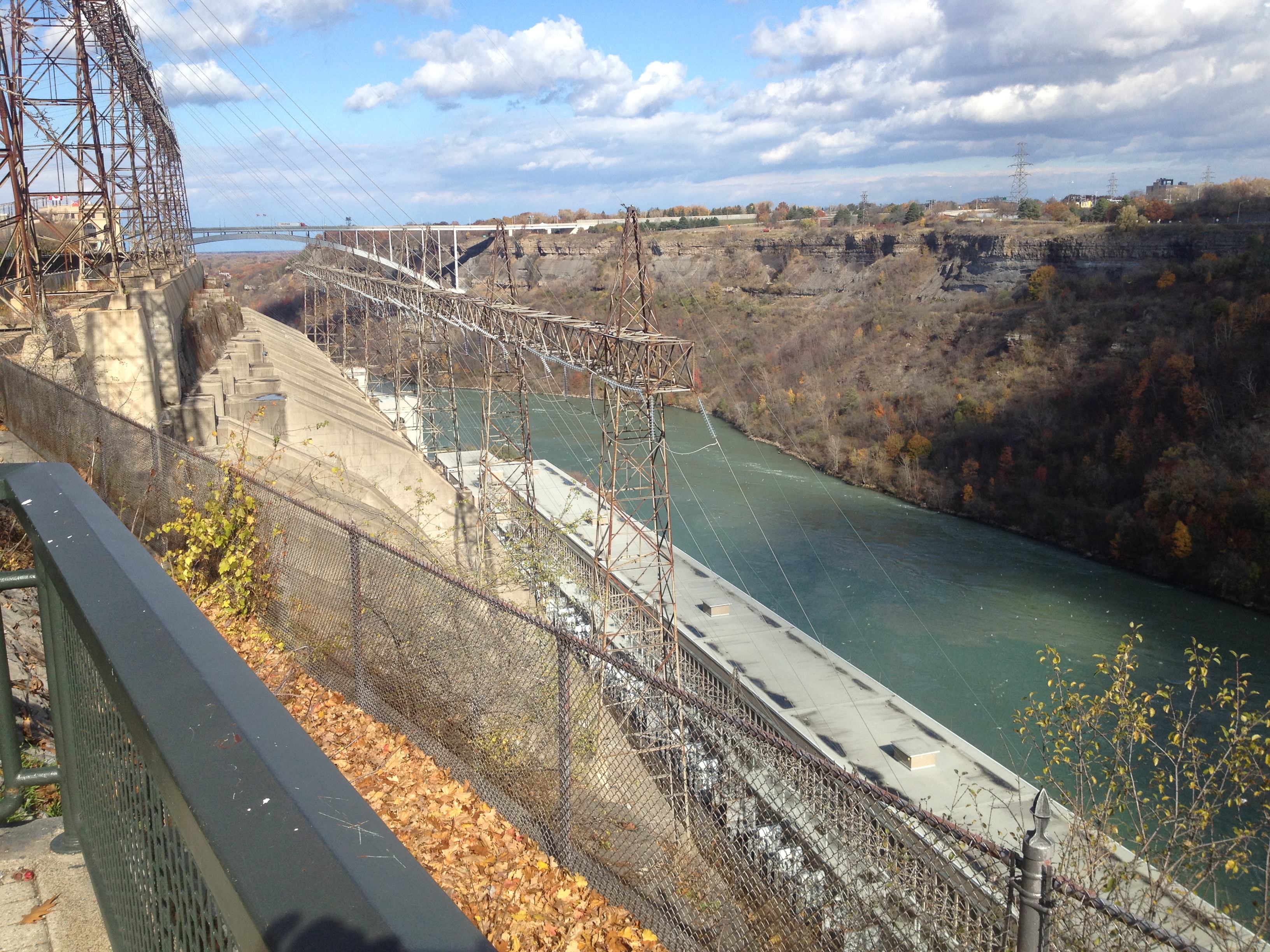
With the increased traffic and to cater for bigger ships, the canal was reconstructed in 1842 and 1887. The fourth and current 9.1 meters deep canal was constructed between 1913 and 1932. There are now eight locks, each 24.4 meters wide and 261.8 meters long. The canal runs perpendicular to the Niagara Escarpment and is the most direct route of all three previous canals. The canal today caters for ships up to a maximum of 225.5 metres long and 23.7 metres wide.

NiagWELLANDCNL20 copy

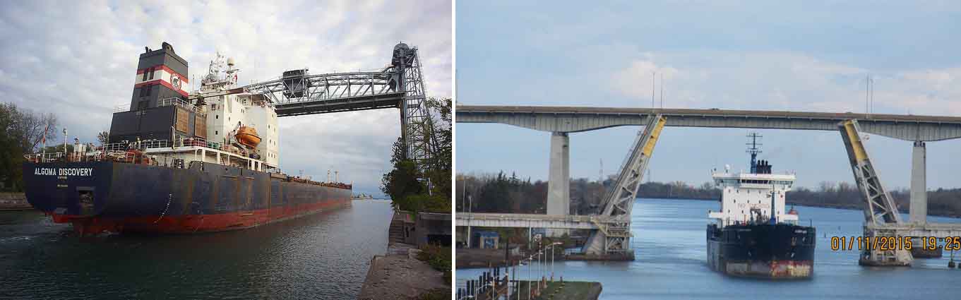
There are about 20 bridges that cross the Welland Canal, of which many have been removed, some are still lifted and lowered to allow the ships to pass through. There have been a few accidents of ships colliding with bridges. On September 30, 2015, a German vessel Lena J, travelling from Montreal to Colborne (upstream), hit a bridge near Port Colborne, closing the canal operations for several hours.

NiagWELLANDCNL25
NiagWELLANDCNL24

The most popular position to view the lifting/ lowering operations is at the observation deck at Lock 3. It is co-located St. Catharines Museum and Welland Canals Centre. The history of the Welland Canal and the St Catherines Town is brought to life through various exhibition galleries at the Museum.

The most attractive one, especially for the students of military history, are the galleries that portrays local stories from the war of 1812 to the current day to life.

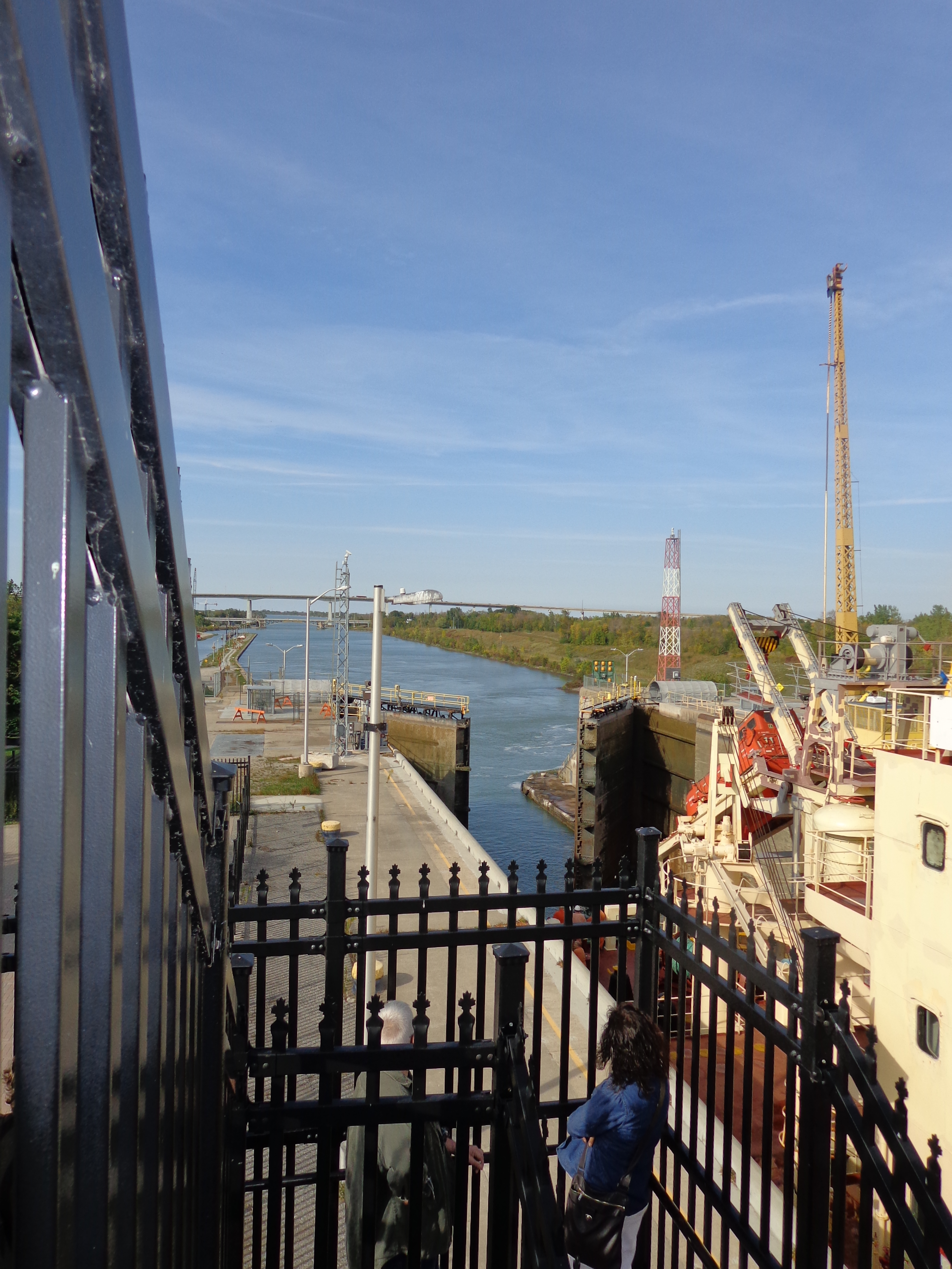
The ships are lifted/ lowered with the help of gravity and large quantities of water in a watertight chamber called a lock. The force of gravity is used to fill or drain a lock moving about 95 million litres of water in about 11 minutes.

NiagWELLANDCNL30

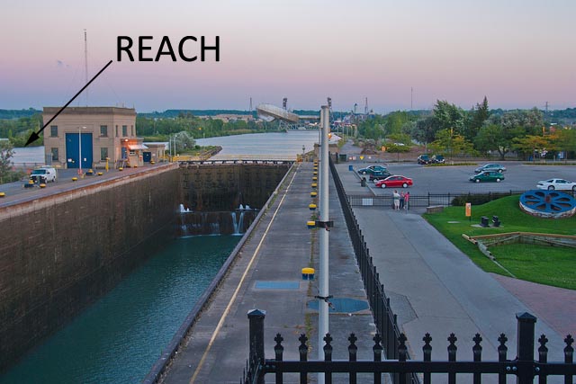
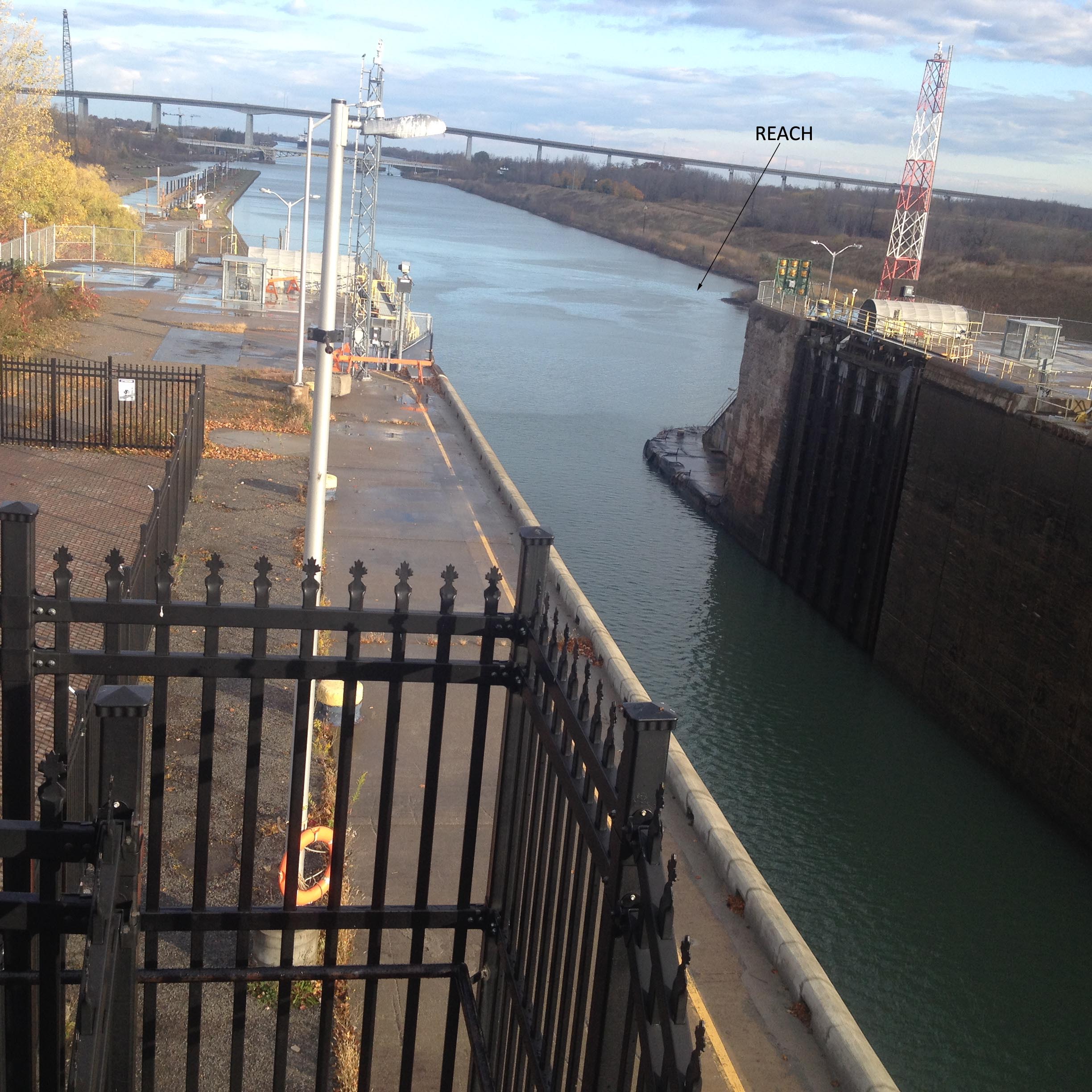
There are no pumps used to either fill or empty the locks. The water comes in from the ‘reach’ above each lock .  When a lock is emptied, the water goes into the ‘reach’ below the lock.  A small amount of electricity is used to open and close the valves. It is an example of brilliant, yet simple innovative engineering.

NiagWELLANDCNL38

It generally takes about 30 minutes for a ship to cross a lock, even though the actual lowering/ lifting operation takes only about 11 minutes. Most of the time is spent manoeuvring the ship into position and tying it up called Spotting a Ship’.  Smaller Ships would take a longer time because more water is needed to either fill or empty from the lock in order to lift or lower it.

A ship being lifted upstream would enter a lock with lower water level at the open gate and a higher water level at the closed gate. The upstream gate is closed, holding back the water that the force of gravity is attracting downstream.

The water level at the open gate is at a lower level, about 12 meters below the water level at the closed gate upstream. The water level between the gates are always in level with the open gate.

NiagWELLANDCNL401
NiagWELLANDCNL402

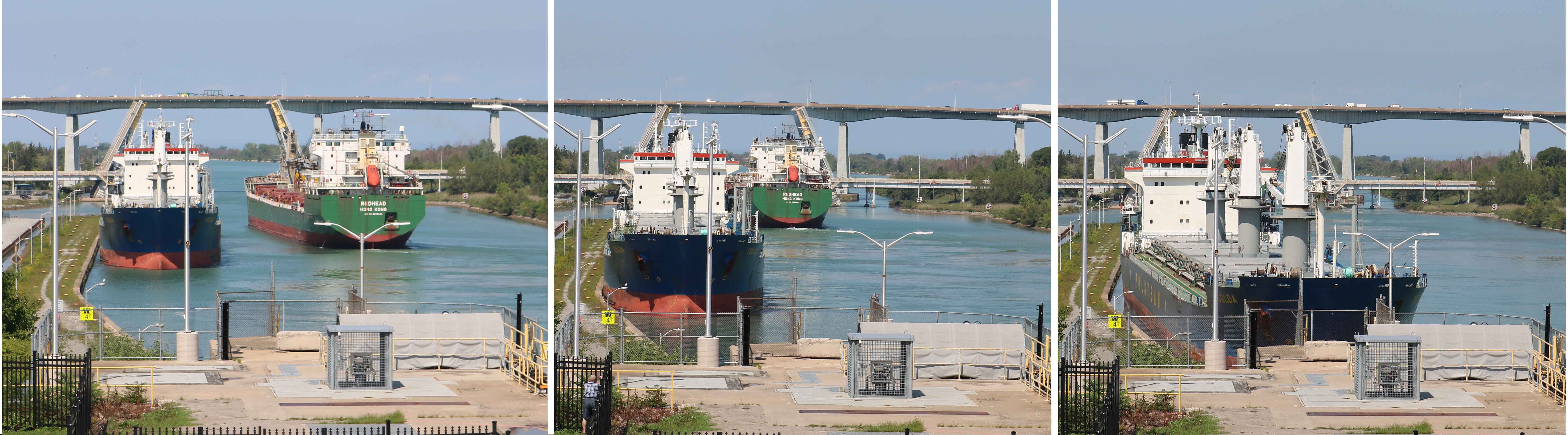
A ship approaching the lower end gate of the lock, touches the ‘sliding  wall’, an angular construction about 200 meters from the lock. This sets the bow of the ship on the right course to facilitate easy entry into the narrow lock. Here the ship may berth to facilitate passing of a ship in the opposite direction.

When the ship enters the lock, between the two gates, the lower gate is closed. This makes the lock a somewhat water tight concrete lock chamber. In Lock Number 3, the ship is secured in the lock chamber by a hands-free system that secures a vessel by using vacuum pads mounted to a rail fixed within the lock wall. In other locks, the ship is secured by tying ropes on to the bollards. This ensures that the ship remains stable during the lifting or lowering process.

Once the ship is secured, water from the reach fills the lock chamber by way of a filling valve.

NiagWELLANDCNL50

When the water level in the lock reaches the same water level as that on the upstream gate, the ship has got lifted by about 12 meters from the position it entered the lock. Now the ship is untied from the bollards.

NiagWELLANDCNL54

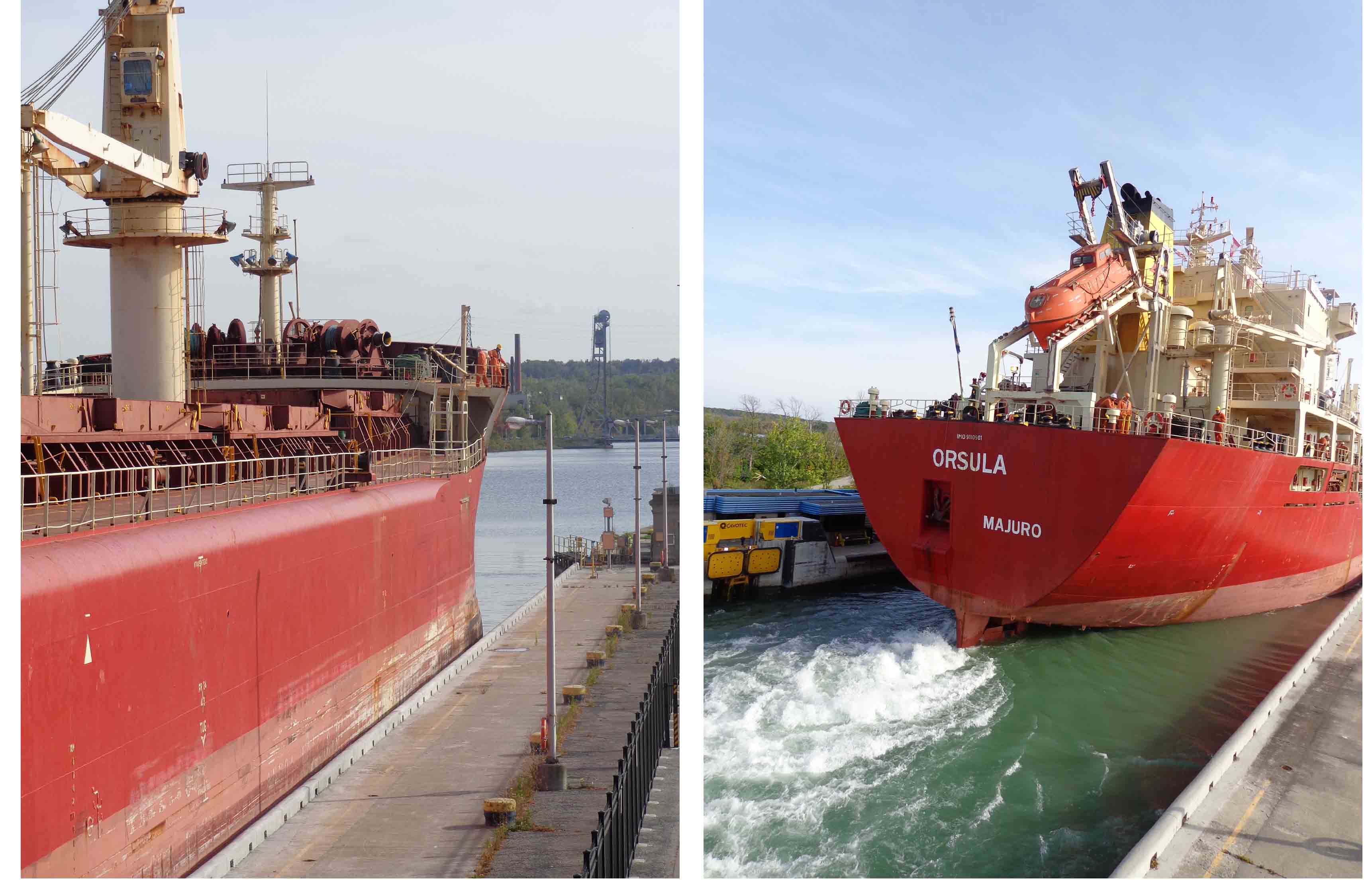
At this stage, the gate is opened to allow the ship to leave the lock. Before the ship leaves the lock. it signals its departure with a loud blast from the ship’s whistle. The ship proceeds ahead to the next lock, to be lifted again by another 12 meters, until the ship crosses Lock 8 on the Canal to reach Port Colborne on Lake Erie.

The reverse process is followed for lowering a ship downstream. The downstream gate is closed and after the ship enters the lock, the upstream gate is closed. Now the water level in the lock is about 12 meters higher than the water level outside the downstream gate. Once the ship is secured, the water in the lock is drained out and with it the ship lowers to a level outside the downstream gate. Now the downstream gate is opened and the ship proceeds ahead to the next lock, to be lowered again by another 12 meters, until the ship crosses Lock 1 on the Canal to reach Port Weller on Lake Ontario.

NiagWELLANDCNL60

The Canal operates 24 hours a day, 7 days a week, from late March until Christmas week.  By then, the ice is usually fairly thick and at times the last ship requires an escort by a tug.  From January until the last week in March, the Canal may be drained anywhere from Lock 7 down to Lock 1 to allow repairs or reconstruction works.

The total cost of transiting the Welland Canal can cost anywhere from $19,000 to $38,000 Canadian Dollar per trip and is based on the gross tonnage of the ship, whether wholly/ partially laden,  the type of cargo in metric tonnes and the number of persons aboard.

The Welland Canal is important because of its ability to move ships full of cargo up and down the Niagara Escarpment and therefore contribute to the economic growth and development of Canada and the United States. Approximately 40,000,000 metric tonnes of cargo is carried through the Welland Canal annually by over 3,000 ocean and lake vessels.

The transportation of goods is not the Welland Canal’s only purpose. The canal’s water is a major resource for industry in Niagara, serving steel mills, ship builders, paper mills and automobile parts manufactures. The canal also serves the people of Niagara indirectly, by providing water for their everyday use. The canal water is also used to generate electricity at a small power plant. It provides recreational pleasure to all who visit and use its connecting lakes, waterways and surrounding trails. The canal area is full of activity with people ship gazing, fishing, hiking and boating all summer long.

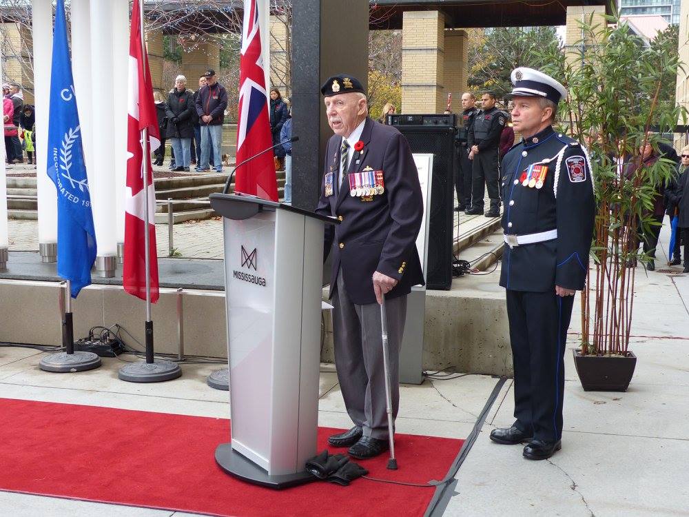
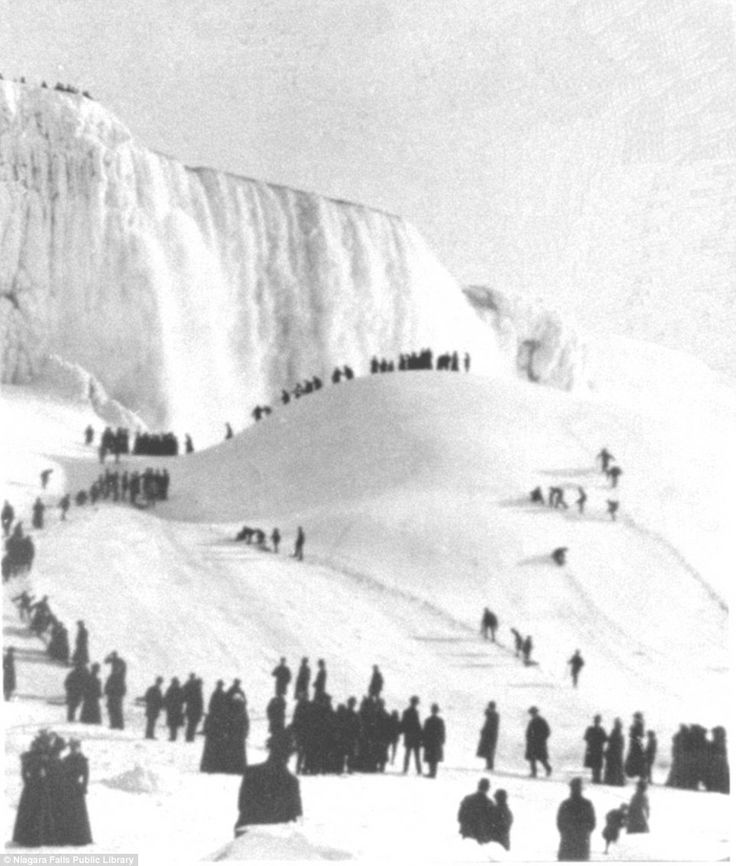
Photos Courtesy Veteran Colonel Abraham Jacob and Major Shona George, Regiment of Artillery, Indian Army

City of Mississauga Remembers Its Braves

WarMemMis1

The City of Mississauga observed the Remembrance Day on November 11, 2015 at 11:11 AM at the Mississauga Civic Centre Community Memorial at the City Hall. The wreath laying and the commemoration ceremony was held at the Community Memorial. The Canadian Flags in the city were lowered to half-mast in honour of Remembrance Day.

WarMemMis2

The Community Memorial consists of a black granite rectangular enclosure with 21 electrically lit candles. These candles represents the 21 gun salute to all the martyrs. Atop the structure, the inscription ” WE WILL REMEMBER THEM” is etched in golden letters.

WarMemMis3

The proceeding was lead by Honourable Navdeep Singh Bains, Minister of Innovation, Science and Economic Development and MP for Mississauga-Malton. Apparently we were the only two India origin attendees among a thousand. The City Commissioners of Police, Fire, Transit, Emergency Medical Services, City Security, all were in attendance. About a thousand people of the City of Mississauaga braved the chilly November morning to assemble at the Memorial to pay their respects and honour the veterans who made sacrifices during times of conflict and those who are still making sacrifices today.

WarMemMis4

There was a choir of primary school children from the neighbouring school in attendance. The schools are where the children usually first learn about who and what Remembrance Day is for. Schools, from Kindergarten to High Schools, go into why we need to give respect and they will usually have an assembly and a veteran or a serving soldier addresses the students. After the assembly, the first hour in class is spent on discussing the sacrifices made by the soldiers and the students are urged to come up with the details of family members, relatives or friends who served or are still serving with the armies around the world.

WarMemMis5

The ceremonies begun with the singing of The Canadian National Anthem. The poem, ‘From the Flanders Fields’, from where begin the tradition of pinning the Red Poppy on Remembrance Day, was recited. The oldest Veteran of the city, Major Robert McNally, a World War II Veteran, gave the memorial address to a standing ovation by the crowd. This was followed by the sounding of the Last Post with a two minutes silence. After that was the wreath laying and all the people trouped past the Memorial, removed their Red Poppies and placed them there.

WarMemMis6a

The history of the City of Mississauga can be traced to the Mississaugas, an Ojibwa band, which migrated South and settled in the area around the delta of Credit River by the 1700s.   ‘Mississauga’ translates as ‘River of the North of Many Mouths’. Through the ‘Mississauga Purchase’ agreement of August 1805, entered by the British Crown and the Native Mississaugas, the Crown acquired over 74,000 acres of land. This area came to be known as the Credit Indian Reserve.

The Mississaugas surrendered all their lands later to the crown through various treaties. This area today forms the cities of Toronto, Mississauga, Brampton and Caledon. By 1847, the Mississaugas relocated and settled in the New Credit Reserve near Brantford, about 100 kilometers South-West of Toronto. The British settlers started arriving by 1800s. They established the villages of Clarkson, Cooksville, Dixie, Erindale, Malton, Meadowvale Village, Port Credit and Streetsville.

By the amalgamation of these villages, the Town of Mississauga was created in 1968, and the City of Mississauga was incorporated in 1974. Today, the City of Mississauga has grown to be Canada’s sixth largest city.

During the World War I, it is estimated that around 800 men enlisted from Mississauga. There are stories about a football team from Port Credit, where all six members reportedly went and enlisted after a game. It is also said about an article in a local newspaper chastising the Streetsville community for having a lower enrollment than Port Credit in an attempt to shame the men of Streetsville to enlist. These brave men fought and died at every major battle, including Vimy Ridge, Somme, Passchendaele and Ypres.

Many war cemeteries in all the villages in today’s Mississauga, stand testimony for the brave deeds of all those who fought in the two World Wars and the Korean War.  Some important memorials are:-

Streetsville War Memorial

WarMemMis6

On July 01, 1926, this monument was unveiled in memory of local veterans who died during World War I in the Village of Streetsville. This 17-foot high Cenotaph has been the centre of many gatherings and ceremonies over the last 70 years. The names of veterans who served in World War II and the Korean War were later added. Over the years, the Cenotaph and its foundation had deteriorated, and the City of Mississauga, assisted by a dedicated community of donors, undertook the restoration work. The Remembrance Day ceremonies in 1993 was conducted at the restored monument. On November 11 of every year, ceremonies are held in remembrance of all those who laid down their lives, the veterans and the serving soldiers of Canada.

Malton Village Memorial

WarMemMis7

The village of Malton played a key role in aircraft production and development for several years. This memorial is featured in two parts.  First is the traditional cenotaph, second is a static aircraft displayed in the same park.

The aircraft is a CF-100, which was produced in Malton, from 1951 to 1958.  It bears the markings of the 414 Squadron from CFB North Bay.  A plaque on the cement pedestal gives thanks to the local production of this all-weather fighter from the cold war era.  The CF-100 monument was erected on this site in 1974 by the Malton branch of the Royal Canadian Legion.  The Malton Legion was also a driving force behind the 1978 unveiling of the cenotaph which pays homage to the war dead of Malton and surrounding regions.

Port Credit Cenotaph

WarMemMis8

Mississauga’s oldest Cenotaph was unveiled on November 9, 1925. It was designed and constructed by Louis Temporale who received the Order of Canada for master craftsmanship in stone masonry. It was built to honour the men who answered the call to serve in World War I. In 1946 and 1983, the names of the soldiers from the area who fell during the World War II and the Korean Conflict were added.

Solomon P. Ortiz, Jr, a former Member of the Texas House of Representatives aptly said “To honor our national promise to our veterans, we must continue to improve services for our men and women in uniform today and provide long overdue benefits for the veterans and military retirees who have already served”.

Women Power in Canada 2015

Cabinet

On November 04, 2015 the twenty-third Prime Minister of Canada, Justin Trudeau, along with his 30 cabinet colleagues were sworn in by David Johnston, the Governor General of Canada. The swearing in ceremony took place at the Rideau Hall called the ‘ Canada’s house’. It is the official residence in Ottawa, the Capitol city of Canada, of the Governor General of Canada.

The Governor General is the representative of the Canadian monarch, currently Queen Elizabeth II.   He is appointed by the monarch on the advice of the Canadian Prime Minister, to carry out most of her constitutional and ceremonial duties.

It was a historical moment for Canada as it was for the first time that the grounds of Rideau Hall were opened to the public to facilitate the crowds to watch the proceedings on giant TV screens. Rather than driving down one by one in their separate cars, as had been the practice in the past, Trudeau and his cabinet arrived at Rideau Hall together on a bus. They then walked up the long driveway, together, while crowds of onlookers clapped and snapped photos. Keeping up with the technological developments, it was for the first time a live video stream of the swearing-in ceremony was shared on Trudeau’s Twitter account.

Finally, but the most important aspect was Prime Minister Justin Trudeau’s ability to fulfill his pledge of gender equality in his cabinet. He had 15 men and 15 women as his ministers. Many supporters claimed that it was a giant leap for the Canadian politics and that Canada never really had gender parity in the past. Many opined that it was a historic day for women and it would send a great message to the country and to the entire world. Canadian politicians have been often talking about parity during campaigns but actually ever implemented it.

On hearing the news, I was reminded of the conversation I had a few years ago with Mr Smith, an octogenarian who lived three streets down our home. He said that when the Second World War broke out, he was living with his parents and two elder brothers up North in a large farm. His dad and the two brothers left to serve the army in Europe and he and his mother were left behind to look after the farm. He added that similarly, most farms, schools, businesses, banks and male dominated jobs like bus/ truck drivers, delivery, factory jobs, etc, were all taken over by the women folk.  As per him, by 1945, when all the male folk returned, they could never take back control of what they had left in the care of women and to the present day, this scenario continues. He opined that this is the reason why we have Hazel McCallion as our Mayor (Click Here to read more about Hazel) (now Bernie Crombie) and Kathleen Wynne as the Premier of Ontario.

When the Prime Minister was posed a question about the gender equality at the swearing in ceremony, he bluntly remarked that it is 2015 and hence he has 15 women and 15 men in his cabinet. Taking a dig at his predecessor, Stephen Harper, Trudeau said that Harper took oath in 2006 and hence he had six women in is cabinet of 26.

Trudeau’s emphasise on gender parity in his cabinet has invited criticism from many fronts. Some termed it as ‘tokenism’ where in the merit has taken a back seat. Some claimed that by not making better qualified and more competent persons as ministers, Trudeau has compromised on national interests.

His supporters on the other hand claim that the women appointed to the cabinet are strong, able and capable. They expect many to leave a mark and also soar to greater heights in terms of competency, recognition and accomplishment.

Worldwide, Finland enjoys the best female representation at the top table of government with 10 women among its 16 ministers. Close behind is Sweden with 52.9 percent female representation. Today Canada ranks in joint-third place with France. In the United Kingdom’s cabinet, only a third is women. At the other end of the scale is  Saudi Arabia and Pakistan, with no women in their cabinets.  The statistics on women members on public company boards is still low with Norway at 36%, Finland & France at 30%, Canada at 21% and USA at 19%.

Prime Minister Trudeau is 43 years old and most of his ministers are aged under 50. This reflects a generation change and a commitment to uphold Canadian values in general, and gender equality in particular.. Justin Trudeau’s father, Pierre Trudeau was the Prime Minister of Canada from 1980 to 1984.

Cabinet1    Cabinet2     Cabinet3

Many of the women ministers have been given key roles. A former journalist, Chrystia Freeland is now in charge of international trade.  Maryam Monsef, who fled Afghanistan as a refugee 20 years ago, will oversee the democratic reform portfolio.The Health Minister, Jane Philpott, is a family physician.

Cabinet4   Cabinet5

Jody Wilson-Raybould, a First Nations leader and former Crown prosecutor, was made the Justice Minister and Attorney General. Catherine McKenna, a lawyer with a graduate degree from the London School of Economics and an impressive background that includes experience in international trade and social justice initiatives, was appointed Environment and Climate Change Minister.

Cabinet7

The Minister of Sport and Persons with Disabilities is Carla Qualtrough. She is visually impaired since birth and she competed for Canada in two Paralympic Games, winning a bronze medal in the 4x100m medley relay at the 1988 Seoul Games, and two more bronze medals in the medley relay and freestyle relay at the 1992 Barcelona Games.  She holds degrees in political science from the University of Ottawa and law from the University of Victoria. She also served as a legal counsel on the Canadian Human Rights Tribunal in Ottawa.

Cabinet8

Kirsty Duncan holds the Science portfolio, has a Ph D in geography and she taught meteorology, climatology, and climate change at the University of Windsor. She has been an outspoken critic of the degradation of scientific research in Canada with government libraries shuttered and government scientists muzzled.

In Canada, women have come to the forefront and Prime Minister Trudeau by his decision to induct 15 women ministers in his cabinet has shown the way ahead.  With more women in Governance, are we heading towards the ideal of a more sane, compassionate and benevolent world?

Niagara Gorge

Visitors to Niagara Falls, a geographic wonder, located at the border of Canada and US, generally view the falls and return without going into its geology and the natural history behind its formation.

Niagaragorge20

Niagara Falls is the aggregate name for three waterfalls that structure the Southern end of the Niagara Gorge. The first person to see and describe Niagara Falls was Father Louis Hennepin, a French priest in 1678.

Niagara Falls is over 12,000 years old and were formed at the end of the last Ice Age, when the melting glaciers formed the Great Lakes. Water from Lake Erie at an elevation of 175 meters above sea level, flowed downhill towards Lake Ontario which is at an elevation of 75 meters. While the water rushed from one lake to another, the Niagara River, about 58 kilometers in length; a natural outlet from Lake Erie to Lake Ontario, was carved out. It is one of the rare rivers in the Northern Hemisphere that flows from the South to North. At one point, the river had to rush over a large cliff (the Niagara Escarpment). As the falls eroded over time, the Niagara Gorge of about 11 km from where the falls were initially formed.

The river formed the gorge, and the Falls has receded upstream and South toward Lake Erie, by slow erosion of hard rock on the surface rock of the escarpment and the relatively soft layers beneath it. The force of the river current in the gorge is one of the most powerful in the world. Due to the dangers this presents, kayaking the gorge has generally been prohibited.

The water that flows over Niagara Falls is greenish-blue and sometimes, after storms, which stir up dirt at the bottom of the river and the Great Lakes, the water briefly turns brown. An estimated 60 tons of dissolved minerals are swept over Niagara Falls every minute. The greenish blue colour comes from the dissolved salts and ‘rock flour,’ very finely ground rock, picked up primarily from the limestone bed and also from the soft rock beneath it.

Niagaragorge21

At the Northern end of the gorge are two hydel power projects on the Canadian side – Sir Adam Beck Hydroelectric Generating Stations I & II. Adam Beck I contain 10 generators and first produced power in 1922 and Adam Beck II contains 16 generators and first produced power in 1954. Today, almost 2000 mega Watts of electricity is generated from these power plants.

In 2019, about 92% of electricity in Ontario was produced from zero-carbon sources: 59% from nuclear, 24% from hydroelectricity, 8% from wind, and 1% from solar.

Niagaragorge22

On the American side of the border is the Robert Moses Niagara Power Plant and the Lewiston Pump Generating Plant, together generate more than 2400 mega Watts of electricity.

The falls still continue to erode, however, the rate has been greatly reduced due to flow control and diversion for hydro-power generation. Recession for at least the last 600 years has been estimated at 1 to 1.5 meters per year. Its current rate of erosion is estimated at 1 foot per year and could possibly be reduced to 1 foot per 10 years. Erosive forces include the action of frost from the spray, the dissolving action of the spray itself, and abrasion action of the softer shales by fallen limestone boulders.

The Great Lakes in general are very sensitive to high-or-low precipitation years, and this can affect the flow from Lake Erie into the Niagara River.  However the levels have been regulated by the International Joint Commission (USA and Canada) since 1910.

The basis for determining the amount of water that can be diverted for power generation is contained in the ‘1950 Niagara Treaty.’ The treaty requires that during the daylight hours of the tourist season (0800 to 2200 hours local time, April 01 to September 15 and 0800 to 2000 hours local time September 16 to October 31), the flow over Niagara Falls must not be less than 2832 cubic meters per second (cubic m/s). At all other times, the flow must not be less than 1416 cu m/s.

From biggest to littlest, the three waterfalls that form the Niagara Falls are the Horseshoe Falls, the American Falls and the Bridal Veil Falls.

Niagaragorge23

The Horseshoe Falls (from its semi-circular shape) lie generally on the Canadian side and the American Falls with the Bridal Veil Falls totally on the American side, differentiated by Goat Island. The best view of the falls is from the Canadian side and you can hardly see the falls from the US side. You are almost always guaranteed to see a rainbow if you are on the Canadian side of the Falls. The best time to capture this beautiful phenomenon is from about noon until sunset in the summer.

Niagara Falls by day is breathtaking, by night it is spectacular. Niagara Falls at night is well-known for the illumination on the falls with coloured lights coming from the Illumination Tower, located on the roof of the Table Rock Centre. The Falls are illuminated in glowing colours creating a stunning vista that can be viewed from near and far. The glowing waters against the dark sky elevate the beauty of the thundering wonder, making Niagara Falls at night unlike anything you’ve ever experienced.

IMG_1588

A boat ride through the gorge to the Horseshoe falls (May through October) is indeed an unforgettable experience for everyone.

The greatest threat to the integrity of the Horseshoe Falls and the American Falls is rock falls. The American Falls has been the victim of many rock falls in the past. As the rock boulders collect at the base, it reduces the distance of the water fall and creates more of a cascade effect.  On July 24, 1954,  a huge section of rock collapsed at the brink of the American Falls, sending about 185,000 tons of rock into the Niagara River Gorge.  Later, many controlled blasts were carried out to remove the fallen boulders beneath the American Falls.

What happens to the Niagara Falls during the freezing Canadian Winters?

Niagaragorge29

Usually in January, after a heavy snowfall, the strong southwest wind breaks up the ice on Lake Erie and sends it down the Niagara River and over the Falls. The wet ice forced up out of the water below the Falls freezes into a huge mass, growing into a structure of considerable size and strength, called an Ice Bridge.   In the 1890s, visitors to the Falls would often venture out on the ice bridge and many vendors would even set up stalls to sell refreshments. Since a tragic event in 1912, when the ice suddenly broke up and two tourists were killed, going out on the ice bridge has been strictly prohibited.

During the severely cold frigid winter days, the falls do appear to be frozen, but the water never actually stops flowing underneath.  The Niagara River being an important source of hydro power, a long ice boom made of steel catches any icebergs, while ice breaker boats work around the clock to prevent the falls from jamming up.

Niagaragorge31

On 29 March 1848, Niagara had stopped for thirty hours. The river bed dried up and those who were brave enough, walked or rode horses over the rock floor of the channel. Then, with a roar, Niagara was back in business. This phenomenon was due to high winds that set the ice fields of Lake Erie in motion and tons of ice got lodged at the source of the river, blocking the channel completely, until finally a shift in the forces of nature released it and the pent up weight of water broke through.

Niagaragorge33

The flow over the American Falls was stopped completely for several months in 1969. The idea was to determine the feasibility of removing the large amount of loose rock from the base of the falls to enhance its appearance.  Visitors from near and far traveled to see this once in a lifetime experience. On one side of the Falls only a trickle of water would flow over the brink, while the Horseshoe Falls were flowing stronger than ever.  The project was abandoned seeing the high cost it involved.

Niagaragorge27

The future of Niagara Falls is not easily predicted. The Falls of Niagara as we know it today will remain as it is for thousands of years to come. Erosion is the largest factor which will alter its appearance in the future. Some have estimated that the Falls would continue eroding Southward for the next 8,000 years at which time it would reach the limits of Lake Erie.

Perhaps the most realistic outlook is that the Falls will continue to erode Southward. There is no doubt that at some point in its future that the main Horseshoe Falls once it has eroded far enough South, will cut off the water flow to the American Falls. The Falls of Niagara will once again become one.

Archive Photos Courtesy Niagara Falls Library