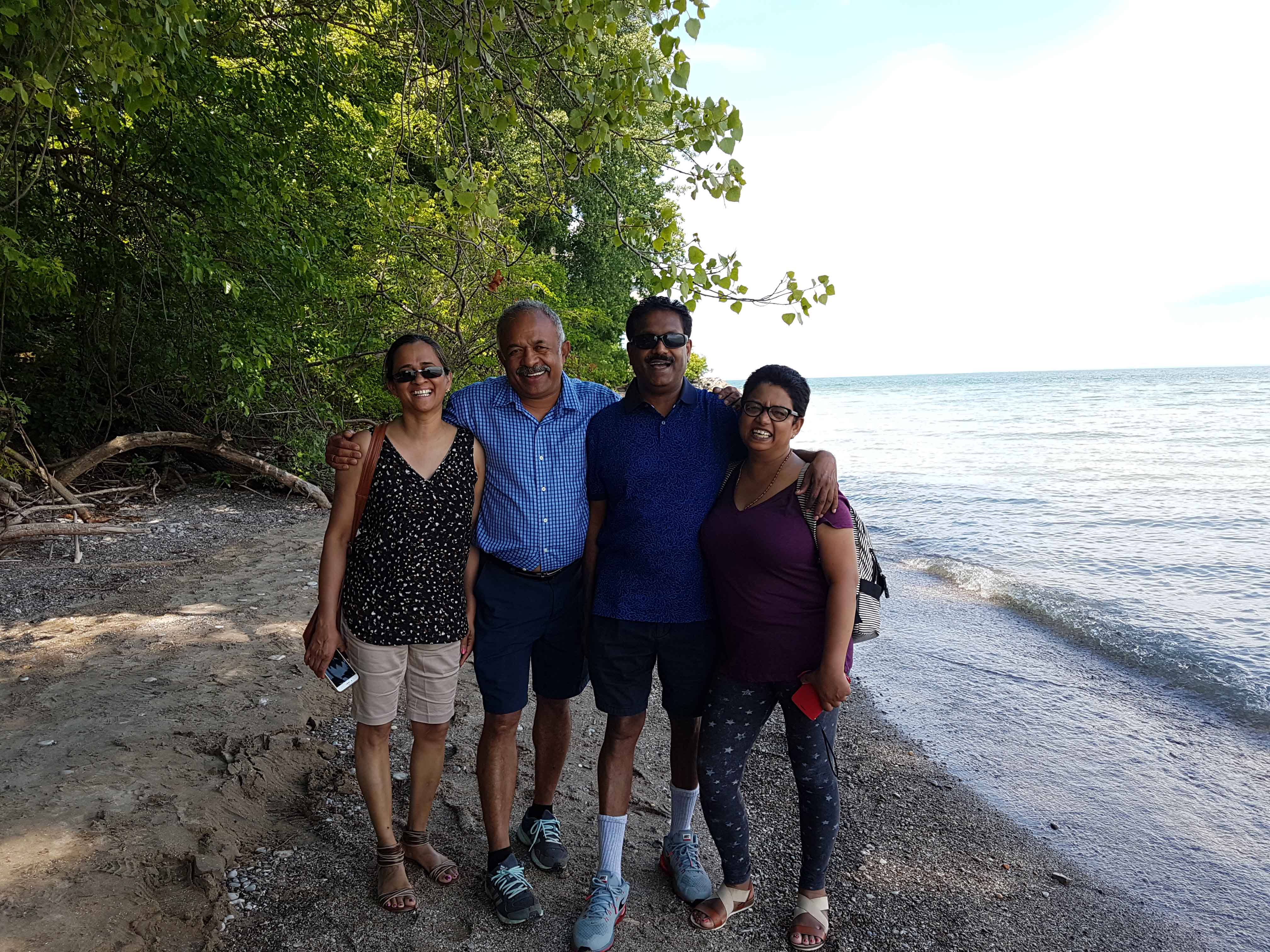
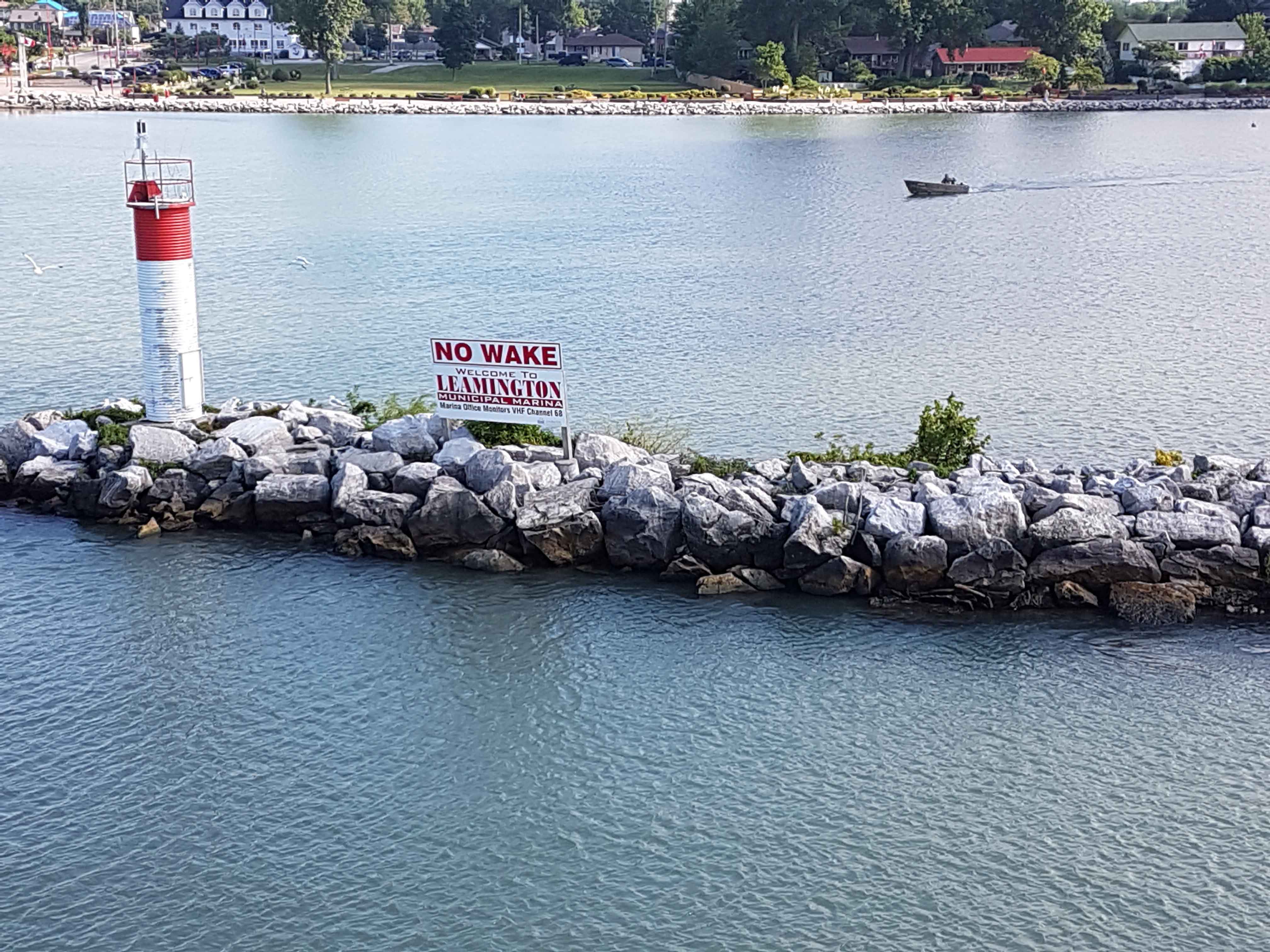
On July 08, 2017, we along with Stephens, our travel companions, travelled from Toronto to Lemington, a four hour car drive along Highway 401. We boarded MV Jiimaan, a vessel 200 ft)in length that transports 400 passengers and 40 vehicles on Lake Erie from Lemington to Pelee Islands. The cruise was of about 90 minutes. The ferry housed a cafeteria and the view from the deck was awesome.
Pelee Island, (42 Sq Km) largest island in the Western End of Lake Erie, is the Southernmost tip of Canada. It was leased to Thomas McKee by Ojibwa and Onawa tribes in 1788. The island’s name is derived from a French word ‘pelee’ meaning barren. It remained barren, true to its name until it was purchased by William McKormick in 1823.
The Pelee Island Lighthouse was built by John Scott in 1833. William McCormick donated the land and also served as its first light-keeper till 1840. The lighthouse used to guide sailors through the rocky Pelee Passage in Erie Lake until it went out of service in 1909.
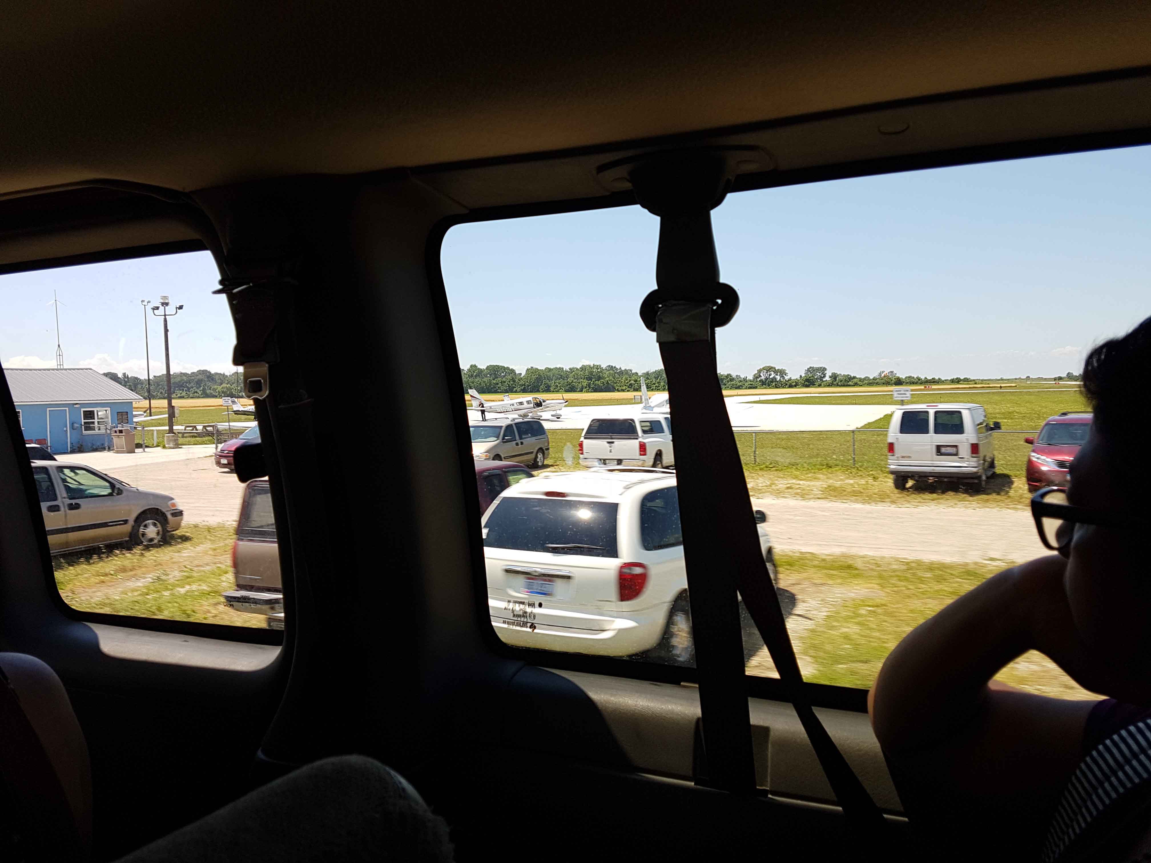
Only other way to get on to the Pelee Island is through the International Airport with a 3,300 feet paved runway. Regular flights operate in winter when the ferry services are closed. It serves as the emergency pickup point. It might be the smallest International Airport in Canada – it is International as it receives flights from USA, just South of it.
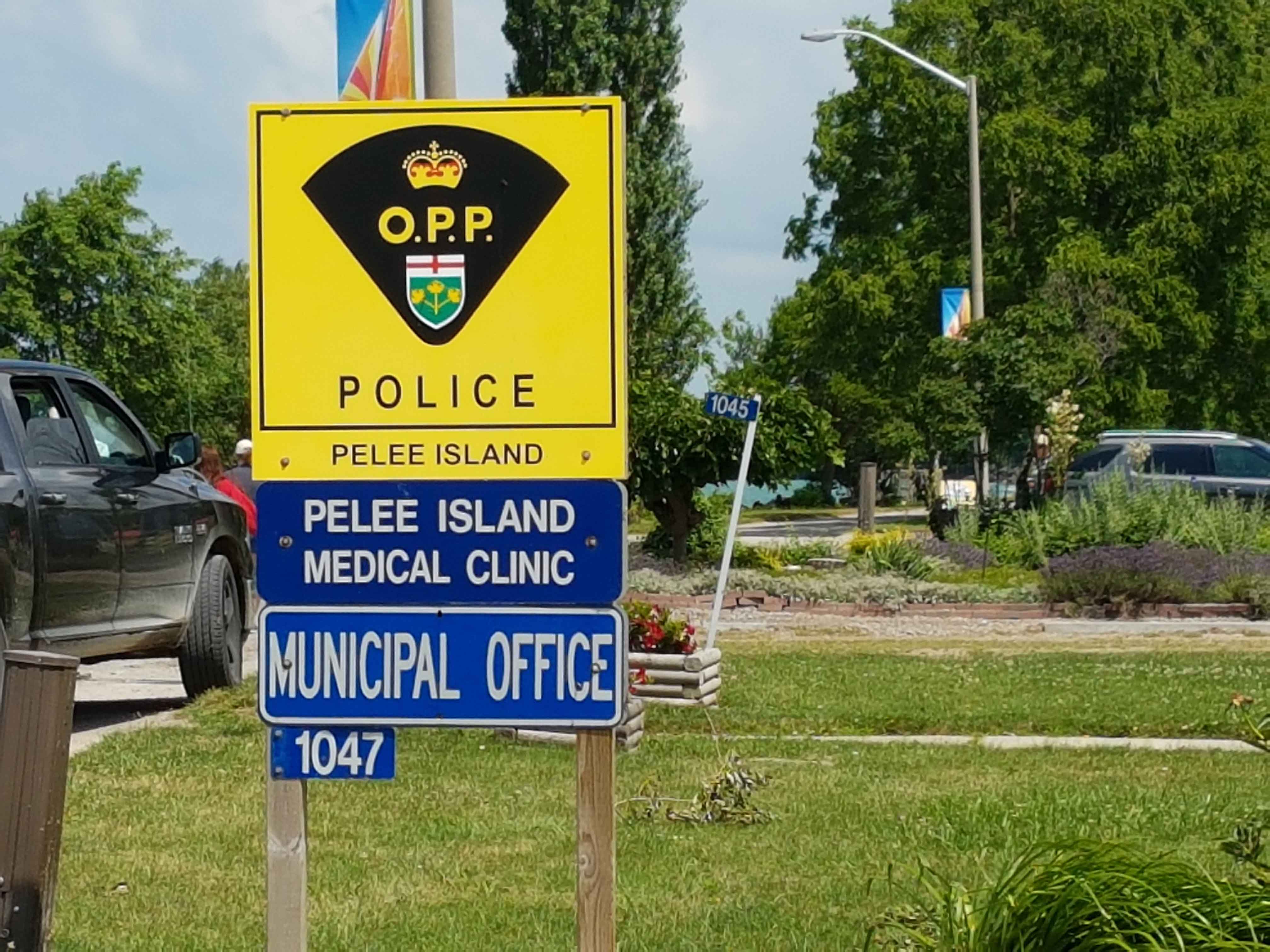
The population of Pelee Island is about 140. In summer about 100 migrant workers land on the island to support both tourism and agriculture. The island has a Police Station manned by two personnel, obviously there is hardly any crime and the last major crime was reported in 1920. The Emergency Services is operated by two Para-Medics with an ambulance and a Nurse Practitioner manning the Medical Clinic. Emergency cases are airlifted to the mainland at Lemington. The Fire Department has a fire tender operated by volunteer crew.
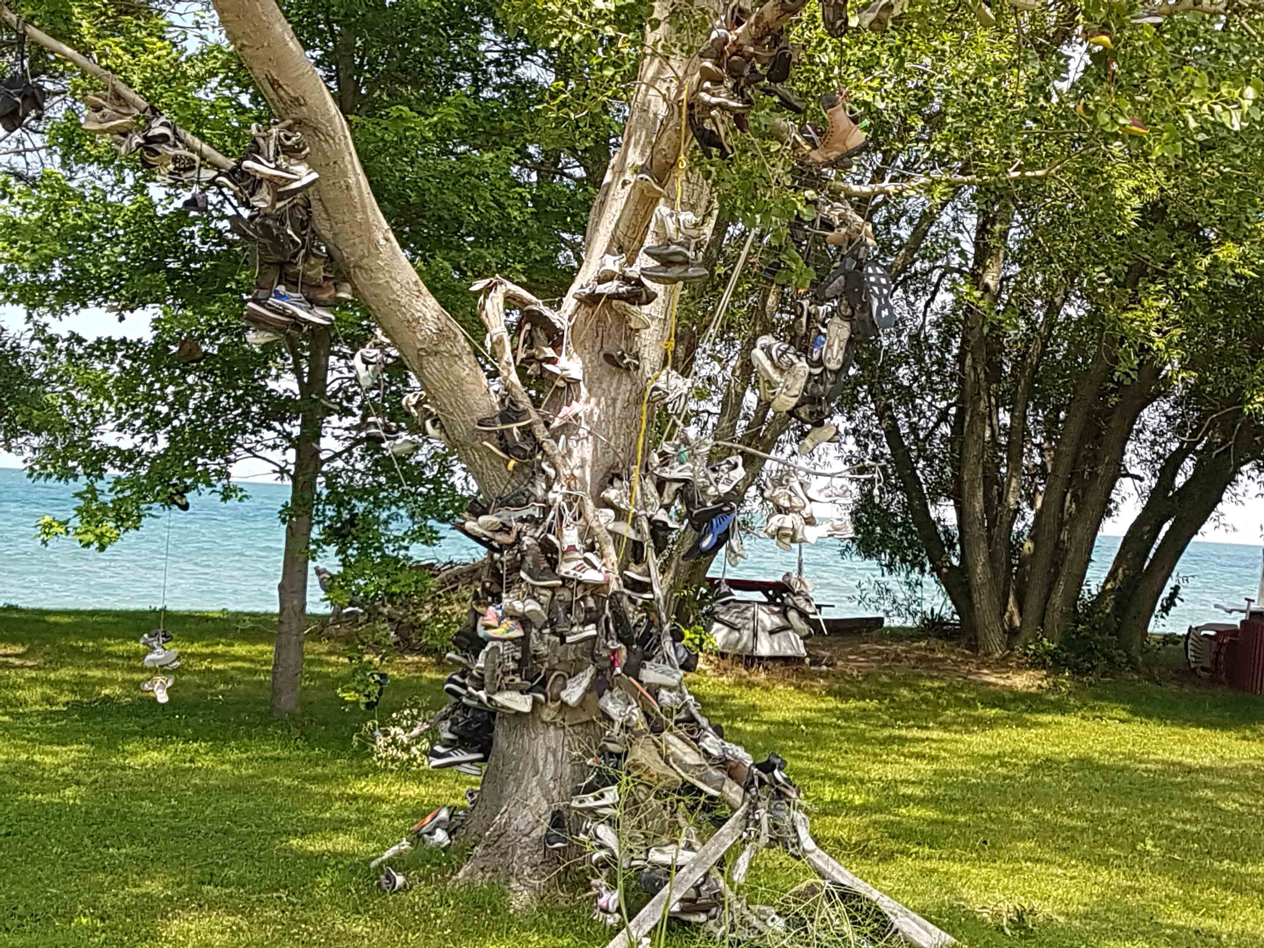
This is the shoe tree which has an interesting history. The tree was given up for dead and the home owner tied a pair of shoes on to it and it is believed that it re-grew thereafter. All the migrant workers, on leaving the island at the end of the season now tie their work-shoes on the tree to bring them good luck. Some do it with a hope to return to the island for work next year.
The island is mainly agricultural based with about 5,000 acres of soybeans, about 1,000 acres of wheat, 500 acres of grape cultivation. The centre of the island was a large marsh which was drained out to form the fertile agricultural land. Thus most cultivation is done below the Lake’s level and hence there is always fear of floods. The houses on the island are built on stilts to save them from flooding.
After spending the day on the island, we boarded the ferry on our return voyage to Lemington and then we drove off to Toronto.
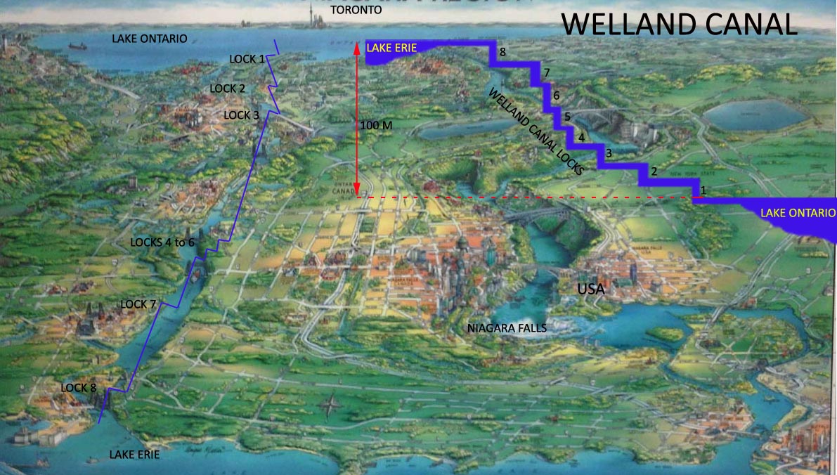
Visitors to one of the greatest natural wonders of the world, the Niagara Falls are often unaware of an amazing man-made wonder of the world, the Welland Canal, located close by, on the Canadian side. The Welland Canal is a navigational canal, 43.5 km long, crossing the Niagara Peninsula, from Port Weller on Lake Ontario to Port Colborne on Lake Erie. It overcomes a height difference of 100 m between the two lakes and bypasses the turbulent Niagara River and Niagara Falls. On average, about 37 million tons of cargo is handled each year through the canal, mainly iron ore, wheat, corn, soyabean, steel and cement.
The first Welland Canal opened in 1829, costing 8 million dollars, under the management of William Hamilton Merritt. It was originally built to solve summer water shortages that affected the operation of a mill owned by Merritt and later converted for passage of ships. It was 2.4 meters deep and consisted of 40 wooden locks. The operation of the canal required a great deal of physical labour as horses, mules and oxen were used to tow the ships from one lock to another.
With the increased traffic and to cater for bigger ships, the canal was reconstructed in 1842 and 1887. The fourth and current 9.1 meters deep canal was constructed between 1913 and 1932. There are now eight locks, each 24.4 meters wide and 261.8 meters long. The canal runs perpendicular to the Niagara Escarpment and is the most direct route of all three previous canals. The canal today caters for ships up to a maximum of 225.5 metres long and 23.7 metres wide.
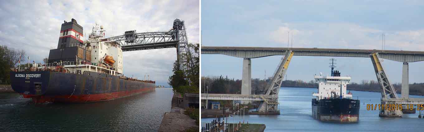
There are about 20 bridges that cross the Welland Canal, of which many have been removed, some are still lifted and lowered to allow the ships to pass through. There have been a few accidents of ships colliding with bridges. On September 30, 2015, a German vessel Lena J, travelling from Montreal to Colborne (upstream), hit a bridge near Port Colborne, closing the canal operations for several hours.
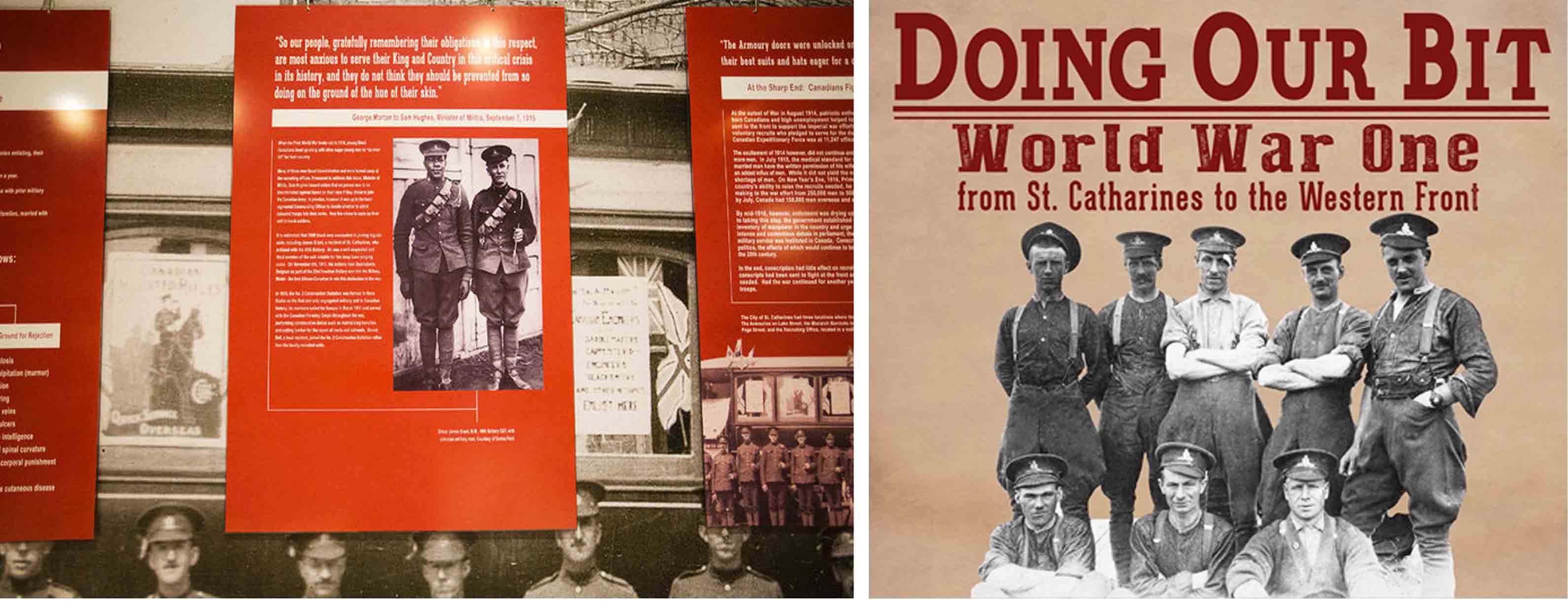
The most popular position to view the lifting/ lowering operations is at the observation deck at Lock 3. It is co-located St. Catharines Museum and Welland Canals Centre. The history of the Welland Canal and the St Catherines Town is brought to life through various exhibition galleries at the Museum.
The most attractive one, especially for the students of military history, are the galleries that portrays local stories from the war of 1812 to the current day to life.
The ships are lifted/ lowered with the help of gravity and large quantities of water in a watertight chamber called a lock. The force of gravity is used to fill or drain a lock moving about 95 million litres of water in about 11 minutes.
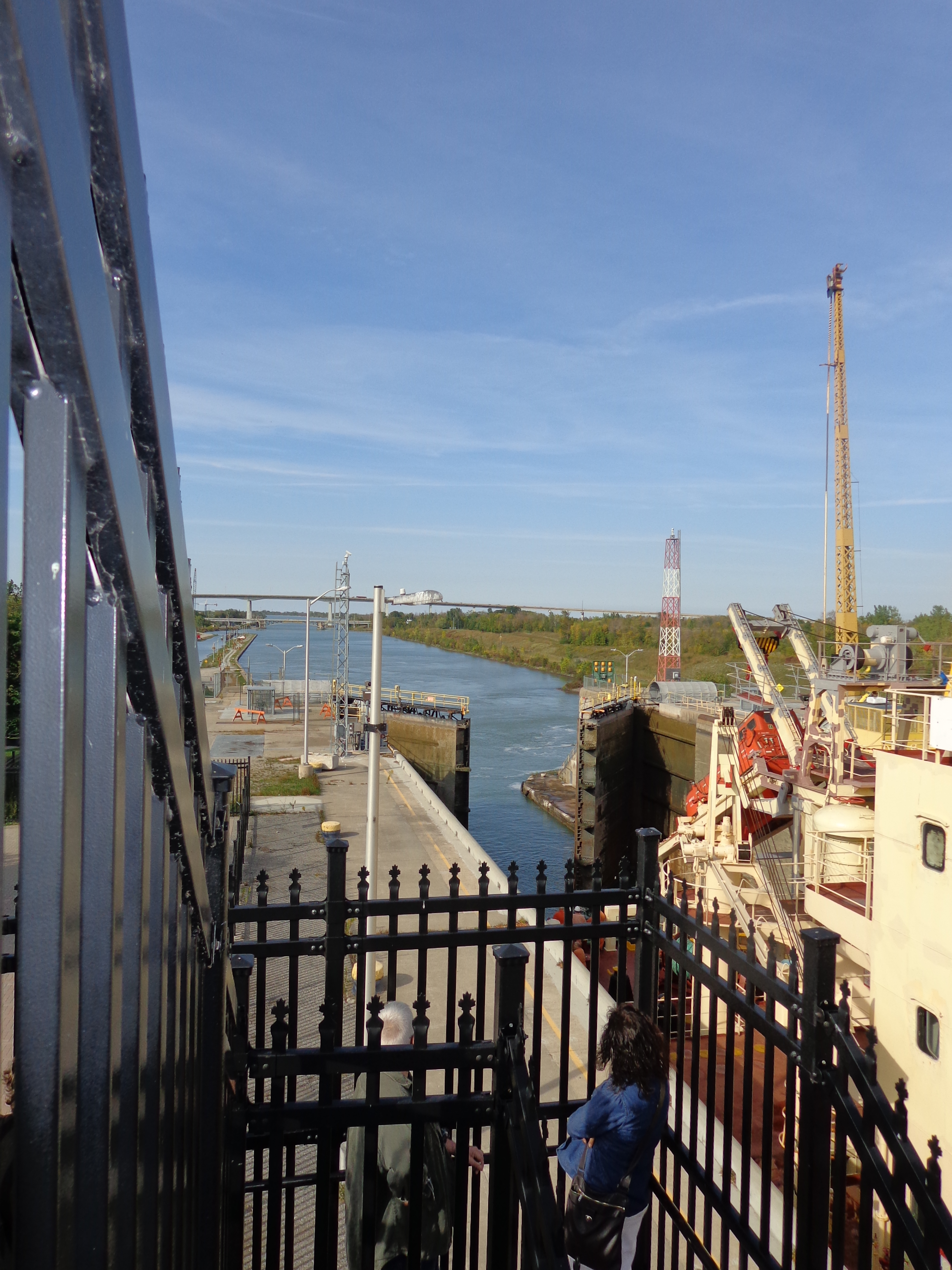
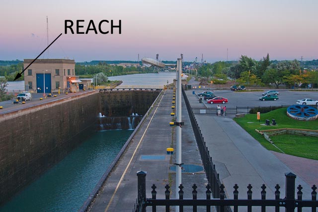
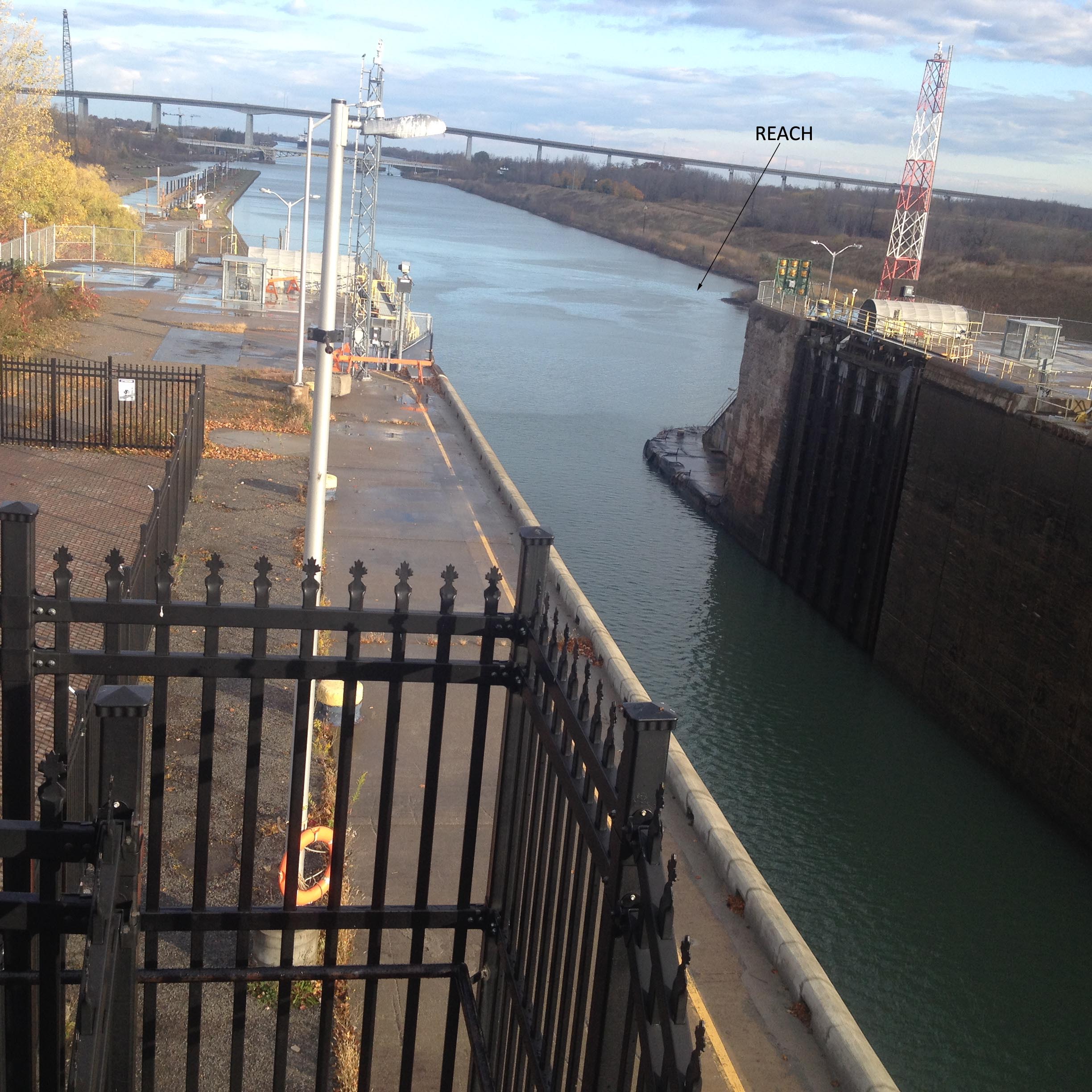
There are no pumps used to either fill or empty the locks. The water comes in from the ‘reach’ above each lock . When a lock is emptied, the water goes into the ‘reach’ below the lock. A small amount of electricity is used to open and close the valves. It is an example of brilliant, yet simple innovative engineering.
It generally takes about 30 minutes for a ship to cross a lock, even though the actual lowering/ lifting operation takes only about 11 minutes. Most of the time is spent manoeuvring the ship into position and tying it up called ‘Spotting a Ship’. Smaller Ships would take a longer time because more water is needed to either fill or empty from the lock in order to lift or lower it.
A ship being lifted upstream would enter a lock with lower water level at the open gate and a higher water level at the closed gate. The upstream gate is closed, holding back the water that the force of gravity is attracting downstream.
The water level at the open gate is at a lower level, about 12 meters below the water level at the closed gate upstream. The water level between the gates are always in level with the open gate.
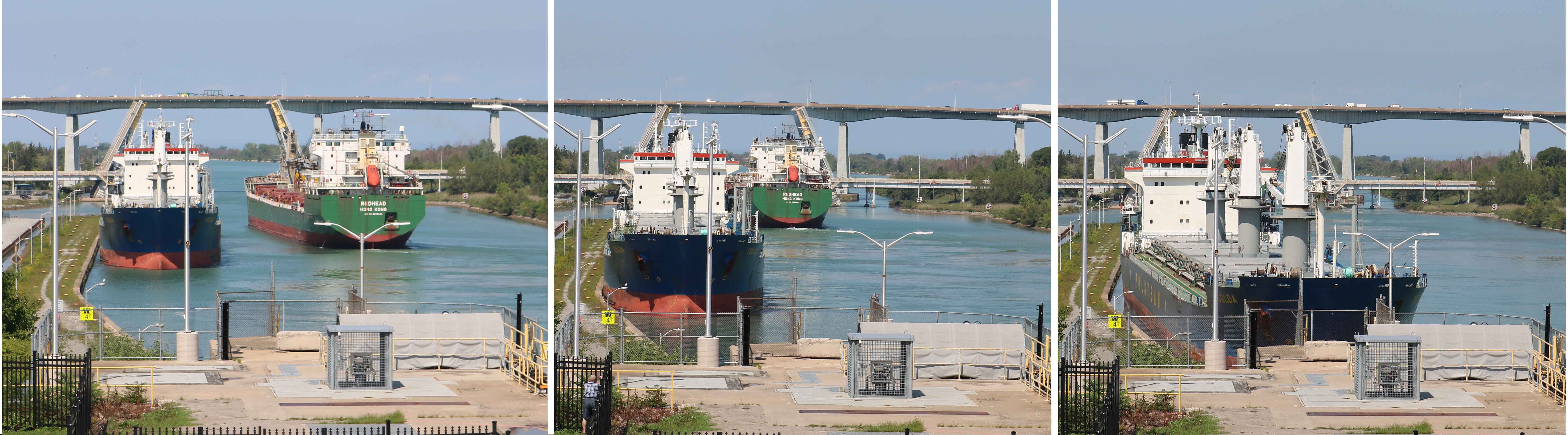
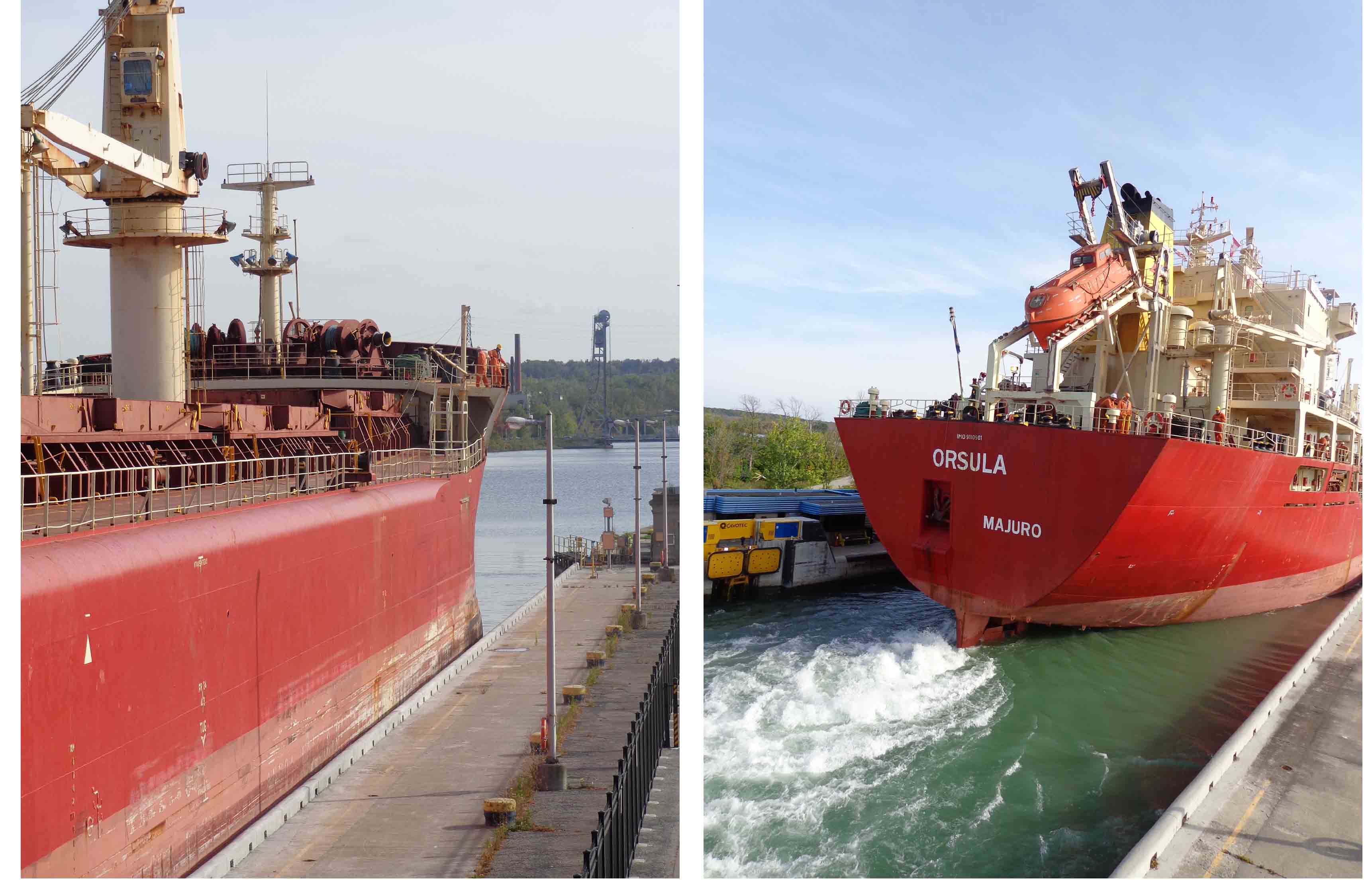
A ship approaching the lower end gate of the lock, touches the ‘sliding wall’, an angular construction about 200 meters from the lock. This sets the bow of the ship on the right course to facilitate easy entry into the narrow lock. Here the ship may berth to facilitate passing of a ship in the opposite direction.
When the ship enters the lock, between the two gates, the lower gate is closed. This makes the lock a somewhat water tight concrete lock chamber. In Lock Number 3, the ship is secured in the lock chamber by a hands-free system that secures a vessel by using vacuum pads mounted to a rail fixed within the lock wall. In other locks, the ship is secured by tying ropes on to the bollards. This ensures that the ship remains stable during the lifting or lowering process.
Once the ship is secured, water from the reach fills the lock chamber by way of a filling valve.
When the water level in the lock reaches the same water level as that on the upstream gate, the ship has got lifted by about 12 meters from the position it entered the lock. Now the ship is untied from the bollards.
At this stage, the gate is opened to allow the ship to leave the lock. Before the ship leaves the lock. it signals its departure with a loud blast from the ship’s whistle. The ship proceeds ahead to the next lock, to be lifted again by another 12 meters, until the ship crosses Lock 8 on the Canal to reach Port Colborne on Lake Erie.
The reverse process is followed for lowering a ship downstream. The downstream gate is closed and after the ship enters the lock, the upstream gate is closed. Now the water level in the lock is about 12 meters higher than the water level outside the downstream gate. Once the ship is secured, the water in the lock is drained out and with it the ship lowers to a level outside the downstream gate. Now the downstream gate is opened and the ship proceeds ahead to the next lock, to be lowered again by another 12 meters, until the ship crosses Lock 1 on the Canal to reach Port Weller on Lake Ontario.
The Canal operates 24 hours a day, 7 days a week, from late March until Christmas week. By then, the ice is usually fairly thick and at times the last ship requires an escort by a tug. From January until the last week in March, the Canal may be drained anywhere from Lock 7 down to Lock 1 to allow repairs or reconstruction works.
The total cost of transiting the Welland Canal can cost anywhere from $19,000 to $38,000 Canadian Dollar per trip and is based on the gross tonnage of the ship, whether wholly/ partially laden, the type of cargo in metric tonnes and the number of persons aboard.
The Welland Canal is important because of its ability to move ships full of cargo up and down the Niagara Escarpment and therefore contribute to the economic growth and development of Canada and the United States. Approximately 40,000,000 metric tonnes of cargo is carried through the Welland Canal annually by over 3,000 ocean and lake vessels.
The transportation of goods is not the Welland Canal’s only purpose. The canal’s water is a major resource for industry in Niagara, serving steel mills, ship builders, paper mills and automobile parts manufactures. The canal also serves the people of Niagara indirectly, by providing water for their everyday use. The canal water is also used to generate electricity at a small power plant. It provides recreational pleasure to all who visit and use its connecting lakes, waterways and surrounding trails. The canal area is full of activity with people ship gazing, fishing, hiking and boating all summer long.
Photos Courtesy Veteran Colonel Abraham Jacob and Major Shona George, Regiment of Artillery, Indian Army