Juneau – The Capital City of Alaska

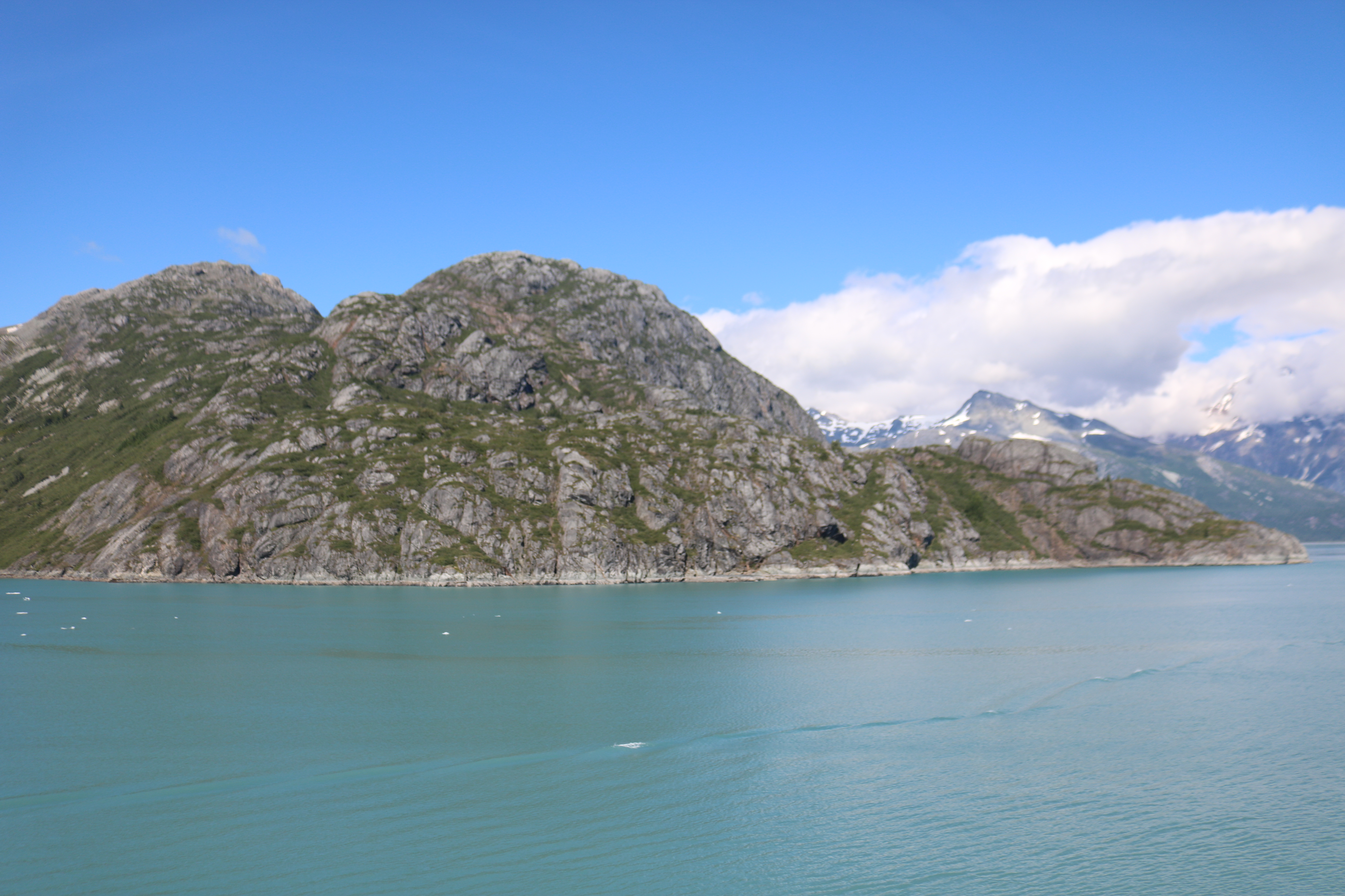
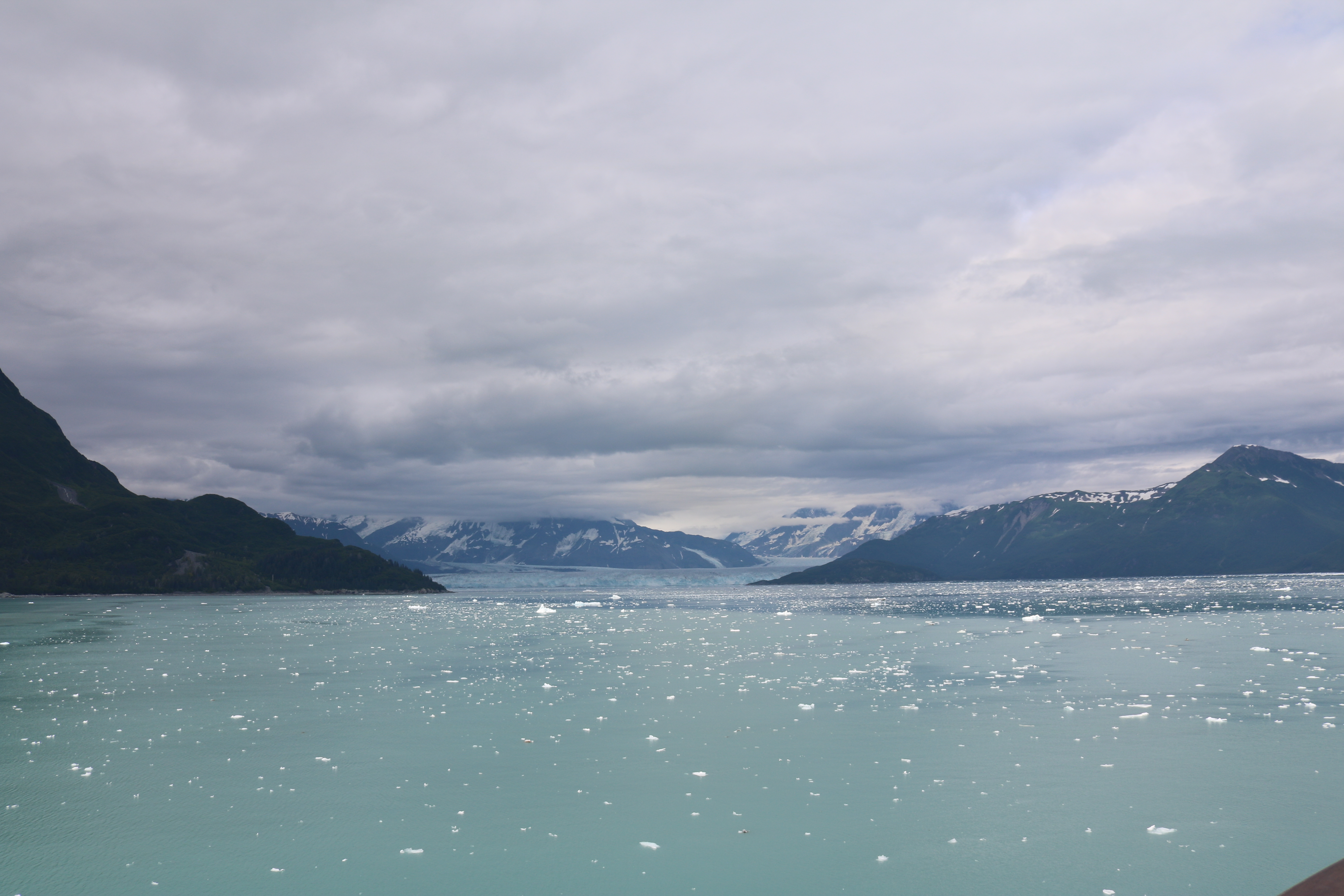
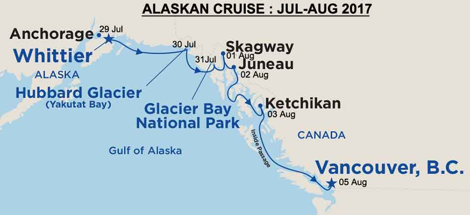
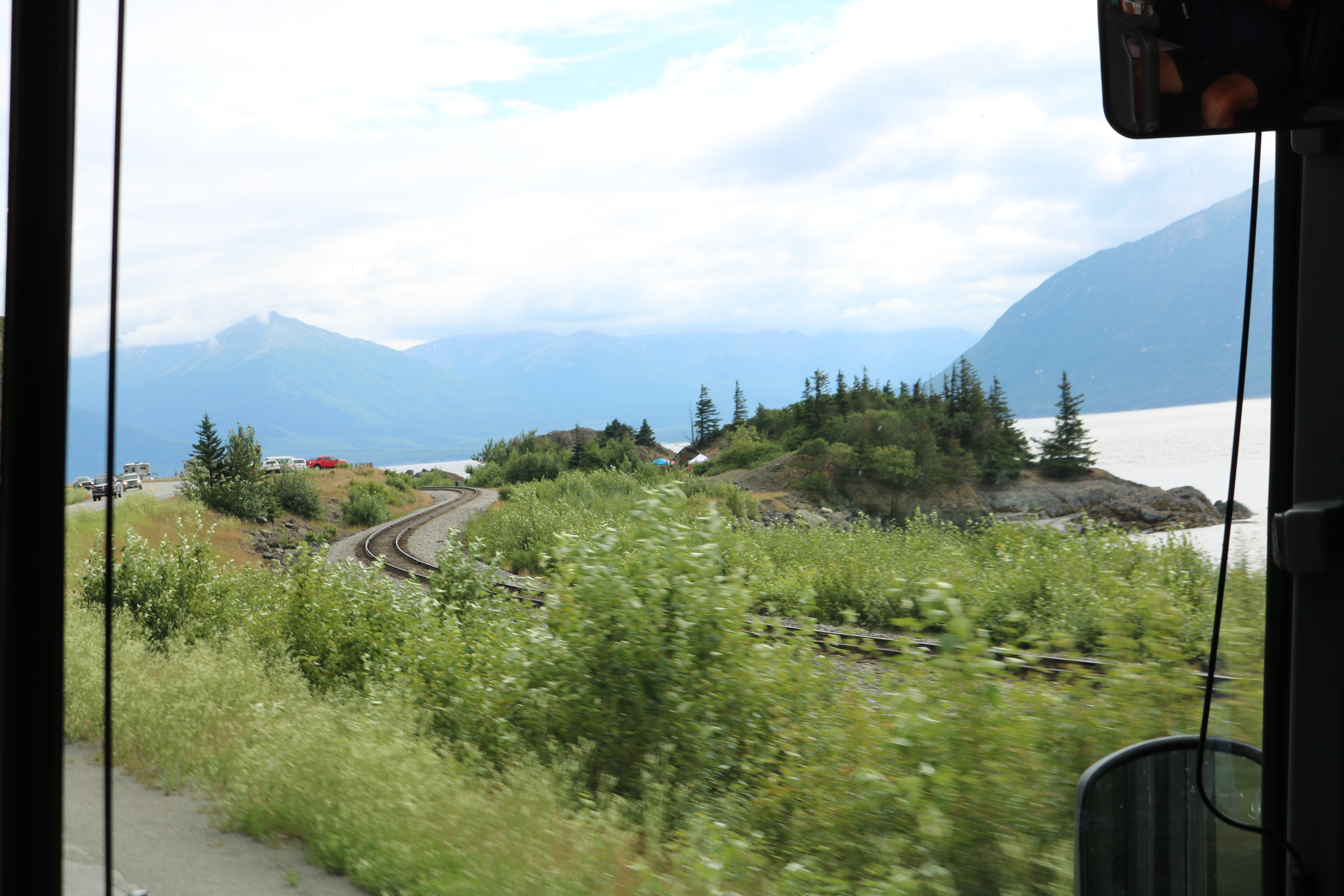
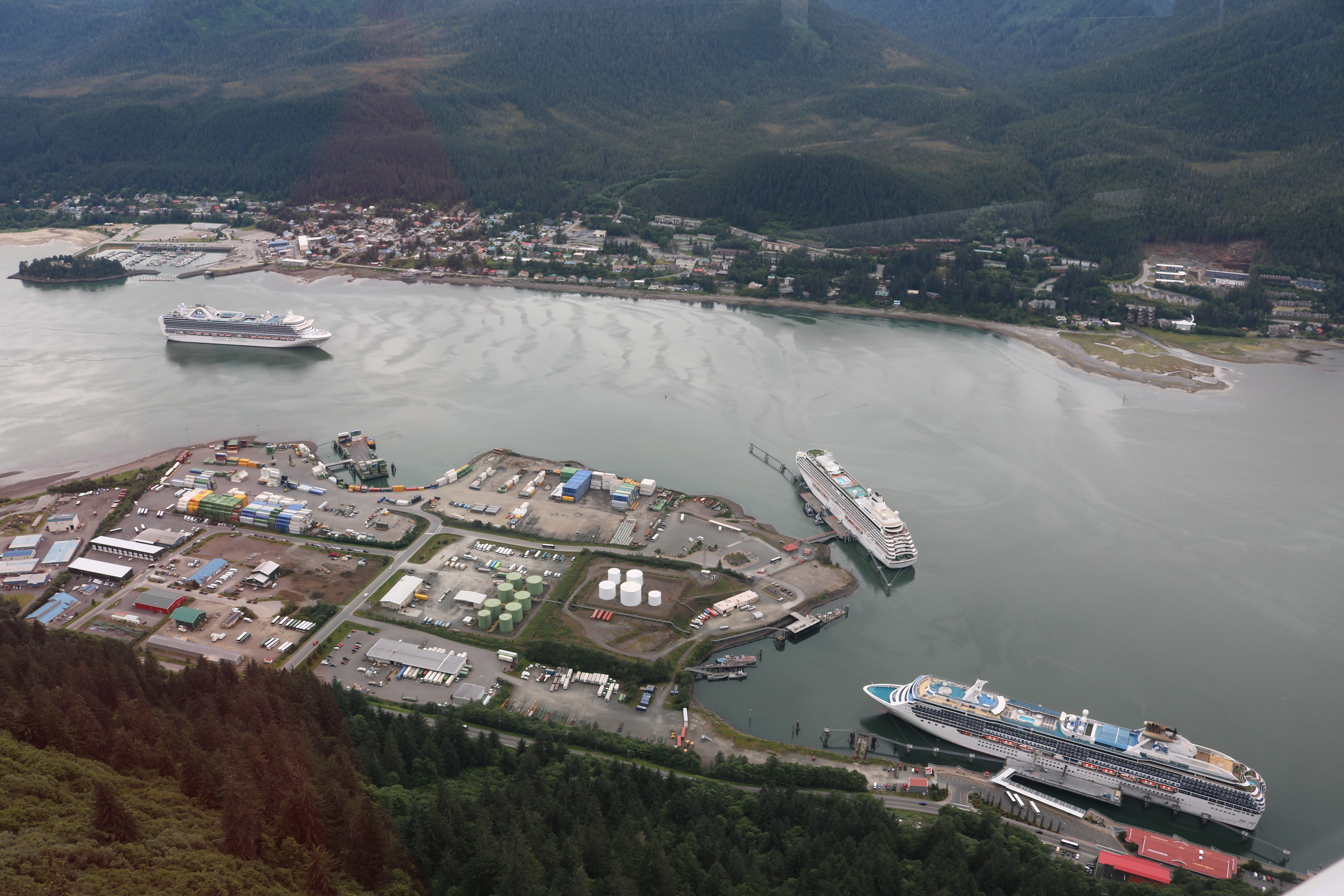
Our ship’s next port of call was Juneau on 02 August early morning.  Juneau has been the capital of Alaska since 1906.  Juneau is rather unusual among US state capitals (except Honolulu, Hawaii) in that there are no roads connecting the city to rest of the state or to the rest of America. Absence of a road network is due to extremely rugged terrain surrounding the city.  All goods and persons coming in and out of Juneau must go by plane or ship.  Downtown Juneau is located at sea level, with tides averaging 5 m, surrounded by steep mountains about 1,200 meter high.

Even though Anchorage is the biggest city in Alaska and is well connected by rail, road and air network, how did Juneau become the capital of Alaska?

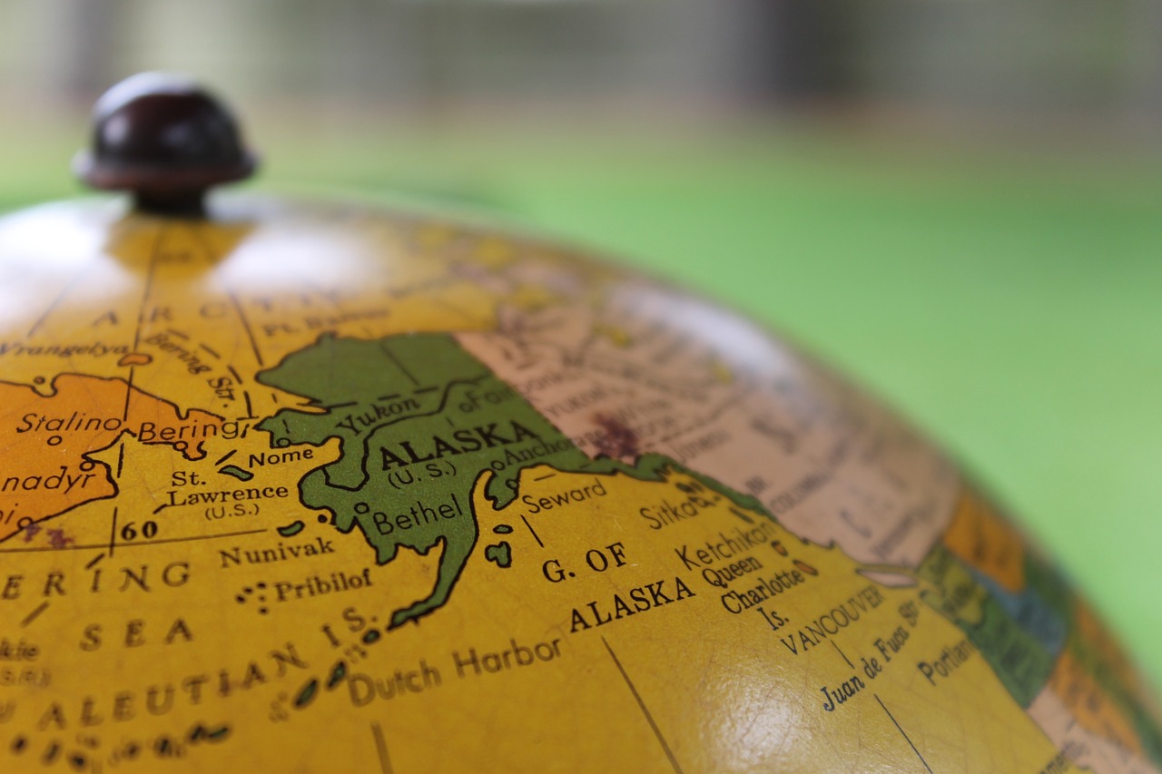
Sitka was the Alaskan capital when US took over Alaska from Russia. The capital was moved to Juneau in 1906 because the gold rush had made it and other towns in the Northern Alaska much more economically significant than Sitka. When Alaska officially became a territory in 1912, Anchorage did not exist. Anchorage came into being during the summer of 1915 as a construction depot on the Alaskan railroad. Anchorage wasn’t that important of a town until the US Military moved in before World War II.

After the war, Alaskans considered moving the capital out of South-East Alaska to a more central location. Anchorage was considered suitable with its central location, but poverty and lack of agreement prevented any action from being taken. Resolution to move the capital was put to vote in 1984 and 1996, but was defeated and is unlikely that the state government will ever physically move.

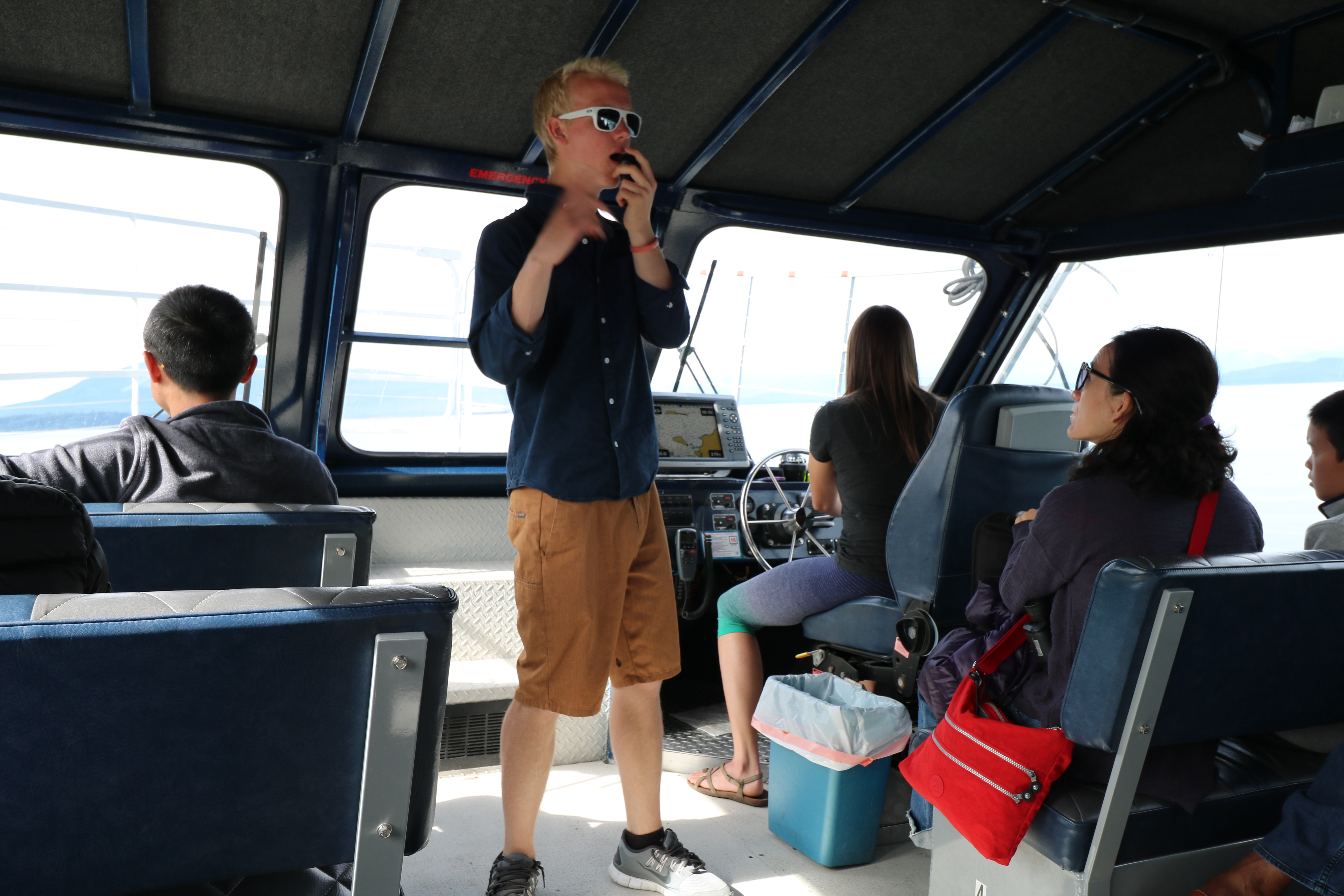
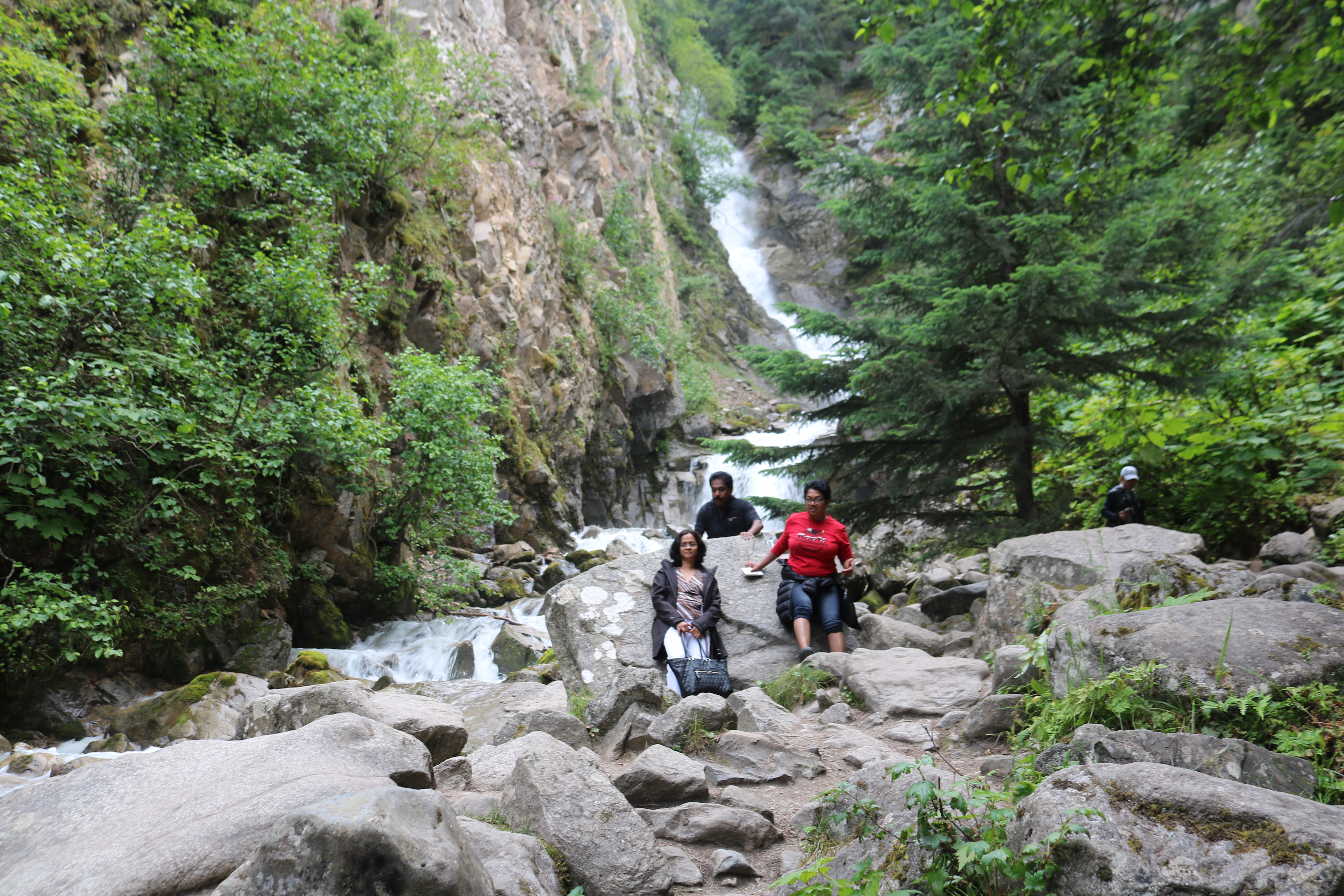
We got off our ship and headed on a bus to Auk Bay, about 20 km from the port, for whale watching.  We were ushered into a boat captained by  Emily.  John, a university student pursuing his pre-medical degree was her assistant.  Both Emily and John were very knowledgeable about Auk Bay and  surrounding areas and also about whales.   We were a group of 12  in the boat and after everyone boarded, Captain Emily gave out safety briefing followed by a talk about what we were expecting to see.  After leaving the jetty, Emily went full throttle, skimming over the water to locate  the whales.  During this journey John gave a detailed briefing on whales.

After about an hour, we sighted Sasha, a humpback whale. The whales located in  Auk Bay are given numbers and names.  Alaska is only a feeding area for the whales as there are lot of fish to feed on and is not a breeding ground due to the cold temperature. We watched bubble-net feeding by Sasha as she dived down and released a ring of bubbles from her blowhole beneath a school of fish. As the bubbles rose to the surface, it created a net, trapping the fish.

The next whale we located was Flame.  Humpback whales have patterns of black and white pigmentation and scars on the underside of their tails or flukes that are unique to each whale.  These black and white patterns are their bio-metric identification akin to our fingerprints.

After watching the whales, Emily steered the boat to an island where over two hundred sea lions were sunbathing.  The males had their heads up while the females and the cubs were all lying down like an arrangement of sausages on the beach. After watching the sea lions, Emily dropped us at the jetty to board a bus back to Juneau.

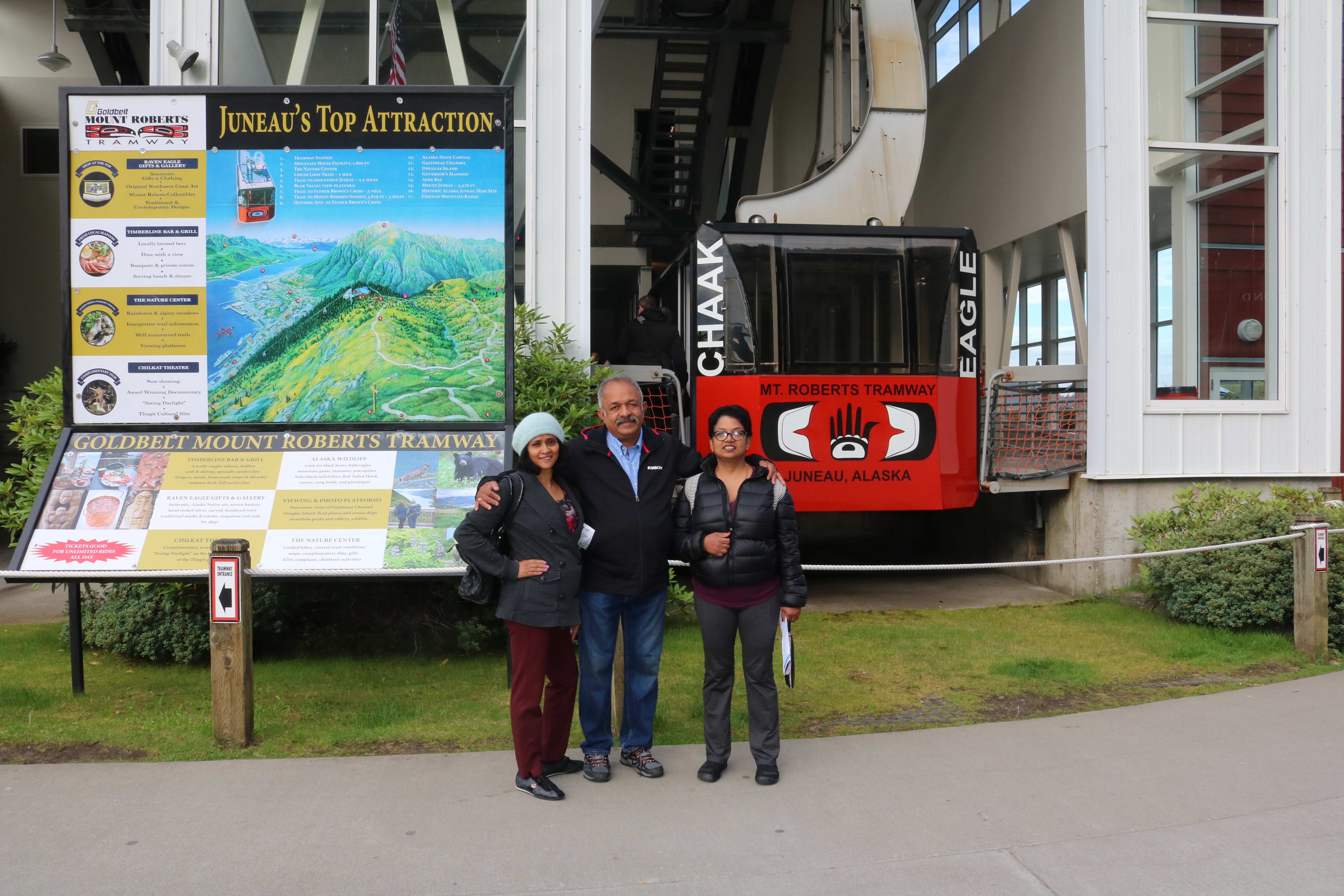
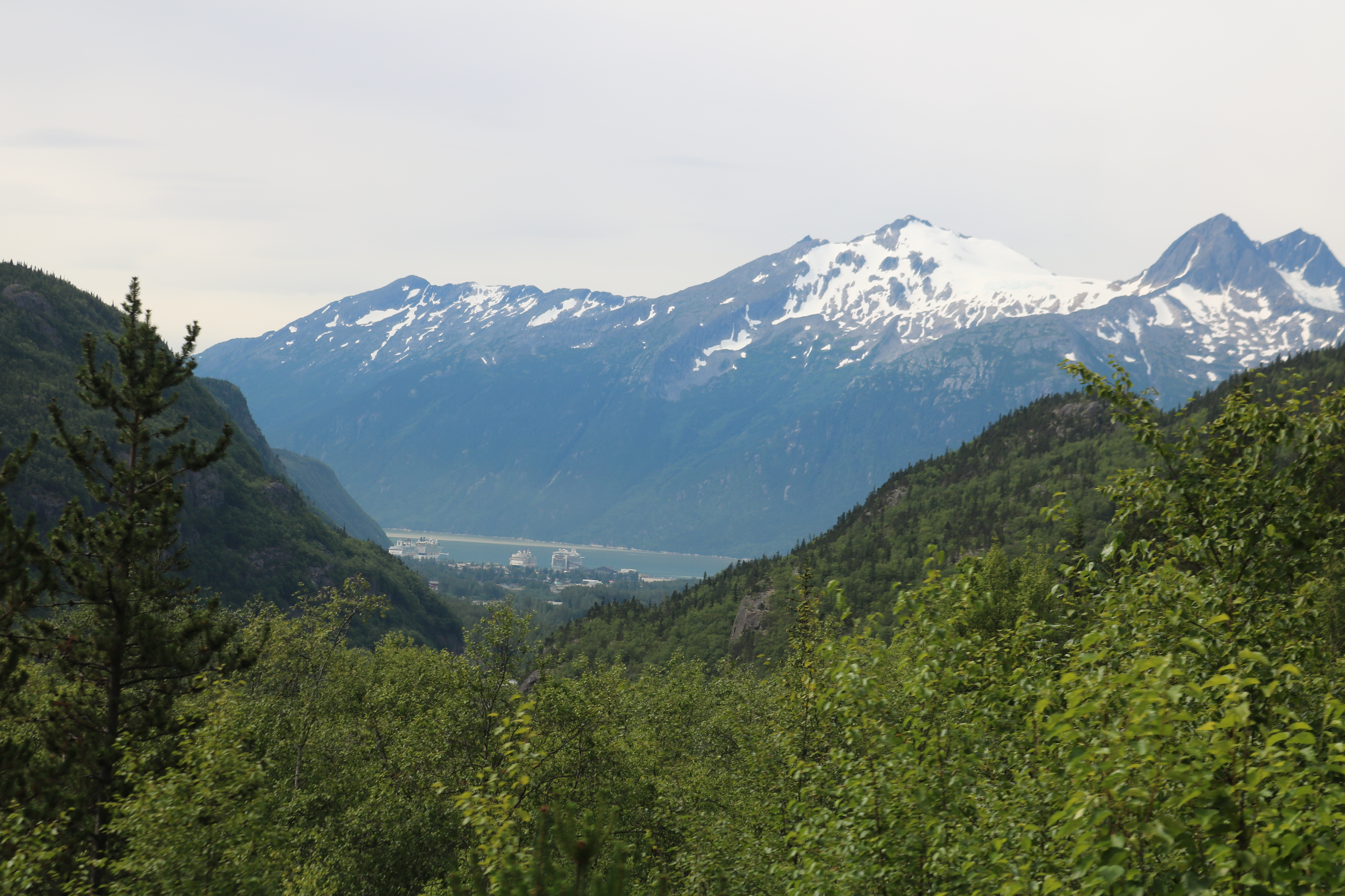
Back at Juneau, we drove on Goldbelt Mount Roberts Tramway,  a five-minute ride through the rain forest, from the cruise ship pier to the  Mount Roberts at an elevation of 600 meter.  It offered a breathtaking view of the cruise ships, the port and  downtown Juneau as depicted in the images at the top. Mount Roberts Tramway is one of the most vertical tramways in the world.

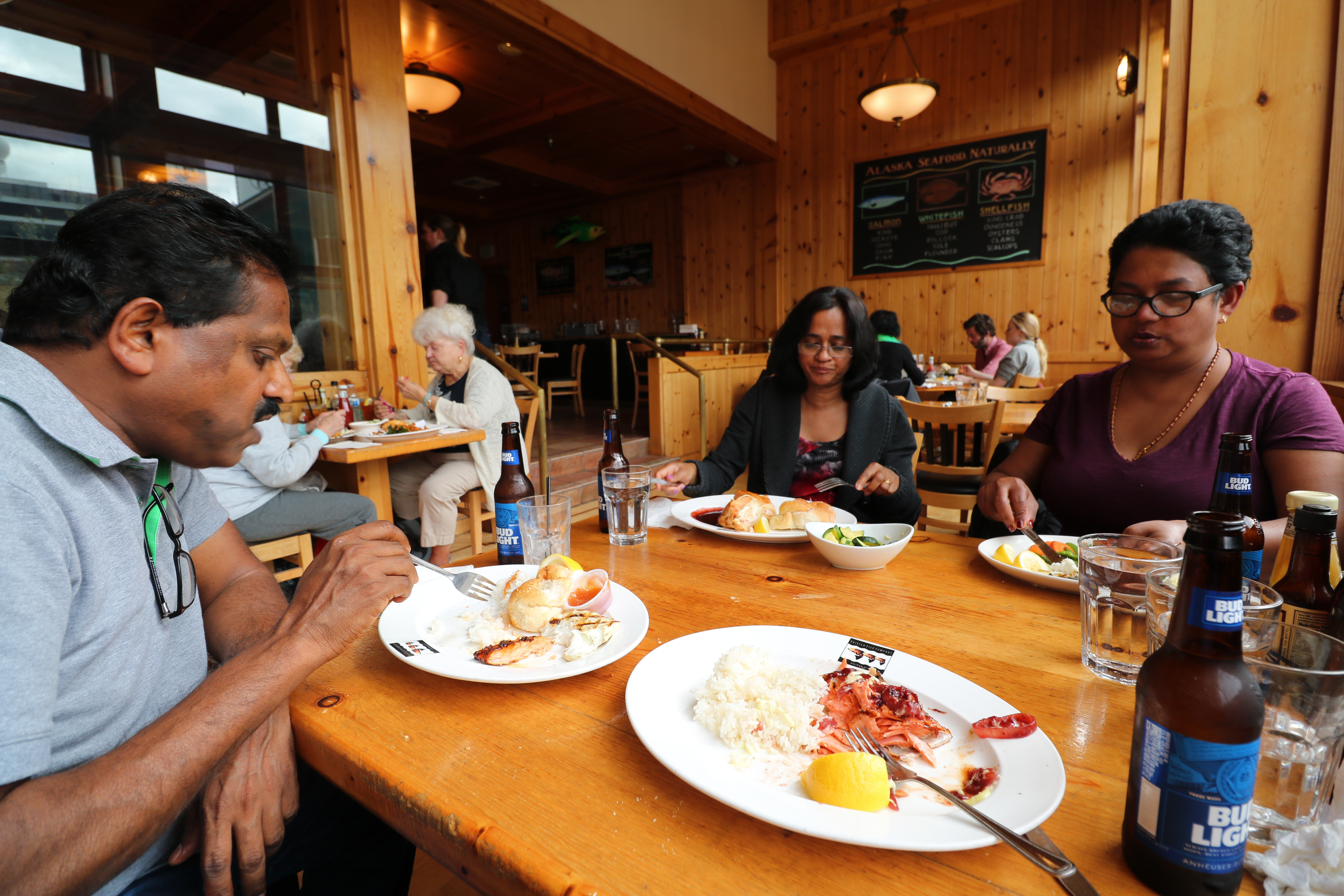
We came down on the tramway and decided to enjoy lunch at Juneau’s Twisted Fish Company, rather than going on board our ship anchored 100 meters away.  This place was recommended to us by locals and it was worth it. We savoured a menu of salmon, halibut and clam, sourced straight from the docks.

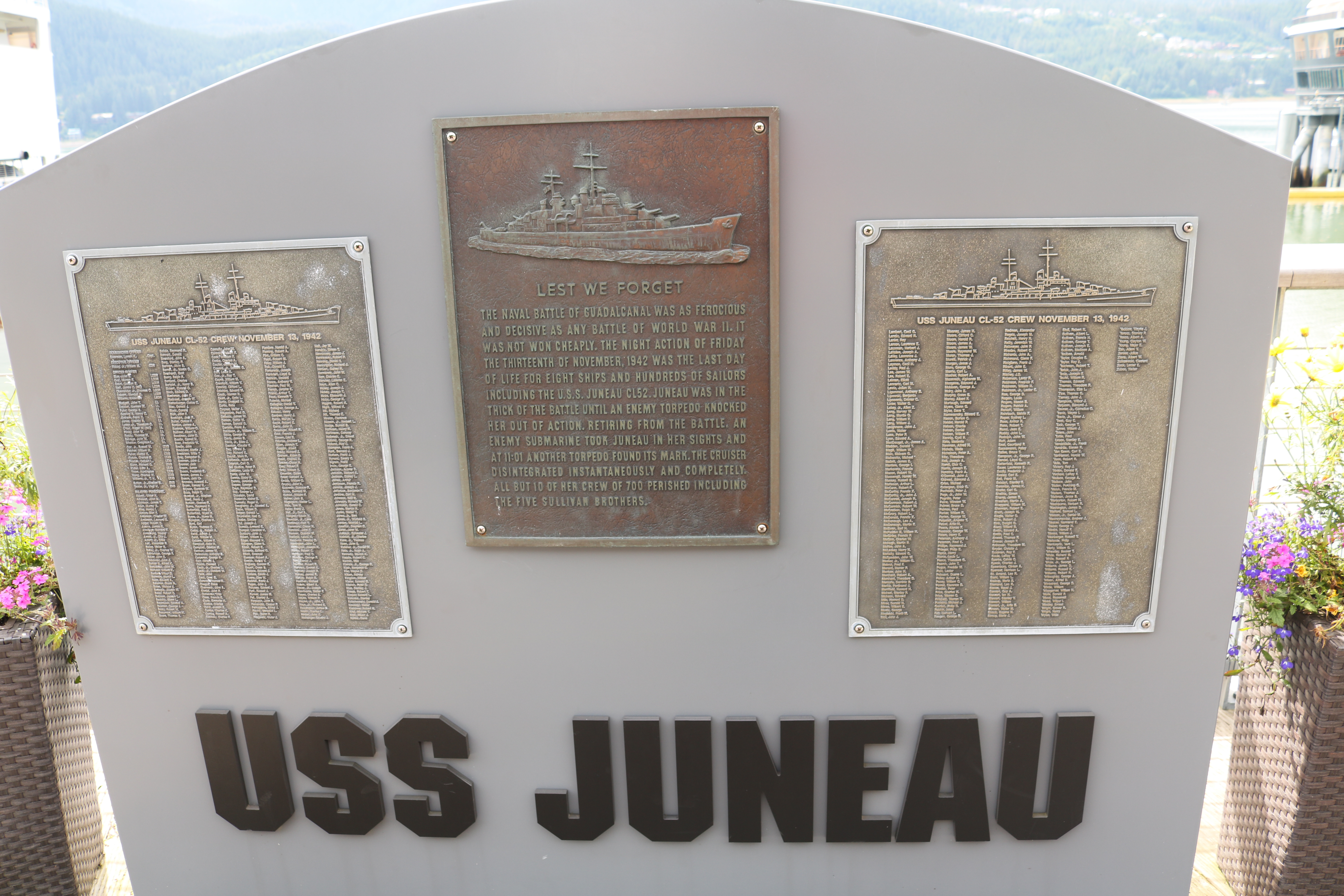
At the dock stood a plaque commemorating ultimate sacrifice by 690 member crew of Anti-Aircraft Light Cruiser Ship USS Juneau.  This ship was torpedoed and sunk by the Japanese submarines in the  Battle of Guadalcanal on the morning of 13 November 1942 in Pacific Ocean.  Only 10 crew members survived to narrate the tale.  Aboard USS Juneau were  George, Francis, Joseph, Madison and Albert – five brothers from the Sullivan family.  Even though US  Navy’s policy of separating siblings was in place,  it was not always followed and the five brothers enlisted to serve together and were assigned to USS Juneau.  The two oldest brothers George and Francis had served in the Navy before World War II and both had been discharged in May 1941. When war broke out, two older brothers with their three younger siblings volunteered to serve in the Navy but only if they could serve together.

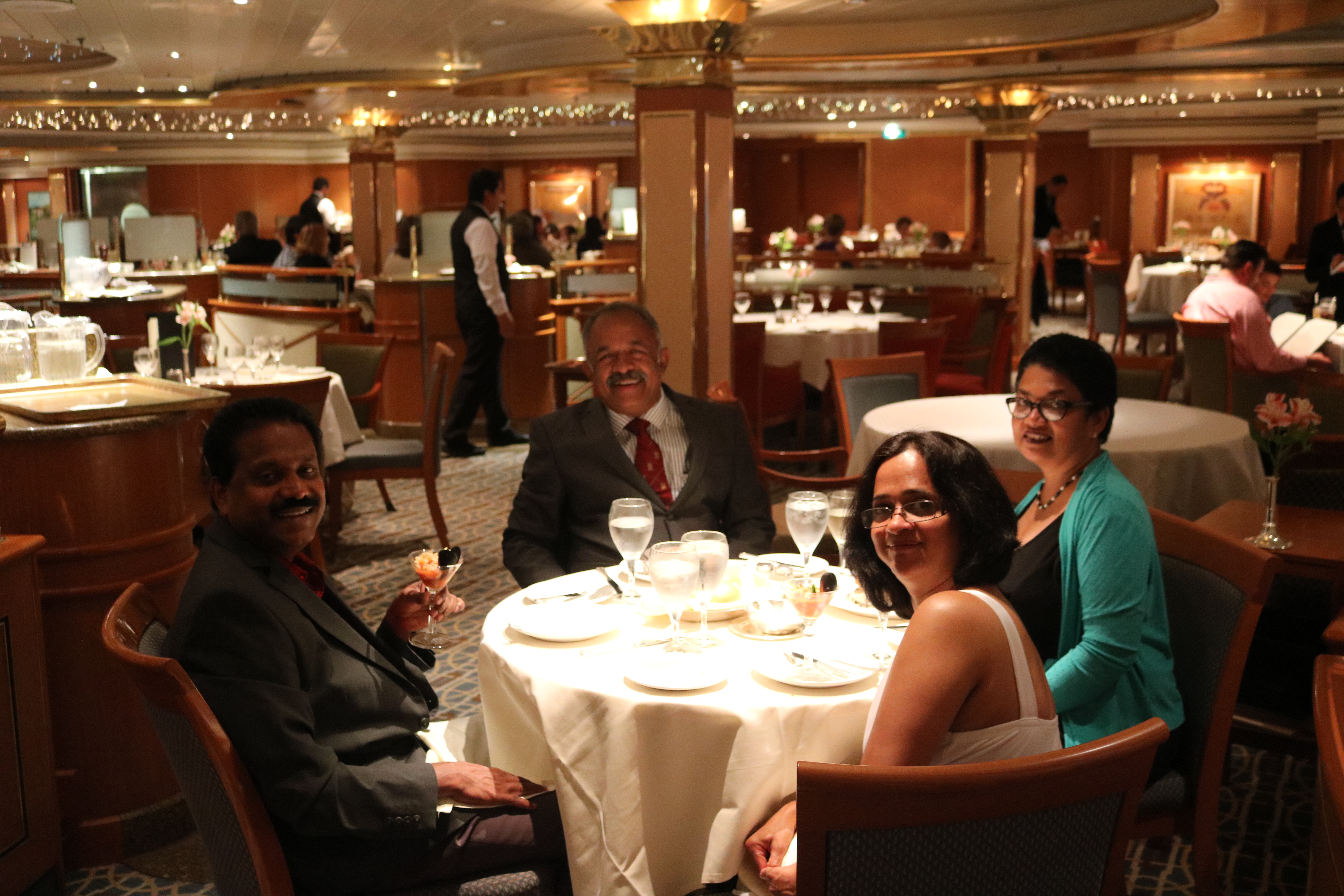
After a sumptuous lunch, we boarded the ship and we sat in the balcony enjoying the breeze and the view outside on the waterfront.  There were many sea planes taking off and landing on water and a fishing boat crew were spreading their nets to catch salmon between the cruise ships and the ‘runway.’

The day for us ended with dinner and our ship bid goodbye to Juneau on its onward journey to Ketchikan, our last port of call in Alaska.

Next : Ketchikan – The First City of Alaska

Skagway – Gateway to the Klondike Gold Rush

On 01 August morning, our Ship anchored at the Port of Skagway.  The City of Skagway has a population of less than a thousand, but in summer months the population doubles with many temporary workers manning various restaurants and shops. Skagway becomes a busy port destination during summer months, welcoming more than a million visitors from around the globe in more than 400 cruise ships.


Skagway came into prominence when gold was discovered in 1896 at Bonanza Creek in Klondike in Yukon, Canada.  Headline of the Seattle newspaper – Intelligencer –  on 17 July 1897 read  “Gold! Gold! Gold!”, broadcasting the news of discovery of gold in Canadian Klondike. In 1897, first ships from San Francisco, Portland and Seattle arrived in Skagway, packed with gold-seekers, beginning Klondike Gold Rush.

In Klondike Gold Rush, an estimated 100,000 people tried to reach Klondike goldfields, of whom only around 30,000 to 40,000 eventually succeeded in reaching there. Out of them, only about 300 actually  found gold and became rich.  Everyone from doctors to farmers, all wanted a share of gold as there was severe unemployment and poverty due to a series of financial recessions and bank failures in  1890s in USA.

Gold-seekers were required, as per Canadian laws to pack and carry one ton of goods, which was needed to last one year, if they wanted to reach Klondike Goldfields. The average man took about 40 trips over three months to haul his ton of supplies to Klondike Gold Fields from Skagway. Soon, Skagway boomed and peaked at a population of 10,000 people, many of them prospectors in the midst of their journey, but many were permanent residents offering goods and services to the gold-seeking hoards.

During Klondike Gold Rush, Skagway was a lawless town, where fights, prostitutes and liquor were ever-present on its streets.  The period saw the rising of a con man Jefferson R Smith, better known as ‘Soapy’ Smith, who was a sophisticated swindler.  He headed a gang of thieves who swindled prospectors with cards, dice, and shell game.  Smith came up with his ingenious ‘Soap Swindle’, which earned the nickname of ‘Soapy.’ The trick began with Soapy wrapping up cakes of ordinary soaps with  paper currency ranging from one dollar bill up to a hundred bill. He would then mix it with other ordinary cakes, re-wrap all in plain paper and would sell them for $1 to $5 a bar. He had his ‘men’ in the crowd who would buy a soap cake, opening it to find a $100 bill. The crowd was then anxious to buy their own, which, of course, held nothing but a 5 ¢ent soap cake.

Soapy Smith was shot and killed by Frank Reid, a town guard, on July 8, 1898, in a shootout when the two men fired their weapons simultaneously. Frank Reid died from his wounds twelve days later. Smith is buried in a corner of the Gold Rush Cemetery, where as the tomb of Reid is located in the center of the cemetery.

Klondike Gold Rush saw two men coming together- Sir Thomas Tancrede, representing investors in London and Michael J Heney, an experienced railroad contractor interested in finding new work for his talents and interests.  Though Tancrede had some doubts about building a railroad over the Coastal mountains, Heney claimed  “Give me enough dynamite and I will build a railroad to Hell.”  Construction of a narrow gauge ‘White Pass & Yukon Route’ railway line commenced on 28 May 1898.  After two years, two months and two days, on 30 July 1900, first train from Skagway arrived at White Horse, Yukon, Canada, about 110 miles.  Agony was that by the time the railway line was completed,  Gold Rush was nearly all over.

Today, fully restored cars, pulled by vintage diesel locomotives climb nearly 1,000 m over 30 km of steep grades and around cliff hanging turns, taking tourists on a  three-hour excursion to White Pass Summit.

We booked our tickets for the morning trip and boarded the train. The train pulled out of the Skagway station and after two km, we came to the railway yard where a fully functional vintage steam engine Number 73 rested.

This  monstrous looking machine is a enormous snow cutter used to cut through the deep snow to allow the train to pass during winter.

The train passed by the grave of the city’s most notorious Soapy Smith in the Gold Rush Cemetery.  Then the train commenced its climb .

We then passed Inspiration Point, looking down on the Skagway Harbour where our ship was anchored.

This abandoned  Switch-Back Bridge came into our view after traveling 24 km from Skagway.  It is a cantilever steel bridge over Dead Horse Gulch with a span of about 400 feet.  It was the world’s longest cantilever steel bridge when it opened.  In the Fall of 1969, a new tunnel and bridge that bypassed Dead Horse Gulch was built to replace the tall steel cantilever bridge that could no longer carry heavier and longer trains pulled by the diesel engines.

Dead Horse Gulch, it is believed that more than 3,000 animals, mostly horses, died on this trail and many of their bones still lie at the bottom on this ravine.

After another three km, we reached White Pass Station on US-Canada Border.  A pillar marks the International Boundary with US and Canadian Flags on either side.  Here the train stopped for its return journey to Skagway.

After alighting from the train we embarked on a five mile trek to the gorgeous Reid Falls, located North of Gold Rush Cemetery.  The Falls is named in honour of  Frank Reid, the town guard who shot dead Soapy Smith.

On return to the ship, it was dinner time.

Dinner was followed by a movie ‘Beauty and the Beast’, watched in the open air theater on the top deck of the ship, aptly named ‘Movie under the Stars.’

Next : Juneau – The Capital City of Alaska

Glacier Bay – Where the Birth of the World is Continuing

In the morning of 31 July after breakfast we played cards in the Card Room as the ship cruised its way into Glacier Bay.  Glacier Bay National Park and Preserve contains some of the world’s most impressive tidewater glaciers. The bay has experienced at least four major glacial advances and four major retreats and serves as an outdoor research laboratory.  Glacier Bay has more than 50 named glaciers, as well as two major arms: East Arm and West Arm. The cruise ships head up the West Arm, towards the Margerie Glacier as it is the most impressive glacier, which is advancing three to four meter a day and calves frequently.

The glaciers in Glacier Bay are remnants of a general ice advance—the Little Ice Age—that began about 4,000 years ago. This advance is not comparable to continental glaciation that occurred during the Wisconsin Ice Age.  By about 1750, Little Ice Age reached its maximum stage and a general recession of glaciers began.  200 years ago Glacier Bay was covered by Grand Pacific Glacier, which was more than 1,200 meter thick and about 30 km wide. Since then the ice has been retreating with Glacier Bay  now having 20 separate glaciers, of which 11 are tidewater glaciers including Margerie Glacier that calve into the bay.

Margerie Glacier is named after French geologist and geographer Emmanuel de Margerie who visited the area in 1913.  Glacier Bay was completely covered by ice in 1794 when Captain George Vancouver, a British officer of the Royal Navy, best known for his expedition which explored and charted North America’s North-Western Pacific Coast region was stopped by a wall of ice 32 km wide and 1,200 m high.  This ice wall has since retreated from the mouth of the bay and is only a remnant of the massive glacier seen by Vancouver.   Today, the ice flows have been recorded at Margerie Glacier at 610 meter per year or about 1.75 meter per day.

Like a river, the glacier flows down the mountain  choosing the path of least resistance. As it moves,  it swallows rocks into its lower layers. These  acquired rocks grind away at the bedrock, carving deep valleys in the  mountainside over the years.

When the ice reaches lower, warmer elevations, it begins to melt. Eventually the loss through melting is greater than the supply of ice flowing down the  mountain. Now the glacier ceases to make further  progress, though the body of ice is still moving  down the mountains.  The length of time it takes for a snowflake that falls in the mountains to emerge at the end, or terminus of a glacier varies, depending on the speed at which the glacier is flowing. The ice visible at the face of the park’s glaciers today  is about 200 years old.

As we entered the Glacier Bay we first sighted the South Marble Island. This small island is a  sunbathing spot of gigantic Sea Lions. They lay on the rocks  with the dominant males sitting with their back arched and head erect.

Then came up the ‘Gloomy Knob’, a well rounded, dome shaped granite feature.  Surely it would have been smoothened by the glacial activities over the years.  Grass growing on the rocks formed a grazing pasture for the Mountain Goats.

After we passed Gloomy Knob, a boat belonging to US National Park Services came alongside our ship.  Rangers from the boat boarded our ship through a rope-ladders provided by the ship’s crew.

These Rangers, lead by Ms Highsmith, the Warden,  conducted classes about the Glacier Bay, its ecology, geology, about the original inhabitants, etc.  She brought out as to how the current conservation effort has been a great success as they included local inhabitants into it, respecting their beliefs, traditions and customs.

Our ship then moved closer to the Margerie Glacier, nearly a mile away, to facilitate us to view the spectacle of calving.  Cows have calves, glaciers calve icebergs, which are chunks of ice that break off glaciers and fall into water. This is caused in the glaciers of the Glacier Bay due to the forward motion of the glacier and the erosive action of the salt water of the Pacific Ocean, the tidal waves and the wind.

As we stood on the deck watching the Margerie Glacier, it calved five times, each time bringing down a heavy volume of ice, falling into water with a thunderous sound.  It was a great natural spectacle showcasing the fury of nature.

As our ship steamed off from the Glacier Bay, we all enjoyed a swim in the top deck swimming pool.

Next : Skagway – Gateway to the Klondike Gold Rush

Yakutat Bay and Hubbard Glacier


Our Ship sailed through the night after casting off from Whittier.  We had early breakfast and set out to explore the ship.


In the Mid-Ship was  lavishly decorated and well laid out Shopping Arcade with stores selling everything from Scotch Whisky to Jewellery.


Shopping Arcade covered four floors, very well done up with chandeliers, artwork, murals and et all.


Our ship entered Yakutat Bay by 11 AM from Gulf of Alaska.  It was a breathtaking sight to see large icebergs that had calved out of the giant glaciers, floating around.


On to the West was  St Elias mountains ranges.  The mountains rise like a white pyramid to an elevation of about 6000 meter in one of the world’s most dramatic transitions from sea to summit.  The Fairweather mountain ranges lies on the Eastern side of the Bay.  These mountains are scarred by glacial activity from the Ice Ages to date.


As we sailed through the Bay, more ice bergs, both small and big, were sighted as we sailed into Disenchantment Bay.  This bay was  named Puerto del Desengano (bay of disenchantment in Spanish) by Alessandro Malaspina in 1792, when he felt ‘disenchanted’ that the bay was not the entrance to the North-West Passage.  He was in fact looking to sail through the Arctic Ocean to Europe through the North-West Passage.


(Map courtesy of the US Geological Survey)

As our ship entered Disenchantment Bay, we could see Hubbard Glacier from over 50 km. This massive glacier is a staggering 125 km  long, 10 km wide, and 400 meter deep. Its face is over 100 meter high, which is as high as a 30-40 story building.  Hubbard Glacier,  is one of the over 110,000 glaciers in Alaska and is North America’s largest tidewater glacier. Hubbard Glacier was named in 1890 in honour of Gardiner G. Hubbard, the founder of the National Geographic Society.


A Tidewater Glacier is fed by the snow that flow out of the mountains and down to the sea.  Saltwater of the sea ‘eat’ into the thick ice-wall, causing it to break off .  This process is called ‘calving’.

Hubbard Glacier has been thickening and advancing toward the Gulf of Alaska, in stark contrast with most glaciers, which have thinned and retreated during the last century. This atypical behaviour is an important example of the calving glacier cycle in which glacier advance and retreat is controlled more by the mechanics of calving than by climate fluctuations. If Hubbard Glacier continues to advance, it will close the seaward entrance of Russell Fiord and create the largest glacier-dammed lake on the North American continent as it had done in 1986 and 2002. Hubbard Glacier remains an ongoing study of calving glacier dynamics for the scientific community.


In 2002 the advancing terminus of Hubbard Glacier created a glacier lake dam which turned Russell Fiord in to a lake for about two and a half months. Rising water in the newly formed lake altered local hydrology and was a threat to nearby communities. During the two and a half months that the channel was dammed, Russell Lake rose 20 meter. In 1986 a similar scenario resulted when the glacier caused dam raised the lake level 27 meter over the course of five months. Erosion of ice dam from saltwater eventually carved a new outlet channel and restored the fiord to its previous elevation in both cases.


Our ship after being in Disenchantment Bay for over two hours turned around.  During this manoeuvre, the ship’s propellers churned out glacial deposits brought down by the calving ice bergs deposited on the ocean floor.

After sailing another two hours in Disenchantment Bay, our ship headed for the Glacier Bay.  We all were really ‘enchanted’ by the natural beauty of the hills, the bay, and the floating icebergs.  We were not at all ‘disenchanted’ as we were surely not looking for the North-West Passage to Europe.


As our ship sailed ahead from the Disenchantment Bay, we watched the Sun setting into the Pacific Ocean – It was 10:45 PM.

Next :  Glacier Bay – Where the Birth of the World is Continuing

Alaska – Here We Are

During the summer of 2017, we along with Stephens, our travel companions, booked Alaskan Cruise on Coral Princess luxury liner.  The cruise commenced from Whittier, Alaska, USA, sailing South-East and ending at Vancouver, British Columbia (BC),  Canada.

On 29 July 2017, we boarded the early morning Air Canada flight from Toronto to Vancouver on the first leg of our Alaskan Cruise.  The flight duration was of about five hours, but the clock only moved by two hours because the clock had to be set back by three hours as the time zone of Vancouver is three hours behind Toronto.

The five hours flight was made more comfortable than the regular one as the aircraft, an Airbus 319 variant deployed was the special charter plane used to fly various teams of the National Hockey League (NHL).  The aircraft had only 60 seats, that too all First Class, with all the accessories like comforters, extra legroom, LCD screens, etc.  Thank you Air Canada.

After a two hour stopover at Vancouver, we flew to Anchorage, the largest Alaskan City.  We were impressed by the Military Lounge at Anchorage Airport.  An effective way to project the power of a strong military, thus a strong nation, especially to  foreign tourists.  A country that respects its soldiers will always be powerful for sure.

We boarded the bus for Whittier where Coral Princess, our cruise liner was anchored.  Route between Anchorage and Whittier on Portage Glacier Highway was very scenic.  The road ran parallel to the railway track, both hugging the coastline.  We passed through Anchorage Coastal Wildlife Refuge, known as Potter’s Marsh, a good place to spot migratory birds, water fowl and moose.

The road continued along Turnagain Arm, a body of water featuring the world’s second highest tides at over 30 feet.  We passed through Girdwood and Portage Glacier and the bus stopped at the entrance of Anton Anderson Memorial Tunnel, also known as Whittier Tunnel. It is a highway and railway tunnel that passes under Maynard Mountain. At 13,300 ft (4,100 m), it is the second-longest highway tunnel and longest combined rail and highway tunnel in North America.

We alighted from the bus at the banks of a lake formed by the melting Portage Glacier.  As the tunnel is one-way and is also shared by the railway, there is a schedule for traffic passing through it.  All the vehicles assembled in the staging area at the entrance of the tunnel.  At the scheduled time the convoy moved with buses leading the way.  Buses being public transport are given preference over cars.

Whittier Tunnel was constructed in 1941 to use Whittier as a rail port during World War II.  It is named after Anton Anderson (1892–1960), Chief Engineer of the Alaska Railroad Company and Mayor of City of Anchorage from 1956 to 1958.  The tunnel’s entrance portals are designed in an ‘A’ shape, with a large  door, which allows traffic in and out of the tunnel. The entrance portals are designed to withstand the force of an avalanche.

Ride through the 4 km tunnel was for about 15 minutes and surely there is light always at the other end of the tunnel.  As we emerged out of the tunnel at Whittier Port, Coral Princess, our cruise liner anchored there, came into our view for the first time.

Whittier came into prominence during World War II as it offered a shorter voyage into the Pacific Ocean and reduced exposure of ships to Japanese submarines.  It also reduced the risk of Japanese aircrafts  bombing the port facilities because of the high mountains around the port and bad weather for which Alaska is very famous for.  It pours all through the year and gets less than a month of bright sunshine every year.

We were escorted into our cabin E731 on the eight floor of the ship.  The cabin was very spacious and comfortable with a balcony facing the ocean.

Adjacent to the port were small boats and fishing boat jetty and also the railway station where a train was waiting its schedule to cross through the tunnel.

The ship casted off at 8:30 PM and we all headed straight to our watering holes for our first drink on board.

How did Alaska become the fiftieth state of the United States of America, detached from the mainland USA with Canada in between?

Russians colonised Alaska in the 17th century and exploited the local resources like fur and gold.  When Crimean War broke out in 1853, Britain, France and Turkey stood against Russia. Russia could neither supply nor defend Alaska during the war as the sea routes were controlled by the allies’ ships. There was a fear that British might blockade Alaska or even seize it.

Tensions between Moscow and London grew, while relations with the American authorities were warmer than ever. Russia offered to sell Alaska to the United States in 1859, believing the United States would off-set the designs of Russia’s greatest rival in the Pacific, Great Britain. US Civil War delayed the sale, but after the war, on March 30, 1867, US agreed to a Russian proposal to purchase Alaska for $7.2 million. The Senate approved the treaty of purchase on April 9.  President Andrew Johnson signed the treaty on May 28, and Alaska was formally transferred to the United States on October 18, 1867.

For three decades after its purchase the United States paid little attention to Alaska, which was governed under military, naval, or Treasury rule or, at times, no visible rule at all. Seeking a way to impose US mining laws, the United States constituted a civil government in 1884. Major gold deposit was discovered in the Yukon (Canada) in 1896, and Alaska became the gateway to the Klondike gold fields. Alaska became a state of US on January 3, 1959.

Next – Hubbard Glacier at Yakutat Bay

To Sir Without Love

‘Sir’ is a term for addressing males who have been given certain honours or titles (such as knights and baronets) in Commonwealth Countries and is strictly governed by law and custom. The term is also commonly used as a respectful way to address a commissioned military officer – surely not civilians. Equivalent term in the feminine gender would be ‘Madam’ and a young woman, girl, or unmarried woman may be addressed ‘Miss’. A knighted woman or baronetess is a ‘Dame’ and a ‘Lady’ would be the wife of a knight or baronet.

In Kottayam, Kerala, there is a girls’ school called Baker Memorial Girls High School. The school was established by Amelia Dorothea Baker (1820-1904) of the Church Missionary Society (CMS). Miss Baker married John Johnson, another CMS missionary, who passed away in 1846. Miss Baker remained in-charge of the school in Kottayam till 1855. Her two sisters married CMS missionaries and three daughters of her brother Henry Baker Jr became teachers at the very same school. (Biographical Dictionary of Christian Missions, edited by Gerald H Anderson, Page 336)

The school today stands as a memorial to celebrate the efforts of the three generations of missionaries who dedicated their lives for the empowerment of the women of Kottayam through education.  Common folk of Kottayam until my student days called it as Miss Baker School. Remember, it was during the British Raj and everyone addressed the founder headmistress of the school, very respectfully, as ‘Miss Baker’. Today, could any student in the very same school address their teacher ‘Miss Anita?’ I have often heard them addressing their teacher as Anita Miss (I could never make out as to what Miss Anita ‘missed’!)

On joining Sainik School, Amaravathi Nagar, Thamizh Nadu in Grade 5 in 1971, our first Class-Master was Mr MJ Raman, our Mathematics teacher. We were about 25 of us from Kerala and only one could understand English and the rest 24 of us knew only Malayalam. In our first class Mr Raman issued us books, stationary, etc and briefed us in English and I did not get any of what he said.

We then had English class by Mr KG Warrier. He asked us something like “Who asked you to do it?” in his Oxford accent and the Cadet who knew a bit of English promptly replied, “Raman Sir told us to do it.” Mr Warrier said “I know that Dr CV Raman was knighted but did not know that Mr MJ Raman was also knighted. You all will address your teachers as ‘Mister’ or ‘Miss’ followed by their surnames.” Those words were imprinted on our young minds and through all these decades until now, we have always revered our teachers but invariably addressed them as ‘Mister’ or ‘Miss’, orally and in writing. Culturally, in Kerala as well as the rest of India, these modes of address have undergone a ‘mutation.’ Today, it is sacrilege for a college/ university student to address his professor as ‘Mister Singh.’

Please Click Here to read Blog-Posts about our teachers at Sainik School Amatavathi Nagar https://rejinces.net/category/sainik-school/

In Canadian high schools, students mostly address their teachers as ‘Mister’ or ‘Miss’ followed by their surnames. In universities, some professors during their introduction class would specify their requirement. Some want to be addressed in the traditional manner and many with their first names or even shortened first names.

While interacting with an Indian immigrant teacher in Canada, he said he felt uncomfortable when the students addressed him as ‘Mr George.’ He had taught in a college in India for over two decades and everyone addressed his as ‘Sir’ and he felt that the Canadian students are disrespecting their teachers by not addressing them as ‘Sir.’

Addressing male teachers as ‘Sir’ and all females irrespective of marital status as ‘Miss’ shows a massive status disparity and sexism of previous years. According to Times Educational Supplement, ‘Sir’ was first used in Sixteenth Century classrooms when male teachers of a lower social standing were attempting to reinforce their authority among largely upper-class boys. ‘Miss’ (surely not anywhere near the status of ‘Sir’) is largely a Victorian era creation when women were pressurised to give up work after they married, with a number of schools only hiring single female teachers.

In the Dutch education system, children address teachers by their first name, using ‘Juf’ or ‘Juffrouw’ as a title for a female and ‘Meester’ for a male teacher. Australians address their teachers as Mr/Mrs/Ms and surname. Sometimes if a teacher has a long or difficult-to-pronounce name, it is shortened to Mr PK, etc.

In Finland, it’s first names or even nick-names with teachers, no titles or surnames. The whole society there is very informal. French kids use the terms ‘Maîtresse’ and ‘Maître’ for female and male teachers respectively, meaning simply ‘teacher’. German students address teachers by using ‘Herr/Frau’ and surname, using ‘Sie’ as the polite form (Herr Schmidt, Koennen Sie…).

How do you wish to address your teachers? How do you wish your children addressed their teachers?