

Can you ever imagine that the survey of the Trans-Himalayan Region was done mostly on foot? That a human being walked all the way through the Himalayas, while counting each step he took to calculate the distances between places.
Reading a 36-page document by Dr Kapil Raj, When Human Travellers Become Instruments: The Indo-British Exploration of Central Asia in the Nineteenth Century, I was fascinated by the ability of the human body and mind to find methods to overcome any difficult situation.
British India in the aftermath of the 1857 mutiny went into mapping and stabilising its surrounding territories. The British needed to bring the Trans-Himalayan region into the ambit of British trade, followed by military intervention. The first step was to map the area of the Kashmir Kingdom, some surrounding areas under the Chinese Empire and some areas in Tibet, Nepal, and Bhutan.

Captain Thomas George Montgomerie of the Royal Engineers was entrusted with the task of mapping Kashmir. He was commissioned as a Second Lieutenant in 1849, arrived in India in 1851, and joined the Great Trigonometrical Survey. The Great Trigonometrical Survey was a project which aimed to survey the entire Indian subcontinent which was begun in 1802 by William Lambton. Under his successor, George Everest, the project was made the responsibility of the Survey of India.
After the survey of Kashmir, Montgomerie had to survey and map Tibet, an autonomous region. Tibetans were very suspicious of the Europeans. Thus, he had to enroll the services of locals who could travel as part of trade caravans to Tibet. Even if he found locals for the task, how could they be trained to use conventional surveying techniques and instruments?
Captain Montgomerie trained the natives, drilled them night and day for weeks, to take a stride of exactly 31.5 inches whatever the terrain or incline. At 63360 inches to a mile, every 2,000 such paces marked a mile.
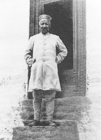
As his first ‘human instrument’, Montgomerie nominated Mahomed-i-Hameed, aka Moonshee who reached Leh on 4 July 1863 after meticulously mapping his route from Kashmir. On 24 August Hameed, disguised as a merchant and accompanied by two servants and a pony-load of merchandise, joined a caravan heading for Yarkand, a major oasis city on the trade route between China, India, and Central Asia.
The party arrived at Yarkand on 30 September. Hameed had precisely traced the entire route, carefully noting all that he had observed, especially the vegetation and human dwellings. He drew a map of the city and the region and transcribed the history of the region as narrated by locals.
On 27 March 1864 the party commenced their return journey to Leh, but Hameed died en route, after eating poisonous rhubarb, according to his companions. Montgomerie’s assistant, William Johnson, was the first to reach the scene of the tragedy. Hameed’s entourage had meanwhile made off with his most saleable belongings. Fortunately, no one had touched his notes. Armed with Hameed’s notes, Montgomerie sailed for England on 20 February 1865 after thirteen years in India. Using this leisure, he drew a map of the route between Leh and Yarkand.

This new mission was entrusted to two Kumaoni Bhotiya cousins, schoolteacher Nain Singh, and Mani Singh, the patwari, the village record-keeper. They had already taken part in topographical surveys and were familiar with geodesic and astronomical instruments and could handle any hurdles in crossing the frontier from Kumaon.
Disguised as Lamas, they carried a prayer wheel and a rosary, perfectly normal adjuncts for the pilgrimage to the holy city of Lhasa. The prayer wheel concealed a small compass, and other miniature survey instruments. Rudraksh Rosary helped count paces, one bead for every hundred paces. The Buddhist rosary has 108 coral beads; those of the cousins only had a hundred, every tenth bead being much larger than the others. A complete round of the Rosary represented exactly 10,000 paces or five miles.
After months of rigorous drilling in the use of the sextant, compass and other survey instruments and techniques, Nain Singh and Mani Singh left for Tibet in March 1864 and returned to DehraDun on 27 October 1866. They were turned back at the Tibeto-Kumaoni border, so they tried to enter Tibet through Nepal, all the while charting the route they followed. Despite the advantage of their origin, they had to adopt different guises and resort to devious ploys for entering Tibet: passing off as merchants with the survey instruments cleverly hidden in their wares, or even as healers curing people of minor ailments!
During a two-and-a-half-year expedition, Nain Singh walked 1,200 miles at a steadily maintained pace. He counted 2.5 million paces on his rosary! He not only succeeded in pinpointing the location of Lhasa, but also measuring the distance between several important Tibetan cities, thirty-one stations in all. He also mapped the 700-mile upper-course of the Tsangpo River from its source to Lhasa and reported that Tsangpo and the Brahmaputra were the same river.
Nain Singh also gave a detailed account of Tibet’s general climatic conditions, demographics, its cities and monasteries, army, agricultural production, economy, the state of its roads, transportation, communications, and most importantly, Tibet’s trade with China and Kashmir. . The Royal Geographical Society awarded Nain Singh a gold watch in 1868 and the Victoria gold medal in 1875.
Kishen Singh, alias AK, a cousin of Nain Singh, travelled across the Tibetan plains and the Kunlun Mountains between 1878 and 1882. In Lhasa, AK was delayed for over a year waiting for his caravan to leave. He was robbed twice, and even imprisoned by the Mongolians! He was freed by a Tibetan merchant who forced him. to ride a horse, which prevented him from counting his strides. Undeterred and innovative, he got round the problem by measuring the length of the horse’s pace and counting each time the right foreleg hit the ground. When he returned to British India in 1882, he had travelled 2,800 miles and counted an incredible 5.5 million paces!
This confidence in natives to record and narrate facts so vital for the survival of the British Empire is especially surprising when one remembers that geography in the nineteenth century consisted not only in taking topographical readings but also in collecting cultural, ethnolographic, political, and commercial information.
Though the survey instruments used then have long become museum pieces, these measurements are accurate and still the basis on which the maps are made in times of GoogleEarth, GPS, and satellite,
