Glacier Bay – Where the Birth of the World is Continuing

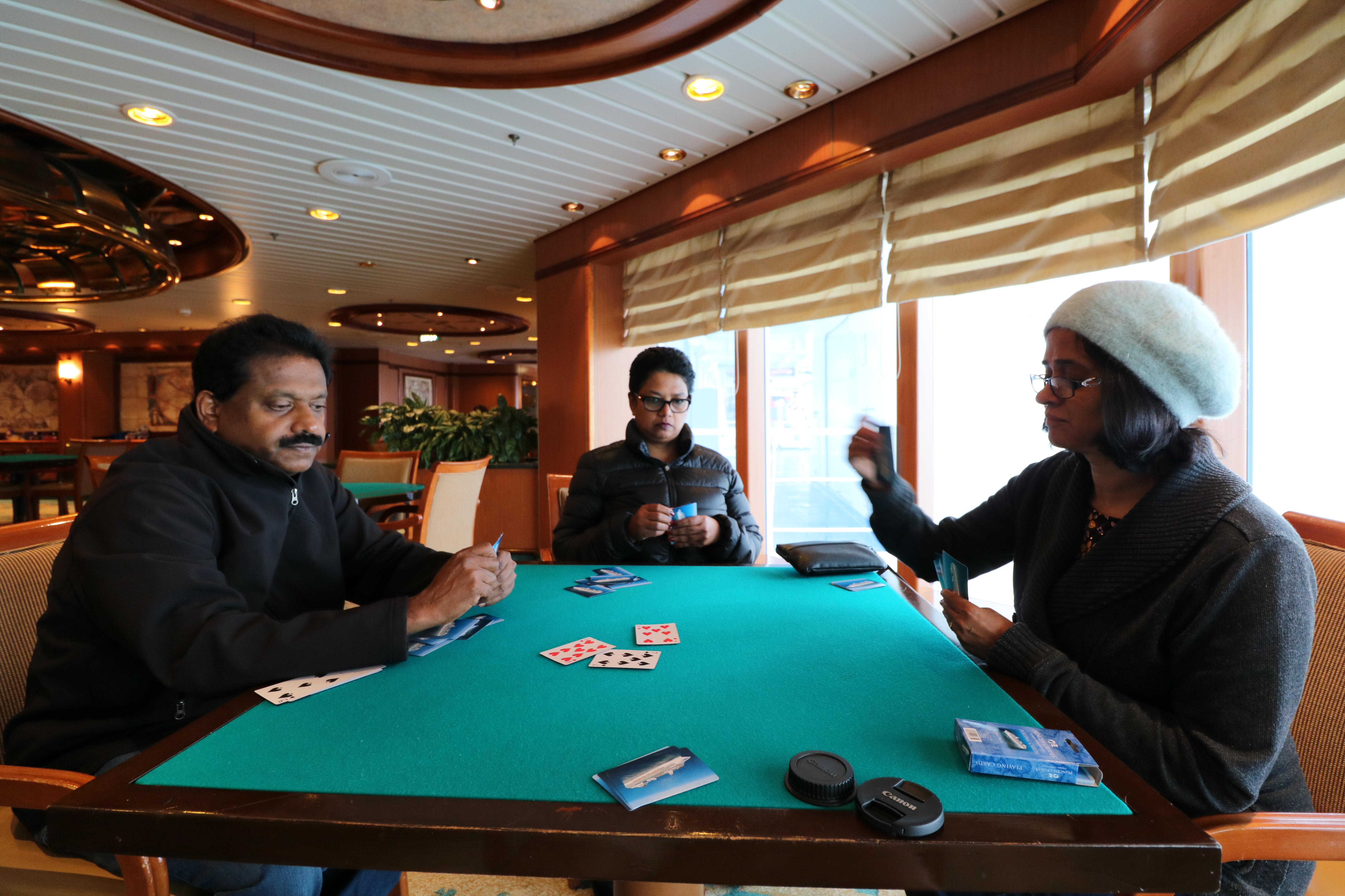
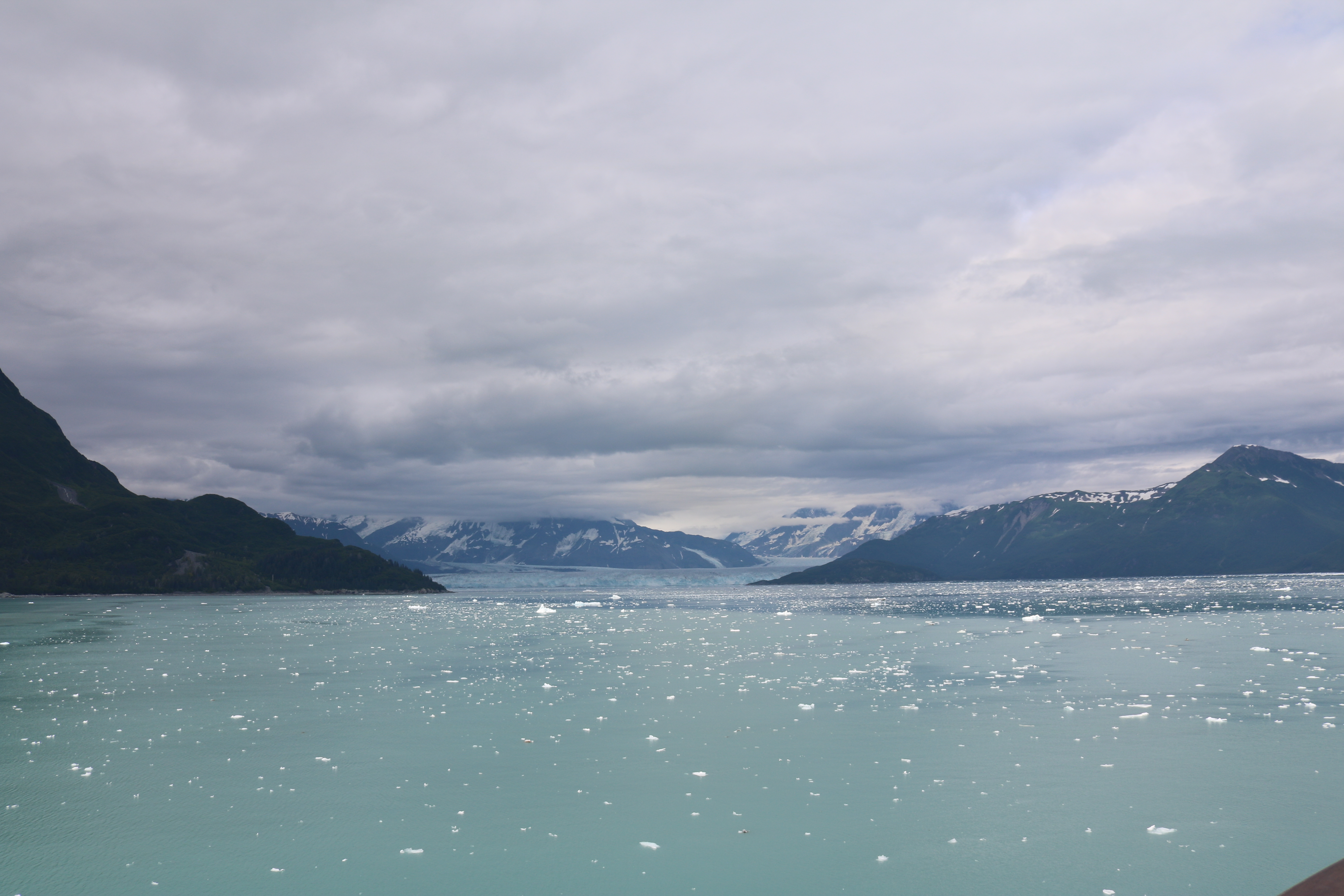
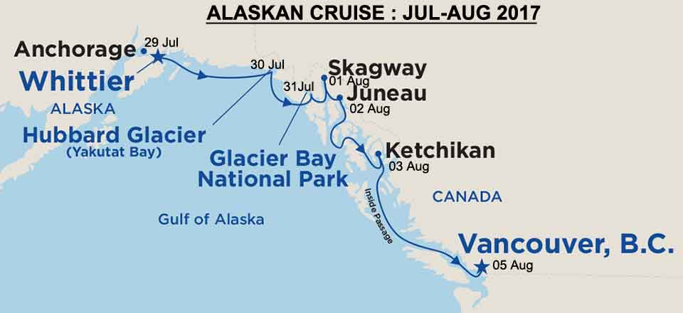
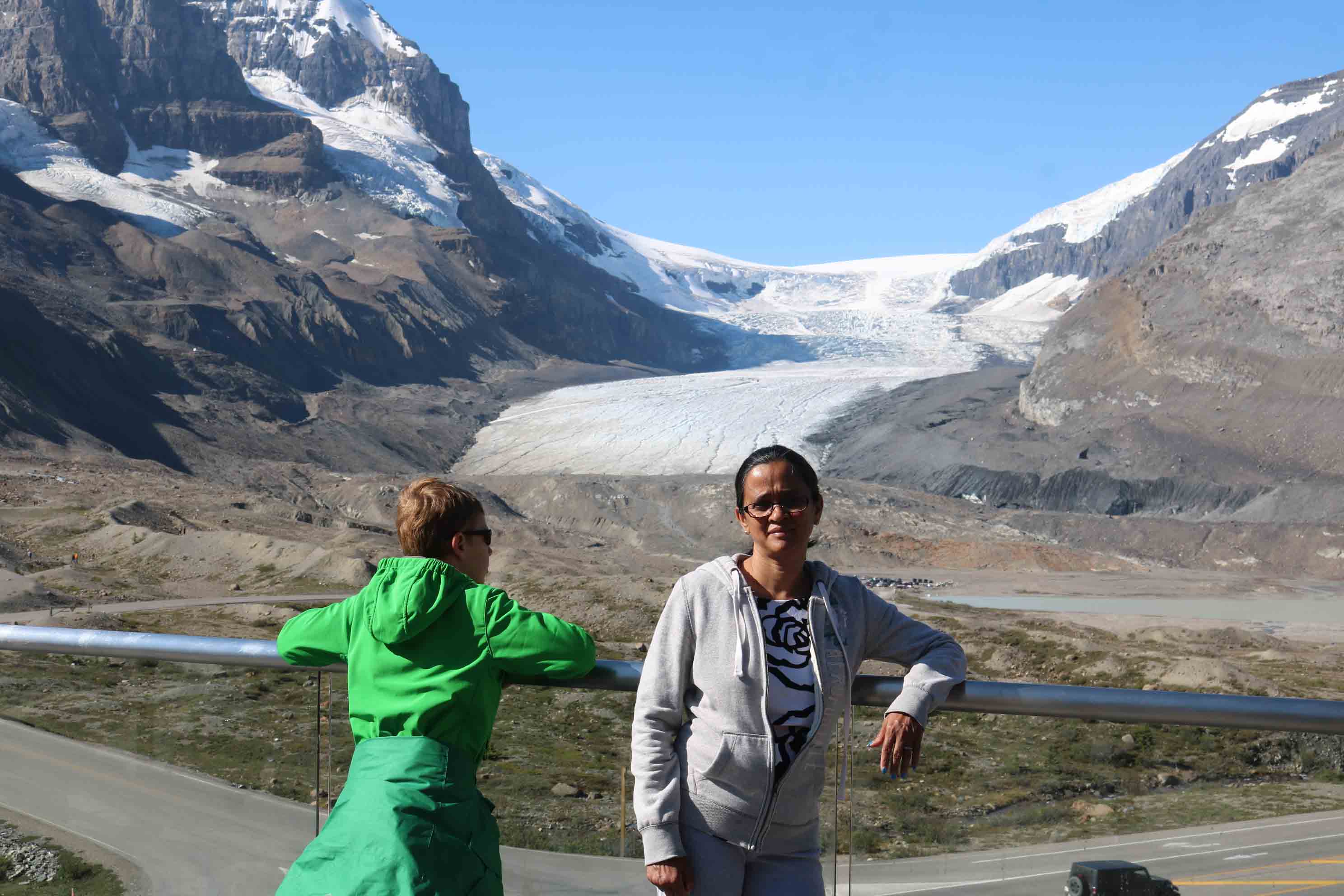
In the morning of 31 July after breakfast we played cards in the Card Room as the ship cruised its way into Glacier Bay.  Glacier Bay National Park and Preserve contains some of the world’s most impressive tidewater glaciers. The bay has experienced at least four major glacial advances and four major retreats and serves as an outdoor research laboratory.  Glacier Bay has more than 50 named glaciers, as well as two major arms: East Arm and West Arm. The cruise ships head up the West Arm, towards the Margerie Glacier as it is the most impressive glacier, which is advancing three to four meter a day and calves frequently.

The glaciers in Glacier Bay are remnants of a general ice advance—the Little Ice Age—that began about 4,000 years ago. This advance is not comparable to continental glaciation that occurred during the Wisconsin Ice Age.  By about 1750, Little Ice Age reached its maximum stage and a general recession of glaciers began.  200 years ago Glacier Bay was covered by Grand Pacific Glacier, which was more than 1,200 meter thick and about 30 km wide. Since then the ice has been retreating with Glacier Bay  now having 20 separate glaciers, of which 11 are tidewater glaciers including Margerie Glacier that calve into the bay.

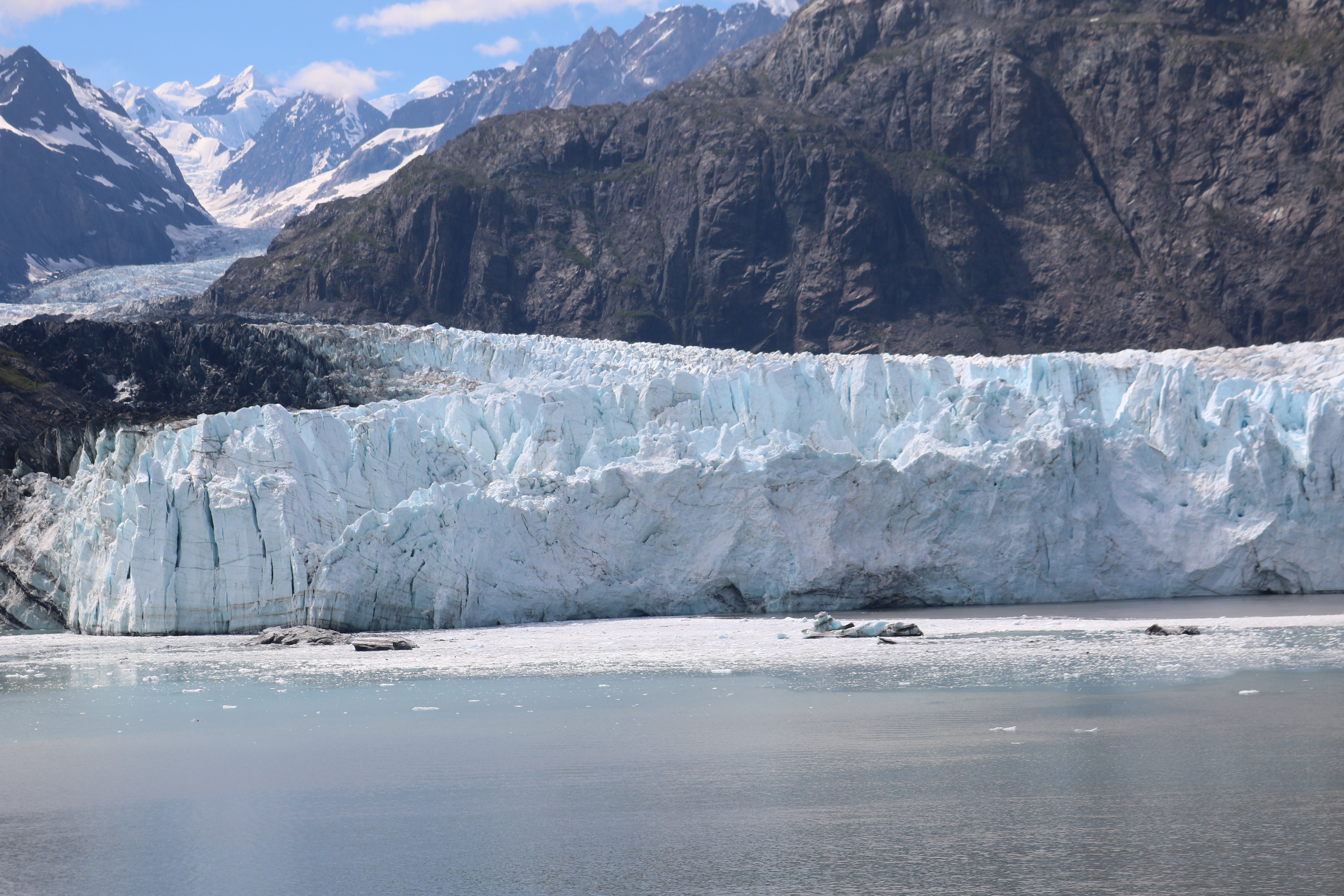
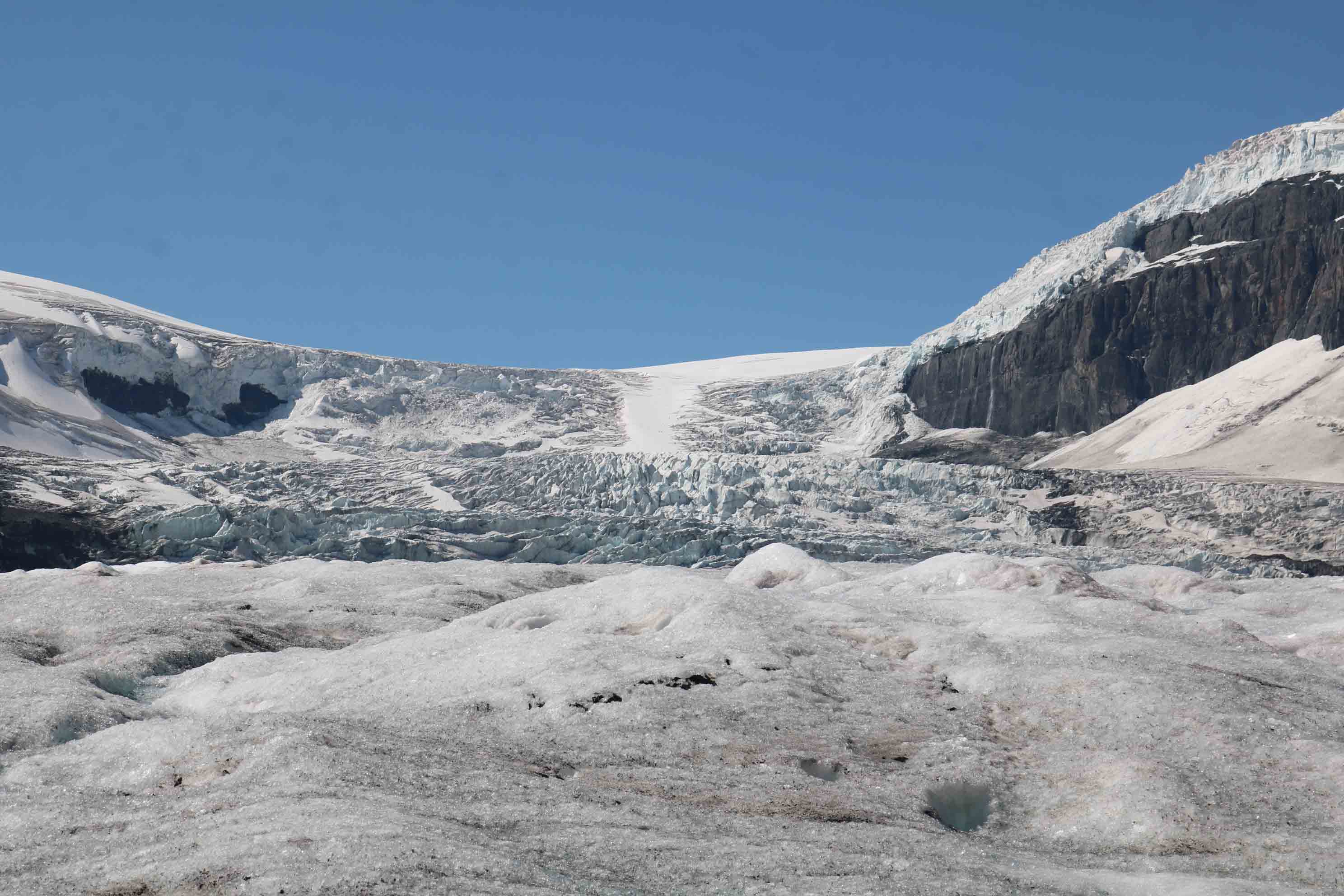
Margerie Glacier is named after French geologist and geographer Emmanuel de Margerie who visited the area in 1913.  Glacier Bay was completely covered by ice in 1794 when Captain George Vancouver, a British officer of the Royal Navy, best known for his expedition which explored and charted North America’s North-Western Pacific Coast region was stopped by a wall of ice 32 km wide and 1,200 m high.  This ice wall has since retreated from the mouth of the bay and is only a remnant of the massive glacier seen by Vancouver.   Today, the ice flows have been recorded at Margerie Glacier at 610 meter per year or about 1.75 meter per day.

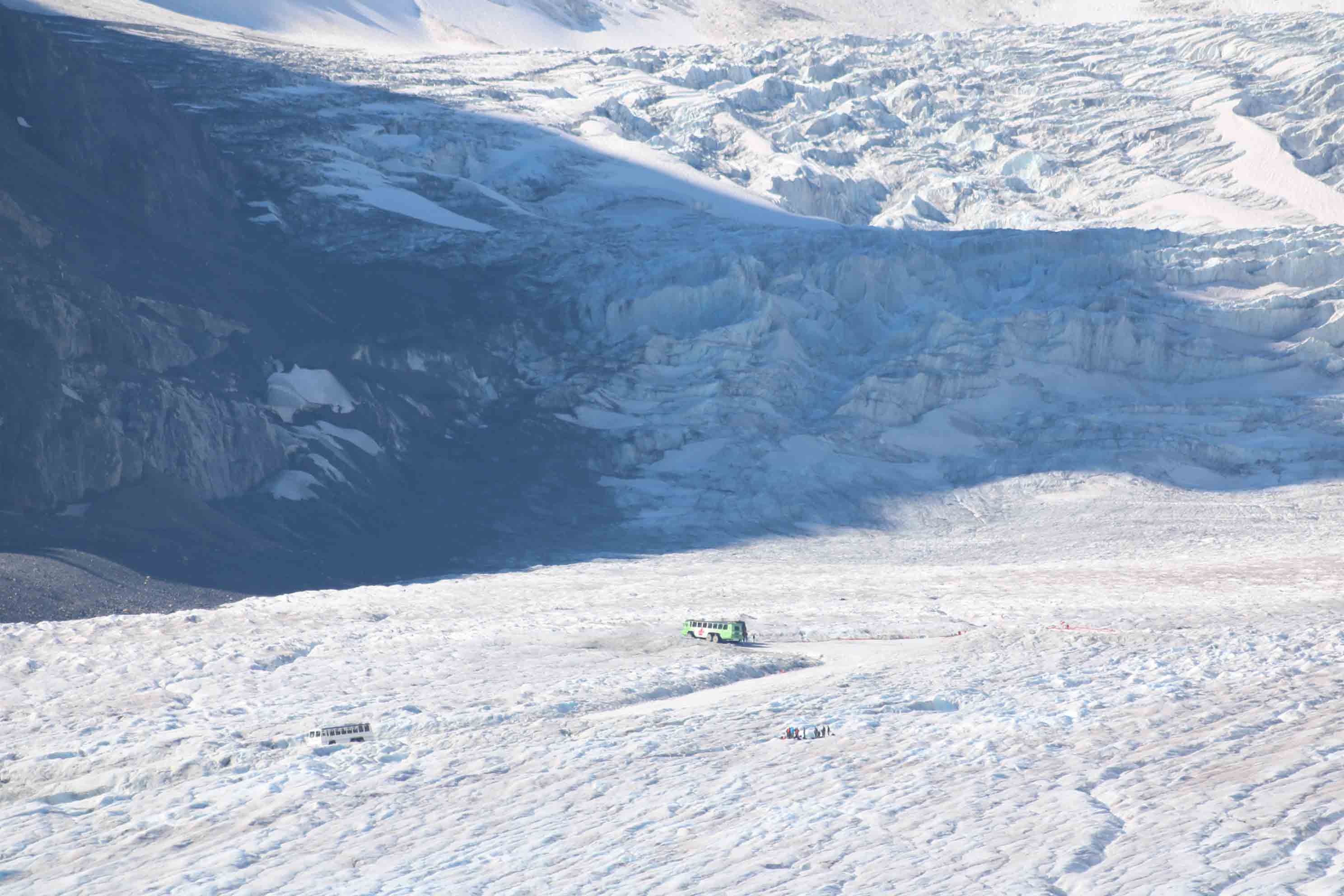
Like a river, the glacier flows down the mountain  choosing the path of least resistance. As it moves,  it swallows rocks into its lower layers. These  acquired rocks grind away at the bedrock, carving deep valleys in the  mountainside over the years.

When the ice reaches lower, warmer elevations, it begins to melt. Eventually the loss through melting is greater than the supply of ice flowing down the  mountain. Now the glacier ceases to make further  progress, though the body of ice is still moving  down the mountains.  The length of time it takes for a snowflake that falls in the mountains to emerge at the end, or terminus of a glacier varies, depending on the speed at which the glacier is flowing. The ice visible at the face of the park’s glaciers today  is about 200 years old.

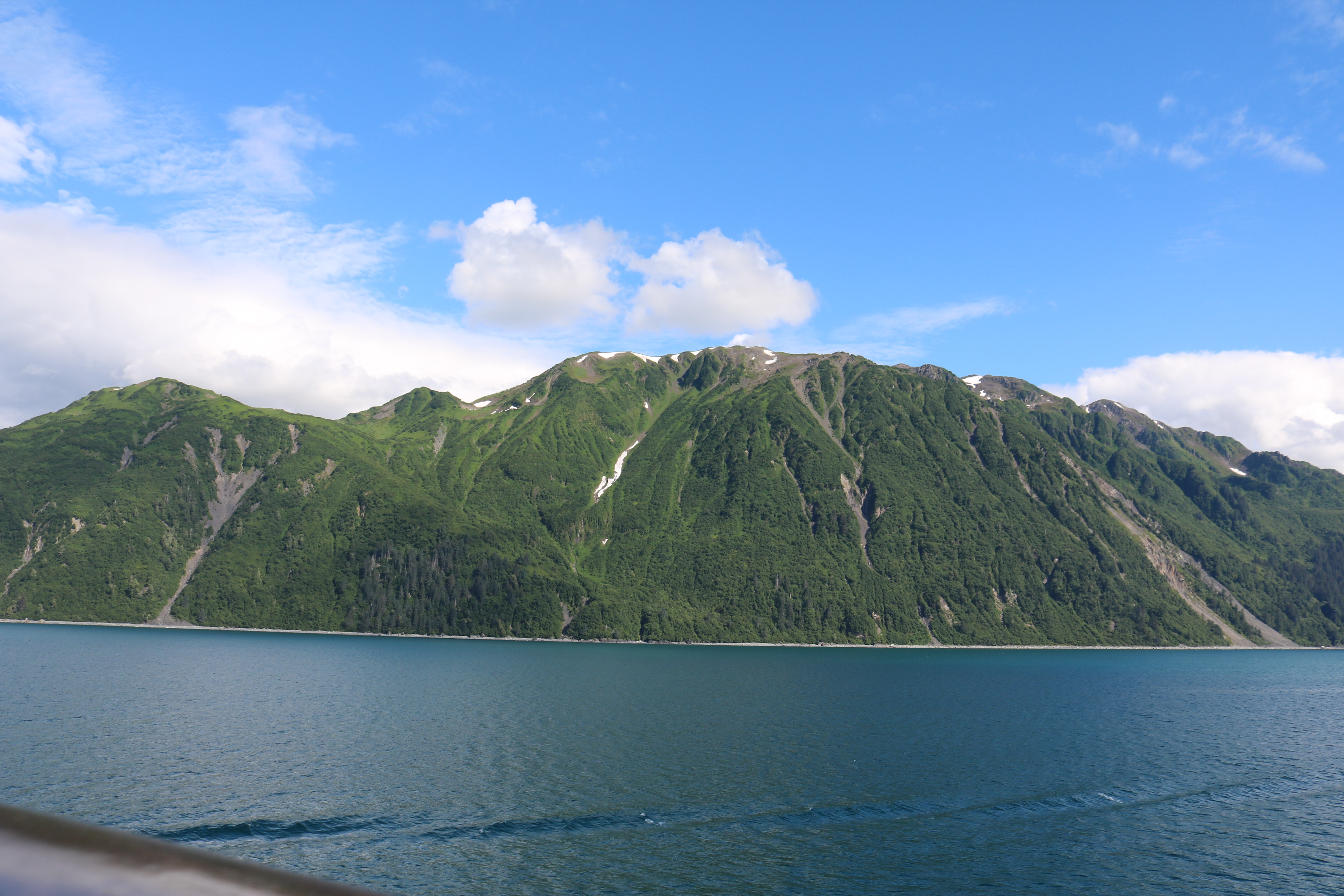
As we entered the Glacier Bay we first sighted the South Marble Island. This small island is a  sunbathing spot of gigantic Sea Lions. They lay on the rocks  with the dominant males sitting with their back arched and head erect.

Then came up the ‘Gloomy Knob’, a well rounded, dome shaped granite feature.  Surely it would have been smoothened by the glacial activities over the years.  Grass growing on the rocks formed a grazing pasture for the Mountain Goats.

After we passed Gloomy Knob, a boat belonging to US National Park Services came alongside our ship.  Rangers from the boat boarded our ship through a rope-ladders provided by the ship’s crew.

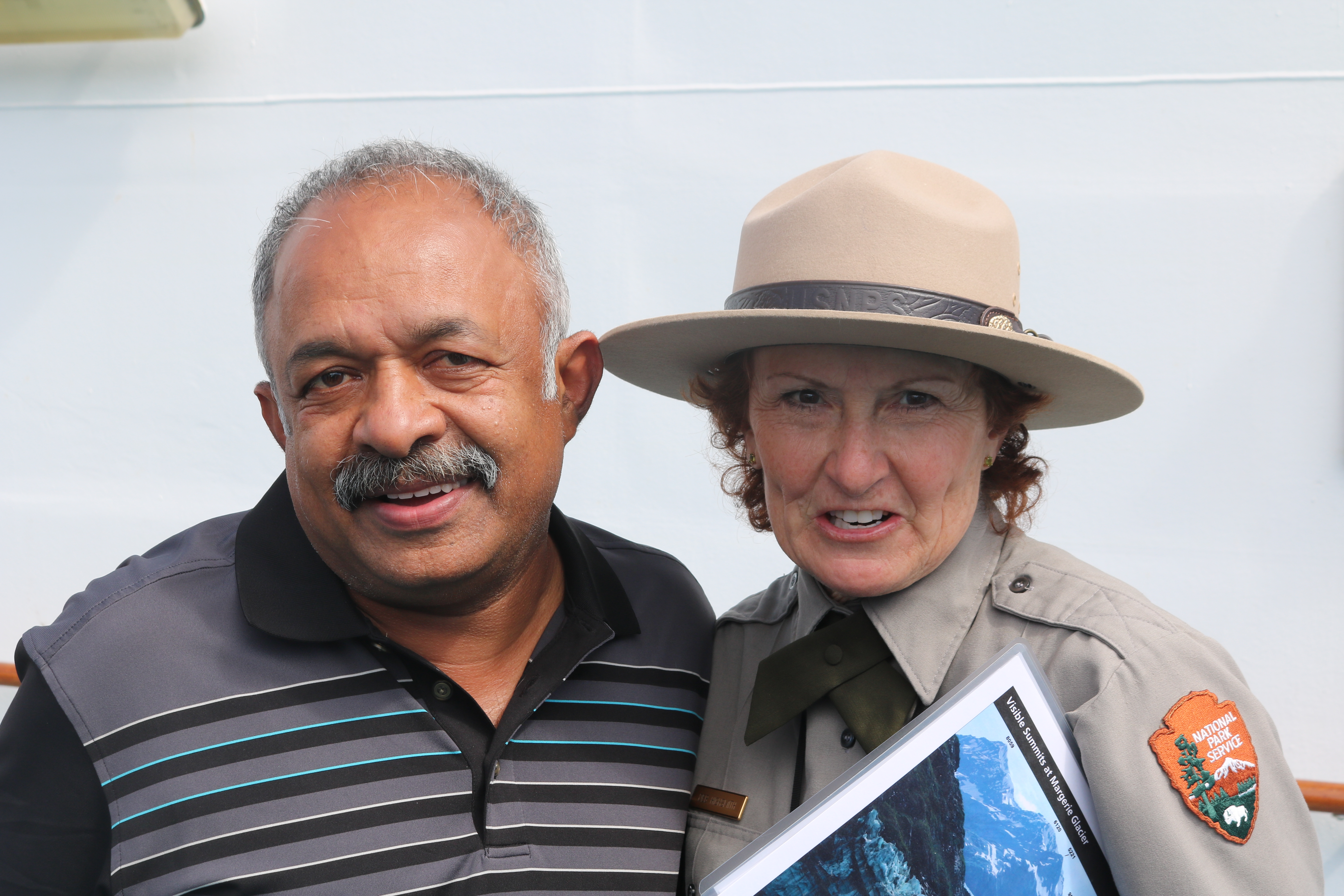
These Rangers, lead by Ms Highsmith, the Warden,  conducted classes about the Glacier Bay, its ecology, geology, about the original inhabitants, etc.  She brought out as to how the current conservation effort has been a great success as they included local inhabitants into it, respecting their beliefs, traditions and customs.

Our ship then moved closer to the Margerie Glacier, nearly a mile away, to facilitate us to view the spectacle of calving.  Cows have calves, glaciers calve icebergs, which are chunks of ice that break off glaciers and fall into water. This is caused in the glaciers of the Glacier Bay due to the forward motion of the glacier and the erosive action of the salt water of the Pacific Ocean, the tidal waves and the wind.

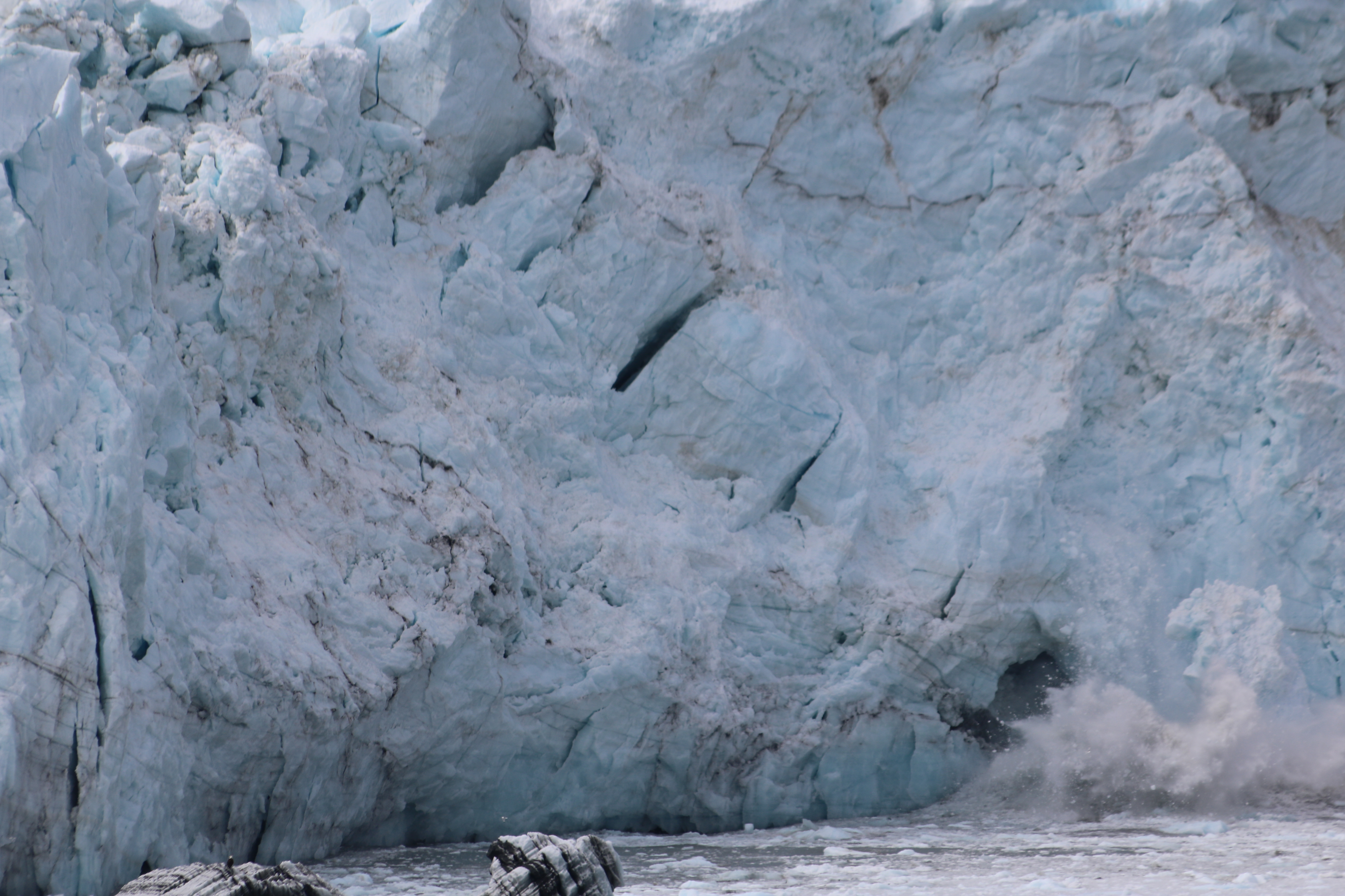
As we stood on the deck watching the Margerie Glacier, it calved five times, each time bringing down a heavy volume of ice, falling into water with a thunderous sound.  It was a great natural spectacle showcasing the fury of nature.

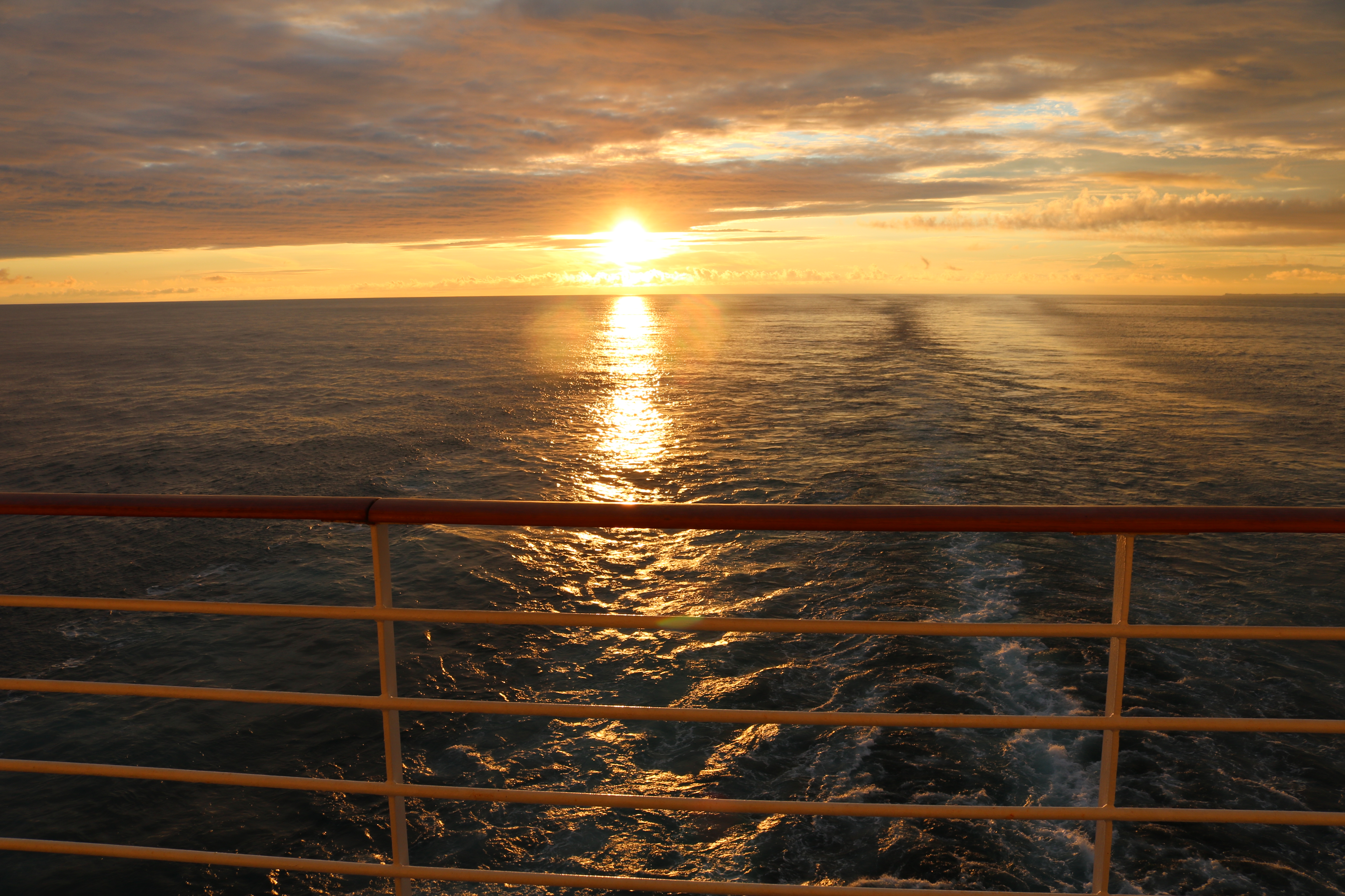
As our ship steamed off from the Glacier Bay, we all enjoyed a swim in the top deck swimming pool.

Next : Skagway – Gateway to the Klondike Gold Rush

Yakutat Bay and Hubbard Glacier


Our Ship sailed through the night after casting off from Whittier.  We had early breakfast and set out to explore the ship.


In the Mid-Ship was  lavishly decorated and well laid out Shopping Arcade with stores selling everything from Scotch Whisky to Jewellery.


Shopping Arcade covered four floors, very well done up with chandeliers, artwork, murals and et all.


Our ship entered Yakutat Bay by 11 AM from Gulf of Alaska.  It was a breathtaking sight to see large icebergs that had calved out of the giant glaciers, floating around.


On to the West was  St Elias mountains ranges.  The mountains rise like a white pyramid to an elevation of about 6000 meter in one of the world’s most dramatic transitions from sea to summit.  The Fairweather mountain ranges lies on the Eastern side of the Bay.  These mountains are scarred by glacial activity from the Ice Ages to date.


As we sailed through the Bay, more ice bergs, both small and big, were sighted as we sailed into Disenchantment Bay.  This bay was  named Puerto del Desengano (bay of disenchantment in Spanish) by Alessandro Malaspina in 1792, when he felt ‘disenchanted’ that the bay was not the entrance to the North-West Passage.  He was in fact looking to sail through the Arctic Ocean to Europe through the North-West Passage.


(Map courtesy of the US Geological Survey)

As our ship entered Disenchantment Bay, we could see Hubbard Glacier from over 50 km. This massive glacier is a staggering 125 km  long, 10 km wide, and 400 meter deep. Its face is over 100 meter high, which is as high as a 30-40 story building.  Hubbard Glacier,  is one of the over 110,000 glaciers in Alaska and is North America’s largest tidewater glacier. Hubbard Glacier was named in 1890 in honour of Gardiner G. Hubbard, the founder of the National Geographic Society.


A Tidewater Glacier is fed by the snow that flow out of the mountains and down to the sea.  Saltwater of the sea ‘eat’ into the thick ice-wall, causing it to break off .  This process is called ‘calving’.

Hubbard Glacier has been thickening and advancing toward the Gulf of Alaska, in stark contrast with most glaciers, which have thinned and retreated during the last century. This atypical behaviour is an important example of the calving glacier cycle in which glacier advance and retreat is controlled more by the mechanics of calving than by climate fluctuations. If Hubbard Glacier continues to advance, it will close the seaward entrance of Russell Fiord and create the largest glacier-dammed lake on the North American continent as it had done in 1986 and 2002. Hubbard Glacier remains an ongoing study of calving glacier dynamics for the scientific community.


In 2002 the advancing terminus of Hubbard Glacier created a glacier lake dam which turned Russell Fiord in to a lake for about two and a half months. Rising water in the newly formed lake altered local hydrology and was a threat to nearby communities. During the two and a half months that the channel was dammed, Russell Lake rose 20 meter. In 1986 a similar scenario resulted when the glacier caused dam raised the lake level 27 meter over the course of five months. Erosion of ice dam from saltwater eventually carved a new outlet channel and restored the fiord to its previous elevation in both cases.


Our ship after being in Disenchantment Bay for over two hours turned around.  During this manoeuvre, the ship’s propellers churned out glacial deposits brought down by the calving ice bergs deposited on the ocean floor.

After sailing another two hours in Disenchantment Bay, our ship headed for the Glacier Bay.  We all were really ‘enchanted’ by the natural beauty of the hills, the bay, and the floating icebergs.  We were not at all ‘disenchanted’ as we were surely not looking for the North-West Passage to Europe.


As our ship sailed ahead from the Disenchantment Bay, we watched the Sun setting into the Pacific Ocean – It was 10:45 PM.

Next :  Glacier Bay – Where the Birth of the World is Continuing

Alaska – Here We Are

During the summer of 2017, we along with Stephens, our travel companions, booked Alaskan Cruise on Coral Princess luxury liner.  The cruise commenced from Whittier, Alaska, USA, sailing South-East and ending at Vancouver, British Columbia (BC),  Canada.

On 29 July 2017, we boarded the early morning Air Canada flight from Toronto to Vancouver on the first leg of our Alaskan Cruise.  The flight duration was of about five hours, but the clock only moved by two hours because the clock had to be set back by three hours as the time zone of Vancouver is three hours behind Toronto.

The five hours flight was made more comfortable than the regular one as the aircraft, an Airbus 319 variant deployed was the special charter plane used to fly various teams of the National Hockey League (NHL).  The aircraft had only 60 seats, that too all First Class, with all the accessories like comforters, extra legroom, LCD screens, etc.  Thank you Air Canada.

After a two hour stopover at Vancouver, we flew to Anchorage, the largest Alaskan City.  We were impressed by the Military Lounge at Anchorage Airport.  An effective way to project the power of a strong military, thus a strong nation, especially to  foreign tourists.  A country that respects its soldiers will always be powerful for sure.

We boarded the bus for Whittier where Coral Princess, our cruise liner was anchored.  Route between Anchorage and Whittier on Portage Glacier Highway was very scenic.  The road ran parallel to the railway track, both hugging the coastline.  We passed through Anchorage Coastal Wildlife Refuge, known as Potter’s Marsh, a good place to spot migratory birds, water fowl and moose.

The road continued along Turnagain Arm, a body of water featuring the world’s second highest tides at over 30 feet.  We passed through Girdwood and Portage Glacier and the bus stopped at the entrance of Anton Anderson Memorial Tunnel, also known as Whittier Tunnel. It is a highway and railway tunnel that passes under Maynard Mountain. At 13,300 ft (4,100 m), it is the second-longest highway tunnel and longest combined rail and highway tunnel in North America.

We alighted from the bus at the banks of a lake formed by the melting Portage Glacier.  As the tunnel is one-way and is also shared by the railway, there is a schedule for traffic passing through it.  All the vehicles assembled in the staging area at the entrance of the tunnel.  At the scheduled time the convoy moved with buses leading the way.  Buses being public transport are given preference over cars.

Whittier Tunnel was constructed in 1941 to use Whittier as a rail port during World War II.  It is named after Anton Anderson (1892–1960), Chief Engineer of the Alaska Railroad Company and Mayor of City of Anchorage from 1956 to 1958.  The tunnel’s entrance portals are designed in an ‘A’ shape, with a large  door, which allows traffic in and out of the tunnel. The entrance portals are designed to withstand the force of an avalanche.

Ride through the 4 km tunnel was for about 15 minutes and surely there is light always at the other end of the tunnel.  As we emerged out of the tunnel at Whittier Port, Coral Princess, our cruise liner anchored there, came into our view for the first time.

Whittier came into prominence during World War II as it offered a shorter voyage into the Pacific Ocean and reduced exposure of ships to Japanese submarines.  It also reduced the risk of Japanese aircrafts  bombing the port facilities because of the high mountains around the port and bad weather for which Alaska is very famous for.  It pours all through the year and gets less than a month of bright sunshine every year.

We were escorted into our cabin E731 on the eight floor of the ship.  The cabin was very spacious and comfortable with a balcony facing the ocean.

Adjacent to the port were small boats and fishing boat jetty and also the railway station where a train was waiting its schedule to cross through the tunnel.

The ship casted off at 8:30 PM and we all headed straight to our watering holes for our first drink on board.

How did Alaska become the fiftieth state of the United States of America, detached from the mainland USA with Canada in between?

Russians colonised Alaska in the 17th century and exploited the local resources like fur and gold.  When Crimean War broke out in 1853, Britain, France and Turkey stood against Russia. Russia could neither supply nor defend Alaska during the war as the sea routes were controlled by the allies’ ships. There was a fear that British might blockade Alaska or even seize it.

Tensions between Moscow and London grew, while relations with the American authorities were warmer than ever. Russia offered to sell Alaska to the United States in 1859, believing the United States would off-set the designs of Russia’s greatest rival in the Pacific, Great Britain. US Civil War delayed the sale, but after the war, on March 30, 1867, US agreed to a Russian proposal to purchase Alaska for $7.2 million. The Senate approved the treaty of purchase on April 9.  President Andrew Johnson signed the treaty on May 28, and Alaska was formally transferred to the United States on October 18, 1867.

For three decades after its purchase the United States paid little attention to Alaska, which was governed under military, naval, or Treasury rule or, at times, no visible rule at all. Seeking a way to impose US mining laws, the United States constituted a civil government in 1884. Major gold deposit was discovered in the Yukon (Canada) in 1896, and Alaska became the gateway to the Klondike gold fields. Alaska became a state of US on January 3, 1959.

Next – Hubbard Glacier at Yakutat Bay

Jonah the Musical

On 01 July 2017, we along with Stephens, our travel companions, set out early morning to Lancaster, Pennsylvania, USA.  After eight hours of car ride from Toronto, we reached our hotel and checked-in by about 10 AM.

Lancaster is nicknamed the Garden Spot of America or Pennsylvania Dutch Country and located in South Central Pennsylvania.  The county is home to America’s oldest Amish settlement, where thousands still lead the age old lifestyle – without motor cars, without modern gadgets like cell phones, computers etc – but with their horse buggies, ploughs pulled by mules, homes without electricity etc.  It is called Dutch Country as most Amish settlers are of German (Deutsch) descend and have nothing to do with the present Netherlands.  It is called the Garden Spot because of the well drained plain farmlands which support agriculture, the mainstay of the Amish people.

In the evening we watched the Biblical Stage Show – Jonah by  Sight & Sound Theatre, a Christian faith-based, company -complete with grandiose sets, costumes befitting the time period, music and songs, use of modern technology like GPS to move various props around the huge stage – it was amazing. The center stage was very wide, and they also had props and action the left stage and the right stage.  They used the aisles in the seating area too for the actors and animals to make their entry.  They lighted up the ceiling of the theatre to immerse the audience into the ambience of day, night, storm, underwater – it was a journey into a different world.

The cast was fantastic and everyone fitted into their roles and the story being told very well.  Kudos to the technical and arts team, the changes of the sets were flawless and smooth.  In minutes one was transported from a little town to a sea port, then to a ship bumping through the storm ravaged seas to an evil town.  The props were magnificent and huge -especially the ship covering almost half the stage.  The details have been really gone into designing the ship with all its sails, masts and the most amazing was the lower deck when the hull opens to show the inside of the ship.  Truly Fantastic!

It was real technical wizardry and art on display all through the two hour show.  They have made three dimensional ancient cities come live with people and animals.  A fleet of boats sailing across the stage, and a 50 foot ship being tossed up and down in a storm at sea is amazing.  After intermission, the entire theatre is transformed to an undersea world with schools of exotic fish swimming about, beautiful iridescent jellyfish floating above our heads, sharks prowling for prey, colourful clownfish and seahorses swimming around, and a giant whale swimming over our head.

The story of Jonah has been scripted very well with a fine touch of humour.  The story has been extended to fill two hours, but will never distract the audience even for a second.  The story dates back to about 700 years before Christ where in a boy, Jonah gets a prophecy from God about the victory of the king of the Israelites.  When it comes true, he is declared a prophet and everyone waits for more prophecies.  God does not appear to Jonah thereafter, but the people of Gath-Hepher erect a heroic statue of him.

One day God ordered Jonah to go to Nineveh to declare the city’s wickedness and impending destruction.  Jonah does not want to save the people of Nineveh as his father was killed by soldiers from Nineveh and he hates the city and its people.  This forces Jonah to flee.

He goes to Joppa, a seaport and embarks on a ship sailing to Tarshish.  A storm rages and the ship is battered and tossed around by it.  Jonah, realising that the storm is God send to curtail his journey to Tarshish, orders the Captain to throw him off the ship.  Thus the storm dies down.

Jonah falls into the deep sea and the audience are transported into a serenely beautiful undersea world.  Jonah is gulped down by a huge whale and he survives this encounter for three days.  He repents and prays to God for mercy.  Now God wants Jonah to help the people of Nineveh find redemption.  God ensures that Jonah is thrown out from the whale’s stomach to land in the City of Nineveh.  Jonah keeps avoiding the people of  Nineveh as he hates his father’ killers, but ultimately understands the idea of forgiveness and redemption and saves the people.

The music and the songs in the play were apt and spectacular, especially the powerful voice of the Queen of Nineveh.   The show was supported by about 25 stage technicians who run the show and the 48 actors who star in it.  They all have done a remarkable job bringing a story alive both as a spectacle and as a Biblical message.

Some history behind the Sight & Sound Theatre.  It was founded by Glenn Eshelman who painted landscapes as a boy. As he grew up, Glenn continued to pursue his artistic interests, eventually buying a camera to take reference photos for his paintings. After marrying Shirley, Glenn sold his artwork out of the trunk of his car to make a living. In 1964 he presented a scenic photography slide-show at a local church using a slide projector, a turntable for musical underscore and a microphone for narration. This was the first unofficial “Sight & Sound” show.  By the mid-1970’s, Glenn and Shirley took their slide-shows around the United States.  They formed the Living Waters Theatre in 1976, marking the birth of  Sight & Sound Theatres.

In January 1997, a devastating fire destroyed the theatre, but the couple rebuilt it in 18 months.  The new 2000-seat, state-of-the-art theater featured a massive, 300-foot panoramic stage that wrapped around the audience, with the ability to house sets four stories tall.  They have now further enhanced the theatre by incorporating the modern technological light & sound equipment and software, coupled with other technologies like GPS and digital communication.

York-Durham Heritage Railway

On October 1, 2016, we embarked on the York-Durham Heritage Railway train on a trip around the city of Uxbridge, about an hour’s drive from Toronto.  The York-Durham Heritage Railway trains operate on the original Toronto & Nipissing (T&N) rail line, built in the late 1860’s. This line was built to allow its owner, William Gooderham, a distiller from Toronto, to carry grain to his distillery as well as lumber.

On March 4th, 1868, the Company was chartered, and construction began the following year. As it was advantageous at that time to have the rail line pass through any town, many paid handsomely for the privilege. Markham raised over $4,000 in one evening, and Unionville made a successful last-minute effort to have the line rerouted after it bought $500 worth of shares. The town of Uxbridge was chosen for the site for the railway’s shops.

We reached the Uxbridge station, with its distinctive Witches Hat roof, owned and maintained by the Township of Uxbridge for the heritage journey. Uxbridge is situated in a beautiful valley on the northern slope of the Oak Ridges Moraine, about 64km northeast of Toronto, Ontario.  The York-Durham Heritage Railway reopened the line between Uxbridge and Stouffville in 1996 and has been running on summer weekends since then. The train journey of about 90 minutes.

After we boarded the train, the Captain of the train – the Conductor – briefed the passengers about the train and its journey, what to see and do with the coach attendant watching. All the staff running the train are volunteers.

The fall had set in (01 Oct) and the leaves were changing colours – before they fall off.  This gave a kaleidoscope of colours all through the journey.

The guard’s wagon of the train called the Caboose at the rear end of the train, acted as an office and living quarters for the crew of a freight train in the old days. A viewing Cupola is built to facilitate a crew member to look forward at the train to see if anything is amiss

The Baggage Car with open doors fitted with safety barricades is the best place to view the landscape while the train is on the move.

One side of the Baggage Car is a ‘Railway Play Station’ for kids, to keep the kids engaged all through the journey.

On the other side of the Baggage Car is the Souvenir shop and a snack-bar – all manned by volunteers.

The rail-road crossings do not have barriers like those along an operational rail line as the trains operate only on weekends.  It is the duty of the drivers who cross the railway line to lookout for approaching trains and stop.

A musician, again a volunteer, entertained the passengers with his melodies. The passengers also joined him in chorus.

A volunteer ‘Clown’ was also seen entertaining kids with his tricks on board

This is a limestone quarry enroute of LaFarge Cement Company.  Ontario has large deposit of limestone which supports the large cement manufacturing industry.

The journey was very pleasant, especially with the friendly, easy – going volunteer staff.  The staff obviously loved what they did.  It is an experience worth sharing as it goes to prove that a volunteer force can run a railway and much more.

Pelee Island : The Southernmost Tip of Canada

On July 08, 2017, we along with Stephens, our travel companions, travelled from Toronto to Lemington, a four hour car drive along Highway 401.  We boarded MV Jiimaan, a vessel 200 ft)in length that transports 400 passengers and 40 vehicles on Lake Erie from Lemington to Pelee Islands.  The cruise was of  about 90 minutes.  The ferry housed a cafeteria and the view from the deck was awesome.

Pelee Island, (42 Sq Km) largest island in the Western End of Lake Erie, is the Southernmost tip of Canada.  It was leased to Thomas McKee by Ojibwa and Onawa tribes in 1788.  The island’s name is derived from a French word ‘pelee’ meaning barren.  It remained barren, true to its name until it was purchased by William McKormick in 1823.

The Pelee Island Lighthouse was built by John Scott in 1833.  William McCormick donated the land and also served as its first light-keeper till 1840.  The lighthouse used to guide sailors through the rocky Pelee Passage in Erie Lake until it went out of service in 1909.

Only other way to get on to the Pelee Island is through the International Airport with a 3,300 feet paved runway.  Regular flights operate in winter when the ferry services are closed.  It serves as the emergency pickup point. It might be the smallest International Airport in Canada – it is International as it receives flights from USA, just South of it.

The population of Pelee Island is about 140.  In summer about 100 migrant workers land on the island to support both tourism and agriculture.  The island has a Police Station manned by two personnel, obviously there is hardly any crime and the last major crime was reported in 1920.  The Emergency Services is operated by two Para-Medics with an ambulance and a Nurse Practitioner manning the Medical Clinic.  Emergency cases are airlifted to the mainland at Lemington.  The Fire Department has a fire tender operated by volunteer crew.

This is the shoe tree which has an interesting history.  The tree was given up for dead and the home owner tied a pair of shoes on to it and it is believed that it re-grew thereafter.  All the migrant workers, on leaving the island at the end of the season now tie their work-shoes on the tree to bring them good luck.  Some do it with a hope to return to the island for work next year.

The island is mainly  agricultural based with about 5,000 acres of soybeans, about 1,000 acres of wheat, 500 acres of grape cultivation.  The centre of the island was a large marsh which was drained out to form the fertile agricultural land.  Thus most cultivation is done below the Lake’s level and hence there is always fear of floods.  The houses on the island are built on stilts to save them from flooding.

After spending the day on the island, we boarded the ferry on our return voyage to Lemington and then we drove off to Toronto.

Victoria – Capital City of British Columbia

Our trip to British Columbia in August 2016 concluded with a visit to Victoria Island, the capital of British Columbia (BC). Victoria is an island that offers heritage architecture, colourful gardens and traditions like afternoon tea, mixed with outdoor adventure, culinary experiences, especially fish and chips. Victoria Island is located about 100 km from Vancouver and can be reached by ferry, sea plane, tourist boats or by air.

We set sail by the 9AM from Vancouver on the ferry operated by BC Ferries and it took about 90 minutes. There were about 200 vehicles and 400 passengers (and a few dogs) on board. The ferry ride offered a deck-side view of the breathtaking scenery through the Strait of Georgia. The ferry had three restaurants with various food options and viewing platforms, both inside and outside.

Our first halt was at the Parliament building. Overlooking the harbour stood the statue of Captain James Cook, the first non-aboriginal man to set foot on Vancouver Island in 1778. Many aboriginal families lived on Victoria Island, each referring to themselves by distinct family group names. In 1843, James Douglas chose Victoria (then known as Camosack), as a Hudson Bay Company trading post. The post was eventually renamed Fort Victoria, in honour of Queen Victoria.

On July 21, 1871, BC became the sixth province of the Dominion of Canada and Victoria was proclaimed the Capital City. The Parliament building to house Legislative Assembly of BC opened in 1898. In the twentieth century, Victoria evolved as a city of government, retirement and tourism.

Above is a statue of homecoming of a sailor to commemorate the 100 year anniversary of the founding of the Canadian Navy, and was unveiled on 04 May 2010 at Victoria, capital of British Columbia.

We were thrilled to see the three statues located in front of the Parliament building. They would enthrall any military history enthusiast and veteran. The first was a statue of a soldier to commemorate BC’s fallen in World War I, World War II and the Korean war; then a statue of a Veteran Sailor and a statue of homecoming of a sailor to commemorate 100 years of Canadian Navy unveiled on 04 May 2010.

Our next destination was Butchart Garden, surely a place for a nature lover and a gardening enthusiast. Robert Pim Butchart, a pioneer in the North American cement industry, came to Victoria Island lured by its rich limestone deposits. In 1904 he developed a quarry and built a cement plant. His wife Jennie Butchart became the company’s chemist. Close to the quarry, the Butcharts established their family home with a small garden. As Mr Butchart exhausted limestone deposits, his enterprising wife Jennie, converted the gigantic quarry into a beautiful garden.

The renown of Mrs Butchart’s garden quickly spread. By the 1920s more than fifty thousand people visited her garden each year. The hospitable Butcharts christened their estate ‘Benvenuto’, the Italian word for ‘Welcome’. Their grandson Ian Ross was given the Gardens on his return from World War II. He made the garden self-sustaining, transforming the mostly neglected home and gardens into an internationally famous tourist destination. Each year over a million bedding plants in some 900 varieties give uninterrupted bloom from March through October. Almost a million people visit annually for spring’s colourful flowering bulbs; summer’s riot of colour and fall’s russets and golds.

The most impressive sight was of the Sunken Garden from the lookout. The old quarry had been transformed by Jennie into a beautiful sunken garden of massive dimensions and dramatic aesthetic qualities representing exceptional creative achievement in gardening. Deep expansive walls, beds of annuals, flowering trees, unique shrubs, central rock mound and a fountain, all added variety to the uniqueness of this marvellous garden.

We were welcomed by the luscious scents of roses to the Rose Garden. The flowerbeds bordered by magnificent delphiniums had roses of many varieties and bright colours. The garden has an extensive collection of floribundas, ramblers, climbers and Hybrid Tea Roses. Each rose variety has been marked by name, origin and year registered with the American Rose Society.

A Torii gate welcomed us into the serene Japanese Garden. Walkways by the side of streams and ponds guided us through many bridges. Japanese maples and birch trees spread abundant shade on to the well manicured lawns. Jennie, with assistant Isaburo Kishida, an expert Japanese landscaper, completed this garden in 1906.

The next stop was the Italian Garden bounded by two arched entrances. This garden was originally Butchart’s tennis court. A splendid Star Pond adorned the centre of this garden. It was originally designed to house Mr Butchart’s collection of ornamental ducks as he was an enthusiastic hobbyist who collected ornamental birds from all over the world. He kept ducks in the Star Pond, peacocks on the front lawn and had many birdhouses throughout the gardens.

Past the Italian Garden, we entered the Mediterranean Garden. This area had an enchanting arrangement of lush, exotic plants from around the world. We were all surprised to see that even a banana grove could enhance the beauty of an enchanting world renowned garden.

From the Butchart Garden, we headed straight to the Red Fish Blue Fish. It is an outdoor waterfront eatery in a modified cargo container, standing on a wooden pier in Victoria’s Inner Harbour. It is one of Victoria’s most cherished eateries. There was a long queue and after about half an hour in the queue, we ordered fish and chips. We relished the battered and steaming pieces of halibut, sitting on the dock overlooking the bay. Indeed it was worth the wait standing in a long queue.

Our next destination was ‘Mile 0’ which marks the start of the over 8,000 km Trans-Canada Highway that spans the entire length of Canada – from the Pacific Coast to the Atlantic. Mile 0 is also home to a statue of Terry Fox. Fox lost his right leg to cancer when he was 18 years old. He started a trans-Canada run to raise money for cancer research, beginning in Newfoundland on the East coast of Canada and was to end at the Mile 0 marker in Victoria. Unfortunately, Fox’s journey ended tragically near the halfway mark when he fell ill and passed away. Since then, hundreds of millions of dollars has been raised in his name by the Terry Fox Foundation for cancer research. With the visit to Mile 0, we culminated our exploration of Alberta and BC this time.

Now it was time for us to catch the return ferry to Vancouver and say goodbye to the beautiful Victoria Island. As we cruised through the Pacific Ocean, the sun was about to set and its rays painted the islands with different shades of gold.

Temperate Rain Forests of British Columbia

Temp100
We visited the Stanley Park and Capilano Park during our visit to British Columbia (BC), mainly to see the temperate rain forests. 

How is the temperate rain forests different from its tropical cousin?

The term ‘rainforest’ implies forests in high rainfall area, making them very dense and green.  Tropical rainforests lie closer to the equator while temperate rainforests are found at latitudes between the two Tropics and Polar Circles.  This causes temperate rainforests to be cooler, have less precipitation, contain less biodiversity and slower decomposition than their tropical counterparts.  Canada’s rainforest falls between the Arctic Circle and the Tropic of Cancer, forming a narrow band along the coast of the Pacific Ocean from Alaska to Northern California. Other countries that have temperate rainforests are Chile, New Zealand and Norway.

Temp200
In the morning we visited the Capilano Suspension Bridge Park.  The park offers visitors a unique mix of adventure, history and culture.  The park showcases a totem pole park, North America’s largest private collection of First Nations totem poles, period decor and costumes.

Temp220
Totem pole is a monument created by Northwest Coast Aboriginal people to serve as a signboard, genealogical record and memorial.  Carved of large red cedar and painted in vibrant colours, they are usually erected to reflect the history of that lineage.  Theses poles are also erected as memorial poles, grave figures, house posts, house front poles, welcoming poles and mortuary poles.

Temp240
The entrance to the park as the name suggests is by way of a suspension bridge.  The bridge was originally built in 1889 of hemp ropes with cedar plank deck.  It was replaced with a wire cable bridge in 1903.  The bridge was completely rebuilt in 1956.  We enjoyed the thrill of crossing the 450-foot long swaying bridge, suspended 230 feet above Capilano River. The bridge offered a splendid view of the river and the forest below.

Temp260
An eco-guided tour is conducted by the Park every hour, which was very informative, covering various ecological aspects of the forest in the Park.  The guide educated us about the rainforest, trees. trout ponds and the undergrowth.

Temp280
The first stop was at a banana slug.  The guide explained that there are no earthworms in these forests and these slugs contribute to the decomposition of organic matter into humus. These slugs are covered with a special slimy coating that numbs the mouth of any predator.  Racoons roll the slugs in mud to coat them and then eat them.

Temp300
We stopped next at a nurse log.  Fallen logs are called nurse logs as they help new seedling growth by creating an elevated and moist habitat.  Decomposition being comparatively slower when compared to tropical forests, results in a deep layer of decaying organic matter that forms the top layer of the forest floor.  This gives a cushioning effect while walking on it. 

Canada’s temperate rainforest is dominated by a relatively small number of tree species because the seeds need to regenerate in the low light levels on the forest floor caused the thick canopy.  Most of the trees found in this forest are coniferous trees like the Western Hemlock, Yellow Cedar, Western Red Cedar, Douglas-fir, and Spruce.  The coniferous trees are well adapted to the temperatures and shorter daylight hours of the winter as they remain green and keep their foliage in winter which helps then to photosynthesise throughout the year.

Temp302
The thick and uneven tree canopies that cover the coastal rainforest allow little sunlight to reach the forest floor, so undergrowth must adapt accordingly.  Indeed, the ground is mostly covered by plants that do not need much sunlight, like ferns. Small trees also grow under the shade of the taller ones. In order to get sunlight, some plants grow on bark and branches of trees, where there is more sunlight than on the forest floor.

Temp304
Along lakes and rivers and gaps left by fallen trees, which lets in more sunlight in, few deciduous tree species like Bigleaf Maple, Red Alder and Black Cottonwood thrive.  

Temp320
The guide escorted us to the ‘Grandma of Capilano’ – the tallest tree in the forest.  It is a Douglas Fir, aged over 1300 years, standing tall at 76 M. 

Temp340
After the guided tour, we ascended a foot bridge for Treetops Adventure Tour – a self guided tour.  This leg consisted of seven footbridges suspended between magnificent 250-year-old Douglas Fir trees, forming a walkway up to 30 M above the forest floor.  The elevated walkway offered a woodpecker’s eye view of the forest.

Temp360
The walkway has been created without harming the trees, with no nails or bolts drilled into them.  Metallic collars hold the ends of the walkway on to trees and are moved every eight years to facilitate the tree to grow. 

 Temp380
On our way back to the parking lot was the Cliffwalk.  This heart-pounding cliff-side journey took us  through rainforest vegetation on a series of suspended walkways jutting out from the granite cliff face above Capilano River.  The Cliffwalk is high and narrow and in some sections, very strong glass is all that separated us from the canyon below. The narrow walkway has fixed handrails supported by steel beams cantilevered from 16 anchor points in the granite rock face of the canyon.  Various information boards along the walkway explained the interaction between water, granite, salmon, flora and fauna.

Temp400
We then drove to Stanley Park on the beaches of the Pacific Ocean, a green oasis in the midst of the heavily built urban landscape of Vancouver.  The 400-hectare natural West Coast rainforest offered us rare scenic views of the ocean with ships anchored, mountains, sky, and majestic trees along Stanley Park’s famous Seawall.  We walked around the park on the walking track which ran all along the beach, adjacent to a separate cycling track.

Our visit to the temperate rain forest parks were both educative and recreational.  Hermann Hesse, a German-born Swiss poet once said “Trees are sanctuaries. Whoever knows how to speak to them, whoever knows how to listen to them, can learn the truth. They do not preach learning and precepts, they preach, undeterred by particulars, the ancient law of life.”


Whistler : Abode of the Gods

Whi100
(Image Courtesy Whistler Blackcomb)

We halted at Whistler on our way to Vancouver in August09, 2016.  Located in the spectacular Coast Mountains of British Columbia (BC), Whistler is Canada’s favourite year-round destination.  Whistler is undoubtedly the most-visited ski resort in Canada, with over 2 million visitors a year.  There are two majestic mountains with a vibrant base Village.  The facilities in the area include skiing and snowboarding, gondolas connecting various peaks, mountain biking trails, hiking trails, golf courses, restaurants, bars and accommodation to suit every budget.  It is undoubtedly the best mountain adventure site in the world.

We headed straight to the Whistler Village Centre to buy our tickets for the Peak2Peak Gondola Ride.  The area was jostling with activity, mainly by hikers and mountain bike riders.  There were many stalls offering mountain bike rentals and training for novice mountain bikers.  The mountain bike trainees ranged in age from five to over 50 years.
Whistler Blackcomb boasts of the largest mountain bike park in North America, officially opening in May each year. With over 4,900 vertical feet and over 60 descending trails spread over three riding zones, there is something to pump up the adrenaline for each level of riders.

The gondolas of Whistler Blackcomb are inspired by the ski lifts in Switzerland.  They connect the two ridge-lines running roughly Northwest to Southeast, separated by a deep valley as shown in the diagram above.

Whistler was originally conceived as part of a Canadian bid for the 1968 Winter Olympics.  Although they lost the bid, construction started and the resort opened for the first time in January 1966.  Blackcomb mountain, originally a separate entity, opened for business in December 1980.  The two resorts underwent a period of intense rivalry through the 1980s and 90s.  Intrawest, the BC real estate firm that developed Blackcomb, purchased Whistler and fully merged their operations in 2003.

Whi110
Whistler Blackcomb offered a renewed bid for the 2010 Winter Olympics, which they won in July 2003. They hosted the men’s and women’s Olympic and Paralympic alpine skiing events.  Over the next decade, Intrawest expanded by purchasing additional ski resorts across North America, before expanding into golf and other resorts as well.

Whi200
We lined up at the Whistler Village Centre for our journey up Whistler Mountain.  The air was a bit chilly and misty.  The gondolas were enclosed, separate for persons and equipment.  Many mountain bike enthusiasts and tourists were already in queue awaiting their turns.  We boarded our gondola for the first leg and the journey up the Whistler Mountain to the Roundhouse Lodge located at about 6,000 feet.

Whi125
Enroute we had a fascinating view of the coniferous tree tops with their young cones blooming with a bluish tinge.  It was thrilling to watch mountain bikers below, negotiating the mountain trail at a very high speed, with precision and grace.  We could also see young kids being trained on mountain biking skills by their instructors.

We alighted at the Roundhouse Lodge after a thrilling 15 minutes.  From there we had a 10 minute hike through a trail to the starting point of Peak Express for our journey to Top of the World Summit.

Whi220
The trail had an explosion of colours offered by the wildflowers growing at that altitude.  They are seen for only two to three weeks in mid-summer and we were indeed blessed to catch a glimpse of these wild beauties.  Most of these flowers are poisonous to ingest, hence are not foraged on by the deer in the forest.

Whi230
The flowers we saw were the Alpine Fireweed, a bright to deep pink flower that grows from 5cm to 3 metres.  The yellow Mountain Buttercup is primarily found in deeper soils and among bunch grasses of undisturbed grasslands. The flower has a waxy sheen to it. The Sitka Valerian grows in moist alpine meadows with flowers that are pale pink to white and form a dense, sweet scented cluster.  Partridge Foot grows in wetland areas. This shrub-like perennial has cream-coloured flowers in the summer and golden seed pods in the fall.

Whi260
The Peak Express  journey was on an open gondola and the cold winds blew hard on to our faces.  As the elevation kept increasing, the landscape kept changing.  It was a fantastic experience to view the rugged beauty of the Canadian Coast Mountains.  The wildflower meadows, boulder  filled slopes and towering peaks offered a picturesque view.

Whi280
After about five minutes we landed at the summit at about 7200 feet.  From there we could catch the glimpses of lakes under distant peaks and massive glaciers, even though there was bit of mist.  We picked up cups of hot chocolate from the coffee shop and walked to giant Inukshuk.  An Inukshuk is a piled-stone marker that looks like a man. Historically it was used in the Arctic as a directional marker but has now become an icon of Canada overtaking the Mountie.

Whi300
After spending about 15 minutes at the summit, we returned to Roundhouse Lodge on the Whistler Mountain for our ride to the Rendezvous Lodge on the Blackcomb Mountain by the Peak2Peak Gondola.  This ride was for 11 minutes and the system holds the record for the highest and longest unsupported cable car span in the world of 3.024 km. It is indeed an engineering marvel – a long steel ropeway hanging between two peaks – unsupported by any pylons.

Whi320
The Peak2Peak Gondola was completed on December 12, 2008 and can transport 4,100 people per hour between the resort’s mountains.  The cars for this leg of the ride are enclosed and can seat 12 persons.  There are some glass bottom gondola cars, but their frequency is once every 15 minutes.  The ride offers spectacular views of the village, valley and surrounding mountains – a 360 degree 3D view in fact.

Whi340
From the Rendezvous Lodge we took the Solar Coaster Express and then the Wizard Express to reach the Blackcomb Base.  The open-air chairlifts on these rides offer a unique experience than what a gondola provides as you get an aerial perspective of the ground directly below.

The Whistler Olympics project took nearly four decades, but the effort taken by the Canadian government in collaboration with business partners is clearly visible.  It has helped to place Whistler as an excellent year-round adventure destination in the world and has generated employment for the local population and businesses.   The Whistler visit showed us as to how the facilities created for a major sporting event could be exploited for the betterment of the community post event.

Silviculture : An Aerial View

During our trip to the Rocky Mountains in Alberta and British Columbia (BC), in August 2016, we undertook a helicopter ride lasting 30 minutes over the mountain ranges and the Boreal Forests of Revelstoke, BC.  The town is located 641 km East of Vancouver, on the banks of the Columbia River.

Canada is home to 10 per cent of the world’s forest cover and 30 per cent of the world’s Boreal Forests.  About 38 per cent of Canada’s land area is forested, or about 3.4 million out of 9.1 million square  km.  92% of these forests are owned by the government and is highly regulated and monitored.  Slightly more than half of this area is classified as commercial forest capable of producing merchantable trees.  

Silvi120

Various government agencies  identify intended methods of cutting, reforesting, and managing timber resources within the defined area of responsibility. The forest management planning time frame considered is 200 years, representing two full life cycles, or ‘rotations.’

Silvi200
Despite being the lead exporter of softwood lumber, newsprint and wood pulp, Canada harvests less than 0.2 percent of its forest annually. On average, a tree must be about 80 to 100 years old before it is ready for harvesting.  In case 1% of trees are harvested each year, forests have 100 years to grow back before they are re-harvested. Every year is different, depending on several factors, including wildfire and mountain pine beetle activity, but the number of trees harvested each year is always much less than 1%.

While trees can now be chopped down with the help of machines, replanting must be done by hand, one sapling at a time.  Certain species, like aspen, regenerate naturally after harvesting. The number of trees in Canada works out to 16 trees for every person.  Canada also plants at  an average of more than 2 trees for every tree the industry harvested.

A silviculture system covers all management activities related to growing forests – from early planning through harvesting, replanting and tending the new forest.  Silviculture is the art and science of controlling the establishment, growth, composition, and quality of forest vegetation for the full range of forest resource objectives.  The policy guideline for silviculture in Canada is sustaining environmental and economic values for the future.  Canada’s forest management policies and practices are among the most stringent in the world.

Silvi300

A common method of logging in in Canada is clearcutting – harvesting and removal of an entire stand of trees. Although efficient, clearcutting poses a variety of environmental problems.  It can increase the harmful impact of wind and rain on local ecosystems; destroy valuable wildlife habitat used by pine martins, caribou, and other animals; and cause soil to become dry and overheated, which may in turn increase the risk of fire or interfere with seedling growth. Logging operations can also alter the chemical and physical makeup of nearby water-bodies and affect the health of fish and other aquatic species.

Since 1949, forest companies have been legally mandated to reforest harvested areas. Reforestation must occur within two years of harvesting. Tree planting operations must promote their survival through the winter months. Forest companies monitor trees for up to 14 years after planting.  In most cases, the logging companies are required to regrow at least two trees for every one they harvest. Sometimes companies plant five or six trees for every harvested tree so that enough will survive to replace those harvested.

Harvesting too many trees can be harmful to the forest, but with careful planning, harvesting trees can actually make the forests healthier. Clearing out old trees makes space for new trees to grow, continuing the life cycle.  Many animals like deer, moose, and elk prefer younger forests with  new vegetative growth to feed on.  The younger trees are less prone to diseases and invasive insects like the mountain pine beetle.

Silvi400

If a forest had only trees, it will be neither healthy nor diverse. In the picture above, you can see patches of forest that are at very different stages of growth. There are older trees which provide habitat for the wild animals and there are young trees too.

Forest harvesting involves cutting trees and delivering them to sawmills, pulp mills and other wood-processing plants. The operations include road construction, logging and log transportation. Years of planning go into deciding when and which parts of the forest will be harvested and how this will occur, all to ensure that these activities are carried out in a manner consistent with protecting social and environmental values. The specifics of forest harvesting will depend on the region and type of forest. 

Silvi500

The forest industry builds thousands of kilometers of logging roads each year.  All these roads require planning and surveying. They must be constructed to minimise soil erosion, protect water quality and cause the least impact on the forest growing site.

Silvi600
The lumber harvested and the timber products of the industry’s mills are transported mostly by rail or road.  Waterways are also used to move lumber by floating them downstream, tied in a raft formation or by powered barges. The trans-Canadian railway line connecting the Atlantic coast to the Pacific coast runs through this area.

Silvi700
Forest fire is the nature’s way of deforestation.  These fires help return valuable nutrients to the soil that helps a natural rebirth.  Some pine cones need high temperatures to help burst open to facilitate their seeds to disperse.  Fires help the undergrowth exposure to sunlight, making them grow better.  Such fires naturally occur in forests every 150 to 250 years. 

Regulated and dedicated efforts by various Canadian government agencies and the timber industry can only sustain the forest wealth of the country.  The efforts are in the right direction to ensure ecological balance  and also to ensure that these forests would thrive through for future generations.

Banff Gondola, Takakkaw Falls and Duffey Lake

Banf100
After visiting the Columbia Icefields, we travelled to the town of Banff and stayed there overnight.  The town of Banff was intended to be a tourist destination from its very inception.  The town is situated in a valley in the Banff National Park, enclosed by the beautiful and rugged Rocky mountains.  The city streets are lively with tourists and is lined with top class restaurants, bars and shops.

The town boasts of the Banff Sightseeing Gondola, located just five minutes from the Town of Banff, on the shoulder of Sulphur Mountain.  The gondola ride offers a marvellous view of the town of Banff as well as the mountains around.

On the morning of August 08, 2016, we boarded a four-seater, glass enclosed gondola at the base.  The glass bottom of the gondola provided us with a 360 degree panoramic view of six scenic mountain ranges around Banff.  Below us, as we were moving up was the walking trail leading to the summit and there were many hikers enjoying the same view.

Banf120
After about 10 minutes in the gondola, we reached Sulphur Mountain at an elevation of about 7,500 ft.  It felt like being on top of the world as we stood on the spacious main level observation deck.

Banf130
We got on to the Skywalk, a kilometer long walkway, created out of cedar wood platforms and steps, leading up to the Sanson’s Peak Meteorological Station.  As we ascended to the top, it offered us with some incredible views into the valley.  There were information boards placed at all the viewing decks explaining what we were seeing in front.

Banf136
The Sundance Ranges was the most prominent of the mountains around the Sulphur Mountain, standing up majestically tall.  Sundance is a sacred ceremony for the Aboriginal people who lived and travelled through these mountains  for many centuries.  The ranges got its name from the many Sundance sites at the base of these mountains.

Banf140
On top of the summit was the Sanson’s Peak Meteorological Station.  In the early 1900’s, Norman Sanson climbed a trail up the mountain every week.  For nearly 30 years he recorded the weather data at the historic stone building that is still standing.

Banf160
From the summit we had a mesmerising view of the Moraine Lake, cupped high among the lofty mountains and the Bow River which originates from this lake, flowing through the Banff town.

Banf180
On our walk back, we were greeted by a flock of Big Horn Mountain Sheep.  They were grazing on the lichens that had grown on the piers of the wooden walkway.  There were many squirrels or marmots running all over the walkway as we descended.

After enjoying the scenic beauty the Sulphur Mountain offered, we returned to the base on the gondola for our onward journey to the Takakkaw Falls, the second highest falls in Canada.

Banf400
Takakkaw Falls, fed by the Daly Glacier, is a waterfall located in Yoho National Park, near Field, British Columbia.  Its highest point is 302 m from its base, but the water’s true ‘free-fall’ is only 260 m.  It is a major tourist attraction in the summer as the melting glacier keeps the volume of the falls up during the warm summer months.  In the fall, the water flow slows down and the raging falls narrows down to a ribbon of ice awaiting summer to set it free.

As we drove off the highway through many hairpin bends to the falls, we were greeted by the tremendous thunder of Takakkaw Falls.  The Yoho Valley access road to the falls is closed during winter due to high-frequency of avalanches.  The road is only open from June through October for the summer season.

Banf420
We left our car in the parking lot and made our way through a forest track, walking for about 10 minutes, we reached the base of the falls.  As we got closer to the falls, we were blasted by the deafening sound of the water pounding against the rocks.  The walk was enjoyable as it offered a clear view of the falls throughout and the light spray from the falls really refreshing.

Banf440
As we inched closer to the falls, we were drenched from head to toe.  The falls appeared to be in slow motion as the wind in the area literally carried the water away from the rocky face.  The falls being high, a large amount of water never reaches the base as it is carried away into a mist that creates many interesting shapes and swirls.

From the breathtaking falls, on our drive to Whistler, we entered the Lil’wat Territory.  Lil’wat is an aboriginal group of people and also one of the largest Indian reserves by population in Canada.  Líl̓wat artifacts dating back to 3,500 BC have been found in this area.  Lil’wat’s connection with the land has been both economic and spiritual, with a harmonious relationship with nature — a value that remains strong today. They harvest wild fruits, hunt deer and fish.  They have passed on their traditional arts, ceremonies and beliefs over the generation and teach their children St̓át̓imc language even today.

Banf600
We halted at Duffey Lake.  The lake is called by the Lil’wat as ‘Teq’, meaning ‘blocked’ or ‘stuck to be in the way’.  This name comes from the log jam at the Eastern end of the lake.

Banf620
The Western end of  the lake is  called Sd’akw and beyond that is the Cayoosh Mountain.

We Canadians are blessed with an abundance of natural wonders with enough lakes, mountains, waterfalls and rivers to keep us exploring for our lifetime.

Glaciers of the Rockies

glac090
During our trip to the Rocky Mountains in August 2016, we set out from Lake Louise to visit the Colombian Icefields.  The road is rightly named as the Icefields Parkway as it offers a breathtaking view of the mountains, glaciers, rivers, waterfalls, lakes and valleys  as one winds the way up.   There is a high chance of encounters with wildlife enroute.

Glac200
After about 30 minutes of drive, we were stunned by the beauty of  Bow Lake, with its cool true-blue waters and mist overhanging the water.  It offered a perfect picture-postcard shot with Crowfoot Glacier in the background, whose meltwaters feed the lake.  Bow Lake is right adjacent to the highway and is one of the largest lakes in Banff National Park.

Glac100
After spending about 30 minutes at the Bow Lake, we drove off to the Colombia Icefield Discovery Centre to undertake out trip to the Athabasca Glacier.  The centre is operated only in summer (in winter the centre closes down) by Brewster Travel and located opposite the Columbia Icefields.

Glac300
Straddling the boundary between the Canadian provinces of Alberta and British Columbia (BC), the Columbia Icefields situated on the Rockies, is the largest ice mass in North America, south of the Arctic Circle.   It is known as the ‘hydrographic apex of North America’ as the rivers emanating from these glaciers flow into three oceans – the Atlantic, the Pacific and the Arctic.  In effect it becomes the centre of water distribution in North America. Only one other similar divide exists and it is in Northern Siberia.

The Columbia Icefield, at an average elevation of about 3,000 m,  covers an area of 365 sq km and has a maximum depth of 365 m. The highest points on the icefiled are Mount Columbia (3745 m) and Mount Athabasca (3,491 m).

Six large outlet glaciers flow from the Columbia IceField – Athabasca, Castleguard, Columbia, Dome, Saskatchewan and Stutfield Glaciers. Meltwater from the Athabasca Glacier feeds the Athabasca River which flows into the Arctic Ocean traversing about 4,000 km. Water from the Saskatchewan Glacier enters into the Saskatchewan River further flowing about 2,600 km into the Atlantic Ocean. Water from other glaciers flow into the Fraser and Columbia rivers leading to the Pacific Ocean. If these glaciers recede or disappear, it would result in a catastrophic effect on the water supply of North America.

Glac400
We boarded the all-terrain Ice Explorer – a massive vehicle specially designed for glacier travel  for the Glacier Adventure – a ride onto the surface of the Athabasca Glacier. During this thrilling trip, the experienced driver-guide shared a wealth of fascinating information about glaciers, icefields, flora, fauna and their impact on our environment.

Glac500
The Ice Explorer crawled its way up and our guide showed us the trees growing close to the glacier.  She said they were almost 400 years old.  These trees have not grown tall as they have only two to three months of growing time.  Further, the cold winds blowing away from the glacier have ensured that the branches grow away from the glacier and the side of the tree closer to the glacier is devoid of any branches.

Glac600
As the Ice Explorer entered the glacier,  we crossed the lateral moraines.  When a glacier recedes, large amounts of debris –  referred to as till – is  deposited as linear ridges called moraines.  As a glacier moves down a valley, the friction created by the valley sides forces deposition along the edge of the glacier. These depositions are referred to as lateral moraines. If a glacier is receding, lateral moraines provide evidence of how far the glacier has retreated.

Glac700
After crossing the moraines, the Ice Explorer halted on the glacier and the tourists dismounted on to the glacier to walk on the ice and fill their water bottle with fresh glacier water. It was perfect time to capture the beauty of the icefield’s breathtaking mountain setting.

Glac800
A glacier is compacted ice that is moving.  Glaciers can be divided into two zones, the zone of accumulation, and the zone of melting. Where a glacier develops near the edge of an ice field, it receives great accumulations of fresh snow. At this point the glacier appears clean and a bright white in color. The elevation is high enough and cool enough to maintain the snow throughout the year. This snow compacts as ice, which becomes part of the glacier as it moves down slope

Glac820
As the glacier flows farther away from the ice field and downhill, it becomes dirty and rougher in appearance. It is entering the zone of melting.  Meltwater streams appear on the surface especially during the summer.

Glac830
When a glacier melts more snow and ice than it receives, it begins to recede. The Athabasca Glacier is receding in length and shrinking in volume at an alarming rate. The melting rate is faster now than it has been in the last 40 years. It appears that a combination of warmer weather and a dirtier surface that absorbs the summer heat are the sources of the problem. The glacier is shrinking by 30 percent every 100 years. At this rate it would be gone in 300 years.

Glac840
We boarded the bus at the glacier for the Glacier Skywalk, operated by Brewster.  We were dropped at the cliff-edge walkway that extends along the Sunwapta Valley.  The first 400 metres of the walk was along a cliff lined with six interpretive stations and an audio tour providing education about the area.

Glac900
At the end of the walkway was  a glass-floored observation platform 280 metres over the Sunwapta Valley, that extends 35 metres from the cliff.  It offered a bird’s eye view and provided a unique perspective of nature at its finest.  Looking down was the deep valley with the Athabasca River flowing and many waterfalls that leap from the cliffs into the river.  One could see the birds flying below, feel the fresh air, relax and enjoy a one-of-a-kind experience.


Medicine Lake and Maligne Canyon

Canyon100
On our return from Maligne Lake to Jasper, we stopped by at the Medicine Lake.  A geological wonder, Medicine Lake is perhaps best described as a sinking lake.  In summer, the lake fills more quickly than it can drain away.  The glacier melt waters flood the lake in summer, sometimes overflowing it and the body of water appears deep and expansive.  In fall and winter the lake disappears, becoming a mudflat with scattered pools of water connected by a stream.

Where then does the water go?

‘Out through the bottom’ like a bathtub without a plug. The Maligne River pours into the lake from the South and the lake waters drain out through sinkholes in the bottom. The water then streams through a cave system formed in the slightly soluble limestone rock, surfacing again in the area of Maligne Canyon 16 km downstream. This is one of the largest known sinking lakes in the Western Hemisphere and may be the largest inaccessible cave system anywhere in the world.

Summer melt water coming into the lake exceeds the amount the sinkholes can drain.  Decreased melt water in the late summer and fall means that the lake’s sinkholes can drain the lake faster than what the Maligne River can fill.  This creates the disappearing lake phenomena.

This natural phenomenon bewildered Aboriginals and other early visitors.  They found no apparent water outlet, but the lake sank in winters.  Many in the early days attributed it to some spirits or demons sucking away the water in winter.  Aboriginal people called the lake Medicine Lake because of its seemingly magical powers and the United Nations declared the Rocky Mountain Parks a World Heritage Site partly because of this unique drainage system.

Wolves in the region have figured out how to make it work for them.  They have been known to chase caribou into the muck so they get slowed down or stuck.

Prior to the construction of the road around Medicine Lake, the irregular water levels made it difficult to get visitors to Maligne Lake.  Shallow bottomed boats were employed, but they ran aground on sandbars or capsized in strong winds prevalent in the area.  In an attempt to establish higher water levels, in 1930’s, the park superintendent ordered that old magazines and mattresses be thrown into the lake to plug the drainage holes and allow the lake to fill.  The scheme failed to work,  and no one ever tried such tricks to fool mother nature ever after. 

The park officials even suggested building a dam to close the sinkholes to stem the outflow of water.  It was also given up as they realised that the sinkholes were immense and needed many truckloads of soil to fill them up.  It was in 1956 after Jean Corbel, a French scientist who concluded that a sinking river system had been created much before the last ice age. 

These cave systems till date remain the largest inaccessible cave system in the world. In case someone attempts to go down through them, they will surely find the old magazines to read when bored.

After leaving Medicine Lake, we drove down to Maligne Canyon.  The Jasper Parks have created a trail for the tourists to hike and follow the canyon as it flows down on its way to the Athabasca River which further drains into the Arctic Ocean.

Canyon200
The Maligne River after draining into the Medicine Lake seem to disappear and then re-emerge 16 km  downstream near Maligne Canyon. Some geologists speculate that parts of the canyon were originally deep caves that have since been uncovered by glacial scraping and water erosion. This scraping of the caves lead to the canyons being narrow at the top and wider down below.

Canyon300

Before the last ice age ended 14,000 years ago, the Maligne Valley was buried under a glacier about a kilometre thick. Glaciers moved  and the heavy ice and rock at the bottom of the glacier eroded the valley floor until it broke into the cave, later tearing the roof away. The glacial ice invaded the passage, grinding much of it away until the climate warmed and the remaining ice melted away. What was left –the geologists theorise  was the Maligne Canyon.

Canyon400
Another interesting thing about the Maligne Canyon is that more water appears to flow out of the gorge than flows in at the ground’s surface. Most of the water in the canyon area flows underground through a cave system, 30 km long, that carries it from Medicine Lake 14 km away to Maligne Canyon’s many springs.

The underground system is extensive and during the 1970s researchers used a biodegradable dye to determine the underground river’s extent. The dye showed up in many of the lakes and rivers in the area and it became clear that the underground system was one of the most extensive in the world.

Canyon500
Walking on the trails along the canyon was awe-inspiring.  The gorges were breathtaking, with its rushing waters and steep walls. In some places the walls narrowed, forcing the large volume of water through a series of rapids. The areas of the gorges are fenced off, as a fall here could prove fatal.

These geological wonders are one of its kind in the world and are always worth a visit.

Maligne Lake and Spirit Island

Mali100

The first place we visited on our tour of the Rocky Mountains in our August 2016 trip was Maligne (loosely translated in French as wicked) Lake  and Spirit Island.   This magnificent lake is located in Jasper National Park, Alberta.  The 46 km drive to the lake from the city of Jasper is on a  road built along the glacier valley running between the Maligne and Queen Elizabeth mountain ranges. Towering glaciated peaks and turquoise coloured glacier lakes dot the route on the banks of rushing Maligne River.  The drive offers plenty of opportunities to spot wildlife such as elk, moose, mountain goats, bighorn sheep, deer and bears.  The road ends at a Jasper National Park facility from where the boat cruises for Spirit Island begins.

Mali210
We boarded a cruise boat for a  90-minute boat cruise to Spirit Island.  This cruise  was, named the “Best Boat Tour in Canada” by Reader’s Digest.  The boat was Captained by a young lady and our tour guide, also a young lady, gave us a lot of information about the lake and the surrounding areas as we cruised to the Spirit Island.

Mali220
Maligne Lake, the second largest glacier-fed lake in the world and the largest natural lake in the Canadian Rockies. Ringed by snow and ice-capped mountains, the 22 km long lake stretches past serene Spirit Island up to the melt-water channels of Coronet Glacier.

The lake was carved out by glaciers and the lake is fed and drained by the Maligne River, which enters the lake on its South side and drains the lake to the North into the Medicine Lake. An open forest of pine and spruce around the lake is home to moose, caribou and many other species of wildlife. Hiking and cross-country skiing trails abound making this a popular destination throughout the summer.

Mali300
Maligne Lake was originally known as ‘Chaba Imne’ or Beaver Lake by the native tribes who lived near Jasper. In 1907 Mary Schaeffer  learned of the mysterious lake and located it.  She later wrote about her adventures, making the area a popular tourist attraction in years to come. She first traveled to the Canadian Rockies at the age of 18 with her friend Mary Vaux.  Here Mary met Charles Schaffer, a medical doctor who was pursuing his passion for botany. They married a year later and returned to the Rockies each summer until Charles’ death in 1903.  The best vantage point from where the lake can be observed with all its beauty has been aptly named as Schaffer’s Lookout after this courageous woman.

Mali400
The highest peak in the area is Mount Brazeau (11,386 feet), stands at the South-East of Maligne Lake. The East side of the valley is made of steeply dipping limestone beds which is part of the Queen Elizabeth Ranges, named in 1953 to celebrate the coronation of Queen Elizabeth II as Canada’s sovereign.

Queen Elizabeth II became queen upon the death of her father King George VI on February 6, 1952.  Over the ensuing days, she received proclamations of allegiance from all of her realms – Canada being the first to do so, beating the United Kingdom by about two hours.  During the coronation year in 1953, Canada offered a grand gesture to mark the occasion by naming the mountain range after her.  The Queen has till date not set her foot in the area, but the mountain range stands testimony to Canada’s loyalty to the Commonwealth.

Mali200
After about 14 km (30 minutes) cruise on the clear turquoise green waters of Maligne Lake, we reached the Spirit Island.   One of the most popular pictures in the Canadian Rockies is the image of Spirit Island in the middle of Maligne Lake. There is no road or trail access the island. Tour boats or private, non-motorised craft are the only means of reaching Spirit Island.

According to some accounts of First Nations (Aboriginal Canadians) mythology, Spirit Island gets its name from two young lovers from feuding tribes who used to meet secretly on the island. However, when the young woman eventually confessed her affair to her father, one of the tribes’ chiefs, he banned her from ever returning to the island. Heartbroken, her lover continued to return to Spirit Island throughout his life, hoping to meet his lover. She never returned and he eventually died on the island, where his spirit still resides.  The aboriginals still hold the island sacred and tourists are not allowed to step on it.  The aboriginals offer prayers and conduct rituals on the island.

Mali500
The boat cruised at a pretty good speed, but had to slow down to reduce the wake for the passing canoes.  There were many adventurists who on their canoes were making a trip to the Spirit Island.  The Jasper National Park facility rents canoes.  When a tour boat crossed our boat, the Captain would warn passengers of the following wake.  As our boat traversed over this wake, it gave everyone a roller-coaster effect.  Had the boat not slowed down to a near stop, one can well imagine the plight of those canoes.

The lookout over Spirit Island, a small isle of trees linked to the mainland by a low, rocky isthmus, provides one of the most famous sights in the Canadian Rockies—and is surely one of the most recognised mountain scenes in all of Canada.  The cruise is a must do for all nature enthusiasts visiting the Rocky Mountains.

Climbing the CN Tower

CN (Canadian National) Tower is a 553.33 m-high (1,815.4 ft) concrete communications and observation tower in Toronto,  Canada.   It was completed in 1976, becoming the world’s tallest free-standing structure and world’s tallest tower at the time. It held both records for 34 years until the completion of Burj Khalifa and Canton Tower in 2010. It remains the tallest free-standing structure in the Western Hemisphere, a signature icon of Toronto’s skyline, and a symbol of Canada, attracting more than two million international visitors annually.  Its name CN originally referred to Canadian National, the railway company that built the tower, following the company’s decision to divest non-core freight railway assets.

The idea of the CN Tower originated in 1968 when the Canadian National Railway wanted to build a large TV and radio communication platform to serve the Toronto area.  As Toronto grew rapidly during the late 1960s and early 1970s, multiple skyscrapers were constructed in the downtown core and the reflective nature of the new buildings compromised the quality of broadcast signals necessitating new, higher antennas that were at least 300 m tall.  The CN Tower opened on 01 October 1976, but soon microwave communication and terrestrial TV/Radio transmissions were overtaken by satellite communication.  Now the tower is more of a tourist attraction and is raking in more money than what it was intended for.

The 1,776 steps of the CN Tower’s main stairwell are climbed by over 20,000 people annually during two fundraising stair climbs for the World Wildlife Fund (WWF) and the United Way raising well over $3 million for charity every year.  A trek up one of the tallest buildings in the world, the CN Tower Climb is one of the steepest physical challenges in the city.  Climbers face 144 flights of stairs with 1,776 steps, but the knowledge that all that hard work benefits a worthy cause like the United Way or the WWF, and with a bit of help from rest spots along the way, it’s sure to be a feat for over 10,000 climbers, who will look back on with pride.

Our family decided to undertake the feat on 21 April 2012, the day of the WWF climb.  We all practiced for a week by climbing up and down the two flights of stairs at home and going for a jog in the evening.  Our children were enthusiastic about the feat, but were a bit scared about their parents.  Appa had left the army eight years before and added a few inches around his waist and Marina, a school days Kerala State 400m winner, had been out of physical activity for a long time.  So each one decided to take along each of the parents and proving Sigmund Freud correct, our daughter Nidhi decided to accompany Appa and our Son Nikhil decided to go along with Marina.  All set we took off early morning and reached the CN Tower.  We had to shed all our jackets at the registration counter and loose objects like coins, keys, cell phones, water bottles etc are not allowed because in case anything falls off, it is sure to hurt someone climbing below.

There were thousands of people either climbing the tower or queuing up at the registration counters.  We commenced our climb after a frisking for loose objects.  Marina was bit slow to begin with and Nikhil kept company.  Nidhi and self started well with Nidhi leading the way, until about 100 flights of stairs and then realised that Appa still had it in him and I reached the top, first amongst us in about 25 minutes.  Our daughter followed a few minutes later.

The organisation enroute is worth mentioning.  There is a para-medic every four flights of stairs to take care of any medical emergencies.  There were posters made by school children, bringing out the importance of wild life conservation and also about the climb, placed at the landing area after each flight.  As we reached on top, a bottle of water was handed over to each participant.  There were climbers of all ages – from kids to grandparents, differently-able, amputees, veterans, etc.

After about 20 minutes we saw Nikhil pushing Marina out of the last step.  I asked him as to how they took 45 minutes to climb up to which he Marina said that Nikhil was all the way pushing and prodding her, and waiting with her when she took breaks and she would not have completed this climb without his assistance.  I felt really happy about his deed to take care of his mother and I asked him as to why he did not leave her and climb in good time as she would have somehow managed her way up.  To this Nikhil said that this may be the only time when Marina would climb the tower and he can do it in a shorter time later.  It was real moment of pride for all of us and I said to him that he did a great job in taking care of his mother and many teens would not have done so and I see a bright star in the sky in you.

CNTower2

On reaching home in the afternoon, an Indian family friend called us to enquire about the climb.  He asked as to how much we paid and I said that we had to pay $100 per climber as charity to WWF.  To this he said that going up the elevator costs only $25 and you pay $100 to strain yourself and climb all the way.  I did not say a word in response.

In the evening another Indian friend wanted to know as to why I took the entire family for such an ordeal (in case you are mad, you could have done it yourself), and I said that it was aimed to boost self confidence and leadership qualities in children and also to encourage charity for a cause like WWF.  To this he said that he did not understand the connection between climbing 1776 steps and leadership qualities to which I did not respond.

The Mennonites

When Gulliam Le Floch, the French exchange student came to live with us in August 2014, we visited the Mennonite community in the St Jacobs Village in the Waterloo Region of Ontario. The aim of the visit was to introduce Gulliam to the Canadian culture and the people. Mennonite is a Christian group, by the name of Anabaptists, who took their name from their Dutch founder, Menno Simons. They believe that they are to follow the mission and ministry of Jesus Christ, which they held onto firmly despite being persecuted by various Roman Catholic and Protestant states. They are known as people of Peace Churches as they would rather flee a country than fight for their rights, or be forced to fight for that country, as they are committed to non-violence. Hence, they do not join the armed forces or the police. Today, there are 1,500,000 Mennonites around the world and there are congregations world-wide with large populations in Canada, the United States and Mexico.

Mennonites are recognizable by the way they live and dress, with many living the way their forefathers did. They have rejected the use of modern technology and motorised transportation and have succeeded in continuing a traditional farming style. Most use tractors and mechanized equipment, though a few very conservative Mennonites use a horse. Driver’s licenses are forbidden, though motorized transportation may be hired for longer distances.

Most Mennonites have telephones, running water and electricity and use freezers and washing machines but not dryers. The community allows for two phones per family, but without accessories on the phones. They do not use cellular phones, fax machines, computers, television, or radios. They accept neither health care nor education paid by the state. Their children are reportedly doing well in mathematics as they do not use calculators and cellphones.  They are considered hard working, thrifty and industrious, and live a rural, agricultural lifestyle and are often seen in local markets selling their home-baked pies, fresh eggs and home-grown vegetables.

The men wear plain trousers and jackets, and often a plain straw hat and women wear their hair long but covered by a prayer cap and have plain dresses, often dark navy blue, brown or black. The overall impression is one of simplicity and plainness, which is their aim.


On the roads of St Jacobs, you can find them in their horse drawn buggies as they go about their daily lives. They often choose to educate their children in schools they run themselves, as this ensures that their beliefs and values are passed on to the next generation, which is probably the reason for their continued growth and success. The Mennonite children are baptised in their late teens when they accept to live as a member of the community, accepting the Mennoite way of life. Those wishing to leave the community for better educational or career objectives are allowed to leave.

Due to their emphasis on the virtues of thrift, diligence, frugality, and humility, Mennonites learned to earn a living on the poorest soils to where persecution often drove them. They learned to improve the fertility of poor soil and experiment with new ways of farming.  Over the centuries, they developed both skills and a reputation as expert farmers.

In Canada, the Mennonites took to maple syrup production in a big way. Maple syrup is often eaten with pancakes, waffles, French toast, or oatmeal and porridge. It is also used as an ingredient in baking and as a sweetener or flavouring agent. Culinary experts have praised its unique flavour, although the chemistry responsible is not fully understood. Maple syrup is also used in specialty products such as maple butter and candies.

Canada has a large number of sugar maple trees. Canadian national arboreal emblem is the maple tree showing Canada as a world leader in sustainable forest management. The Canadian flag is red and white, with a stylized eleven-point maple leaf at its centre.

Menonites3

The sugar maple trees are tapped in the spring to extract the sap of the trees. Each fall, the maple trees shed all their leaves and also produce starch that helps protect their roots from freezing during winter. The trees then convert this stored starch into sugar. When the snow melts, water penetrates the roots and mixes with this sugar to produce sugared watery sap. During the warm spring days, this sap moves up the tree to the buds in preparation for the growing season. During the cold nights, the sap moves down to the roots to avoid freezing. The spring thaw causes the wood of the tree to expand, which puts the sap in the wood under pressure. This movement of the sap lasts for about three weeks, until the tree’s buds leaf out, generally from March to April.

Menonites2

During this period of spring of warm days and cold nights, the sap is extracted through a hole drilled into the wood. The holes are connected with a pipeline ending at the collection tank. In the earlier days, buckets were used to collect the sap.  The sap is then boiled in huge boilers to produce the maple syrup. The sap has to be boiled the same day that it is harvested, so maple producers must keep steady fires going constantly to obtain good maple syrup. On average, it takes about 32 liters of maple sap to produce one liter of maple syrup.

The visit to the Mennonite community was an interesting study for all of us and to see a close-knit community in Canada still living under the age-old traditions, customs and practices.

RCMP Musical Ride

RCMP001
The Tavistock Agricultural Society hosted the Royal Canadian Mounted Police (RCMP – fondly called ‘Mounties’ by Canadians) Musical Ride on August 15, 2016.  Tavistock, part of Oxford County in Ontario, is a German/Scottish community founded in 1848  by Captain Henry and is famous for its cheese production and fresh meats.   It served as a gathering place for agricultural workers and soon became equipped with taverns, flour mills, blacksmith shops and general stores.  Tavistock is also home to many Mennonite families today.

RCMP160
An RCMP Musical Ride performance is a splendor to watch. It is exciting, full of pageantry, and truly Canadian.  The ride is performed by a full troop of 32 riders and their horses. Their performance consists of intricate figures and drills choreographed to music. These movements demand utmost control, timing and coordination.  It presents a first-hand view of the precision and attention to detail for which the RCMP has become famous for.

The RCMP has become a national symbol of Canada. The courage, sacrifice and steadfast determination of its members to maintain law and order have been the source of many legends.  Many movies and over 300 fiction and non-fiction books have told the tale of the adventures and history of RCMP.  The image of RCMP members on their trusted and faithful horses finds its righteous place on Canadian stamps, coins, souvenirs, and posters.

In early 1869, the Canadian government purchased Rupert’s Land (now Alberta, Saskatchewan, Manitoba, Yukon, and Eastern Northwest Territories) from the Hudson’s Bay Company and renamed it the North-West Territories.  The Canadian Government encouraged settlements in the area to harness the agricultural potential of the fertile area.    In order to establish and maintain social order, North West Mounted Police (NWMP) was created in 1870.

RCMP180
The first officially recorded NWMP Musical Ride was performed in Regina on January 16, 1887 and the first general public display of the Musical Ride was held in 1901.  In 1902, the uniform of the NWMP changed to a more modern uniform of this day.  Two years later, prefix  of ‘Royal’ was conferred on the NWMP by His Majesty King Edward VII, in recognition of its past service.  In 1920, the name of the Force changed from the Royal Northwest Mounted Police to the Royal Canadian Mounted Police and was designated Canada’s national police force.

In the summer of 1921, the RCMP Musical Ride members performed their first public display in Ottawa.  in 1930, the Musical Ride went to England for the first time to perform at Olympia and in London.  The first Musical Ride tour to the United States was in 1934 to New York City, with a repeat performance the following year.

In 1951, a Musical Ride troop provided an escort for Princess Elizabeth and her husband Prince Philip when they visited Canada.  Two years later, when Princess Elizabeth became Queen Elizabeth II, a Musical Ride troop acted as the RCMP contingent in her coronation procession.  It was also part of Queen Elizabeth II’s Diamond Jubilee celebrations in 2012.  Queen Elizabeth II is the Honorary Commissioner of the RCMP and she takes a keen interest in horses and is and highly knowledgeable.  She has been presented with four horses as gifts from the Force.

RCMP140
In 1974, the RCMP Regulations changed to permit females to join the Force.  Six years later, the first female members were selected for the Musical Ride.  Since that time, two or more female members make up each Musical Ride.

One of the most prominent symbols of Canada is the Royal Canadian Mounted Police (RCMP) ‘Mountie’, wearing his red serge uniform and brown Stetson. The red tunic was chosen to emphasize the British nature of the NWMP, and to make it distinct from the blue American military uniforms.

RCMP221
The ceremonial uniform of the RCMP and its horses is perhaps one of the most recognised in the world.  The riders wear the red serge, which consists of a high collared scarlet tunic, a Sam Browne belt with shoulder cross strap and white sidearm lanyard, dark blue breeches with a yellow stripe, brown riding boots, a brown Stetson hat with a wide, flat brim, and brown gauntlets.  It is believed that Sam Steele, one of the original NWMP, introduced the style of hat, as it was a practical item to wear while on patrol, unlike the British pith helmet.

RCMP223

The riders carry lances, while the Officer in Charge carries a sword.  The lance was carried by the men on the Long March as it was believed to be intimidating.RCMP330
The horses also wear a uniform, which consists of a double bridle with a white neck strap or ‘head rope,’ white brow-band and English style saddles.  The horse’s white head rope was used by the NWMP to tie the horses when dismounted.  The horses’ royal blue saddle blankets, called ‘Shabrack’ are emblazoned in yellow with the fused letters MP.  The horses also have a maple leaf brushed onto their rumps; this is done with a wet brush and a stencil before each performance.

in 1938, Commissioner Wood had ordered the RCMP to use only black mounts after being impressed at how the red RCMP tunics looked against black horses.  Today, the horses are bred primarily for colour, temperament, and conformation. They got to be athletic, with the stamina, substance, and conformation to be able to perform the intricate movements required in the Musical Ride performance.

RCMp440
About 200 horses are owned by the RCMP Musical Ride.  36 travel on the Ride each year.  32 take part in each performance, one is ridden by the Officer in Charge, and three extra horses act as replacements if another gets sick or lame.

RCMP550
One of the most familiar Musical Ride formations is the ‘Dome’ that once featured on the back of the Canadian fifty-dollar bill.

RCMP580
The riders demonstrated their lance drill wherein they showcased various movements with their lances.

RCMP600
Another highlight is the ‘Charge,’ when lances, with their red and white pennons, are lowered, and the riders launch into the gallop.

RCMP610
The conclusion is the ‘March Past,’ performed to the strains of the “RCMP Regimental March”  and a salute to the guest of honour.

RCMP622
After the much-anticipated performance was over, the troops lined up facing the fence so that young and old could pet the horses and ask the riders questions about their experiences as members of the ride and as RCMP.

The RCMP Musical Ride consists of the execution of several intricate figures, with movements being formed by horses and riders in two’s, four’s and eight’s at a trot and canter.  The RCMP Musical Ride continues to provide displays of horsemanship around the world.

Umbrella

The schools reopen for the new session in Kerala after the summer vacation in June every year.  The school opening is marked by the commencement of the monsoon rains and in the low-lying areas of Kottayam, there would invariably be floods and the schools are often closed at least for a fortnight thereafter.

Our father was the headmaster of a school in thithereafter.qs area near Kumarakom and once I asked him “Why can’t you have an extended school session till April end and have summer vacation in May and June?”

“This idea was tried out unsuccessfully as the combination of extremely hot summer days and scarcity of drinking water posed major difficulties and hence the proposal was shelved,” he replied.

ktd

The low-lying areas of Kottayam are a part of the North Kuttanad, known as the rice bowl of Kerala. This is perhaps the only region in the world where rice farming is done at about 2.5 meter below sea level.  The paddy fields are reclaimed land from the backwaters.  In case one embarks on a boat ride through the backwaters, one can observe that the paddy fields are at a much lower level than the water level of the backwaters.  If you carefully observe the images above or below, you can differentiate the two levels.

kuttanad-fields3

Kuttanad meaning ‘low lying lands’ is one of the most fertile regions of Kerala, spread over the districts of Alappuzha and Kottayam, crisscrossed by rivers, canals and waterways.  The region contains the low-lying lands measuring about 25 kilometers East-West and 60 kilometers North-South on the West coast of Kerala. A major portion of this area lies 1 to 2.5 meters below the sea level.  Kuttanad has 1,10,000 hectare area, of which 50 % is reclaimed and 88 % is under agriculture.  The area is characterised by Dyke building in deep waters, land reclamation and maintenance and Rice-Fish rotation farming.

kuttanad-fields111

The dykes (bund) construction and maintenance are intricate tasks, for which an array of long and stout coconut poles are hammered deep enough into the lakebed in two rows, about two meters in width enveloping the entire area. It is then fenced with bamboo mats on either side.  The channels of the bund are now filled to the desired height, first with sand, followed by twigs, interspersed with high quality clay dug from the bottom of the lake.  Then water is pumped out and the land is prepared for rice cultivation.

The dykes are now mostly permanent ones built with granites and concrete.  Only a few gaps are left to facilitate flowing in of water after the harvest.  The gaps are filled prior to cultivation as mentioned above.  In the earlier days, water was pushed out from the low lying areas manually using a waterwheel.  Nowadays, the manual labour has been replaced by electric pumps.

kuttanad-fields22

During heavy monsoons, the flood waters may breach the bunds and inundate the paddy fields, causing heavy losses to the farmers.

The freshwater environment close to rice fields and the canals provide abundance of Pearl spots (Karimeen for which Kerala is well known for), fresh water giant prawns (Attukonju) and freshwater catfish.

So much for the geography of Kuttanad and its peculiarities.

Let me now relate to a monsoon related necessity. It was customary for our father to gift all four of us with an umbrella, with our name inscribed on it, at the beginning of every school year.  One either lost them or damaged them as the school year passed by. In the autumn of his life, he resumed the old habit and continued with the same gift to all his grandchildren.

In China, gifting your friend an umbrella means you want to end the relationship because umbrella sounds like San in Chinese, which means to separate. Giving a married couple an umbrella as a gift should be avoided in all cases, at least in China. The Chinese believe that if it is raining and you are worried, he or she will get wet, it’s better for both of you to huddle under one umbrella until you reach your partner’s destination.

That brings me to a personal anecdote related to the gifting of umbrellas. A few weeks after assuming command of the unit in the operational area in Rajasthan, our Second-in-Command (2IC) Late Col Suresh Babu approached me and said “There are about 100 umbrellas lying unsold in the Regimental Canteen at Devlali, Maharashtra.  I propose a 50% reduction sale for them.”  

I realised with the unit in the operational area, it may not be feasible to execute the sale.

After analysing the loss being incurred by the canteen and the overall cost of the umbrellas, and taking a cue from my father, I said “Let the Regiment buy all the umbrellas from the Regimental fund and let them be gifted to all children of the unit at the beginning of the academic session.”

As in Kerala, in Devlali too, the monsoons pour down heavily coinciding with the school opening, but luckily there are no floods.  The gift must have impressed all the families and children, back in Devlali as they had not yet met the new Commanding Officer.

In 2009, five years after handing over command, I received a call from Subedar Ravinder Singh.  His son came online and said “Sir, the umbrella you gifted to me at the time of taking over command of the unit has been preserved by me and was always a sign of encouragement for me.  Thank you very much Sir and also for training all the children of our unit on computers.  The introductory training to technology I received at that early age made me explore the world further and it has helped me immensely in my career. Thank you, Sir.

Most of your deeds and actions may not matter much to you, but it matters to the one who is in the receiving end.  The resultant effect will always be as to how the receiver perceives it. And, if the recipient perceives it well, he or she will replicate it in later life, in one form or the other.

Good deeds generally have a chain reaction as do bad deeds. But in case of good deeds the chain is generally much longer than in the case of bad deeds.

Joe’s Canadian Sojourn – Casa Loma

Joe110

Air Vice Marshal TD Joseph (Joe), our course-mate from the National Defence Academy (NDA) and Sophie Joseph visited us during the last week of May 2016.  Joe and I hail from the same village -Ayarkkunnam – in Kerala, India.  Joe was surprised to be invited to many homes of people who had migrated to Canada from the very same village.

Prior to leaving India, everyone wanted to know as to why he was only visiting Canada and not the US.  Most sub-continental travellers presume that Canada has nothing much to offer and a journey to the North American continent essentially was limited to a handful of US destinations.  Joe was however convinced after reading many of my travelogues on my blog that Canada has many fascinating unexplored areas, unknown to even many who have settled here for decades.

The weather was good, adequately warm to undertake long journeys and for trekking.    We travelled well and made use of every minute at our disposal.  The itinerary included Mennonites of St Jacobs, Niagara Gorge, Niagara Falls, Welland Canal, Wine Country, Flower Pot Island, and CN Tower.  (Please click on each one to read about them on my earlier Blog Posts).    We also visited the African Lion Safari and Casa Loma.

Joe111

Casa Loma (Spanish for Hill House), was a dream house Major General Sir Henry Pellatt built.  It still stands out as the biggest residential place ever built in Canada.  It was General Pellat’s  dream castle.

Casa Loma took three years and $3.5 million to build (today’s worth about $75 million). General  Pellatt filled Casa Loma with artwork from Canada and around the world. With soaring towers, tunnels and secret passageways, it was a  castle than a private residence.

Casa Loma has 98 rooms, 30 bathrooms, three bowling alleys, an indoor swimming pool, and a rifle range. The original internal telephone system is preserved till date.  Casa Loma had 50 telephones, one in each room, when the whole of Toronto had only 250.  It served as a location for many movies such as X-Men, Strange Brew, Chicago, The Tuxedo,  Love Guru and The Pacifier.

Joe112

The main floor opens with the Great Hall which leads into a library and the main dining room.  In the main dining room, the Pellatts hosted many formal dinner parties. The 10,000-book library had the Pellatt family coat of arms carved into the ceiling, with herringbone oak floor pattern creating an optical illusion of different shades from each end of the room.

Joe113

Pellatts had a Serving Room which was also used as a breakfast room.  The room was inspired by Roman carvings.  This room was the staging area into which the kitchen staff brought the cooked food for the waiters to carry to the dining room.

Joe114

General Pellat’s Study on the main floor had a marble fireplace with carvings of Hercules on the mantle.  The walls had walnut panels which concealed a secret door on either side of the fireplace – the left one leading to the Pellatts’ bed rooms and the right one to the basement.  The room also boasted of a desk that was the exact replica of Napoleon’s writing desk.

Joe115

This floor also had a  Smoking Room for a game of chess or cards.  Adjacent to it was the Billiard Room where General Pellatt and EJ  Lennox, the architect of Casa Loma and his neighbour,  often played in the evenings.

Joe116

The second floor housed Genral Pellatt’s Suite, separate from Mary’s.  The walls are of mahogany and walnut.  The tiger skin on the floor was imported from India in 1920.  The bathroom has a  shower structured to completely surround the body with spray by using 6 taps that controlled 3 levels of pipes.

Joe117

Lady Pellatt’s suite adjacent to her husband’s suit had walls painted in her favourite colour: Wedgwood blue.  Lady Pellatt’s bathroom was smaller than General Pellatt’s.  It had a bidet, a rare feature in Canadian homes at the time.

Joe118

General Pellatt had five guest rooms, all suited for the royalty.  He dreamt of having the Royal Family as guests at Casa Loma.  This room was named Windsor Room after the Royal Family in England.  It has a nineteenth century walnut bed with dolphins carved on to the posts representing Venus.

Joe119

This suite for guests is decorated in Chinoiserie style with a large red lacquered dresser imported from China.  The walls are covered with Chinese inspired patterns of phoenixes and foo dogs.  It also has a Chinese screen with carvings of flowers and trees and a mother-of-pearl peacock.

Joe120

The Third Floor housed the servants’ rooms and the Queen’s Own Rifles Museum.  General Pellatt enlisted as a rifleman with The Queen’s Own Rifles on November 2, 1876.  He rose through the ranks and eventually became the Commanding Officer. In 1905.  In recognition of his services, he was appointed a Knight Bachelor by King Edward VII.

In 1910, Pellatt took the entire 600-men regiment (including its horses) to England for military training at his expense, to mark the Regiment’s fiftieth anniversary from 13 August to 03 October 1910.  General Pellatt later served as the regiment’s Honorary Colonel and was promoted to the rank of Major-General upon retirement.  When Queen Victoria celebrated her Diamond Jubilee, General Pellatt went to England with some men and officers of the Queen’s Own Rifles to be part of the honour guard.

Joe121

In the basement was a Wine Cellar.  Ammonia and brine-filled pipes chilled the collection of nearly 1800 bottles of exotic wine and champagne.

Joe122

The Stables are connected to Casa Loma by an 800-ft tunnel.  The tunnel also housed a coal based heating system to heat the entire building.  Canadian army used the tunnel as a secret base to build a new SONAR system during World War II.

Joe123

The tunnel ended at the stables and garage.  The stalls for the horses are constructed of mahogany and the floors covered with Spanish tiles so that the horses did not slip.  Each horse’s name was inscribed on the wall in 18 Carat Gold.

Joe124

Major General Sir Henry Pellatt was born to British parents in Kingston, Ontario on January 6, 1859.  General Pellatt left his studies when he was seventeen to pursue a career in commerce in the family business. By the age of 23, he became a full partner in his father’s stock brokerage firm Pellatt and Pellatt.  He married Mary Dodgeson whom he met when he was twenty.

He achieved fame in 1879 for beating the US  amateur champion in one mile.  As a partner in Pellatt and Pellatt, he founded the Toronto Electric Light Company in 1883. By the time he was 30, the Toronto Electric Light Company enjoyed a monopoly on street lighting of the city of Toronto.

In 1892 his father retired, enabling General Pellatt to invest with more risk.  By 1901, he was chairman of 21 companies with interests in mining, insurance, land and electricity. In 1902, he won the rights to build the first Canadian hydro-electric  plant at Niagara Falls.  All these he achieved while serving with the Queen’s Own Rifles.  After retirement, in 1911, he began building his  dream castle – Casa Loma.

Unfortunately, General Pellatt’s fortunes nosedived and he went into debt. The one sure source of income from the monopoly of electrical power vanished when the government took over the company without any compensation.  He then invested into the airline business, to be taken over again by the government towards the war efforts for World War I.

Post World War I economy of Canada slumped.  So did General Pellatt’s fortunes.  He owed the Home Bank of Canada $1.7 million and City of Toronto a heavy tax bill.  He had no choice but to auction off his prized possessions for a fraction of their worth and to abandon his dream home – Casa Loma.  After moving into many smaller homes, he last lived with his trusted chauffeur.

Though he lost a great fortune, General Pellatt never lost his spirit of philanthropy, a character trait for which he was honoured late in life. His service of fifty years with the Queen’s Own Rifles was celebrated on June 27, 1926 with a march past of 500 men complete with the fly-past of three military planes.   A dinner was hosted at the Royal York Hotel, a reunion of the Queen’s Own Rifles, for his 80th birthday, including a telegram of congratulations from King George’s wife Queen Mary.  General Pellat was moved to tears.

He died two months later, in his chauffeur’s arms.  Thousands lined Toronto streets to witness his funeral procession. He was buried with full military honours befitting a soldier who gave so much to his country.

Visit to African Lion Safari follows.

Ayyappan Kovil

Ayyappancoil11
(Suspension Bridge in August with the catchment area filled after monsoons)

During my Kerala visit in December 2015, along with my elder brother and sister-in-law, we visited our cousin Raju at Kattappana in Idukki District. He cultivates cardamom and pepper, the main cash crops of the region. Kattappana, the largest town of Idukki District, is the main trading centre for cardamom and pepper. The Spices Board of India has its office here and also a Spices Park. There are many tea-estates too in the area.

Ayyappancoil22

The drive from Kottayam (3m above sea level) to Kattappana (1100m above sea level), is about 100 km and the road winds its way through the Western Ghats, revealing an uncanny mystic beauty of the countryside side all around. At the lower levels of the hills is mostly rubber plantations and as you gain altitude, the cultivation turn into pepper, ginger, cardamom, coffee and tea. The natural beauty that the drive offers will surely mesmerise and captivate the beholder and the only colour one gets to see is Green.

During our Sainik School days in the 70s we often trekked to Munnar, Thekkady and Idukki. In those days, the area in and around Kattappana had only jeepable dirt track connecting a few villages and homes were not electrified. The scenario has changed a great deal today with all homes electrified and most villages connected with black-top roads.

At lunch, Raju said that we must see the suspension bridge at Ayyappan Kovil (Temple of Lord Ayyappa) on our way back. After lunch, Raju took on to the wheels and we drove to Thoppippala, a village along the Kottayam-Kattappana road. In the 80s, Raju ran a jeep taxi service in the area with a rickety jeep. The jeep used to carry about two dozen people with the stuff they bought from Kattappana Market to their homes in the remote villages, connected through the dirt tracks. I was once a passenger in his jeep and the way he negotiated the hair-pin bends and near 60 degrees slopes still lingers in my memory.

Ayyappankoil22

The car veered off from Thoppippala, to a stone-topped dirt track through the reserve forest, home to teak and rose wood trees. Only the local jeep drivers can drive through such a road and with the expertise of Raju, the ride was very smooth. After driving about 5 km, we reached the suspension bridge, the longest one in Kerala State. The bridge about 200 m in length and about a meter wide, facilitates the locals to cross the Vellilamkandam River which flows under it.

Ayyappancoil444
(Suspension Bridge in December when the waters recede)

The need for the suspension bridge arose as the catchment area of the Idukki Dam, constructed in the 70’s with Canadian aid, covered Ayyappan Kovil Village. The area was home to about 500 families then, who were relocated as the entire area got submerged during the next monsoons (June to October).

Ayyappancoil555
(View from the Suspension Bridge – North East Side with a bridge on the old road)

The old alignment of the Kottayam-Kattappana road traversed through this submerged area and the old road with a bridge is visible when the waters recede. The suspension bridge provides a stunning view of the mountains of the Western Ghats with its forests and plantations. The beauty of the surrounding region is exquisite and any visitor would be drowned in its pristine glory. I couldn’t help feeling that the tagline for Kerala Tourism, “Gods Own Country” must have been coined by someone who visited this area.

Ayyappancoil666
(View from the Suspension Bridge – North West Side)

Ayyappancoil777
(View from the Suspension Bridge – South Side)

The area does not attract many tourists, possibly due to its limited accessibility and hence not disturbed and littered. Some locals run a raft boat made of bamboo for tourists, but has not yet been commercialised. The suspension bridge is undoubtedly an attraction that should be visited before it becomes popular amongst tourists. The area surrounding the suspension bridge is undoubtedly a paradise for the romantics, an adventure terrain for the outdoor enthusiasts and a serene land for a nature lover. The best way to reach here would be to hire a jeep at Kanchiyar on the Kottayam-Kattappana road and drive to the suspension bridge through the forest track.

Ayyappancoil11888

About 5 km from the suspension bridge is located Kovilmala (Temple Hill), the only area in Kerala to be ruled by a ‘King’. The current King, Raja Raman Mannan ascended the throne in 2012. He is an economics graduate from Maharaja’s College, Kochi and worked in the Forest Department before he ascended the throne. The area attracts a lot of visitors, especially with the recent media coverage about the King and the tribe. Mammootty, Malayalam movie star visited the King and the tribe in 2012. The King discussed the current situation of his community with the superstar and sought his support for higher education of the children of his tribe. Mammootty promised that he would do his best to help the tribe.

The Mannan Tribe is a peace loving community which has joined the mainstream. When they were with Travancore Kingdom (pre-independence), they had the sole right over harvesting wild cardamom and other spices and hill produces, which were the key sources of income. Today, the tribe has lost its special rights over cardamom and spices and is generally dependent on collecting forest produce for their livelihood. Some of them have taken to other jobs and agriculture.

The tribe, currently around 50,000 and dwindling, has a rich legacy. Goddess Meenakshi, principal deity of Madurai Meenakshi temple, is their deity. There are many folklores about their association with the Pandya kings who ruled from Madurai during 13th century. Later they are believed to have enjoyed the patronage of Poonjar and later Venad Kingdoms. Annexation of Venad by Travancore brought the Mannans under their control. Travancore kings gave Mannan Kings special titles and the right to wear bangles and carry a cane as mark of their position. As per the Kerala State Government’s policy of allowing the tribe to preserve its customs, the position of king is accepted on certain matters. The Kerala government had built a house for the former Mannan King Ariyan at Kovilmala. The funeral of former king was held with state honours.

The King is respected in public society as the leader of the tribe. He is believed to be the protector, administrator and spiritual leader of the tribe. The King commands a lot of respect and also settles disputes among members.   He has power to ostracise members of the community who fail to obey orders. The king is assisted by nine ministers who help him arrive at decisions and implement them. When it comes to criminal and civil disputes, they follow the Indian laws.

Despite claims of government officials of spending huge amounts of money for the upliftment of the Mannan tribe, locals say a majority of Mannans still continue to lead a primitive life. Large sections of the community are addicted to liquor and there are reports that Ariyan, the king who recently died, had developed liver complications from heavy drinking.

In case you plan for holidays in Munnar or Thekkady, you must take a detour and visit Kattappana and Kovilmala. There are many resorts that have sprung up in the area to cater for tourists. These resorts are pretty comfortable and mostly located adjacent to rivulets or streams. The area, having temperate climate, can be visited all through the year. The monsoons (June to October) brings in a lot of rains and in case you do not enjoy the showers, these months may be avoided.

Silencing the Roar of the Niagara Falls

NiagaraScilence11(Image Courtesy Google Maps)

Niagara Falls is the aggregate name for three waterfalls that structure the Southern end of the Niagara Gorge; the Horseshoe Falls on the Canadian side and the American Falls which includes the Bridal Veil Falls, on the American side.

Niagara Falls is over 12,000 years old and were formed at the end of the last Ice Age, when the melting glaciers formed the Great Lakes. Water from Lake Erie at an elevation of 175m above sea level, flowed downhill towards Lake Ontario which is at an elevation of 75m. While the water rushed from one lake to another, the Niagara River, about 58 km in length; was carved out. At one point, the river had to rush over a large cliff (the Niagara Escarpment). As the falls eroded over time, the Niagara Gorge of about 11 km from where the falls were initially formed.

About 800 years ago, only one fall existed. Due to erosion, Goat Island got carved out, separating the flow of the Niagara River into two channels. The larger channel formed the Horseshoe Falls and carried 90% of the water and the smaller channel, now known as the American channel carried 10%. Please click here to read more about the Niagara Falls.

The New York State Parks have now proposed to shutdown the American Falls for nine months to replace the two 115-year-old pedestrian stone bridges that connect the mainland to Green Island and Green Island to Goat Island and also to repair a concrete bridge that connect the mainland to Goat Island. The State has placed two proposals for the impending task.

The first is a two-year construction which would divert water from the American Falls for five months in the first year, from August to December. The bridges would be demolished and new piers would be anchored to the bedrock and the water flow would be restored in late December. Construction would continue in the second year with the water flowing over the Falls.

The second option is an accelerated one year construction, where in water would be diverted from the American Falls for nine months, April through December. It would affect the entire summer tourism season and require 24-hour-a-day construction.

NiagaraScilence22

Earlier from 12 June 1969, The flow over the American Falls was stopped completely by the US Army Corp of Engineers. It was to remove the large amount of loose rock from the base of the falls to enhance its appearance. When the Falls were shut off, it attracted a drove of tourists. In case the event repeats, tourists from the world over are sure to congregate at the Niagara Falls and the social media would be filled with images and videos of the spectacle.

The erosion of the American Falls resulted in major rock falls in 1931 and 1954 had dumped heavy boulders at the base of the Falls. It was felt that further erosion of the American Falls would result in more rock falls and ultimate death of the American Falls. The Horseshoe Falls is yet to experience such major rock falls.

With a view to save the American Falls, the Army Engineers contracted Albert Elia Construction Company to construct and remove a cofferdam to stop the water flow in the American Channel. In addition, they were required to clean the surface of the river bed and remove loose rock from the face of the Falls. A cofferdam is a temporary barrage built within across a body of water to divert the water or to allow the enclosed area to be pumped out, creating a dry work environment for the major work to proceed.

NiagaraScilence33

Construction of the cofferdam began at midnight of 09-10 June 1969 and was completed by 2:40 AM on 12 June. It took 1,264 truckloads, consisting of 27,800 tons of rock and earth, to stop the flow. As the water flow sopped, a fence was erected to prevent onlooker from falling into the gorge.

As the Falls dried, the Niagara Police recovered the remains of a man, a woman and the carcass of a deer amongst the rocks. Closing of the American Channel resulted in heavier flow into the Horseshoe Falls. The boulders deposited at the base of the American Falls was estimated by Army Engineers at 358,000 tons, reaching 41m high in places, reducing the water fall from 30m to a mere 14m.

After studying the rock-falls at the American Falls, the International Joint Commission of the US and Canada came to five conclusions:-

  1. While it is technically feasible to remove the boulders collected at the base of the American Falls, it is not desirable to do so at the present time.
  2. While structural solutions are available to arrest erosion at the crest of the American Falls, the Falls should not be stabilized by artificial means.
  3. A broad environmental study should be jointly carried out by Canada and the US to identify and give priority to those measures which best enhance the total setting and beauty of the Niagara Falls area.
  4. The two flanks of the American Falls and the Goat Island flank of the Horseshoe Falls are sufficiently stable to warrant remedial action.
  5. A statistically minor element of risk from unpredictable rock movement will remain and must be accepted by the viewing public.

On 25 November, 1969 at 10:05 AM a drag-line lifted out the first scoops of earth and rock from the 180m long cofferdam that had been in place since 12 June. There was a little ceremony to mark the beginning of the return to normalcy. David Kennis, age 11, symbolising the next generation, pulled a cord which operated a horn. The blast from the horn signaled the drag-line operator to begin work. By 10:43 AM, the first trickle of water flowed through the dam. The first gush of muddy water spurted through the dam at 11:05 AM, but it was mid afternoon before water once again plunged over the falls. About 2,650 people watched from various vantage points with cameras and newsreels as workers began removing the dam. By the evening of 25 November 1969, the roar of Niagara returned to normal.

In case the water flow of the American Falls is stopped, it would be a breathtaking sight and a spectacle not to be missed, likely to be in 2019 if federal, state or private funding is found right away.

Icewine of Niagara

grapes01

As one drives along the highway to Niagara, on to the West is the orchards and wineries. The orchards grow cherries, peaches, plums, nectarines and apples. The stalls along the roads in the country side sell their produce throughout the early summer to fall. Some orchards allow visitors to pluck the fruits, but all at a cost.

Grapes02

The wineries grow the grape vines vertically, unlike in most places around the world, where it is grown as a horizontal canopy. This vertical vine training systems is aimed primarily to facilitate photosynthesis without excessive shading that could impede grape ripening. The region has severe winter conditions from November through March and as the growing season is limited, the need for vertical vine training systems. This also facilitate mechanisation of tasks like pruning, sprays as well as harvesting the grapes. The grape bunches grow at about two feet above the ground and the leaves grow above it.

Grapes03

Growing grapes and wine making have been a tradition in the Niagara Region from the 17th Century. European settlers who had been growing grapes in Europe, started with native grape varieties as well as the European varieties. They found that the European varieties were prone to disease and easily damaged by humidity.

Prohibition in Ontario from 1916 to 1927 did not affect the wine industry as the wineries were exempted from prohibition for export market only. After prohibition laws were repealed, the Government of Ontario issued a moratorium on the issuing of new winery licenses. This led to a decline in the industry and by 1974 the number of wineries in the province fell from 61 to only six.

1975 marked a turning point for the grape and wine industry as the government issued the first new winery license in the province since 1929. Since then, grape growers began to develop new techniques for better yield and to grow European grape varieties. The industry continued to mature and by the 1990s was beginning to compete on the global market. Today, there are over 180 wineries in Ontario, producing about 70% of Canadian wine.

The Niagara Peninsula is Ontario’s largest and most important grape producing region, producing more than 90% of Ontario’s grapes. The region is a narrow strip that extends 45 km between Lake Ontario and Lake Erie to the East and Lake Huron to the West. The fertile soils, enhanced by the moderating effect of the Great Lakes and moderate climate, combine to produce orchards and vineyards yielding fruits of unique character and supreme quality.

Vintners Quality Alliance (VQA) is Ontario’s Wine Authority, a regulatory agency responsible for maintaining the integrity of local wine production and enforcing wine making and labelling standards. Through origin verification, extensive laboratory testing and tasting by an independent expert panel, as well as comprehensive label reviews, VQA ensures precise adherence to rigorous wine making standards and label integrity that consumers can trust.

The Niagara Region produces three major types of wines. The Dry Wine – both red and white -makes up the majority of all Ontario wines. The most common wines in this category are Chardonnay, Riesling, Merlot, Pinot Noir, and Cabernet Franc. Sparkling wine is now on the rise and is made in the traditional way with fermentation in the bottle. Icewine is an iconic Ontario product made from grapes that have been left on the vine well into winter. The frozen grapes are pressed into a sweet, concentrated juice that produces a wine which is sweet but balanced.

grapes04

Because of the lower yield of grapes and the difficulty of processing, Icewines are more expensive than table wines. The high sugar levels in the frozen grapes lead to a slower than normal fermentation. It may take months to complete the fermentation (compared to days or weeks for regular wines) and special strains of yeasts are used. Icewines are often sold in half-bottle volume (375 ml), and occasionally 200 ml and 50 ml gift packages.

When was Icewine was discovered? No one is sure about it. It is believed that it was accidentally discovered in the Franconia wine region, near the city of Wurzburg, Germany, in 1794. An unexpected frost froze the grapes, and the region’s wine growers wanted to salvage the crops by picking and pressing the frozen grapes. It wasn’t until the late 1960s that Dr. Hans Georg Ambrosi (“The Father of Eiswein”) began experimenting with Icewines in Germany. Germany and Austria continue to produce Eiswein but their moderate European winters do not always provide the cold weather needed to freeze the grapes.

grapes06

In preparation for Icewine season, the grape vines are netted in the autumn when the grapes are ripening to protect them from being devoured by birds. In November, the grapes must be registered with VQA Ontario inspectors and the grape variety, acreage and estimated tonnage is verified. The grapes are then left on the vine until a sustained temperature of minus 8 degrees Celsius or lower is reached. Depending on the season, this could happen anytime from December to February. During the time between the end of the growing season and harvest, the grapes dehydrate and the juices are concentrated and develop the characteristic complexity of Icewine. Typically, a period of at least six hours is needed to harvest and press the grapes—usually during the night. Many wineries harvest by hand.

grapes05

While still frozen, the harvested grapes are pressed, leaving most of the water behind as ice. Only a small amount of concentrated juice is extracted. Juice yields for Icewine grapes are much lower than for table wines. The juice is very sweet and can be difficult to ferment. High sugars can create a hostile environment for the yeast, and fermentation stops early, leaving relatively low alcohol and high sugar levels in the finished wine.

grapes07

German immigrants to Canada carried on the tradition of Eiswein in their new country, with Icewine being made in British Columbia and Ontario beginning in the 1970s. With almost ideal climate conditions for the reliable production of Icewine – warm summers to ripen the grapes and cold but not too cold winters – Ontario is now a leading Icewine producer and has earned global acclaim for its Icewines.

Photos Courtesy Veteran Colonel Abraham Jacob and Major Shona George, Regiment of Artillery. Indian Army

Welland Canal

NiagWELLANDCNL10

Visitors to one of the greatest natural wonders of the world, the Niagara Falls are often unaware of an amazing man-made wonder of the world, the Welland Canal, located close by, on the Canadian side. The Welland Canal is a navigational canal, 43.5 km long, crossing the Niagara Peninsula, from Port Weller on Lake Ontario to Port Colborne on Lake Erie. It overcomes a height difference of 100 m between the two lakes and bypasses the turbulent Niagara River and Niagara Falls.   On average, about 37 million tons of cargo is handled each year through the canal, mainly iron ore, wheat, corn, soyabean, steel and cement.

The first Welland Canal opened in 1829, costing 8 million dollars, under the management of William Hamilton Merritt. It was originally built to solve summer water shortages that affected the operation of a mill owned by Merritt and later converted for passage of ships. It was 2.4 meters deep and consisted of 40 wooden locks. The operation of the canal required a great deal of physical labour as horses, mules and oxen were used to tow the ships from one lock to another.

With the increased traffic and to cater for bigger ships, the canal was reconstructed in 1842 and 1887. The fourth and current 9.1 meters deep canal was constructed between 1913 and 1932. There are now eight locks, each 24.4 meters wide and 261.8 meters long. The canal runs perpendicular to the Niagara Escarpment and is the most direct route of all three previous canals. The canal today caters for ships up to a maximum of 225.5 metres long and 23.7 metres wide.

NiagWELLANDCNL20 copy

There are about 20 bridges that cross the Welland Canal, of which many have been removed, some are still lifted and lowered to allow the ships to pass through. There have been a few accidents of ships colliding with bridges. On September 30, 2015, a German vessel Lena J, travelling from Montreal to Colborne (upstream), hit a bridge near Port Colborne, closing the canal operations for several hours.

NiagWELLANDCNL25
NiagWELLANDCNL24

The most popular position to view the lifting/ lowering operations is at the observation deck at Lock 3. It is co-located St. Catharines Museum and Welland Canals Centre. The history of the Welland Canal and the St Catherines Town is brought to life through various exhibition galleries at the Museum.

The most attractive one, especially for the students of military history, are the galleries that portrays local stories from the war of 1812 to the current day to life.

The ships are lifted/ lowered with the help of gravity and large quantities of water in a watertight chamber called a lock. The force of gravity is used to fill or drain a lock moving about 95 million litres of water in about 11 minutes.

NiagWELLANDCNL30

There are no pumps used to either fill or empty the locks. The water comes in from the ‘reach’ above each lock .  When a lock is emptied, the water goes into the ‘reach’ below the lock.  A small amount of electricity is used to open and close the valves. It is an example of brilliant, yet simple innovative engineering.

NiagWELLANDCNL38

It generally takes about 30 minutes for a ship to cross a lock, even though the actual lowering/ lifting operation takes only about 11 minutes. Most of the time is spent manoeuvring the ship into position and tying it up called Spotting a Ship’.  Smaller Ships would take a longer time because more water is needed to either fill or empty from the lock in order to lift or lower it.

A ship being lifted upstream would enter a lock with lower water level at the open gate and a higher water level at the closed gate. The upstream gate is closed, holding back the water that the force of gravity is attracting downstream.

The water level at the open gate is at a lower level, about 12 meters below the water level at the closed gate upstream. The water level between the gates are always in level with the open gate.

NiagWELLANDCNL401
NiagWELLANDCNL402

A ship approaching the lower end gate of the lock, touches the ‘sliding  wall’, an angular construction about 200 meters from the lock. This sets the bow of the ship on the right course to facilitate easy entry into the narrow lock. Here the ship may berth to facilitate passing of a ship in the opposite direction.

When the ship enters the lock, between the two gates, the lower gate is closed. This makes the lock a somewhat water tight concrete lock chamber. In Lock Number 3, the ship is secured in the lock chamber by a hands-free system that secures a vessel by using vacuum pads mounted to a rail fixed within the lock wall. In other locks, the ship is secured by tying ropes on to the bollards. This ensures that the ship remains stable during the lifting or lowering process.

Once the ship is secured, water from the reach fills the lock chamber by way of a filling valve.

NiagWELLANDCNL50

When the water level in the lock reaches the same water level as that on the upstream gate, the ship has got lifted by about 12 meters from the position it entered the lock. Now the ship is untied from the bollards.

NiagWELLANDCNL54

At this stage, the gate is opened to allow the ship to leave the lock. Before the ship leaves the lock. it signals its departure with a loud blast from the ship’s whistle. The ship proceeds ahead to the next lock, to be lifted again by another 12 meters, until the ship crosses Lock 8 on the Canal to reach Port Colborne on Lake Erie.

The reverse process is followed for lowering a ship downstream. The downstream gate is closed and after the ship enters the lock, the upstream gate is closed. Now the water level in the lock is about 12 meters higher than the water level outside the downstream gate. Once the ship is secured, the water in the lock is drained out and with it the ship lowers to a level outside the downstream gate. Now the downstream gate is opened and the ship proceeds ahead to the next lock, to be lowered again by another 12 meters, until the ship crosses Lock 1 on the Canal to reach Port Weller on Lake Ontario.

NiagWELLANDCNL60

The Canal operates 24 hours a day, 7 days a week, from late March until Christmas week.  By then, the ice is usually fairly thick and at times the last ship requires an escort by a tug.  From January until the last week in March, the Canal may be drained anywhere from Lock 7 down to Lock 1 to allow repairs or reconstruction works.

The total cost of transiting the Welland Canal can cost anywhere from $19,000 to $38,000 Canadian Dollar per trip and is based on the gross tonnage of the ship, whether wholly/ partially laden,  the type of cargo in metric tonnes and the number of persons aboard.

The Welland Canal is important because of its ability to move ships full of cargo up and down the Niagara Escarpment and therefore contribute to the economic growth and development of Canada and the United States. Approximately 40,000,000 metric tonnes of cargo is carried through the Welland Canal annually by over 3,000 ocean and lake vessels.

The transportation of goods is not the Welland Canal’s only purpose. The canal’s water is a major resource for industry in Niagara, serving steel mills, ship builders, paper mills and automobile parts manufactures. The canal also serves the people of Niagara indirectly, by providing water for their everyday use. The canal water is also used to generate electricity at a small power plant. It provides recreational pleasure to all who visit and use its connecting lakes, waterways and surrounding trails. The canal area is full of activity with people ship gazing, fishing, hiking and boating all summer long.

Photos Courtesy Veteran Colonel Abraham Jacob and Major Shona George, Regiment of Artillery, Indian Army

Niagara Gorge

Visitors to Niagara Falls, a geographic wonder, located at the border of Canada and US, generally view the falls and return without going into its geology and the natural history behind its formation.

Niagaragorge20

Niagara Falls is the aggregate name for three waterfalls that structure the Southern end of the Niagara Gorge. The first person to see and describe Niagara Falls was Father Louis Hennepin, a French priest in 1678.

Niagara Falls is over 12,000 years old and were formed at the end of the last Ice Age, when the melting glaciers formed the Great Lakes. Water from Lake Erie at an elevation of 175 meters above sea level, flowed downhill towards Lake Ontario which is at an elevation of 75 meters. While the water rushed from one lake to another, the Niagara River, about 58 kilometers in length; a natural outlet from Lake Erie to Lake Ontario, was carved out. It is one of the rare rivers in the Northern Hemisphere that flows from the South to North. At one point, the river had to rush over a large cliff (the Niagara Escarpment). As the falls eroded over time, the Niagara Gorge of about 11 km from where the falls were initially formed.

The river formed the gorge, and the Falls has receded upstream and South toward Lake Erie, by slow erosion of hard rock on the surface rock of the escarpment and the relatively soft layers beneath it. The force of the river current in the gorge is one of the most powerful in the world. Due to the dangers this presents, kayaking the gorge has generally been prohibited.

The water that flows over Niagara Falls is greenish-blue and sometimes, after storms, which stir up dirt at the bottom of the river and the Great Lakes, the water briefly turns brown. An estimated 60 tons of dissolved minerals are swept over Niagara Falls every minute. The greenish blue colour comes from the dissolved salts and ‘rock flour,’ very finely ground rock, picked up primarily from the limestone bed and also from the soft rock beneath it.

Niagaragorge21

At the Northern end of the gorge are two hydel power projects on the Canadian side – Sir Adam Beck Hydroelectric Generating Stations I & II. Adam Beck I contain 10 generators and first produced power in 1922 and Adam Beck II contains 16 generators and first produced power in 1954. Today, almost 2000 mega Watts of electricity is generated from these power plants.

In 2019, about 92% of electricity in Ontario was produced from zero-carbon sources: 59% from nuclear, 24% from hydroelectricity, 8% from wind, and 1% from solar.

Niagaragorge22

On the American side of the border is the Robert Moses Niagara Power Plant and the Lewiston Pump Generating Plant, together generate more than 2400 mega Watts of electricity.

The falls still continue to erode, however, the rate has been greatly reduced due to flow control and diversion for hydro-power generation. Recession for at least the last 600 years has been estimated at 1 to 1.5 meters per year. Its current rate of erosion is estimated at 1 foot per year and could possibly be reduced to 1 foot per 10 years. Erosive forces include the action of frost from the spray, the dissolving action of the spray itself, and abrasion action of the softer shales by fallen limestone boulders.

The Great Lakes in general are very sensitive to high-or-low precipitation years, and this can affect the flow from Lake Erie into the Niagara River.  However the levels have been regulated by the International Joint Commission (USA and Canada) since 1910.

The basis for determining the amount of water that can be diverted for power generation is contained in the ‘1950 Niagara Treaty.’ The treaty requires that during the daylight hours of the tourist season (0800 to 2200 hours local time, April 01 to September 15 and 0800 to 2000 hours local time September 16 to October 31), the flow over Niagara Falls must not be less than 2832 cubic meters per second (cubic m/s). At all other times, the flow must not be less than 1416 cu m/s.

From biggest to littlest, the three waterfalls that form the Niagara Falls are the Horseshoe Falls, the American Falls and the Bridal Veil Falls.

Niagaragorge23

The Horseshoe Falls (from its semi-circular shape) lie generally on the Canadian side and the American Falls with the Bridal Veil Falls totally on the American side, differentiated by Goat Island. The best view of the falls is from the Canadian side and you can hardly see the falls from the US side. You are almost always guaranteed to see a rainbow if you are on the Canadian side of the Falls. The best time to capture this beautiful phenomenon is from about noon until sunset in the summer.

Niagara Falls by day is breathtaking, by night it is spectacular. Niagara Falls at night is well-known for the illumination on the falls with coloured lights coming from the Illumination Tower, located on the roof of the Table Rock Centre. The Falls are illuminated in glowing colours creating a stunning vista that can be viewed from near and far. The glowing waters against the dark sky elevate the beauty of the thundering wonder, making Niagara Falls at night unlike anything you’ve ever experienced.

IMG_1588

A boat ride through the gorge to the Horseshoe falls (May through October) is indeed an unforgettable experience for everyone.

The greatest threat to the integrity of the Horseshoe Falls and the American Falls is rock falls. The American Falls has been the victim of many rock falls in the past. As the rock boulders collect at the base, it reduces the distance of the water fall and creates more of a cascade effect.  On July 24, 1954,  a huge section of rock collapsed at the brink of the American Falls, sending about 185,000 tons of rock into the Niagara River Gorge.  Later, many controlled blasts were carried out to remove the fallen boulders beneath the American Falls.

What happens to the Niagara Falls during the freezing Canadian Winters?

Niagaragorge29

Usually in January, after a heavy snowfall, the strong southwest wind breaks up the ice on Lake Erie and sends it down the Niagara River and over the Falls. The wet ice forced up out of the water below the Falls freezes into a huge mass, growing into a structure of considerable size and strength, called an Ice Bridge.   In the 1890s, visitors to the Falls would often venture out on the ice bridge and many vendors would even set up stalls to sell refreshments. Since a tragic event in 1912, when the ice suddenly broke up and two tourists were killed, going out on the ice bridge has been strictly prohibited.

During the severely cold frigid winter days, the falls do appear to be frozen, but the water never actually stops flowing underneath.  The Niagara River being an important source of hydro power, a long ice boom made of steel catches any icebergs, while ice breaker boats work around the clock to prevent the falls from jamming up.

Niagaragorge31

On 29 March 1848, Niagara had stopped for thirty hours. The river bed dried up and those who were brave enough, walked or rode horses over the rock floor of the channel. Then, with a roar, Niagara was back in business. This phenomenon was due to high winds that set the ice fields of Lake Erie in motion and tons of ice got lodged at the source of the river, blocking the channel completely, until finally a shift in the forces of nature released it and the pent up weight of water broke through.

Niagaragorge33

The flow over the American Falls was stopped completely for several months in 1969. The idea was to determine the feasibility of removing the large amount of loose rock from the base of the falls to enhance its appearance.  Visitors from near and far traveled to see this once in a lifetime experience. On one side of the Falls only a trickle of water would flow over the brink, while the Horseshoe Falls were flowing stronger than ever.  The project was abandoned seeing the high cost it involved.

Niagaragorge27

The future of Niagara Falls is not easily predicted. The Falls of Niagara as we know it today will remain as it is for thousands of years to come. Erosion is the largest factor which will alter its appearance in the future. Some have estimated that the Falls would continue eroding Southward for the next 8,000 years at which time it would reach the limits of Lake Erie.

Perhaps the most realistic outlook is that the Falls will continue to erode Southward. There is no doubt that at some point in its future that the main Horseshoe Falls once it has eroded far enough South, will cut off the water flow to the American Falls. The Falls of Niagara will once again become one.

Archive Photos Courtesy Niagara Falls Library

Algonquin Park – A Riot of Fall Colours

alogqa1
We along with Stephens went ahead with our plans to camp in the Algonquin Provincial Park and celebrate the Thanks Giving Day of 2015. (Please click here to read more about Thanks Giving Day). The children were excited about the camping and visit to the park to view the fall colours, especially after the good times they had in the summer camp in Northern Ontario.
Algonquin Provincial Park, about 7,600 square kilometres in area, is located between Georgian Bay and the Ottawa River in Central Ontario, Canada. Over 2,400 lakes and 1,200 kilometres of streams and rivers, formed by the retreat of the glaciers during the last ice age, are located within the park. The park is in an area of transition between Northern coniferous forest and Southern deciduous forest. There are over 1,200 campsites in eight designated campgrounds. I booked the Campsite # 45 at Achray Campgrounds in July for the October camping. Most camping sites are booked well in advance as only the early birds will catch the prey. The best time to view the fall colours in the park is during the Thanks Giving long weekend and the traffic on the roads are heavy with campers and tourists. After this weekend, the camp is closed to visitors and campers.
alogqa2
(Image Courtesy Google)
Achray Campground was selected because it was well into the interior of the park with no electricity and cell-phone coverage and also for the view it offered. Achray Campground is located on the East side of Algonquin Provincial Park at the southeast end of Grand Lake. The drive from Toronto took about 7 hours with the last 50 km accessed via a gravel road.
On entering the park, all vehicles and visitors have to register at the main gate and obtain necessary permits and passes. The park staff will brief about the rules to be followed, Do’s and Don’t’s, procedure for garbage disposal, etc. After the registration, we drove about 25 kms on the gravel road to the Achray Campgrounds. The store in the campground, the ‘Stone House’, was part of a railway depot complex that was built in the 1930’s, made with stone quarried on the opposite shore of Grand Lake. The store offers canoe rentals, ice, firewood, chips, chocolate bars, camper’s supplies and park merchandise.
alogqa3
We settled down at our campsite and after a sumptuous lunch, embarked on to the Jack Pine trail, in search of the place where Tom Thompson painted his famous painting ‘The Jack Pine’ which hangs in the National Gallery. Thomson worked as a fire ranger at Achray in 1916. We reached the spot marked with a plaque where the pine was (tree has since died), which inspired the artist.
alogqa4
The walk up to the plaque was mesmerising with the vivid red, yellow and orange colours the leaves of the deciduous trees – maples, birches, poplars, tamarack, etc – had turned into. The coniferous trees with their green needles added variety. The varied colored leaves and the brown pine needles that had fallen on the ground and in the cracks in the rocks provided an interesting view.
alogqa5
The green leaf colour comes from pigments of chlorophyll, used by the trees to make food with the help of sunlight. There are other pigments namely carotenoids and anthocyanins present in the leaves, but are overshadowed by the chlorophyll in the spring and summer. Carotenoids create bright yellows and oranges like in corn, carrots, and bananas. Anthocyanins impart red colour to fruits like cranberries, red apples, cherries, strawberries, etc.
alogqa6
In the fall, trees break down the green pigments and nutrients stored in the leaves. The nutrients are shuttled into the roots for reuse in the spring. Some tree leaves turn mostly brown, indicating that all pigments are gone. Trees respond to the decreasing amount of sunlight by producing less and less chlorophyll and eventually stops producing chlorophyll. Now the carotenoid in the leaves show through and the leaves become a bright cascade of various shades of glowing yellows.
alogqa7
The fall season being characterised by short days and longer and cooler nights. When a number of warm, sunny autumn days and cool but not freezing nights come one after the other, the Maple leaves produce lots of sugar, but the cool night temperatures prevent the sugar sap from flowing through the leaf veins and down into the branches and trunk. The anthocyanins are now produced by the leaves for protection. They allow the plant to move down the nutrients in the leaves to the roots, before they fall off. The nutrients stored in the roots help the trees to sprout out their leaves in the coming spring. During this time, the anthocyanins give leaves their bright, brilliant shades of red, purple and crimson.
alogqa8
In a maple or a birch tree, the tender thin leaves, made up of cells filled with water sap, will freeze in winter. Any plant tissue incapable of living through the winter must be sealed off and shed to ensure the tree’s survival. As sunlight decreases in autumn, the veins that carry sap into and out of a leaf gradually close. A layer of cells, called the separation layer, forms at the base of the leaf stem. When this layer is complete, the leaf is separated from the tissue that connected it to the branch, and it falls. Coniferous trees like pines, spruces, cedars and firs, don’t lose their leaves, or needles, in winter. The needles are covered with a heavy wax coating and the fluids inside the cells contain substances that resist freezing. Evergreen leaves can live for several years before they fall off.
It is easy to track the changing colours on the Ontario Parks’ website with suggestions for the best viewing locations and links to ‘Great Fall Drives’ around each park. There’s also the Ontario Tourism’s fall colour report starting soon at http://www.ontariotravel.net.
alogqa9
In the evening, we celebrated the Thanks Giving with a dinner – but not with the traditional Turkey Dinner, but with chicken barbeque.
As per the old military adage, I decided to take a different route on our way back home the next day. The route was mostly through the country roads up to Peterborough. The roads passed through many townships, all dependant on agriculture and diary interspersed with few timber mills to convert the abundantly available wood into lumber. The region was hilly with many streams and small lakes and again a spectacular display of fall colours.