Buffalo Airport is 160 km from our home, about two hours of drive by car. She was scheduled to land at 2 PM. It was snowing in the morning and was foggy. Hence, I left home by 10 AM, catering adequate time for a slow drive, breaks, and crossing at the Canada-US border. We generally cater for about 30 minutes for border crossing formalities.
As I pulled up at the US Customs & Border Protection counter, there was hardly anyone waiting there to cross. I drove up to the counter and the officer manning the post came out. As I was handing over my passport he asked “Sir, aren’t you watching the Super Bowl?” “I am off to Buffalo Airport to pick up our family friend” I answered. Returning my passport he said “Drive safely, have a nice day, Sir.” This quick clearance must have been due to the ‘Veteran‘ Licence Plate of my car.
The Super Bowl is the final game of the National Football League (NFL), played on the first Sunday in February. It is one of the most watched TV event in United States with more than 100 million people from the United States alone watching it. Every year the TV commercials, known as Super Bowl ads attract a lot of interest and also money. This year it featured Hollywood stars Cardi B, Tiffany Haddish, Keanu Reeves and Morgan Freeman.
I reached the Airport at noon and was looking for a place to spend two hours at my disposal. I picked a book I had in the car and my reading glasses after parking the car in the parking lot. As I entered the arrival area, I read a sign ‘Freedom Lounge – A Courtesy Centre for Military Service Members and Veterans.’
This lounge was setup in 2016 by WNY Freedom Lounge Inc in recognition of sacrifices by the US Military Service personnel. It ensures a welcoming environment for traveling Military personnel & Veterans at the Buffalo-Niagara International Airport. The lounge is open to members of the military, veterans and their families free of charge.
WNY Freedom Lounge Inc is a private, non-profit organization, headed by Veteran Lieutenant Colonel Dan Walther of Kenmore, who raised funds and made arrangements for the lounge. The lounge provides morale and recreational services to members of the US Military and their families. The lounge offers comfortable seating, reading material, TV, phone, snacks, and internet access. It is staffed by veteran volunteers, veteran organizations and military supporters.
I was welcomed in by Veteran Chief Petty Officer Ronald of the US Navy. After exchanging usual pleasantries, he ushered me in and showed me three rooms – a reception area, a kitchenette and a small living room with sofas and chairs. He opened the fridge, well stocked with beverages and asked “What would you like to have Sir?” “Black Coffee” I replied. He brewed a cup for me in the coffee maker and we sat down and talked.
He said that this lounge has been created for transitioning Military personnel, who often have significant wait times between connecting flights. Most Military personnel often travel alone and they need a place to rest. The lounge is staffed and maintained fully by volunteers. It is generally open from 9 AM to 10 PM and during other times, the Information Desk staff would open it.
We spoke about all matters two Veterans would speak – about our service in the Forces, places served, family, children, aspirations, dreams, et al. At the end I realised that we Veterans – from US and India – why from world all over – speak the very same language. The Military is in our blood and it cannot be shed easily.
Great experiences make military life marvelous – even for the family members of soldiers. It lasts a long time, much after we hang our boots and even after we migrate to another continent.
Marina emigrated to Canada in March 2002 and I took over command of the Surveillance and Target Acquisition (SATA) Battery in June 2002. For someone who served his entire regimental life in a Medium Regiment operating Bofors guns to suddenly land in a Surveillance Regiment equipped with radars, drones and survey gadgets – it was an altogether different experience. I had to learn everything from scratch and had to familiarise with the officers and soldiers.
The regiment was an excellent outfit. I set off with training on various surveillance equipment, starting with radars. I had to convert from a Medium Gunner to a Surveillance Gunner. The officers and soldiers helped me to imbibe both the art and the science of surveillance, many a times explaining the procedures and drills repeatedly. I read all the operator and training manuals of all equipment and in two weeks time, I was proficient enough to handle them.
(With Santosh the evening I hung my boots in July 2004)
My Radio Operator Santosh Kodag a Maratha, took charge of the household, but was surprised that my family had not come along. Commanding Officer living alone in a fabulous peace station like Devlali – Santosh realised something was wrong.
Devlali is one of the most relaxed military stations located near Nasik city – about 150 km from Mumbai. It has a colonial charm and is clean with fresh air and lots of greenery and open spaces. The climate is fabulous all through the year. The schools in the area are well known for their educational standard. The Cantonment offers all recreational facilities like horse riding, swimming, squash, tennis, golf, club, etc – all that goes with a good military station. The School of Artillery is located here where all Gunner officers are trained. Hence, it is always abuzz with Young Officers and also newly married young couples.
A week after landing in Devlali and when Santosh felt that I was well settled, one evening, handing over a glass of whisky to me said “I know your wife is away in Canada and your children are in Kerala. Why don’t you get the children here?“
“Our daughter is in Grade 4 and our son in LKG. I will not get adequate time to take care of them. My mother is taking care of them well in Kerala,” I replied.
To this Santhosh said “Why don’t you get your mother and your kids here. I will take care of everything. I know your mother is pretty old. You do not have to worry.”
I thought for a while and then called up my mother about my plans to shift her and children to Devlali. She said “I was also thinking about it. My duty is to take care of the children and it would always be better that you are around.“
I booked the tickets for my mother and children to travel to Devlali and Santosh went to Kottayam, Kerala to accompany them.
Santosh now took over everything – handing over the medications to my mother and also taking her for her regular medical appointments with the Military Hospital – getting our son Nikhil ready for school (Nidhi was independent by then)- serving breakfast for all, packing up lunch boxes, etc.
After two years, I relinquished command and also hung up my boots and migrated to Canada.
Now Santosh is married with two kids, serving in the regiment as a Havildar (Sergeant). Every year when we visit India, we send a parcel of gifts for him, his wife and children.
February 2018, we travelled to India to attend the Golden Jubilee celebrations of my parent unit – 75 Medium Regiment. The SATA Regiment deputed Havildar Santosh to receive us and accompany us to the Medium Regiment.
Marina was busy shopping for gifts for Santosh and his family. Marina had met Santosh only twice – when we traveled to India – and she has been ever thankful to him for taking care of the children in her absence.
I recently asked Nikhil as to whether he remembered anything of Devlali days and he said “The only person I remember is Santosh Bhaiyya – the poor guy, I gave him a difficult time – especially when he tried to feed me and get me ready for school.“
On 01 November 2018, our SATA Regiment celebrated its Diamond Jubilee. We could not travel to India for the occasion as our daughter Nidhi was expecting our grandson’s birth. I got a silver trophy made for the occasion and it was presented to our Regiment on my behalf by Havildar Santosh.
Wind can blow either way in the Indian Army. A soldier can soothe the pains of his Commanding Officer too.
On 31 January 2018, it was a Super Blue Blood Moon – crossover of three individual lunar occurrences happening at the same exact time. It was a lunar spectacle, a stellar show in the sky that night. Last super blue blood Moon happened way back on March 31, 1866.
Social media was abuzz with all possible details and explanations and also many e-rumours, some grotesque and some funny. Many conspiracy theorists claimed that this spectacular lunar display as a sign that end of the world is coming near.
To study this phenomenon, one needs to look at the moon’s orbit. It is elliptical shaped, inclined at about 5 degrees. It is offset from the centre with the closest point from the earth called ‘Perigee’ and the farthest ‘Apogee’. The moon revolves around the earth along this orbit in 27.55 days. As the moon revolves, it also rotates along its axis in very same 27.55 days. Thus we see the same face of the moon every time.
New moon waxes to a full moon and then wanes back to new moon. This takes 29.53 days and is called a lunar month. It is due to revolution of the moon around the earth and the earth’s revolution around the sun.
A super-moonis when a full moon occurs when the moon is at its Perigee. The New Year Day of 2018 was ushered in by a super-moon. A super-moonappears around 7% bigger than an average full moon and 12% to 14% bigger than a micro-moon– when a full moon occurs around Apogee. Super-moonappears the biggest of all full moons as it is the closest it can get to earth.
Next super-moonwill appear after 15 revolutions by the moon around the earth (15×27.55) – about 413 days as it would coincide with a full moon after 14 lunar months (14×29.53) – about 413 days (one year and 48 days). Thus we can calculate past and future super-moons.
The term super-moonis believed to have been coined by astrologer Richard Nolle in 1979 in Dell Horoscope magazine . It gained credence when the media titled the full moon of March 19, 2011 as super-moon.
The idiom ‘once in a blue-moon‘ refers to a rare occurrence, but in fact it appears once every 2.7 years, because the lunar month – from new moon to new moon- is 29.53 days compared to 30 or 31 days of our calendar month. Hence February (with 28 or 29 days) can never witness a blue-moon.
12 lunar months (12×29.53) makes it 354.36 days, against the 365.25 days in a calendar year, The difference of (365.25-354.36) 10.89 days adds up over 2.7 years (2 years 8 months) to about 29.5 days, which is a lunar month. Last blue-moon occurred on July 31, 2015.
2018 had another specialty. January has a blue-moon on 31st. As February of 2018 year had only 28 days, there was no full moon in February. This resulted in March having two full moons on the 2nd and 31st being a blue-moon again. Double blue-moons occur about 3 to 5 times in a century. The next occurrence will be 2037, while the last was in 1999.
Super-blue-moon on January 31 coincided with a total lunar eclipse, which is colloquially referred to as a blood-moon or a red-moon. The Moon turned a shade of red as observed from many parts of the world as the earth moves between the sun and the moon, casting its shadow on the moon’s surface. The moon takes 3 hours and 23 minutes to cross the earth’s shadow.
Even though the moon was in the umbral region of eclipse, some of the red spectrum of visible light emanating from the sun (longest wavelength) tended to skim over the earth and reach the moon. This red spectrum was reflected by the moon when it was passing through the umbral region. Thus the moon appeared red with a copper-tone during the eclipse.
Lunar eclipse, partial or total, can only occur on a full moon day as that is the only time, the earth may come in line between the sun and the moon, casting its shadow on the moon. Eclipse does not happen every full moon as the earth’s orbit around the sun is not in the same plane as the moon’s orbit around the earth.
(Image Courtesy NASA)
Eastern North America saw beginning stages of the partial umbral eclipse low in the west before sunrise of January 31. Portions of the Middle East and far-eastern Europe viewed the ending stages of the partial umbral eclipse low in the east after sunset. Indian subcontinent, the Middle East and Eastern Europe, the eclipse was already underway as the moon rose. In India it commenced at 6:21 PM on January 31 2018 and was visible till 7:37 PM. South America, most of Europe and Africa did not witness this trilogy.
It has become a ritual for me to take our guests to the African Lion Safari, located in Cambridge, Ontario. I have even lost count on the number of times I have been there. I can for sure claim that I am now an accomplished tour guide for anyone visiting the Safari. When Air Vice Marshal TD Joseph (Joe) and Sophie Joseph came calling in May 2016, how could I omit the African Lion Safari from the itinerary.
African Lion Safari, a family-owned private entrepreneurship, is a picturesque and fun-filled Wildlife Park that offers not only a Safari trip of 9 km, but also conducts educative shows on birds and elephants. This conservation theme-park showcases many different and rare animals from Africa, Europe, Asia, and the Americas. The drive through the game reserve will get you as close as you can ever get with fascinating wildlife.
At the Safari, animals are exhibited in an entirely different way – visitors are caged in their cars or tour bus, and the animals are free to roam the 5-to-50-acre reserve, in their natural habitat. The Safari Trail comprises seven game reserves that showcase a diverse collection of species such as lions, cheetahs, baboons, rhinos, ostriches, giraffes, and many other exotic and native species.
In case you take your own car, you are in better control of the time that you spend observing and photographing the animals, and it affords a great deal of flexibility. There is a guided tour on the Safari bus, which takes just over an hour. The tour guides offer great information about the animals you encounter. Visitors who spend a full day at the African Lion Safari, often exercise both options. I prefer the drive in our car and surely there are a few risks involved.
It is worthwhile to note some interesting facts about the founder of this wonderful place. Late Colonel GD Dailley founded the Safari with a vision to create an environment for self-sustaining populations of declining wildlife species. It opened with 40 lions in three reserves in 1969. Today the park houses in excess of 1,000 animals comprised of more than 100 species.
Colonel Gordon Debenham Dailley (July 24, 1911 – May 3, 1989), was born in Winnipeg, Canada and was educated at St John’s College at the University of Manitoba. He was a member of the team which won the gold medal in ice hockey for Great Britain at the 1936 Winter Olympics. The team consisted mostly of British-born Canadian citizens, as well as Dailley, whose only justification for playing for Britain lay in his long years of living in England. He led the team to European Championships in 1937 and 1938, after which he left hockey to join the Canadian Army.
Colonel Dailley served in England throughout World War II. After the war, he remained with the Canadian Forces and held a number of posts in Ottawa and served on the United Nations Armistice Commission in Korea. He was promoted to the rank of Colonel in 1955 and was assigned to Belgrade, Yugoslavia as the Canadian Military Attaché. In August 1960 he was appointed the base commander at Gagetown in New Brunswick. He retired from the army in 1964.
After about an hour’s drive from our home, we generally reach the Safari gates at 9:55 AM, five minutes before the gates open. In order to avoid the rush, it would be better to visit the park on a weekday, that too well before the schools close for summer vacations. This gives all the time to watch and photograph the animals as there is no pressure from the vehicles following.
First reserve is Nairobi Sanctuary which houses elegant birds like the crowned crane and white stork with llamas and robust Watusi cattle from Africa with its large distinctive horns that can reach up to 8 feet.
Next is the Simba Lion Country, home to a large pride of lions, perched on large rocks or in the shade of trees.
If you are lucky, you can capture the lions in such poses too.
There is a separate enclosure for the White Lions. They are same as their African Lion cousins with a rare color mutation. They are found in the Timbavati area of South Africa.
Adjacent to the lion sanctuary is the Duma Cheetah Preserve. African Lion Safari has been very successful with breeding cheetahs, who are notoriously difficult to breed in captivity, with over 40 cubs to date.
Most entertaining reserve is Wankie Bushland Trail where you will encounter baboons. This is where the risk of taking your car lies. These baboons have developed special skills to pull at wipers or peel rubber stripping or to simply perch atop the car’s roof and take a ride around their habitat.
Next enclosure is the Rocky Ridge Veldt representing the Savannahs of Africa. It is home to a mix of species from the curious ostrich to the highly endangered Rothschild giraffes, as well as zebras, eland and rhinos.
Ostriches and giraffes come very close to the cars, and this shot of the giraffe saying hello through the moon-roof of our car.
Last reserve takes you to North America which houses animals like elk and the bison
There are also a number of entertaining, educative and informative shows starting with the Elephant Swim. The keepers bring the Asian elephants, all cutely holding the tail of one in front by their trunk. They range from the oldest at 35 to the youngest at two years.
Next show, the ‘Birds of Paradise’ where various birds showcase their incredible intelligence like a crow cleaning up tin cans to put in a blue recycle bin to a macaw deciphering colours, as well as the red-legged Seriemas, a long-legged bird from South America, showing off their natural abilities. The Serena displayed its skill at killing a snake by picking it up and throwing it repeatedly hard on to the ground. They also showcased a wide assortment of birds like macaws, emu, an Indian bat, peacock and ended the show with a talking and singing parrot.
The next is another great show, the ‘Birds of Prey’. The flying and hunting skills predator birds are on display here. The birds include marabou stork, a bald and golden eagle, a couple of owls and peregrine falcon ,the fastest moving creature in the animal kingdom.
Elephant Round-Up show is a display of elephant’s impressive strength, agility and intelligence. One even paints a t-shirt in the show, holding the paint brush in its trunk. It was heartening to see that not even once was an elephant shouted at or goaded with a pointed metal rod as seen in some parts of Asia. African Lion Safari is home to the largest Asian elephant herd in any zoological facility in North America and has one of the most successful breeding programme. The Safari announced the birth of Jake in 2009, a healthy male calf, through artificial insemination, the first ever in Canada.
African Queen boat cruise piloted by one of the parks guides, circles a lake to see exotic birds, primates, ring-tailed lemurs, ground hornbills, spider monkeys, black and white ruffed lemur and endangered Angolan Colombus monkeys that reside on the islands.
The shows were conducted mostly by university students, many pursuing their degrees in zoology related fields. What an opportunity and environment for these students to earn, learn and apply their knowledge and also improve their confidence levels, communication skills and self-esteem?
How do these animals, mostly from the tropics, survive through the harsh Canadian winter? The Safari has large barn-like centrally heated housing where the animals can go in and out. As per the Safari staff, the Cheetahs love playing in the snow and enjoy the winters.
Since its inception in 1969, the Park has been successful in breeding 30 species, considered endangered, and 20 species, considered threatened. The original idea of maintaining self-sustaining populations of species in decline is still the Park’s priority, all while providing its visitors with a safe, entertaining, and educational environment.
Life is a random sequence of events on which neither God nor humans have any control. It should and must remain as random as it could be. Otherwise, where is the thrill in one’s life? Where is the place for our dreams? How do we celebrate our achievements? When will we shower our praises on our children and other humans who helped us through this randomness? When will we thank our God Almighty for all His blessings for guiding us through this randomness?
Godmen will try to influence you with a promise that this randomness can be controlled, but you will always be happier with very same randomness and your will to face it. Hence, let it remain random. Let us not allow godmen and astrologers to solve this randomness.
Let us begin with our birth. So God created man in His own image; in the image of God He created him; male and female He created them. (Genesis 1:27) He created us in His image indicates that we were made to resemble God. He gave us all Godly powers- power to create, power of love, power to carryout Godly acts, power to influence others, power to control the environment around us, etc.
If He created us like Him, He would never want us to suffer. He did not want to create unpleasantness or cause sickness in our lives. He did not want us to face disasters. These are natural, hence random, and never a satanic or a demonic attack. When we overcome these difficulties, we look back at our lives and grow closer to God, learn to trust Him more, and also evaluate the true value of our God gifted life. God is not trying to test you at all as He is ever-loving and all-knowing, and He knows how much you love Him.
Our birth, was a random chance, a divine occurrence that our parents met. It was also a random occurrence that a sperm out of thousands fused with our mother’s egg in a specific condition and time. The genes we inherited due to this fusion could well be traced back to the family tree of both our parents and here too randomness play an important role, despite all Mendel’s theory of genetics.
Now comes our physical birth. Who decided the time of your birth? Wasn’t it random, even if it was a C-Section? The time of birth, based on which astrologers predicted your life span by means of Kundali or Jathakam or birth chart, who recorded it? Was it as per the hospital clock? Was it as per the nurse’s or surgeon’s watch? Was the time accurate? Wasn’t the time of your birth random? Hence let it remain random and let us not allow the astrologer to play into this randomness and dictate how our lives are going to flow through.
As we grow up and cross many milestones, we realise this very same randomness. Many people around us help us through difficulties we face, some known and many unknown. Some call it a miracle but isn’t it all humane? God does not come down to execute miracles, but He does it through us humans and that too randomly. We need to recognise these humans, which we ignore conveniently many times.
God himself never did any miracle, but it was always through humans -Moses split the Red Sea, Elijah divided Jordan River, Jesus cured lepers – and so on. Lord Vishnu took ten Avatars (Dasavatharam) of humans, animals and also their combination to restore cosmic order.
Our family friend in Canada, suffered a massive stroke and was admitted to the ICU. I was there with his wife at the ICU for the 10 days. The bed on which the patient lay was maintained at a temperature, a degree less than normal human temperature with many gadgets connected. There was a dedicated nurse, sitting beside his bed 24 hours, monitoring all his body parameters. The nurses changed every eight hours.
The doctors attending to him said to us at least seven times that he is gone, but always managed to resuscitate him. They said that his complete recovery was doubtful. On the tenth day, he came into his conscious self, surprising even the doctors, with all his facilities intact. It was a ‘miracle’ for sure. The Canadian Government spent nearly a million dollars to bring him back to life. Now, I realised where the heavy tax money we were paying was put to use. I concluded that the tax I paid and would pay in future will not be sufficient to compensate this miracle.
After a week, I had to drive him and his wife to hospital for follow-up. Enroute his wife said that they are visiting Tirupathi (India) to offer the hair of him and their son as a vow (Mannath.) I asked her “Do you know the name of the Doctor who took care of your husband for those ten crucial days? Do you remember any of those nurses who sat beside his bed?” Obviously the answer was a clear “No“.
“What use is hair to Tiruppathi Balaji? You are likely to incur Rs 10 Lakh ($20,000) for the journey from Canada. In case you even donate 10% of it to educate a child in your village or buy books & blackboard for the village school, I am sure Tiruppathi Balaji will be much happier,” I said.
Whatever it was, they went to Tiruppathi, shaved off their heads and returned to Canada.
In Canada, a few of our friends working as nurses have shown me Thank You cards dropped off by patients or their relatives, appreciating their services. There would also be many offering prayers, poojas and their hair to the Gods instead.
God executed a miracle for you through some random person. Now, you become the instrument of God in executing a miracle for another random person and let the randomness prevail.
St Matthew 25:35-40 – For I was hungry and you gave me something to eat, I was thirsty and you gave me something to drink, I was a stranger and you invited me in, I needed clothes and you clothed me, I was sick and you looked after me, I was in prison and you came to visit me. Then the righteous will answer him, “Lord, when did we see you hungry and feed you, or thirsty and give you something to drink? When did we see you a stranger and invite you in, or needing clothes and clothe you? When did we see you sick or in prison and go to visit you?“
The King will reply, “Truly I tell you, whatever you did for one of the least of these brothers and sisters of mine, you did for me.”
Ultimately, what you do for the least of these brothers and sisters, will be counted and you will reap the benefits. You may call it Karma, you may call it destiny or fate, following as effect from cause.
Mercury in Toronto region plummeted to minus 30⁰ C, with the wind-chill it felt minus 35⁰ C to minus 40⁰ C soon after Christmas of 2017. The freezing temperatures continued through for the first week of January. The New Year eve of 2018 was the coldest New Year’s Eve in 158 years. Quebec recorded frigid minus 49⁰ C. Taking Maximus out on a walk during these days was bit difficult. We shortened our walks to about 15 minutes. I always walked on the sidewalk which the city had cleared of snow, but Maximus – he is a Labrador Retriever from Canada – obviously he enjoyed the cold and the snow. He preferred walking in the snow with his legs buried.
This record-breaking stretch of cold weather started when a mass of abnormally warm air moved up the western side of Canada and settled over the North Pole. That pushed a huge mass of frigid air known as The Polar Vortex southwards into Central and Eastern Canada.
A polar vortex is an upper level low-pressure area circulating around both of the Earth’s poles, an upper level feature in the troposphere and extend into the stratosphere. It may not be felt directly on the Earth’s surface. It acts as a heat pump that moves extra energy from the tropics towards the poles and keeps the Earth’s temperatures in balance. Polar Vortex weaken in the summer and pick up strength in the winter.
Due to the rotation of the Earth, this circulation is counter-clockwise in the North Pole and clockwise in the South Pole. The cold air gets locked into the Polar Vortex and can be scientifically explained by Coriolis/ Magnus effect. This could well be added to the reason why the spin bowlers of the Indian cricket team (Northern Hemisphere) are ineffective in Australia and South Africa (Southern Hemisphere) and vice-versa.
The outer edges of the Polar Vortex – a low pressure conveyor belt like circulation above 60⁰ Latitude – ensures that the cold air remain in the polar regions, like water being held in a dam. When the warm air from the equatorial region moves towards the poles, the dam like edges weaken at places. This results in the Polar Vortex getting elongated towards the equator like a sheet of dough or chewing gum being pulled. This winter, the elongation of the Polar Vortex covered Central and Eastern Canada, going down south to touch Florida in US. As this elongation of Polar Vortex escaped Western Canada and Alaska, while Toronto was freezing, Alaska – much North of Toronto – enjoyed warm weather with mercury at plus 5⁰ C, about 20⁰ C above the average winter temperature.
The outer edge of the Northern Polar Vortex is like a conveyor belt moving counter-clockwise. It is at a much lower pressure and when it collides with warmer air and when the pressure rapidly drops by at least 24 millibars in 24 hours. This causes ‘Weather Bomb‘ or ‘Bombogenesis‘.
The effect of Polar Vortex this time ended with a Weather Bomb, resulting in a storm that dumped snow on the Southeast of Canada and US and delivered near hurricane-force blistering winds, with record-breaking cold. Florida in the sunny south also experienced snow this winter due to this Weather Bomb.
Did Niagara Falls freeze this winter due to Polar Vortex? The Niagara was not frozen and probably never will. It may appear to a viewer that parts of Niagara Falls are frozen. It is due to the miniature glaciers and long icicles forming around the mouth of the falls, but water continued to flow beneath the ice.
The mistaken frozen appearance could also be due to increased diversion of water, a kilometer away from the falls, through tunnels and canals for hydro-electric purposes. In winters about 75% of water flow is diverted and in summers about 50%, obviously to give a better view to the tourists. With less water going over the falls, there is more scope for ice build up, giving the appearance of frozen falls.
The only instance when Niagara Falls nearly froze occurred in March 1848 when a preponderance of ice above the falls reduced the flow of water to a trickle. However, there are lots of images floating over the internet claiming to show Niagara falls in a frozen state.
Power Companies have been generating hydro-electric power from the Niagara River since the 1880’s. The ice floating on the river at the mouth of the tunnels reduce water flow into the turbines and may also jam the tunnels. To avoid such a havoc, an ‘ice boom’ – 2.7 km long, made of floating 30 feet long steel pontoons – is installed each fall since 1964 by the US Army Corps of Engineers.
During the winter season, the ice breaking boats work at breaking ice formations in the river that may hinder the flow of water into the hydro water intakes along the American and Canadian shoreline. The boats are operated by the power generation companies.
By Monday, January 8, 2018, the Polar Vortex receded bringing in above seasonal temperature in Toronto region with a forecast of about plus 8⁰C. This warming up melted the ice and the cold evening temperatures froze this water on the roads and sidewalks causing ‘Black Ice’, making it slippery.
As I was walking Maximus, a lady carrying a large bag slipped and fell as she got on to the sidewalk. I helped her to get up and offered to carry her bag and escort her to her apartment building entrance. I tied Maximus to fire hydrant and then escorted the lady while I carried her bag. At the entrance to her apartment where I bid bye to her, she said “Thanks a ton, you really saved my day, but tell me why you helped me.” I replied “I only helped a fellow human. Like Simon of Cyrene who carried the cross for Jesus despite not knowing who Jesus was, I have done it for you. Take care and Good Night.“
Field Marshal Helmuth von Moltke the Elder of Prussia, who considered himself a disciple of Clausewitz, was posted to command a cadet school in Frankfurt called Kadettenschule. He is credited as the father of the modern concept of war games, which he adapted from chess.
Moltke was known for his dependence on decentralised style of command in the army termed ‘Auftragstaktik‘. In this concept, the junior officers were required to take crucial decisions and that necessitated a drastic change in officer training. He was of the opinion that in the war front, rapidly changing scenarios will surely make a senior commander’s decision obsolete in no time. Here, the subordinates have to take independent decisions as the situation evolved. It may sometimes result in defiance of orders, without impeding discipline.
Moltke ensured that ragging was stamped out in Kadettenschule and he stressed on the cadet’s achieving self-confidence and independent thinking. He had a promotion policy in place where he rewarded junior cadets excelling with promotions where they could overtake their seniors. The instructors were specially selected and trained to motivate and train the cadets and with their exemplary conduct could wipe out ragging. This resulted in cadets turning into officers who were decisive.
The need for ‘ragging’ in cadets‘ training is to break the cadet’s ‘individuality’ and make him ‘fall in line‘. This has in fact resulted in inability of junior commanders at various levels to act as the situation demanded, based on their judgements. What we need to do at our Academies is to encourage youngsters to speak up against cheating, stealing, etc; but the toughening aspects, including group ragadas (punishments) strengthen one mentally and physically. What we need to do is to adapt and reinvent to empower the cadets with better all-round knowledge.
Army courses conducted at various schools only teach a standard baseline aspect. In most cases, there is hardly any real soldier involved, which means only the science of warfare and military leadership is taught, but never the art. The courses are structured around ‘What to think’ than ‘How to think‘. All training must be to create critically thinking junior commanders with ability to think and execute plans well ‘outside the box’. Promoting adventure activities to be taken up by young officers in their fields of interest, unsupervised and un-assessed, duly supported by the army, will surely develop self-confidence and independence of judgment among junior leaders.
Here is a story- purely a figment of imagination – I told our officers to analyse various levels of training- regarding planning a raid by a section to capture two hidden militants – each officer to work out their individual solutions. The first group is of 10 young officers, fresh out of the academy, then 10 Junior Command (JC) Course qualified officers – Captains with about six to nine years of service, followed by 10 Staff College qualified officers – Majors with 10 to 12 years of service. Ten young officers will come out with about eight solutions, but the staff work would not be complete, out of which seven will work and one may fail. Ten JC officers will come out with five solutions, the staff work may not be all that good, of which three will work, one may work and one likely to fail. The 10 Staff college officers will all come out with one or two solutions, complete with all staff work, and the likelihood of success, you can guess. That is what the structured training (with pinks) has resulted into.
A friend asked me to suggest methodology to make the training at Staff College creative. I suggested that for one exercise, provide just a map with minimum guidelines on force levels and resources. Let the students mark the International Boundary, deploy troops including the enemy, assume additional resources, etc and come out with a complete package. Run one exercise found suitable for a group. Idea was well received and was presented to the faculty and for the most unthinkable reason, it was thrown out. One senior officer asked only one question – “How will we assess the students?” It appears that the essence of all Army courses is to assess and neither to teach nor to learn.
Coming to the physical training, the current one is archaic. All cadets want to put in their best in physical training and want to pass all the tests as early as possible. No two cadets are alike, and some will lag behind. The aim of the instructors must be to motivate them and not belittle or humiliate them, especially in front of their peers and they will surely achieve the desired results in most cases.
Modern sports medicine has developed much beyond, and the nation has adequately trained doctors in this field. In the Academies, it tends to be an overdose of unscientific physical training. The Army Physical Training Corps (APTC) has to get more Sports Medicine trained Doctors. The Physical Training Officer at the Academies got to be Sports Medicine trained.
Cadets’ training at the Academies and Officers’ training in the Army, both in the Regiments and during various courses need to be scientifically analysed, mainly to impart application-oriented education, develop decisiveness and remove ‘over standardisation.’
As per the US Department of Defense (2013) Dictionary of Military Terms, Power Projection is a term used to refer to the capacity of a state to apply all or some of its elements of national power – political, economic, informational, or military – to rapidly and effectively deploy and sustain forces in and from dispersed locations to respond to crises, to contribute to deterrence, and to enhance regional stability.
Projection of Hard Military Power paid dividends up to the end of old War era. With the breakup of USSR and change in the world order, even the US military was not successful in projecting Hard Military Power as was seen in Somalia, Afghanistan, Syria and Iraq.
Soft Power Projection can be defined as ability of a state to project its influence other than through military combat into an area that may serve as an effective diplomatic lever, influencing the decision-making process and acting as a potential deterrent on other states’ behavior. Deployment of various countries’ militaries during the humanitarian response to the 2004 Indian Ocean Tsunami is one of the best examples.
Hard Power facilitates India’s use of military, economic and political means to influence other States; Soft Power has, through our cultural or ideological means, the ability to indirectly influence the behaviour of other States. ‘Soft Power’ also enables us to distinguish the subtle effects of our culture, values, societal ideas, developmental assistance programs and other forms of influence on the behaviour of other States, from the more direct coercive measures such as, military action or economic incentives or sanctions. A potent form of soft power is ‘intellectual power’, which entails ‘the knowledge and insight of the populace and their leaders’. The strength of India’s soft power has been the power of assimilation. India’s unique ability to embrace different cultures and the philosophy of tolerance and peaceful co-existence continues to be a source of strength for our Nation and a shining example to the world community. Smart Power would be our evaluative ability to combine Hard and Soft Power resources into effective strategies. The Indian Armed Forces have been in the lead in projecting the nation’s Hard Power the soft way. The political leadership, bureaucracy and media have not played up these achievements many a times, resulting in the soft power projection not achieving its full potential.
Humanitarian Aid. Indian Armed Forces have an enviable track record in providing humanitarian aid whenever needed, within the country and also in the neighbouring countries, especially in the aftermath of a natural disaster. In many cases, the armed forces moved its troops and resources, without awaiting a formal request from the civil administration or from the higher headquarters. In the aftermath of the Tsunami that hit the Indian Ocean countries including India, the Indian Armed Forces provided assistance to Sri Lanka and Maldives and was able to reach out to Indonesia as well. India provided humanitarian aid in the aftermath of earthquake that devastated Pakistan Occupied Kashmir in 2005 providing relief materials of medicines, blankets, and food packets. When a severe-cyclonic storm, Nargis, struck Myanmar in 2008, the Indian Air Force and Navy transported more than 100 tonnes of relief material. The 2015 Nepal saw the Indian Army and Air Force commence relief operations on the first day itself, which was scaled up in the subsequent days.
Non-Combatant Evacuation Operations. The Indian Air Force has come out with flying colours in the evacuation of Indian citizens and people from other countries from a third country when they were endangered by war or civil unrest (Operation Rahat in April 2015, Yemen). During the evacuation operations during the Yemen crisis of 2015, the Indian Air Force took a lead in rescuing Indian citizens as well as foreigners trapped in Yemen, evacuating more than 550 foreigners from 32 countries, including a dozen Americans and three Pakistanis. The 1990 airlift of Indians from Kuwait post Iraqi Invasion of Kuwait by Air India, the national carrier, with support of the Indian Air Force finds a place in the Guinness Book of World Records for the most people evacuated by a civil airliner. They evacuated 175,000 people. This stands out as a prime example of the nation’s Hard Power, projected the soft way in a foreign land. The Indian Armed Forces repeated this act in Iraq (2003), Lebanon (2006) which included Sri Lankan and Nepalese nationals, Libya (2011), Nepal (after the 2015 earthquake- Indian and foreign nationals) and South Sudan (2016).
United Nations (UN) Peacekeeping. A state that wants to project itself in the international arena as a major power needs to have strong presence in UN Peacekeeping efforts. Indian Armed Forces have had a fair share in the UN’s commitments and always accredited themselves with their great deeds. India is the largest cumulative troop contributor, having provided almost 200,000 troops in nearly 50 of the 71 UN peacekeeping missions over the past six decades. India, with its demand for a permanent seat on the UN Security Council (UNSC), has to prove to the world through its Peacekeeping that our demand is fully justified. Such actions will surely ensure that India projects its hard military power the soft way, resulting in the nation having a greater say in international decision-making process.
Securing Sea Lanes of Communication (SLOC). For India, a peninsular state with a coastline of about 7500 km and with Lakshadweep and Andaman & Nicobar Islands, it is imperative to have a powerful navy. The Indian Navy is a three-dimensional force, capable of operating above, on and underwater, ensuring the safety and security of the Eastern sea board and its assets and India’s Exclusive Economic Zone (EEZ). The oceans in Indian Navy’s area of influence has witnessed an increase in maritime terrorism and piracy coupled with illegal narcotic trade, unregulated fishing, dumping of pollutants and natural disasters. Also, there must have been many SOS calls made by the ships and fishing boats.
In order to project hard naval power the soft way, the Indian Navy along with the Coast Guard should possess sufficient resources to mount round-the-clock, all-year-around maritime surveillance in the SLOC. Indian Navy has been an active part of the anti-piracy ops in the Gulf of Aden and in the Arabian Sea. There are quite a few success stories of interceptions by the Indian Navy, but they have not received adequate global publicity. The Navy and the Coast Guard got to be well equipped to respond to the distress calls of ships and got to pursue cases of illegal and unregulated fishing. They got to be vigilant enough to prevent illegal dumping of pollutants in the oceans around us.
Developmental Activities. The Indian Military has proved time and again that it can take up any task that cannot be executed by their civilian counterparts. Run-up to the Commonwealth Games in Delhi in 2010, it took seven years for a company to build a Foot Over Bridge (FOB) near the Jawaharlal Nehru Stadium, which then collapsed. The Indian Army, which was called in to salvage Delhi’s pride executed the same job in four days flat and at a fraction of the original cost. In the aftermath of the tragedy where 23 people were killed in a stampede on a bridge at Mumbai’s Elphinstone railway station, the government has turned to the army for a new bridge. This will help in projecting the Hard Power of the Indian Military in a soft way.
Parades and Pageants. The Republic Day Parade at Delhi is the best example for projecting the nation’s Hard Power the soft way. It is the culmination of synergy between all the departments of Indian Government and is telecast worldwide as a great show. There is a need to encourage military formations in other cities and towns to facilitate the general public to view such parades/ pageants and also telecast them for wider viewership.
Military Facilities. Most American airports have ‘Military Lounges’ and the signage for the same is placed everywhere in the airport. The airlines board the serving soldiers even prior to the Business class passengers. This surely projects the power of the American Military, especially to the travellers from other countries. Many Indian railway stations have ‘Movement Control Office (MCO)’ for the military with a lounge, but is not signaged so. Leave alone foreign travellers, even the Indian travellers are unaware of such facilities. By doing so, it is sure to project the Hard Power.
Home Coming Videos. The internet and social media is filled with ‘Home Coming’ videos of American soldiers. Indian soldiers also do ‘Come Home’, but there are hardly any clips on the internet. The same can be orchestrated well by incorporating various videographers available in Indian towns and villages and compensating them well for the clips they provide. Many would even execute the task without charging as most Indians are devout patriots who hold their Defence Forces in high esteem.
Recognition to Soldiers, Martyrs and Veterans. In Canada, almost every city and town has war memorials and museums. During the innings break of baseball games, the two team captains present a signed shirt of their teams to veterans and serving soldiers. During the cricket matches in India, a similar act will pay rich dividends in projecting Hard Military Power.
Military History. India has had a chequered and colourful military history, but the reality is that many Indians are unaware of it, forget about projecting it to the world. Many European countries celebrate and recognise the service of the Indian soldiers during the World Wars in grand scale, but there is hardly any such celebrations in India. This year for the Armed Forces Flag Day (07 December 2018) was observed throughout the country to honour the martyrs, veterans and the men in uniform. The media came out with clips of the political leadership urging everyone to wear the Flag on the day, but the political leadership did not wear the Flag as seen from various news clips.
In Canada, during the week prior to the Remembrance Day (11 November), almost everyone appearing on the media are seen wearing the Red Poppy.
The English Cricket Team that played a test match at Rajkot (November 9-13, 2016) were seen wearing the Red Poppy. Will the Indian Cricket Team ever do so? In order to make the Indian youth aware of the great Military History, there is a need to infuse the same into the school curricula. The Union Public Service Commission (UPSC) and the state Commissions must include at least 5% questions from Indian Military History in their examinations. This will ensure that the candidates study India’s Military History in detail, to a certain extent to answer the questions.
The Government of Ontario, Canada, in recognition of my service with the Indian Army has given me a new plate. My gratitude to Canada for honouring a Veteran from another county. Another example of projecting soft power.
If India is to prove that it is a major Military power and also stake its claim for permanent membership in UNSC, there is a lot to be done to project its Hard Military Power. Doing it the soft way will be cost effective and will also enthuse the nation.
It is an irony that a few veterans – surprisingly many who held senior ranks in the Indian Armed Forces – having radicalised thoughts and many times seen spewing venom on the media. The malice appears to have spread to officers who held junior ranks and also among soldiers.
There are two types of radicalised Veterans all over the world. The first category is a minuscule – the ones who have been through intense combat and have seen their comrades in arms die or maimed. They mostly suffer from Post Trauma Stress Disorder (PTSD) and there is no care or support for these cases, even from the Military Hospitals. Why, many in the Indian Armed Forces do not even accept that PTSD exists among serving soldiers who have been through intense combat. One can very well imagine the plight of the Veterans, especially those below officer rank. Some of these persons tend to recoil and spend their life mostly in solitude and hardly ever communicate, even with their dear and near. Some also have taken the spiritual path to fight PTSD. They tend to carry their emotions within them.
They generally appear well in public and say nothing to offend anyone. They are always a gentleman on the surface and treats everyone with respect. In private, they may occasionally make off-handed comments when discussing politics, or society. One feels disenchanted to hear someone of such intelligence and valour, someone who everyone respected and cared for immensely, have such a distorted view, and to speak in generalisations about an entire religion or community.
This group cannot be categorised as radical, but may well be called prejudiced. This could well be attributed to their years of dedicated service in the worst parts of the country, and having to deal with corrupt politicians and bureaucrats on a regular basis. This is bound to take a toll on anyone’s faith in humanity.
Now comes the second group – the most dangerous ones and are in majority – the so called ‘Poodle Fakers‘ of the Armed Forces. They may have been in the battlefronts, but have hardly seen intense combat. They were the arm-chair Generals who pushed their soldiers into combat situations, presuming themselves to be ‘Guderians,’ but with hardly any practical knowledge of tactics or the real ground situations.
Post retirement, they try to cover up all their shortcomings through their ‘verbal diarrhea‘ in the media or with their articles or books in print. They find everything wrong with the current setup in the Defence Forces and are ever ready with their answers for all the troubles the Defence Forces are going through. They never realise that they were the ones who laid the foundation for such troubles.
In the present Indian political environment, they have found a place to air their Gyan – the so called nationalists or patriots – who believe that to be patriot one got to believe in the party that has created an image of being the only patriotic one. They also believe that all the history of the nation are all wrong and only the ones espoused by the current bunch is the most appropriate version.
They appear to have forgotten all the ethos the Defence Forces taught them while in service. They claim that the Indian Muslims and Christians can never be nationalists and are only there to convert the poor Hindus. They never remember the sacrifices and valour of the non-Hindu soldiers who served under their own command.
They tend to paint everyone as non-nationalist in one stroke. Most of them obviously are faking it to remain relevant in the current religio-political turmoil the nation is going through. They will never miss an opportunity to cash in by giving their sermons on various television channels, which are ready to pay them for their most grotesque comment. It appears that every evening they wear their suits, armed with some venom spewing statement and await a call from a news channel.
These Veterans employ theatrics – they are ever ready to shed a few crocodile tears – and many viewers believe what they say. The viewers do not know the antecedents of the person, but they only know him as a Veteran.
Have you ever seen a General who was a professional soldier ever deliver such Gyan? Is it time that the Government come out with some regulations to quieten or soften up such diatribes?
Our son Nikhil went to the recruiting office in Toronto to collect the application form for Canadian Army. The office was manned by a very senior Sergeant Major who had seen action in Afghanistan and Iraq. He asked our son the reasons for joining Canadian Army. One of the reasons listed out by Nikhil was that his father had served the Indian Army.
The Sergeant Major asked “Did he see combat?“
“Yes he did two or three times to the best of my knowledge,” said Nikhil.
“Does he talk about it?” queried the Sergeant Major.
“Never,” replied Nikhil.
To this the Sergeant Major said “Then he has been into combat.“
During our Sainik (Military) School days (boys only) in Grade 8, I had an opportunity to play a girl’s role in a play. Ms Sheela Murphy, our English Teacher was in charge of the event and she really decked me up to be a beautiful girl. The photograph of me sitting down came out after a few days and Ms Murphy said “I have always been telling you to sit with your legs closed. Ladies always do so. While on stage, men should also keep their knees as close as possible, else it becomes an eyesore.” From that day I made efforts to ensure that whenever I sat, my knees were together, especially with legs visible.
Recently I read an article about ‘Manspreading’ by our friend Suresh Nellikode, which was published as a middle in the New Indian Express newspaper dated October 25, 2017. This made me analyse and I realised that menspreading is a habit of men, whether in a public transit or in their homes or offices. Some men take extra care to avoid manspreading while being photographed, especially in the group photos. Sometimes it may be the fault of the cameraman to have shot the image while the man was in a manspreading position. Ultimately, the responsibility to avoid it lies with the man being photographed.
“Manspreading” is an act of a someone, usually a man, taking up two seats in a public space by spreading his legs. This has been a cause of inconvenience to many, one of them could have taken a seat had the man not manspread.
Oxford Dictionary (online) describes manspreading as a practice whereby a man adopts a sitting position with his legs wide apart, in such a way as to encroach on an adjacent seat.
Does man’s anatomical structure make him manspread? Is it a natural act by a man to avoid testicular compression from his thigh muscles? Is it natural for a woman to sit with their knees close together and ankles crossed, but the same may be painful for a man? Is it that God gifted women with a wider pelvis and thighbones resulting in sitting with their knees close together as a stress-free position? Is it the male ego that makes a man to manspread? Is it that the parents and teachers never corrected a boy while he manspread? These were the questions that came to my mind after reading Suresh’s middle.
New York police officers arrested two men on the charge of manspreading on the subway in May 2015, for they were taking up more than one seat and therefore inconveniencing other riders. Now Spain’s capital city Madrid has taken a stand against manspreading, banning men from indulging in the rude leg extending move on its trains and buses..
If we want perfect, equitable commuting, why not legitimise that all able-bodied persons, both males and females, between the age of 19 (voting/ marriageable/ drinking/ smoking) age and 30 stand while traveling on public transit?
Keeping your legs planted on the floor, with the knees a feet apart would be the most ideal way for men to sit. Men may also lock their heels or cross their legs, but sitting with straight legs works best for most situations. Ensure that one does not over project his genitals as monkeys and chimps are known to display their genitals to act more aggressive. This many a times looks grotesque, especially when one is seated on a stage or facing a camera. While crossing legs, men often cross their left leg over their right – because …. Please click here to read my Blog and you may be able to reason it out.
Are we going to finish at manspreading? Are there more issues that the women are concerned about men’s behaviour? ‘Manslamming’ is one feminine concern when men do not move out of the way of women on the sidewalk fast enough to give them way. Then is ‘manterupting’ where the women are shouted down by men at conferences/ meetings, shopping malls, etc. Then comes ‘Mansplaining’ where the women describe men who infringe on their feelings of narcissistic superiority; and the list will go on, adding new terms in times to come.
On returning from his orientation programme from the city’s swimming pool, where he works as the Swimming Instructor and Life-Guard, I asked our son Nikhil, “What’s new this time?”
The Swimming Instructors have to undergo an orientation programme prior to commencement of any teaching session – a ritual once in three months. They are assessed for their swimming ability and life saving techniques. The incidents that occurred during the quarter in all the swimming pools are discussed in detail and the correct methodology to deal with them are brought out. Any changes to the existing protocols of First-Aid, CPR, Child Psychology, etc are also covered during this programme.
“The age old tourniquet is back in,” was his reply.
His reply made me dwell back into my memory of the Cadet days at the National Defence Academy (NDA) where the tourniquet and a blade adorned our Field Service (FS) Cap. The tourniquet was in fact two pencils, four inches long, wound neatly by a shoelace. The ends of the shoelace were neatly tied on to the two holes on the left side of the FS Cap. Luckily never heard of anyone untying the knot and using it during the Academy days.
On commissioning as a Second Lieutenant, I still carried the blade and the tourniquet as an integral part of my FS Cap. The blade was the first to go as the Indian Army found that the blade had a great chance of infecting the wound rather than saving a person from a snake bite.
By the late Eighties, Indian Army recommended doing away with tourniquets. The tourniquet meant to stop circulation of blood through the limb where a poisonous snake might have bitten was found to be more damaging than allowing the poison to spread across the victim’s body. In case a limb that had a tourniquet applied for hours, with no blood or lymph flow, caused a huge buildup of toxins in the limb. When the tourniquet was released, all those toxins spread into the victim’s entire body.
The simple tourniquets were employed as an effective means during many wars to stop serious bleeding wounds. It saved many a life that would have been lost due to blood loss. The tourniquet, in case applied over a prolonged period of over two hours, may damage tissues due to a loss of circulation. This may result in permanent nerve injury, muscle injury, vascular injury, etc.
Periodic loosening of a tourniquet in an attempt to reduce tissue damage may often lead to blood loss and death. Further, the victim suffers immense pain when a tourniquet is applied and may need heavy dose of pain killers. For the tourniquets to be effective, the person applying the tourniquets must be well trained and must be aware as to what he is doing, how to do it and why.
In today’s world where the threat of a militant attacks, industrial accidents, natural disasters, man-made disasters like stampedes, etc may result in mass civilian causalities with serious limb injuries. The first responders and medical aid, even if available, may not be sufficient enough to treat all casualties. Hence there is an urgent need for all responsible citizens to be trained in First-Aid and in use of tourniquets. A casualty with multiple injuries, including serious bleeding limb injuries may be effectively managed by the immediate application of a tourniquet as a temporary measure to stop bleeding.
In most cases there is a need to improvise a tourniquet. One must use a broad band to provide adequate compression. A shoelace is a last resort, being thin, may not provide adequate compression. The tourniquet must be applied just above the injury, onto bare skin to prevent slipping.
The first tourniquet may be applied ‘high and tight’ over clothing until a more considered assessment and reapplication may be considered. The tourniquet should be tightened until bleeding stops. Insert something rigid under the tourniquet and next to the knot to keep the tourniquet taught. In case it is ineffective, the tourniquet should be tightened or re-positioned. One may even consider applying a second tourniquet above the first if required. Always write the Time and Date on the tourniquet.
Releasing the tourniquet once the casualty has been stabilised will theoretically avoid or limit the complications of prolonged use of a tourniquet. Release the tourniquet, observing the wound and If bleeding continues, tighten the tourniquet until bleeding stops.
The tourniquet should remain in place if:-
The transit time to medical care is less than one hour.
The casualty has other life-threatening injuries.
The casualty has unstable vital signs.
Tourniquets are an effective method of controlling serious bleeding which may not otherwise be controlled by simple measures but only if applied effectively. The greatest risks of serious complications are due to inappropriate or incorrect application of tourniquets, not the tourniquet itself.
Sgt Dakota Oklesson, senior line medic with Apache Troop, 1st Squadron (Airborne), 40th Cavalry Regiment, helps an Indian Army soldier apply a tourniquet during their first day of joint training for Yudh Abhyas 2010 Nov 1 at the Battle Command Training Center and Education Center on Joint Base Elmendorf-Richardson, Alaska.
On November 10, 2017, our friend’s daughter, Ann Maria, a Grade 6 student, invited me to her school to attend the Remembrance Day Memorial Service. On reaching the school’s auditorium, I was greeted by Ann’s teacher and said she was expecting me as Ann had spoken to her about me coming.
All the students of the school and staff were present, and it was a solemn ceremony, paying tribute to all the soldiers, veterans and their families. The theme was to Remember the Soldiers and Veterans and also who laid down their lives to bring peace to Canada. The children enacted various scene from the lives of soldiers and read passages from bible and also a few lines remembering the soldiers.
The most inspiring and heart touching moment for me was the recitation of the poem “Why Wear A Poppy?” by Don Crawford. He turned this poem, handwritten in pencil and on two sheets of foolscap, into The Perth Courier one morning in the early 1960’s, which was printed a few days later. Since then, this poem has appeared in a multitude of weekly newspapers and magazines, including Legion Magazine in Canada, and foreign publications like Australia’s Anzac Appeal and Scotland’s Claymore magazine.
Such events at schools are sure to develop the students into good citizens and also instil respect in them for the soldiers and their sacrifices to ensure peace and prosperity in Canada
In the summer of 2010, we decided to travel to the Eastern most province of Canada, the Prince Edward Islands (PEI).
PEI is located close to the Eastern Canadian coast in the Atlantic Ocean. The Confederation Bridge links Prince Edward Island with mainland Canada. The 12.9-kilometre bridge opened on 31 May 1997. One can also reach the island on a ferry. There is no toll on the bridge or charges on the ferry while entering PEI, but on leaving one got to pay.
The island is named after Prince Edward, Duke of Kent and Strathearn, the fourth son of King George III and the father of Queen Victoria. The Island is 224 km long and from 6 to 64 km wide with a total area of 5,660 square km. No place in the province is more than 16 km from the sea and the highest point is 152 metres or 466 feet above sea level.
The island has three counties: Prince, Queens and Kings. The Island is formed from sedimentary bed rock of soft, red sandstone which produces the rich, red soil. The redness of the soil is due to the high iron-oxide (rust) content.
Agriculture remains the dominant industry, especially potato farming in the red soil. The province currently accounts for a quarter of Canada’s total potato production. In the PEI, fishing, particularly lobster fishing as well as oyster fishing and mussel farming, is second to farming as an occupation and is a highly regulated industry.
The lobsters are fished using a lobster trap. Lobster traps are constructed of wire and wood and an opening permits the lobster to enter a tunnel of netting. The size of the opening depends upon the size of the lobster to be caught. The majority of the newer traps consist of a plastic-coated metal frame. Traps are usually constructed in two parts, called the ‘kitchen’, where there is bait, and exits into the ‘parlour’, where the lobster is trapped from escape.
During fishing season, bait fish is placed inside the trap, and the traps are dropped onto the sea floor. A long rope is attached to each trap, at the end of which is a plastic or Styrofoam buoy that bears the owner’s license number and is identified by their colour coding. The traps are checked every day by the fisherman and re-baited if necessary.
The activity that really enthused us was the lobster and crab fishing tour, operated by Captain Mark Jerkins and assisted by his younger brother Codi. Captain Mark runs this tour in July and August at the end of the fishing season. During the tour we experienced what the lobster fisher folk undergo. It involved locating a buoy, hauling a trap and banding a claw of the lobsters. The claws are banded to ensure that the lobsters do not fight with each other and lose their claws. Watch how Cody holds the lobster’s claws in the image. Outside water, if not handled properly, these claws will fall-off as they are really heavy.
As per Mark, this Lobster is about 40 yrs old.
Everyone took a turn at the boat’s wheel and learned how to use modern technologies to fish for lobster. Captain Mark also shared his personal experiences while fishing for lobster and also how this fourth generation lobster fishing family makes their living on the water. At the end of the tour we were treated to a sumptuous dinner of lobsters and crabs.
More than 1,200 lobster fishers set out for these waters to haul in lobsters during the first fishing season in PEI that runs from April 30 to June 30 each year. Setting Day marks the start of the eight-week lobster fishing season. The annual event starts at 4:45 am when the fishing communities across the island come out to cheer on their local fishing fleets as they head out to the sea. The first lobster boat that leaves the wharf is that of the most veteran fisher and his crew and other boats follow and the wharf roars with the sounds of engines, cheers and silent prayers. Some harbours invite local clergy to bless the boats and crews during this annual spring rite.
PEI’s lobster industry strongly believes in sustainability and would never jeopardize their rich resources for short term gains. Its fishery is strong because of the aggressive and sustainable management strategies implemented throughout its history. The Canada government’s Department of Fisheries and Oceans (DFO) sets minimum legal sizes to sustain the lobster fishery and fines fishermen caught with smaller lobsters on their boats.
The smaller lobsters called the ‘Canners’ are unique to the PEI, where the warmer temperatures cause the lobsters to mature quickly. These small lobsters were canned in the earlier days and so they got their name. Minimum size of ‘Canners’ is now set to 72 mm and they weigh between 250 and 375 grams. This is where the marine-scientific community believes the population is sustainable, as 50% of female lobsters in PEI’s waters would have reproduced at least once by the time they reach this size. In other regions, the minimum legal size is 81 mm. The waters are colder there and it takes longer for the lobsters to mature – when they do, they are much bigger. The ‘Market’ lobsters are about 81 mm and weigh more than a pound. They are used in the restaurants and are exported live to the United States.
The Island’s 27 crab fishermen are engaged in the trade. Their allotted annual quota for PEI fishermen is about 600 tons which include snow crab, rock crab and spider crab.
In PEI, during a tuna fishing season (mid July to mid October), each licence is allotted one tuna and the captain owns that fish, to conserve Bluefin tuna population. According to Captain Mark, he stays in the high-seas until a Bluefin Tuna weighing about 400 kg is caught. Tunas are fished using ‘tended line’ method where a baited hook is attached on a line, connected to a powerful motor on the boat to reel in the catch. At the hook end Captain Mark ties a kite which flutters in the air and goes down once the fish bites the bait. The line is now pulled in and if the tuna is not large enough, is released and the operation is repeated.
95 %of the Bluefin Tuna is exported to Japan. A fish can be caught on a Monday, trucked to Halifax on Tuesday and arrive by plane in Tokyo on Thursday. A fish that fetches about $25,000 at the PEI Wharf may fetch half a million dollars in the Tokyo’s fish market auction.
The fishing industry being regulated stipulates that there is a need for a licence to fish lobsters. The licenses are passed on from generation to generation and it is not that easy to get a new license as the DFO has put a cap on it. With each licence comes stipulations regarding the harvesting season dates, area they can set their traps, the number of traps permitted, the minimum and the maximum size of the lobsters that can be caught. Any violation of the stipulations will lead to hefty fines and also suspension of the license for three days. There have been hardly any violations reported as a three day suspension during a sixty day harvesting season will prove to be big loss.
The fishing community along with the DFO officials and the environmentalist have succeeded in maintaining the equilibrium of the fragile eco-system and also ensure optimum market value for their catches.
On October 24, 2017, we travelled to Bala in Muskoka Region of Ontario to visit Johnston’s Cranberry Marsh. Johnston and his wife, Wendy Hogarth, now run the oldest commercial cranberry farm in Ontario. The farm was founded in 1950 by Johnston’s father, Orville, and his wife June.
Early North American settlers from Europe called it ‘Crane Berry’ as the shape of the blossom resembled the head of a crane. Over time, they dropped the ‘e‘ and the fruit came to be called Cranberry. Captain Henry Hall was the first to successfully cultivate cranberries with the first documented harvest occurring in 1816 in Dennis, Massachusetts, USA. William MacNeil planted Canada’s first commercial cranberry farm in Nova Scotia in 1870.
Cranberry is a native fruit of Canada. The vines on which the cranberry grows is very hardy and can easily survive a Canadian winter. The fruit is packed with antioxidants and other healthy plant chemicals. Cranberry got a boost in the early 1990s when scientists at Harvard University found that drinking cranberry juice was a natural way of preventing and relieving Urinary Tract Infections (UTI.) Then came research that said cranberries helped to keep the arteries healthy, are a good source of vitamin C and may even help to prevent cancer. This resulted in most retail grocery stores selling cranberry and various other cranberry related products like juices, crasins (dried cranberries,) sauces, capsules, etc.
Cranberry vines grow in bogs and these bogs evolved from deposits left by the glaciers more than 10,000 years ago. These deposits were left in low lying areas lined with clay when the Ice Age ended. The clay prevents materials from leaching into the groundwater. As the glaciers receded after the ice age, they deposited peat, sand and moss in these low-lying areas, creating a marshy land.
Cranberries thrive best in these bogs, which consist of alternating layers of sand, peat, gravel and clay. Cranberry vines produce horizontal stems called runners that may grow up to 2 meter long and spread profusely over the bog’s floor. The runners spread along the ground and rise only a foot above. The fruit grows at the lower side of the runners and hence picking it is a difficult job. Cranberry growing season extends from April to October. Thus, it is often the last of the fruits are harvested in Ontario.
Many people believe that cranberries are grown in water. The berries are mostly depicted floating on top of the water during harvest. The vines flower in early spring, but the chill of the Canadian Spring may damage them. To prevent this damage, the bogs are flooded to ensure that the blooms and the tender buds are not exposed to the cold. The vines need to be irrigated all through their growing season.
There is an extensive network of pumps and pipelines, coupled with water reservoirs controlled with floodgates all through the farm for irrigation. Most of the irrigation and flooding is carried out from these reservoirs with the water flowing down due to gravity.
Come harvest time in Fall and the bogs are flooded again to facilitate picking. The cranberry fruit has four air pockets and hence they float in water. Once the bogs are flooded with about 2 feet of water, the vines holding the cranberry fruits rise up.
A water reel picker now rakes the fruits off the vines. The cranberry fruits float up on the water surface as the picker moves ahead. This method ensures that the vines are not damaged while picking.
The red berries floating on top of the water are swept together with the help of a floating hosepipe and pumped into trucks to be taken to the packing plant for further processing.
The truck carrying the cranberries from the bogs empty them into a hopper. From here begins the packing journey of the cranberries. The cranberries now travel through a conveyer belt up to the Vibrating Table of the Air-Cleaner. The table has holes, adequate enough to let the cranberries pass through. The vines are collected here. From this table, the cranberries fall through a wind tunnel. The wind clears all the leaves.
The cranberries again travel up a conveyer belt to the Dryer. The dryer houses a huge fan which blows cold air on to the cranberries. As the cranberries move from the top step to the bottom one, the forced cold air dries surface moisture off the fruits. This process last about one hour.
The dried fruit is delivered to fresh fruit receiving stations where it is graded and screened based on color and ability to bounce. These berries bounce because they have four air-pockets in them. An early cranberry grower named John Webb had a wooden leg – and he couldn’t carry his cranberries down the stairs. So apparently, he dropped them instead. The story goes that “He soon noticed that the firmest berries bounced to the bottom, but the rotten ones stayed on the steps.”
Most of the cranberries are red, but there are white ones too. They are surely ripe ones. They are white because they did not get enough exposure to sunlight. The anthocyanin (red pigment) that gives red colour to these berries have not come out to the surface. Cooking or freezing these white cranberries will turn them Red. At the Johnston’s farm, they convert these white cranberries into their specialty product – White Cranberry Wine. It has become very popular and are an immediate sellout.
The bogs are also flooded in winter to form a protective layer of ice over the vines. Sand is then placed on the ice, where it falls to the bog floor in spring, allowing the vines’ long runners to set roots. At the Johnston’s farm, they convert the bogs into a 10 km skiing and skating trail that wind around and through the 350-acre farm.
The Johnstons run a Shop at their farm, open all year around. The shop sells fresh cranberries during harvest season and cranberry products like wines, crasins, jams, jellies, preserves etc through the year. The products are hand made by Mrs June Johnston and is sold as ‘Mrs J’s Preserves’. Mrs Johnston also and wrote a cookbook and is also available in the store.
The farm also offers a tour of the farm aptly named Bog to Bottle Tour. The tour commenced with a briefing about cranberry, its history, how the Johnston’s farm was established etc. Then we moved to the bogs to see how cranberry is grown and harvested. the tour gave many interesting insights into cranberry and its cultivation.
The tour ended at the shop with wine tasting. We tasted their famous Cranberry Wine, Blueberry Wine, Red Maple Dessert Wine and also their signature White Cranberry Wine. At the end we picked up a few bottles of wine to be taken home.
As we bade goodbye to the Johnstons Farm, rain clouds had formed up in the sky. As we drove through the countryside, a huge rainbow appeared in the horizon. Might be wishing us all the luck for our next journey.
When Air Vice Marshal TD Joseph (Joe) and Sophie Joseph visited us in May 2016, how could we miss a trip to the Niagara Falls. Niagara Region has much more to offer, other than the falls, like Niagara Gorge, Welland Canal, and Wine Country. (Please click on each one to read about them on my earlier Blog Posts).
The place, a nature lover should not miss is the Butterfly Conservatory, filled with beautiful free flying butterflies, a tropical wonderland located on the grounds of the Niagara Parks Botanical Garden. It really is a near ethereal experience.
Whenever I see butterflies, my mind races back to the nostalgic memories of our childhood in Kerala, India. Kerala is home to more than 500 birds, 330 butterfly species from the largest butterfly in India, Birdwing, with a wingspan of about 25 cm to the smallest, the Grass Jewel with only 2 cm. It is also home to 68 species of dragonflies – the most common types being Malabar Torrent Dart, Yellow Bush Dart, Pied Reed Tail, and the Long-legged Clubtail. Many writers and poets were fascinated and inspired by these romantic creatures that they became subjects of some great contributions to Indian literature.
As kids, we enjoyed the sight of butterflies and dragonflies fluttering around, especially after the monsoons (June to August) and during the Onam Festival (end August / early September), when the flowers were in full bloom. We chased and caught a few of them. Then we tied a small thread to their tails so as to control them and make them take short flights.
We prompted the dragonfly in our captivity to pick up small pebbles. We increased the size of the stones until the dragonfly could lift no more. This sadistic game ended with the death of the dragonfly, when it severed its head from its torso.
Advent of rubber cultivation and extensive use of pesticides in Kerala for over three decades have driven these beautiful creations of God from our farmlands.
Thumbi Thullal (Dance of Dragonfly) is a dance performed by women of Kerala as a part of Onam celebrations. About six to seven women sit in a circle and the lead performer (called Thumbi meaning Dragonfly) sits in the middle of the circle. The lead performer sings melodious fast paced songs and other performers clap their hands and sway to the melody. Gradually the tempo of the song increases, and the lead performer brushes the floor with her hair as if she is possessed by a spirit. It usually ends with the lead performer fainting or playacting so.
Back from nostalgia. At the commencement of the Niagara Gorge, about 10 km from the spectacular falls is the Butterfly Conservatory. This glass-enclosed conservatory is home to over 2000 butterflies. This state-of-the-art facility is designed to have a tropical environment within a Canadian climate characterised by both warm and cold weather. The mechanical and electrical systems maintain optimum environmental conditions for the butterflies and plants while accommodating comfort needs for its visitors.
Around 45 different species of butterflies can be found fluttering in this rainforest setting spread over 11,000 square feet. The exact number of butterflies and species fluctuate on a day-to-day basis. The butterfly conservatory accommodates as much as 300 visitors per hour.
The self-guided walking tour of the Butterfly Conservatory begins with a short, informative video presentation that is close captioned for the hearing impaired. After this, one is allowed to explore the area and spot different species of butterflies as they fly all around you. The setting has a lovely pond, waterfall and a series of meandering pathways amidst several tropical plants with lovely flowers.
The jungle vegetation and delightful fluttering of hundreds of beautiful butterflies are unusual and a very uplifting experience. Everywhere there are exquisite butterflies floating in the warm, moist air or spreading their iridescent wings on leaves and flowers. One can even catch them mating.
It is a great place to see beautiful butterflies up close, but you are not allowed to touch them, because if you touch their wings, they get damaged and they cannot fly anymore and may die. One may photograph them, but surely, they need to be kept out of harm’s way.
The Conservatory currently hosts species such as Monarchs, Swallowtails, Owls, Mosaics, Red Lacewings, Blue Morphos and Small Postmans. The green house setting also hosts goldfish, turtles, beetles, toads and Eurasian quails to help regulate insect population.
The best part about the tour is that you can actually get the butterflies to land on you. Some might be even willing to rest on your outstretched hand. Visitors are encouraged to wear bright clothes, wear perfume or cologne and move slowly if they wish to have butterflies land on them.
Plates filled with fruits are kept at certain places to attract butterflies who like to feed on these and you can watch them doing so.
Most of the butterflies have been imported from farms in tropical countries while some have been raised in a greenhouse behind the conservatory. The tour is not only entertaining but also educative. One can watch the metamorphosis process and the life cycle of a butterfly in real time. One can also observe the butterflies come out of their cocoon, dry their wings and take their first flight.
Adjacent to the Butterfly Conservatory is the Floral Clock. This unique and stunning display is a very popular stop and is photographed almost as often as the Falls. The planted face is maintained by the Niagara Parks horticulture staff, while the mechanism is kept in working order by Ontario Hydro, the originally builders of the clock.
The Floral Clock is 40 feet wide, with a planted area 38 feet wide, making it one of the largest such clocks in the world. The Tower at the back of the clock, houses Westminster chimes that chime at each quarter of an hour. There is a 10-feet wide water garden that curves 85 feet around the base of the timepiece.
If you are lucky you may come across the Niagara Parks Commission’s gardeners crawling along the special aluminium ladder they lay across the face of the clock, in order to plant and tend the clock face. Designs are created a year in advance to allow for the proper preparations. Tin dividers are built and installed to prevent soil slippage caused by the slope of the face of the clock. The clock is stopped during the planting process.
The floral design is changed twice each year. Spring designs are made up with Tulips, Forget-Me-Nots or similar plants, therefore, do not last long. It is followed by Violas planted in late Spring to provide a colourful design. From the latter part of May, traditional carpet bedding material is used until frost occurs. The summer designs in general are made up of approximately 24,000 carpet plants whose foliage rather than their blooms provide the necessary contrasting colors. Flowering plants are not suitable for summer planting because the plants that are used must be kept trimmed to form relatively sharp contrasting patterns and not be allowed to grow up and interfere with the movement of the hands. For this reason, reddish, green and yellow Alternanthera and Santolina form the background and markings of the various dial designs from year-to-year. California Golden Privet and Blue Festuca Grass may be used for contrast. In winter, the summer design is perpetuated by using rock chips of various colours.
Anyone planning a visit to the Niagara Falls on the Canadian side must include these little wonderful sites in their itinerary. Always remember that the falls are better viewed from the Canadian side as one can hardly see it from the US side. So, always obtain a Canadian Visa in case you are visiting the Niagara Falls.
During the first week of September 2017, I visited our ancestral home at Kottayam in Kerala State of India. The last time I was at our ancestral home in the month of September was in 1971, prior to my joining the Sainik (Military) School at the age of nine.
St Mary’s Church in Manarcaudu village, the village adjacent to ours, celebrates the feast of the Nativity of Virgin Mary on September 8. The first eight days of September are observed as Eight Day Lent by the devotees. This occasion attracts thousands of pilgrims from all religions, Hindus, Muslims and Christians.
On the sixth day of the Lent, a historic procession called Raaza is taken out. The Raaza is accompanied by traditional drums of Kerala – Chendamelam and caparisoned elephants. Thousands of devotees from far and wide participate in the celebrations, carrying Muthukkuda (Royal Umbrellas), lavishly decorated umbrellas with silk parasols and silver crosses.
On the seventh day of the Lent, the ceremony of Nada Thurakkal (opening of the sanctum sanctorum) is held. This enables the devotees to have Darshan (Holy Viewing) and venerate the Holy portrait of holy Mother Mary with child Jesus in her hand. Such ‘darshan’ of the portrait is then closed after a week.
On the eight day of the Lent, Pachor (a sweet dish made from rice, milk and jaggery), prepared by the church, is offered to all devotees. In the evening of the eight- day lent, the culmination of the festival is marked by a spectacular display of fireworks. After the fireworks, parish members perform traditional art forms like Margam Kali – a group dance by women – and Parichamuttu Kali – a martial dance by men – with songs tracing their origins to the evangelistic activity of St Thomas.
A granite cross known as Kalkurisu (Stone Cross) is located at the rear side of the church. Lighting candles around this stone cross is an important ritual in this church. Many of the devotees who come to the church to take part in the Eight Day Lent, after taking a ritual bath, roll themselves on the ground around the cross and light candles there. It is believed to have a miraculous cure.
There are two ponds next to the church, one on the northern side for women and on the western side for men. Taking bath in these ponds is believed to have miraculous healing powers.
In the centre of the hall of the Church burns the Kedavilakku (the eternal lamp or lamp that is never put out).
The rituals, the structural architecture, traditions and customs, all point to the natural amalgamation Indian Hindu culture with the Christian belief that the Syrian Christians of Kerala follow. Christianity in Kerala is believed to have been established by St Thomas, a disciple of Christ, in the first century.
Rev. Joseph Pit, an Anglican Missionary who visited the church in 1836 was surprised to find a large crowd of pilgrims in the church and its premises. He chronicled that “I heard that some Christians observed a special lent for a week in the name of St. Mary in Manarcaudu. They observed it in the church by avoiding certain items of food, taking daily bath and by attempting to make themselves holy….. More than 2000 pilgrims had assembled in the church and its premises.”
About 400 meters from the St Mary’s Church is the Sri Bhagavathy (Goddess) Temple. According to local folklore, St Mary and the Bhagavathy are sisters. At the temple’s annual festival, the priests carry the Goddess around the village on top of an elephant to receive offerings from the people. The Goddess on this journey stops at the Church to meet her sister Mother Mary. When the Goddess arrives at the church to meet her sister, the congregation of the church receive the Goddess and makes a donation to the temple – money and a tin of oil for the temple lamps.
The devotees coming to Manarcaudu, the Hindus pray at the church and the Christians at the Temple for the blessings of Mother Mary and the Bhagavathy. They believe that the pilgrimage is incomplete without a visit to both the sisters.
During the third week of September 2017, we travelled to Bermuda for a week’s vacation. Bermuda is Britain’s oldest and smallest British Overseas self-governing (except for external affairs and defense) overseas territory. It lies 1000 km East of USA in the North-West Atlantic Ocean. Bermuda is about 56 square km in total land area, a cluster of six main islands and 120 small islands.
We landed at LF Wade International Airport, the sole airport connecting Bermuda only to Canada, USA and UK. It is named in honour of Leonard Frederick Wade, Leader of the Opposition, who passed away in 1996. Bermuda is home to registered corporate offices of many multinational business entities, particularly for investment, insurance, reinsurance and real estate companies. Tourism is the other major industry.
As we drove through, the pastel coloured houses with slanting white roofs caught my attention. The roofs are designed to harvest rain. The steps slow down heavy rainfall helping the gutters to collect the water and store it in a tank under the house. The tanks get topped up regularly with every rainfall and every home is self-sufficient for water. There is no governmental or municipal water supply system in Bermuda.
Bermuda is not blessed with any fresh water source like lakes, rivers or ponds. The lakes and waterholes hold brackish water, hence unfit for human consumption. As Bermuda gets abundant rainfall, well distributed all through the year, the early settlers were forced to harvest rain.
The design of the slanting white roof has multiple benefits. It is mostly made of limestone and hence is heavy and not easily shifted by hurricanes or heavy winds. The white paint help reflect ultra-violet sunrays, thus keeping the homes cool.
Bermuda is the only country where the national dress for men is known by the country’s name. It is worn by male Bermudians and visitors from all walks of life for business and parties. It is a colourful shorts, worn three inches above the knee. Bermuda Shorts are not uniquely Bermudian, but were originally worn by British military forces. It was designed as a light attire for the British Military while deployed at British garrisons in tropical and sub-tropical colonies of the erstwhile British Empire.
We spent five days in Bermuda, swimming and relaxing on its beaches. The beaches are characterised by its pink textured sand and turquoise blue water. We also enjoyed Kayaking in the serene quiet waters.
We visited the Crystal Caves on a guided tour- a journey of amazing natural beauty – on pathways of floating pontoons spanning a crystal clear underground lake, about 50 feet below ground level.
Mark Twain, one of the first visitor to this wonder of Mother Nature wrote in a letter “The most beautiful cave in the world, I suppose. We descended 150 steps and stood in a splendid place 250 feet long and 30 or 40 wide, with a brilliant lake of clear water under our feet and all the roof overhead splendid with shining stalactites, thousands and thousands of them as white as sugar, and thousands and thousands brown and pink and other tints.”
Crystal cave was discovered in 1907 when two young boys were attempting to retrieve a lost cricket ball. They saw the ball dropping into a large hole. As one of them went deeper and deeper into the hole to fetch the ball, he realised that it wasn’t an ordinary hole. It was leading to some wondrous cave.
The owner of the property Mr Wilkinson was immediately informed. He then used a rope and lowered his 14-year old son through the hole. At a depth of about 120-ft and using a bicycle lamp, his son for the first time saw the wonder of the caves. The hole through which the boys entered is still visible.
The dramatic formations of stalactites and stalagmites which are crystal-like pointed structures naturally formed out of limestone rocks, offer an awesome view. A stalactite is an icicle-shaped formation, with a pointed tip, that hangs from the ceiling of a cave. It is produced by precipitation of minerals and lime from water dripping through the cave ceiling. They grow at a yearly rate of about 3 mm.
A stalagmite is an upward-growing mound of mineral deposits that have precipitated from water dripping onto the floor of a cave. Most stalagmites have rounded or flattened tips.
When a stalactite touches a stalagmite it forms a column as seen on the Right side of the image, which will surely take thousands of years.
Different chemical elements along with the limestone give different colours to the stalactites and stalagmites. Iron and other minerals, as well as acids from surface vegetation, combine with calcite crystals to add shades of red, orange and black.
Crystal Cave, just like other caves in Bermuda, formed, when sea level was considerably lower than now. When the Ice age ended and glaciers melted, sea level rose and inundated the beautiful cave formations.
We Visited HMD Bermuda (Her Majesty’s Dockyard, Bermuda) after a 30 minute ferry ride. This base was the principal base of the Royal Navy in the Western Atlantic between American independence and the Cold War. After the closure of most of the base as an active Royal Navy’s dockyard in 1957, the base fell into a state of disrepair. Storms and lack of maintenance caused damage to many buildings. Beginning in the 1980s increased tourism to Bermuda stimulated interest in renovating the dockyard and turning it into a tourist attraction. The Naval Air Station located here was called HMS Malabar by the Royal Navy, after the Indian princely state, now forming part of Kerala State.
Bermuda Triangle, for sure everyone must have heard about it; it did not engulf any of us. It is surely a myth. Even if it is not, I have no place there. I would better stay in Bermuda.
This book is authored by Major Shona George, Regiment of Artillery, Indian Army, a personal friend. Rather, his father Late Colonel Raju George, again from Artillery and I shared many hours discussing various subjects ranging from military, history, religion, faith, parenting, philosophy, etc.
The book is fast paced and gripping. It is a about 160 pages – short enough hold your interest and cover the essentials, but long enough to get into your mind with a detailed account of what an Indian Army Officer – Sam Kapoor goes through.
The language used is simple, with adequate explanations about other language words and also military terminologies. The book is as expected, divided into three sections.
The first dealing with Sam’s childhood of growing up in the Military Cantonments – a gypsy life – natured in Assam and nurtured in Gujarat, Maharashtra, Bengal, Rajasthan, Delhi, Nagaland – rather most Provinces of India Union. The life of a kid maturing to an adult through his teens is well etched. The language and narration keeps up with the innocence of a kid, with all the pranks, comical situations and activities the youngsters indulge in. This chapter depicts the growth of Sam into a leader, through his various childhood activities. Turning into adolescence – a university student in Delhi – and the hiccups everyone faces, interaction with friends, crushes, infatuations and ultimate love for a girl has been essayed out with its essence intact. Ultimate dilemma of Sam to choose between his dream of becoming an Army officer like his dad and his love gives a cinematic twist to the narration.
Sam as a newly commissioned Lieutenant serving in Siachen Glacier – the highest and coldest battlefield in the world – forms the second part. It is real fast paced, fascinating and will surely touch your inner cord. What goes through Sam’s mind, without any dilution has been well explained, especially what Sam goes through losing the soldiers under his command. The irony every Army Officer faces while breaking the news of loss of a soldier to his parent, carrying out the last rites of an officer whom he met briefly, digging out a soldier trapped under an avalanche – could not have been explained better. At least I can vouch for it having been through similar situations.
Third part of the book deals with the operations in Kashmir Valley, dealing with terrorists. Here again the author has done justice bringing out what goes through Sam’s mind as a military leader. This I am sure is an experience most Officers of the Indian Army in the last three decades would have been through.
This book is a must read for all those who follow the Indian Army, its Officers and Soldiers. The reader will surely end up with a feeling of patriotism and leave you with a hair-raising and spine-chilling sensation.
A prescription for sure of all those self-claimed Desh-Bhakths.
The book is available on Amazon.in, eBay and Flipkart. The ebook version is available on readwhere.com and the international edition is available on Amazon.com.
During our recent trip to Alaska, we flew from Toronto to Vancouver. We boarded the early morning Air Canada flight from Toronto. The flight duration was of about five hours, but the clock only moved by two hours because the clock had to be set back by three hours as the time zone of Vancouver is three hours behind Toronto.
The five hours flight was made more comfortable than the regular one as the aircraft, an Airbus 319 variant deployed was the special charter plane used to fly various teams of the National Hockey League (NHL). The aircraft had only 58 seats, that too all First Class, with all the accessories like comforters, extra legroom, LCD screens, and a private jet-like experience. Thank you Air Canada. They neither charge us any premium nor extra for the additional comfort and services rendered on our Economy Class ticket.
Former India cricket captain Kapil Dev has suggested the Board of Control for Cricket in India (BCCI) to buy an airplane for the Indian cricket team in order to reduce travel time and resulting fatigue in an already busy schedule. He had made a similar suggestion to the BCCI a few years ago too. With the T20 Indian Premier League (IPL) also going great guns, BCCI is surely making good money. By owning a plane, could be in partnership with any of the leading carriers, it is sure to save a lot of time and make life easier for Team India and also for various IPL teams.
In the middle of the aircraft were four seats on either side with a large table. Surely, it must be for the team management, the captain, the coach, the physio to hold any meetings in flight to work out strategy for the next game or to evaluate the team’s performance in their previous game.
With a busy schedule ahead, both at home and at international locations, Team India is in for spending a lot of time in air. The effect of jetlag travelling across the globe takes a fair share of energy that too sitting in a cramped position, especially after playing a physically and mentally tiring match. Why, even the practice sessions of today takes the toll.
It could also be feasible for various IPL teams to own their own aircrafts in collaboration with various domestic carriers. The aircraft could be used on the domestic circuit when the IPL is not in session. It will surely be a great draw with the cricket crazy Indian public, to be sitting on a seat usually occupied by their cricketing hero. Obviously, such seats will go at a premium. The aircraft can also be chartered for corporate events, tourism packages, pilgrimage and also for weddings.
It would not only generate extra mullah for the airline, but would also help in with their publicity.
Kapil Dev’s suggestion must be taken up by BCCI and all the IPL franchisees, at least to make the players enjoy a better and comfortable flight in future.
During my visit to our village in Kerala in August-September 2017, I observed an increased use of cellphones and lack of verbal communication among family members and also among friends. A family on a dinner at a posh restaurant, all the family members were glued to their mobile devices. If it was the aim of the outing, it would have been better at home. The relatives at homes I visited, the scene was no different – each one busy with their devices – smiling at times – may be enjoying the very same joke or watching the very same video clip, with hardly any verbal communication. Wouldn’t it be better in case the same was shared by all?
Another notable aspect was the absence of laptop or desktop computers at home. Obviously the modern cellphone does have much more capabilities than the computer, but it reduces the possibilities of parental monitoring. Fast and cheap data connectivity, at a fraction of a cost as compared to Canada, appears to be the major factor driving children to over-use their cellphone. The Indian parents care too much for their children – they pay for both the cellphone and the monthly bills of their children. Some parents take ‘pride’ in the digital abilities of their young kids and flaunt their kid’s latest cellphone. Could be that some parent is today looking out to be first proud parent of the school to provide iPhone X.
Everyone, at home, travelling or at places of leisure, were all too busy swiping continuously on their mobile devices. They were obviously not reading, but only glancing which is given out by the frequency of their swipes.
The next causality of this ‘digital revolution’ is reading. No one seemed interested in paperback books, newspapers or periodicals. They appear more interested in sharing or forwarding what they received. The comments posted on social media are mostly solitary words. If someone does not read, how can you expect him/her to write?
The ‘sharing and forwarding’ syndrome has nipped creativity in the children and in the youth. The most appreciated video clips are of those children mimicking the movie superstars. Mimicry seems to have become accepted as an art form in Kerala and is the most sternly competed event in the Youth Festivals organised by the schools and also at the district and state level competitions. Most TV Channels air at least a couple of mimcry shows with children as young as Kindergarten kids to grandparents as participants. There are hardly any show to explore the creative talent of the kids and the youth.
Kerala homes about two decades ago had a gravel spread courtyard with a little garden. Every morning the courtyard was swept clean of the fallen leaves. Today there is neither the gravel spread courtyard nor the garden. The courtyards have all been tiled or concreted and the gardens have been replaced by potted plants – some even the artificial ones. No one appears to have time and energy to get up early morning to sweep away the fallen leaves. Further, most fruit trees that adorned the area in front of the homes have been felled. Where are the leaves to fall now?
In our growing days, it was the duty of all the children at home to ensure that the courtyard was kept clean and the garden tended to. As both our parents were school teachers, we had to do the hard work to keep the home beautiful. Nowadays the parents want their children to study all the time and do not want them dirtying their hands. Obviously there is some disconnect.
Two days after I landed in Kerala, the morning newspaper carried the frontline news about the Blue Whale Game, an Internet game that claimed the life of college student. The game allegedly consists of a series of tasks assigned to players by administrators during a 50-day period, ending with the challenge requiring the player to commit suicide like the beached whales.
The parents of the victim claimed that before ending his life, their son did not behave normal and also carved some initials on his body. The victim’s mother said that there were signs that he was taking up the life-risking challenges that Blue Whale administrators ask its users to perform. The victim is believed to have jumped into a river though he did not know how to swim and had to be rescued. In April, once the victim is said to have asked his mother, “What if I die? Will you be upset?”. Two weeks later he committed suicide and before ending his life, he had watched a number of horror movies.
The administrators or curators of the game are in the lookout for kids who visit sites carrying suicidal content or the kids ‘googling’ issues like suicide, self inflicted injuries, etc. The administrator now sends in an invite to join. Once a kid gets in touch with the administrator, he is given a new challenge each day. Then children are supposed to take a photo or video to prove that the challenge is completed.
When kids accept the game, the administrator gets some personal information from them or they extract images and video clips from their device. In case children want to leave or terminate the game, the administrator threatens with exposure or harm to their family. On the fiftieth day, the administrator instructs the participant on how to commit a suicide.
When I discussed this subject with the parents, everyone seem to carry a misconception that “Our children are God fearing and respectful to their parents. They will never visit such sites.” No one appeared concerned about it and the news channels carried the news accompanied by verbose discussions by the so called ‘experts’ for a day. Barring a few, most participants in the channel discussions brushed it off as a onetime phenomenon. The clerics blamed it on lack of prayers and fear of God among youth.
The parents got to talk to their kid about the game. The aim being to find out as to whether it has already taken root in the child’ school. In case of any indication, it is best to inform the school about it. The parents need to be aware of mood and behavioural changes of their children and got to go for professional advice to deal with the situation. The quacks and clergy are obviously not the answer to your child’s problems.
We steamed off from Ketchikan by 5 PM on 03 August and we had to sail for about 40 hours to our final destination – Vancouver. The ship cruised through Inside Passage, crossing from US to Canada. On either sides were coastal mountains cut off by glaciers millions of years ago. It provided a spectacular view of coastal rain-forests, beaches, waterfalls and mountains. The passage has been the preferred route since the first passenger steamers of Yukon Gold Rush in 1890’s. Inside Passage provides safe transit as a sheltered West Coast waterway. The journey offered a view of many fishing trawlers laden with their catch heading to harbour, historic lighthouses on rocky isolated shores, coastal First Nations houses fronted with proud totem poles and bald eagles.
In the evening, crew of the ship (882 crew members from 44 countries) put up an absorbing and entertaining cultural programme to bid goodbye to their guests.
Next morning, Fabrizio Fazzini, Executive Chef of the ship held a culinary demonstration, showcasing few of his signature dishes. Jean Paul Misiu, the Maître d’Hôtel was the host. In large organisations such as hotels, or cruise ships with multiple restaurants, Maître d’Hôtel is responsible for overall dining experience including room service and buffet services, while head waiters or supervisors are responsible for specific restaurant or dining room they work in.
The culinary show was followed by a tour of the kitchen. The kitchen was spread over two decks, connected by two sets of escalators. It was a well laid out kitchen with adequate space for the staff to work and was all spick and span. Every section had separate storage lockers, maintained at specified temperature as dictated by the items stored.
Pasta and Spaghetti Section
Pastry Shop where 7000 assorted pastries are produced each day. All baking needs like bread, cakes, and pastries are made here.
Soup Section
Sauce Section
Vegetable Section where four tonnes of vegetables are used.
Butchers Shop where 700 kg of fish and seafood and 1600 kg of meat is prepared and served each day.
Garde Manger (French for ‘keeper of the food’) is a cool, well-ventilated area where cold dishes (such as salads and appetizers) are prepared and other foods are stored under refrigeration. The person in charge of this area is known as the Chef Garde Manger or Pantry Chef.
At the end of the tour Marina purchased a cookbook authored by Fabrizio Fazzini, the Executive Chef. The book was autographed by the Executive Chef and Jean Paul Misiu, the Maître d’Hôtel.
Our ship docked at the Vancouver’s Fraser Port on 05 August morning. The port resembled a modern airport with all the facilities like aero-bridge, customs and immigration offices, car parking etc. This port has been is consistently ranked as one of the most passenger friendly ports in the world and so is no surprise over 800,000 cruise passengers come through this port each year,
On coming out of the cabin balcony, I realised that the visibility was pretty poor with smoke hanging in the air. It was all due to wildfires in British Columbia (BC), about 150 of them burning that day. Since April, there have been 928 fires due to a combination of lightning and tinder-dry conditions. Of these over 500 of them have been confirmed to be naturally caused while another 364 were human caused. These numbers are consistent with previous years where roughly 60 per cent of fires are natural and 40 per cent are caused by people.
Bans on campfires as well as the use of off-road vehicles on public lands had been in effect for most of BC. People were warned about the heavy smoke causing poor visibility on roads and drivers should have their headlights on and watch out for any wildlife. The smoke also posed a health risk for infants, the elderly and people with chronic health conditions.
The BC Province and Canadian government have left no stone unturned to fight these wildfires. They have moved in firefighters with their equipment from all other Canadian provinces and also requisitioned water-bomber aircrafts. The Canadian Armed Forces (CAF) through Operation LENTUS is in the forefront by providing aircrafts for transportation of the firefighting crew and equipment from all over Canada. The CAF aircrafts are also employed in evacuating locals who are affected by the wildfires, transporting first responders (Ambulance with Paramedics, Police and Firefighters), delivering essential aid to isolated communities and in assisting the local police in providing information to the public and conducting observation and reporting tasks at assigned points along access roads in affected areas.
We disembarked from the Coral Princess and bid goodbye to the crew and boarded a coach to the Vancouver Airport to catch out flight to Toronto,
All good voyages and travels must come to an end, but surely the next experience is awaiting.
Over 80 Native American Totem Poles dot Ketchikan and a traveler cannot go a few blocks without seeing one. These Totem Poles serve as important illustrations of family lineage and cultural heritage of Native American people.
Totem Pole shown above tells the story of a Raven, who desired the sun, the moon and the stars believed to have been owned by a powerful Chief. The Raven is depicted on the top of the pole. Below the Raven is the Sun. In order to procure the heavenly bodies, Raven changed form to appear as the Chief’s daughter’s son. The Chief’s daughter is depicted below the Sun. The Raven cried to his grandfather until the Chief gave him the boxes containing the heavenly bodies. Raven opened the box, bringing the sun, moon and the stars to the earth.
This is the Chief Johnson Totem Pole. The figures symbolise a single story about Raven. On top is the mythological Kajun Bird. The un-decorated long blank space symbolises high regard in which Kajun Bird is placed. Below the blank space are Raven’s slaves with the Raven below it. The bottom figure is that of the Fog Woman. She is identified with the summer salmon run. It was believed that the Fog Woman produced all salmon and caused them to return to the creeks of their birth.
Life story of Alaskan Salmon is another interesting tale – a story that takes the Salmon from the rivers and streams of Alaska’s wild frontier to the Pacific Ocean and back again. How they find their way back from Pacific Ocean is intriguing.
Starting out as small eggs in a stream bed, they hatch and begin their journey downstream towards the ocean. They spend a couple of years in the streams and rivers growing up. During this time, their bodies change to adapt to seawater. Young adult salmons then head out to sea and spend several years swimming in Pacific Ocean.
Adult salmon spend one to four years swimming and feeding in Pacific Ocean. They grow to their adult size and develop unique adult markings . Their ocean journey is long and hazardous as they are constantly hunted by seals, whales and fishermen. After swimming more than 2000 miles throughout Pacific Ocean, they swim back to their original stream or river where they re-adapt to fresh water and swim back up the stream to reach their spawning grounds, the place of their birth.
To ‘spawn’ means to release or deposit eggs. Sometimes this involves swimming up rugged rivers with rapids and even waterfalls to leap. Upon reaching their spawning ground, female adult clears a spot in the stream-bed by sweeping her tail back and forth creating a gravel nest and lays her eggs. Male adult salmon now fertilizes the eggs with his sperm and protects them until both die within a couple of weeks and leave the embryos to fend for themselves. Their carcasses decompose in the stream creating a nutrient-rich environment for new infant salmons that are about to hatch.
It is obvious that Alaska salmon have interesting lives. One has to admit that a salmon that has returned to its birth stream after years at sea is an admirable fish to say the least. Due to the excellent salmon management practices that now exist in Alaska, salmon populations are well protected.
If the salmons could come up the Ketchikan’s streams to spawn, men of Ketchikan were not far behind. By the turn of the Twentieth Century, population of male workers in the city was almost double that of females. This encouraged prostitution and thrived until banished in 1954. In 1903, the City Council ordered all bawdy houses to be moved to the Creek Street. At the time in Alaska, prostitution was tolerated but only if it did not occur on land. This gave birth to Creek Street, where houses were built on stilts above a creek. The women who worked in Creek Street called themselves as ‘sporting women.’
As per the then Alaskan laws, more than two ‘female boarders’ constituted a prostitution house. Hence, most Creek Street ladies lived in pairs or alone. Only exception was Star Dance Hall, (the building with the salmon), a two storey building with 21 rooms, with live music and dance partners.
Single men frequented Creek Street openly, whereas married men used more discreet Married Man’s Trail through the woods. The girls could easily identify them by the mud on their shoes
At the other end of Creek Street lived Dolly who bought this house in 1919 and lived here till her death in 1975. Dolly lived all alone as she preferred to work alone. In those days when an average Ketchikan male worker earned $1 a day, Dolly charged each man $3. She purchased her house for $800 and paid it off in two weeks.
Dolly neither smoked nor drank, but her house was the most sought after ‘watering hole’ as prohibition was in place. Dolly earned more money selling small amounts of liquor for large sums to her clients than she did through prostitution. She kept one or two bottles in the house at a time and hid the rest under the dock. It was easier for her to discard them in case of a raid. Many of the Creek Street houses had trapdoors where they could receive alcohol deliveries under the dock in the darkness of night.
Dolly was an industrious lady. As soon as people realised the ineffectiveness of French Silk Condoms in vogue then, with the dead stock Dolly had, she made flowers out of them to decorate her bath curtain.
Dolly’s bedroom was done up very tastefully, obviously it was here she conducted her business. It appears she loved pink, red and green colours. Furniture in this room was a gift from a client a from Petersburg.
When Dolly died on July 1975 at the age of 87, all major newspapers in Alaska carried her obituary, paying tribute to a woman with an indomitable spirit exemplified the tough, roistering years of Ketchikan’s early history.
By evening, It was time for us to bid adieu to the colourful historic city of Ketchikan. We embarked on our ship for the last leg of our sailing to Vancouver, Canada.
Our ship reached Ketchikan Port in the early hours 03 August. After breakfast, we disembarked and walked to the Great Alaskan Lumberjack Show arena.
The term ‘lumberjack’ is a Canadian derivation and are workers in logging industry who perform initial harvesting and transportation of trees. The term usually refers to a bygone era when hand tools were used in harvesting trees. The lumberjack’s work was difficult, dangerous, intermittent, low-paying, and they lived in makeshift cabins and tents. However, these men built a traditional culture that celebrated strength, masculinity and confrontation with danger. Lumberjacks, exclusively men, worked in lumber camps and often lived a migratory life, following timber harvesting jobs as they opened. Their common equipment were axe and cross-cut saw.
In popular culture, a stereotypical lumberjack is a strong, burly, usually bearded man who lives to brave the natural environment. He is depicted wearing suspenders, a long-sleeved plaid flannel shirt, and heavy caulk boots. With a rugged group of expert lumberjacks, some razor sharp equipment, and a mix of corny jokes, a hour long exhibition of logging events was worth watching. Great Alaskan Lumberjack Show featured a page right out of history with old fashion axe swinging and lumbering skills.
Great Alaskan Lumberjack Show is the re-enactment of how lumberjacks competed and displayed their skills. There was a rivalry between Dawson Creek Mill in British Columbia, Canada and Spruce Mill in Alaska, USA. Both camps claimed they produced better timber and their lumberjacks were more skillful. To stake their claims, they held an annual Lumberjack Competition and the winners won bragging rights. Arena where we watched the Lumberjack Show was the very same place where Spruce Mill was functioning. The show began and it was a hysterical, hand clapping and foot pounding spectacle as the audience were also divided into two sides supporting each team – Canadian and American.
First event was Underhand Chop while standing on a log. It required the lumberjack to swing an axe fractions of an inch from his feet, mimicking how early lumberjacks would cut fallen logs to length in the forests. It needed immense skill and control of the axe as margin of error was very narrow. The axe had to move vertically up and down, else would land on the lumberjack’s foot.
This was followed by the Standing Block Chop. To a casual observer, standing block chop may resemble a baseball swing. It involves swinging a razor sharp axe at a 11 inch thick pine chopping block. It was surely more than just smashing on a log with brute muscle power. The lumberjack had to ensure that the axe met the log at the correct angle to cut the wood fibers and slice into the block.
Next event was the Springboard Chop. The lumberjacks had to severe a log placed about nine feet high. In the earlier days springboards used to allow lumberjacks a flat working surface in uneven terrain or where tall trees were cut by hand in steep hills. The lumberjacks started by cutting a small pocket with an axe at roughly hip level for the first springboard, then jumped onto the first board before cutting another pocket higher up the pole. Then they placed the second board into this hole and jumped on it, providing a secure location to chop the log. Standing on this springboard, they chopped and severed the block.
This was followed by Stock Saw cutting. The lumberjacks had to cut two cookie shaped slices from a block using a powered chainsaw, first cutting down and then next cutting up. The lumberjacks had to have a keen ear to the sounds the saws made while feeding the saw just enough wood to ensure that it is cutting fast but not too much wood that it got bogged down
Next competition was the 60-feet Speed Climb where in the lumberjacks climbed a 60-feet-tall cedar pole using steel-core climbing ropes and spurs and then came down slithering. While descending, the lumberjacks had to touch the pole once every 15 feet.
This was followed by Double Buck Sawing where two sawyers working as a team with a two-man bucking saw had to cut through a 20-inch-diameter pine log.
Next event was Axe throwing where the lumberjacks threw an axe at a target, attempting to hit the bulls eye as near as possible in the allowed five throws for a maximum score of 25. The target was a three feet diameter circle, consisting of five rings four inches wide. Scoring was based on where the axe struck with the outside ring worth one point, the next one in worth two, then three, then four and finally the bulls eye worth five points. Distance of the throwing line to the target was 21 feet. In case the thrower stepped over the throwing line, or the axe did not lodge correctly on the target, he got no points.
Final event was Logrolling, also known as Birling. Two lumberjacks from opposing teams stepped onto a floating log and started the roll and spin it rapidly in water with their feet. They would stop it suddenly by digging into the log with special caulked birling shoes and a reverse motion to maneuver their adversary off balance and into water, a feat called ‘wetting’. Dislodging an opponent constituted a fall.
The Lumberjack Show reflected upon North America’s rich logging history and came to life with thrilling displays of strength and agility. The show in fact honours an industry that was the backbone of Ketchikan’s economy from the late 50s to the 80s.
Our ship’s next port of call was Juneau on 02 August early morning. Juneau has been the capital of Alaska since 1906. Juneau is rather unusual among US state capitals (except Honolulu, Hawaii) in that there are no roads connecting the city to rest of the state or to the rest of America. Absence of a road network is due to extremely rugged terrain surrounding the city. All goods and persons coming in and out of Juneau must go by plane or ship. Downtown Juneau is located at sea level, with tides averaging 5 m, surrounded by steep mountains about 1,200 meter high.
Even though Anchorage is the biggest city in Alaska and is well connected by rail, road and air network, how did Juneau become the capital of Alaska?
Sitka was the Alaskan capital when US took over Alaska from Russia. The capital was moved to Juneau in 1906 because the gold rush had made it and other towns in the Northern Alaska much more economically significant than Sitka. When Alaska officially became a territory in 1912, Anchorage did not exist. Anchorage came into being during the summer of 1915 as a construction depot on the Alaskan railroad. Anchorage wasn’t that important of a town until the US Military moved in before World War II.
After the war, Alaskans considered moving the capital out of South-East Alaska to a more central location. Anchorage was considered suitable with its central location, but poverty and lack of agreement prevented any action from being taken. Resolution to move the capital was put to vote in 1984 and 1996, but was defeated and is unlikely that the state government will ever physically move.
We got off our ship and headed on a bus to Auk Bay, about 20 km from the port, for whale watching. We were ushered into a boat captained by Emily. John, a university student pursuing his pre-medical degree was her assistant. Both Emily and John were very knowledgeable about Auk Bay and surrounding areas and also about whales. We were a group of 12 in the boat and after everyone boarded, Captain Emily gave out safety briefing followed by a talk about what we were expecting to see. After leaving the jetty, Emily went full throttle, skimming over the water to locate the whales. During this journey John gave a detailed briefing on whales.
After about an hour, we sighted Sasha, a humpback whale. The whales located in Auk Bay are given numbers and names. Alaska is only a feeding area for the whales as there are lot of fish to feed on and is not a breeding ground due to the cold temperature. We watched bubble-net feeding by Sasha as she dived down and released a ring of bubbles from her blowhole beneath a school of fish. As the bubbles rose to the surface, it created a net, trapping the fish.
The next whale we located was Flame. Humpback whales have patterns of black and white pigmentation and scars on the underside of their tails or flukes that are unique to each whale. These black and white patterns are their bio-metric identification akin to our fingerprints.
After watching the whales, Emily steered the boat to an island where over two hundred sea lions were sunbathing. The males had their heads up while the females and the cubs were all lying down like an arrangement of sausages on the beach. After watching the sea lions, Emily dropped us at the jetty to board a bus back to Juneau.
Back at Juneau, we drove on Goldbelt Mount Roberts Tramway, a five-minute ride through the rain forest, from the cruise ship pier to the Mount Roberts at an elevation of 600 meter. It offered a breathtaking view of the cruise ships, the port and downtown Juneau as depicted in the images at the top. Mount Roberts Tramway is one of the most vertical tramways in the world.
We came down on the tramway and decided to enjoy lunch at Juneau’s Twisted Fish Company, rather than going on board our ship anchored 100 meters away. This place was recommended to us by locals and it was worth it. We savoured a menu of salmon, halibut and clam, sourced straight from the docks.
At the dock stood a plaque commemorating ultimate sacrifice by 690 member crew of Anti-Aircraft Light Cruiser Ship USS Juneau. This ship was torpedoed and sunk by the Japanese submarines in the Battle of Guadalcanal on the morning of 13 November 1942 in Pacific Ocean. Only 10 crew members survived to narrate the tale. Aboard USS Juneau were George, Francis, Joseph, Madison and Albert – five brothers from the Sullivan family. Even though US Navy’s policy of separating siblings was in place, it was not always followed and the five brothers enlisted to serve together and were assigned to USS Juneau. The two oldest brothers George and Francis had served in the Navy before World War II and both had been discharged in May 1941. When war broke out, two older brothers with their three younger siblings volunteered to serve in the Navy but only if they could serve together.
After a sumptuous lunch, we boarded the ship and we sat in the balcony enjoying the breeze and the view outside on the waterfront. There were many sea planes taking off and landing on water and a fishing boat crew were spreading their nets to catch salmon between the cruise ships and the ‘runway.’
The day for us ended with dinner and our ship bid goodbye to Juneau on its onward journey to Ketchikan, our last port of call in Alaska.
On 01 August morning, our Ship anchored at the Port of Skagway. The City of Skagway has a population of less than a thousand, but in summer months the population doubles with many temporary workers manning various restaurants and shops. Skagway becomes a busy port destination during summer months, welcoming more than a million visitors from around the globe in more than 400 cruise ships.
Skagway came into prominence when gold was discovered in 1896 at Bonanza Creek in Klondike in Yukon, Canada. Headline of the Seattle newspaper – Intelligencer – on 17 July 1897 read “Gold! Gold! Gold!”, broadcasting the news of discovery of gold in Canadian Klondike. In 1897, first ships from San Francisco, Portland and Seattle arrived in Skagway, packed with gold-seekers, beginning Klondike Gold Rush.
In Klondike Gold Rush, an estimated 100,000 people tried to reach Klondike goldfields, of whom only around 30,000 to 40,000 eventually succeeded in reaching there. Out of them, only about 300 actually found gold and became rich. Everyone from doctors to farmers, all wanted a share of gold as there was severe unemployment and poverty due to a series of financial recessions and bank failures in 1890s in USA.
Gold-seekers were required, as per Canadian laws to pack and carry one ton of goods, which was needed to last one year, if they wanted to reach Klondike Goldfields. The average man took about 40 trips over three months to haul his ton of supplies to Klondike Gold Fields from Skagway. Soon, Skagway boomed and peaked at a population of 10,000 people, many of them prospectors in the midst of their journey, but many were permanent residents offering goods and services to the gold-seeking hoards.
During Klondike Gold Rush, Skagway was a lawless town, where fights, prostitutes and liquor were ever-present on its streets. The period saw the rising of a con man Jefferson R Smith, better known as ‘Soapy’ Smith, who was a sophisticated swindler. He headed a gang of thieves who swindled prospectors with cards, dice, and shell game. Smith came up with his ingenious ‘Soap Swindle’, which earned the nickname of ‘Soapy.’ The trick began with Soapy wrapping up cakes of ordinary soaps with paper currency ranging from one dollar bill up to a hundred bill. He would then mix it with other ordinary cakes, re-wrap all in plain paper and would sell them for $1 to $5 a bar. He had his ‘men’ in the crowd who would buy a soap cake, opening it to find a $100 bill. The crowd was then anxious to buy their own, which, of course, held nothing but a 5 ¢ent soap cake.
Soapy Smith was shot and killed by Frank Reid, a town guard, on July 8, 1898, in a shootout when the two men fired their weapons simultaneously. Frank Reid died from his wounds twelve days later. Smith is buried in a corner of the Gold Rush Cemetery, where as the tomb of Reid is located in the center of the cemetery.
Klondike Gold Rush saw two men coming together- Sir Thomas Tancrede, representing investors in London and Michael J Heney, an experienced railroad contractor interested in finding new work for his talents and interests. Though Tancrede had some doubts about building a railroad over the Coastal mountains, Heney claimed “Give me enough dynamite and I will build a railroad to Hell.” Construction of a narrow gauge ‘White Pass & Yukon Route’ railway line commenced on 28 May 1898. After two years, two months and two days, on 30 July 1900, first train from Skagway arrived at White Horse, Yukon, Canada, about 110 miles. Agony was that by the time the railway line was completed, Gold Rush was nearly all over.
Today, fully restored cars, pulled by vintage diesel locomotives climb nearly 1,000 m over 30 km of steep grades and around cliff hanging turns, taking tourists on a three-hour excursion to White Pass Summit.
We booked our tickets for the morning trip and boarded the train. The train pulled out of the Skagway station and after two km, we came to the railway yard where a fully functional vintage steam engine Number 73 rested.
This monstrous looking machine is a enormous snow cutter used to cut through the deep snow to allow the train to pass during winter.
The train passed by the grave of the city’s most notorious Soapy Smith in the Gold Rush Cemetery. Then the train commenced its climb .
We then passed Inspiration Point, looking down on the Skagway Harbour where our ship was anchored.
This abandoned Switch-Back Bridge came into our view after traveling 24 km from Skagway. It is a cantilever steel bridge over Dead Horse Gulch with a span of about 400 feet. It was the world’s longest cantilever steel bridge when it opened. In the Fall of 1969, a new tunnel and bridge that bypassed Dead Horse Gulch was built to replace the tall steel cantilever bridge that could no longer carry heavier and longer trains pulled by the diesel engines.
Dead Horse Gulch, it is believed that more than 3,000 animals, mostly horses, died on this trail and many of their bones still lie at the bottom on this ravine.
After another three km, we reached White Pass Station on US-Canada Border. A pillar marks the International Boundary with US and Canadian Flags on either side. Here the train stopped for its return journey to Skagway.
After alighting from the train we embarked on a five mile trek to the gorgeous Reid Falls, located North of Gold Rush Cemetery. The Falls is named in honour of Frank Reid, the town guard who shot dead Soapy Smith.
On return to the ship, it was dinner time.
Dinner was followed by a movie ‘Beauty and the Beast’, watched in the open air theater on the top deck of the ship, aptly named ‘Movie under the Stars.’


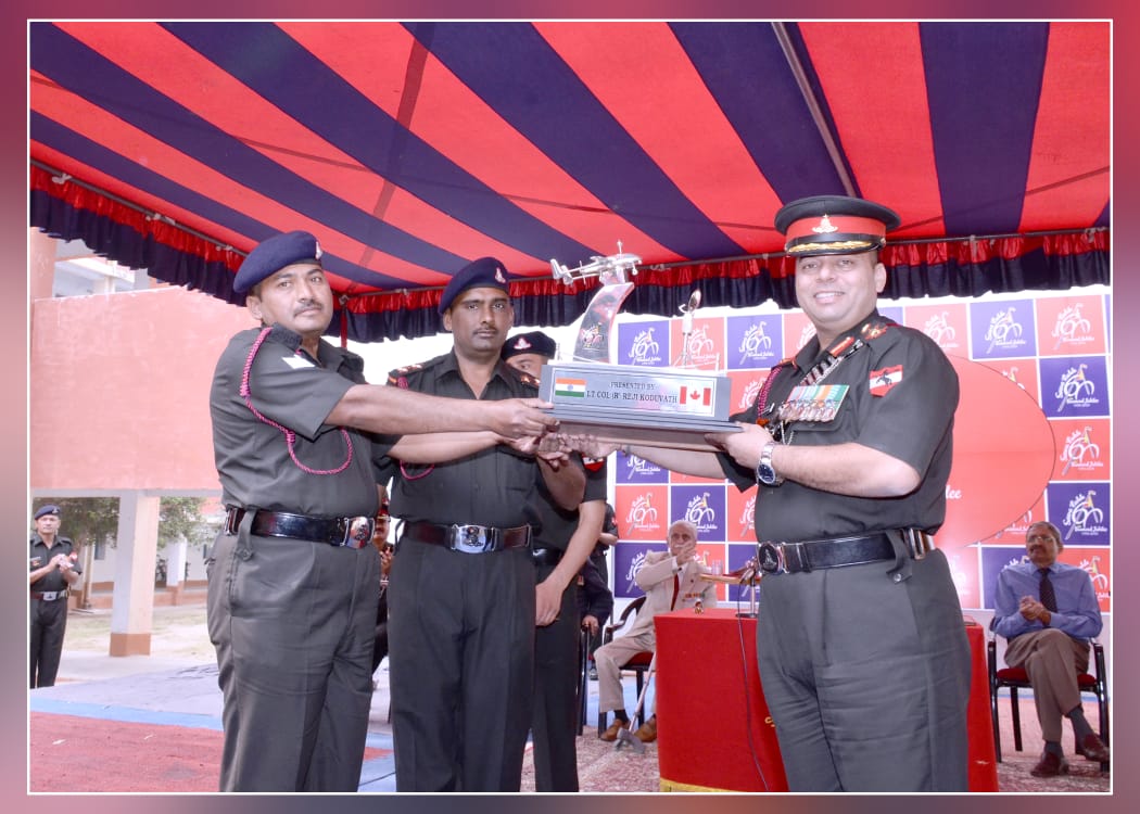


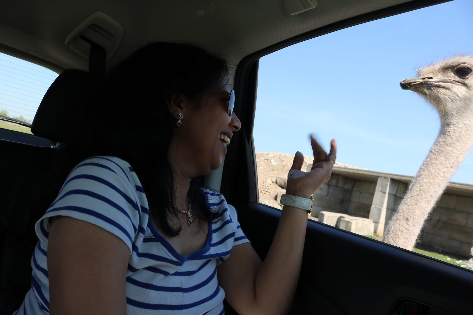
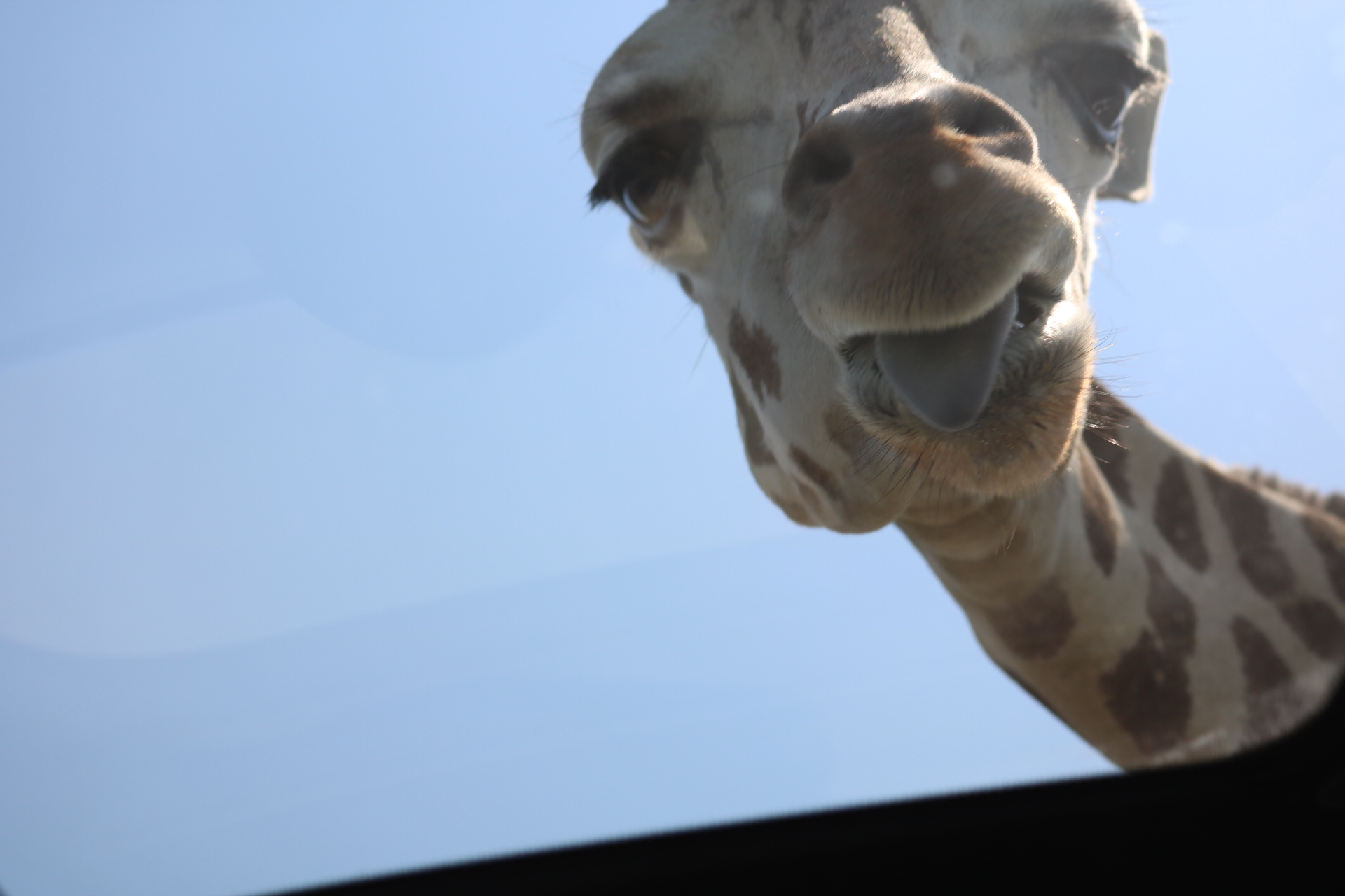

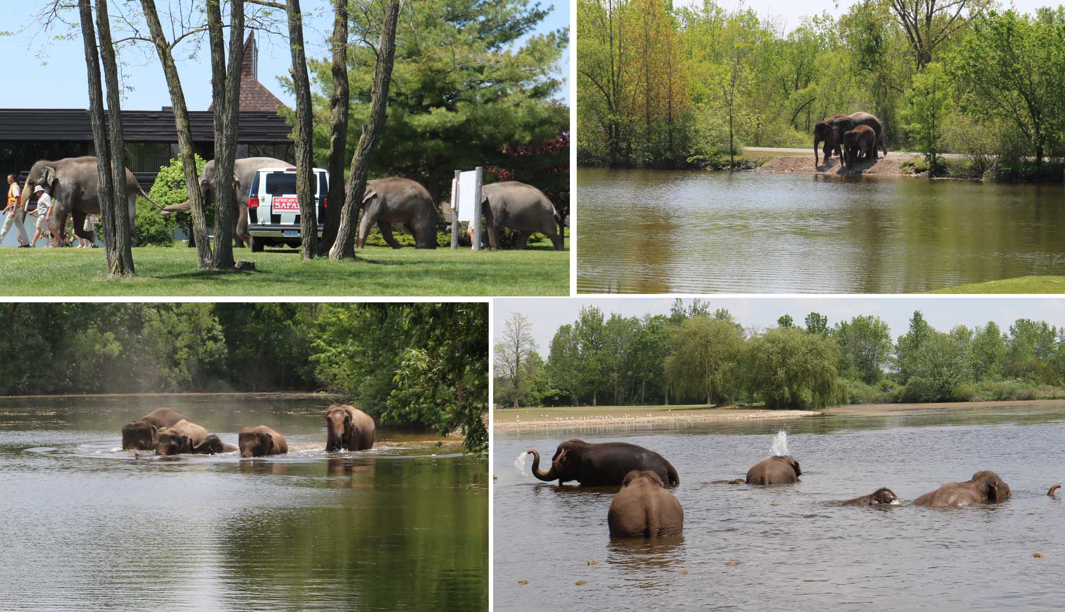

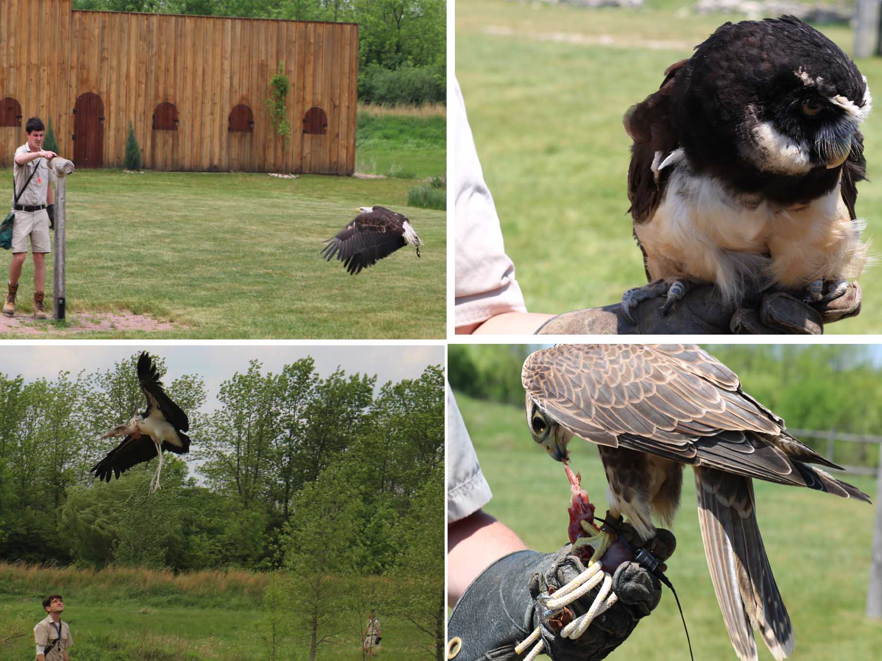


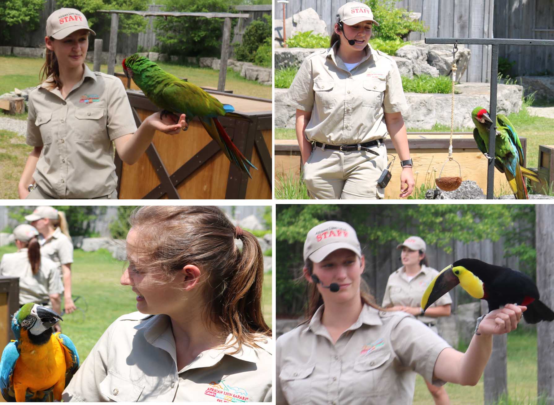


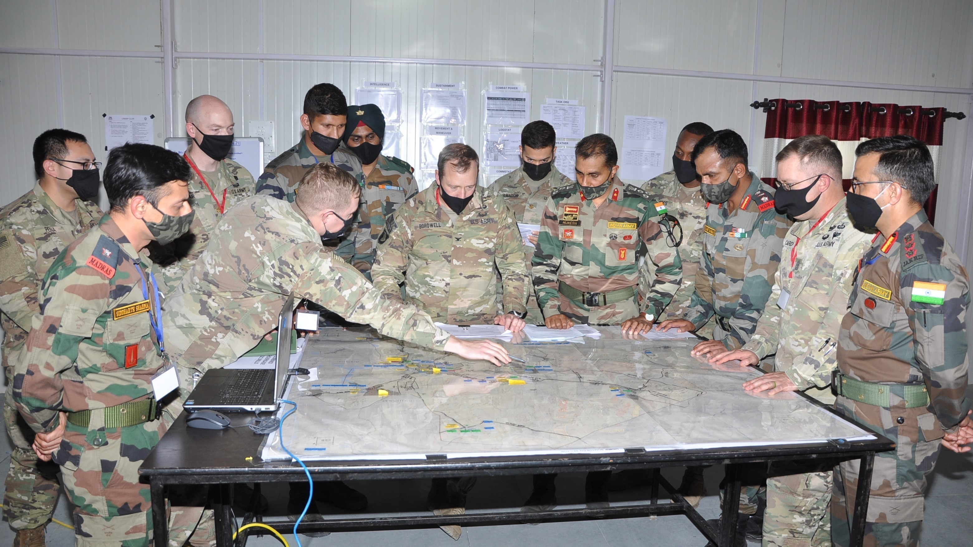
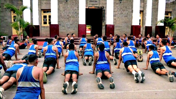


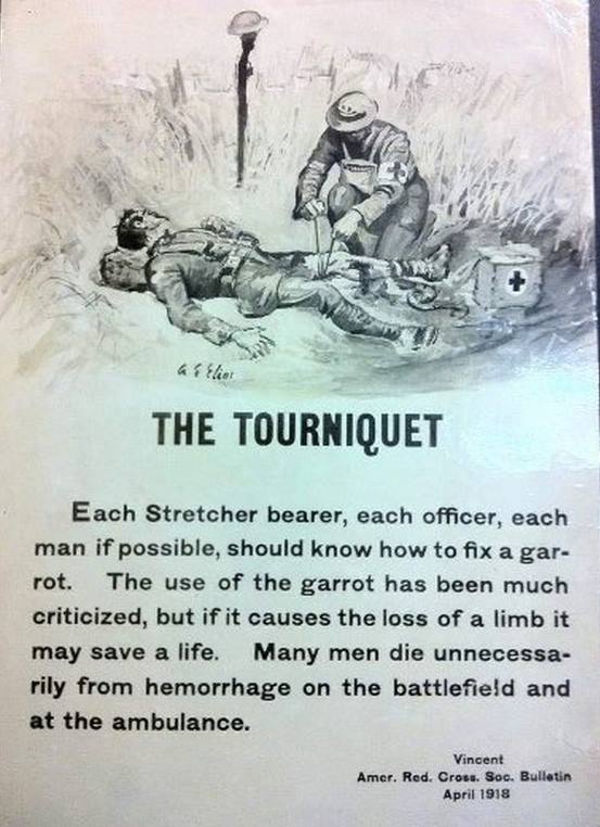


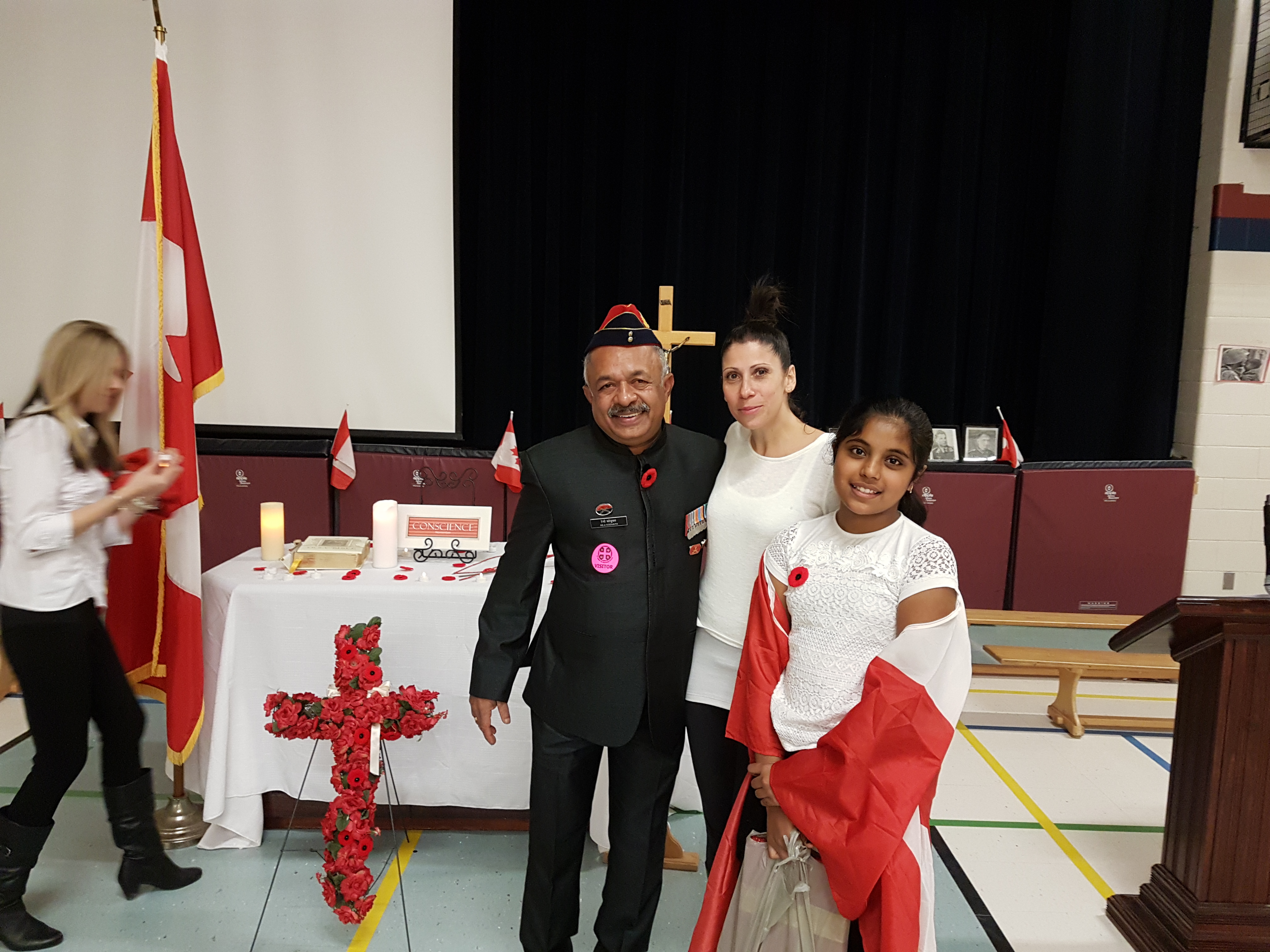
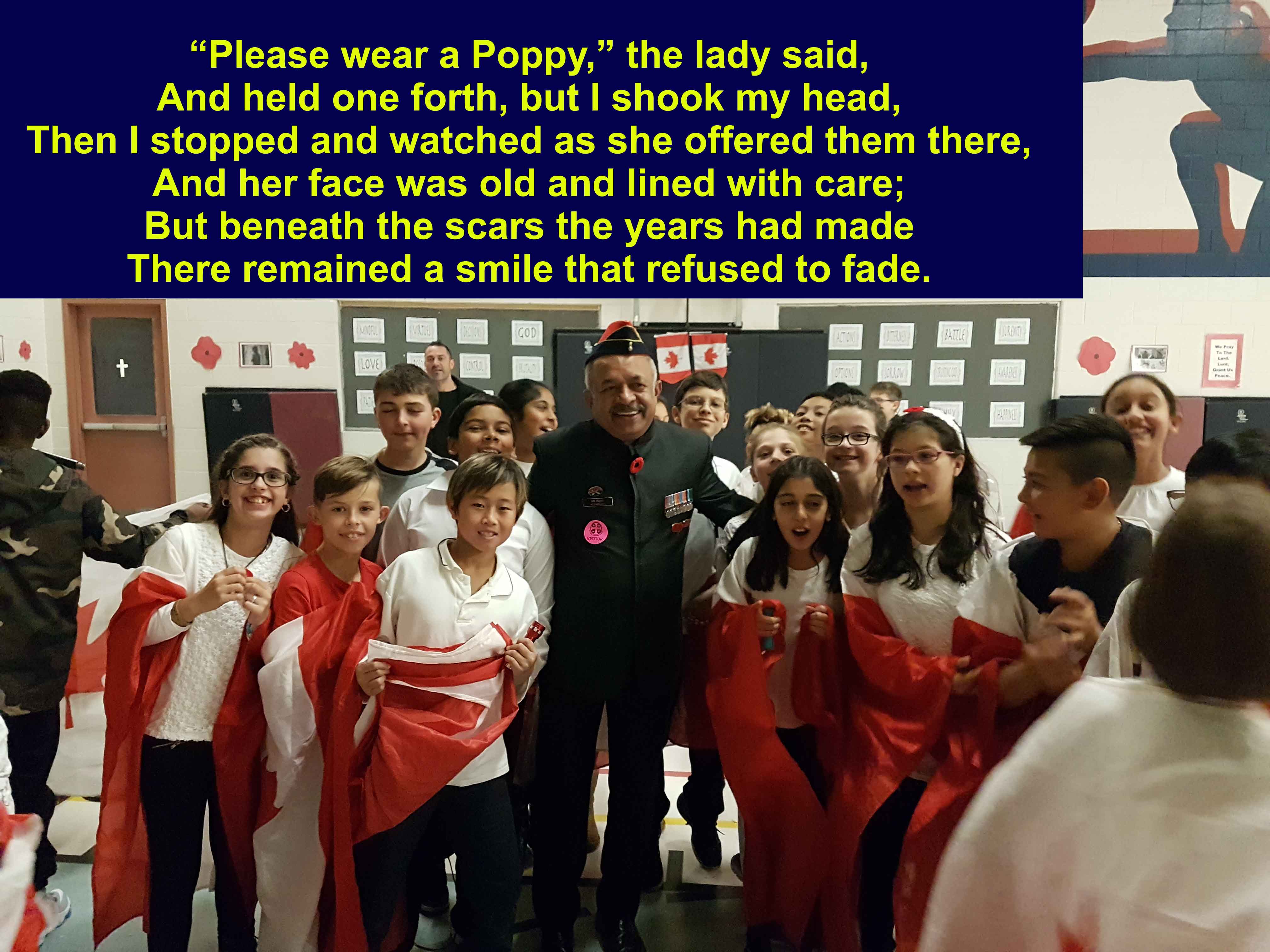
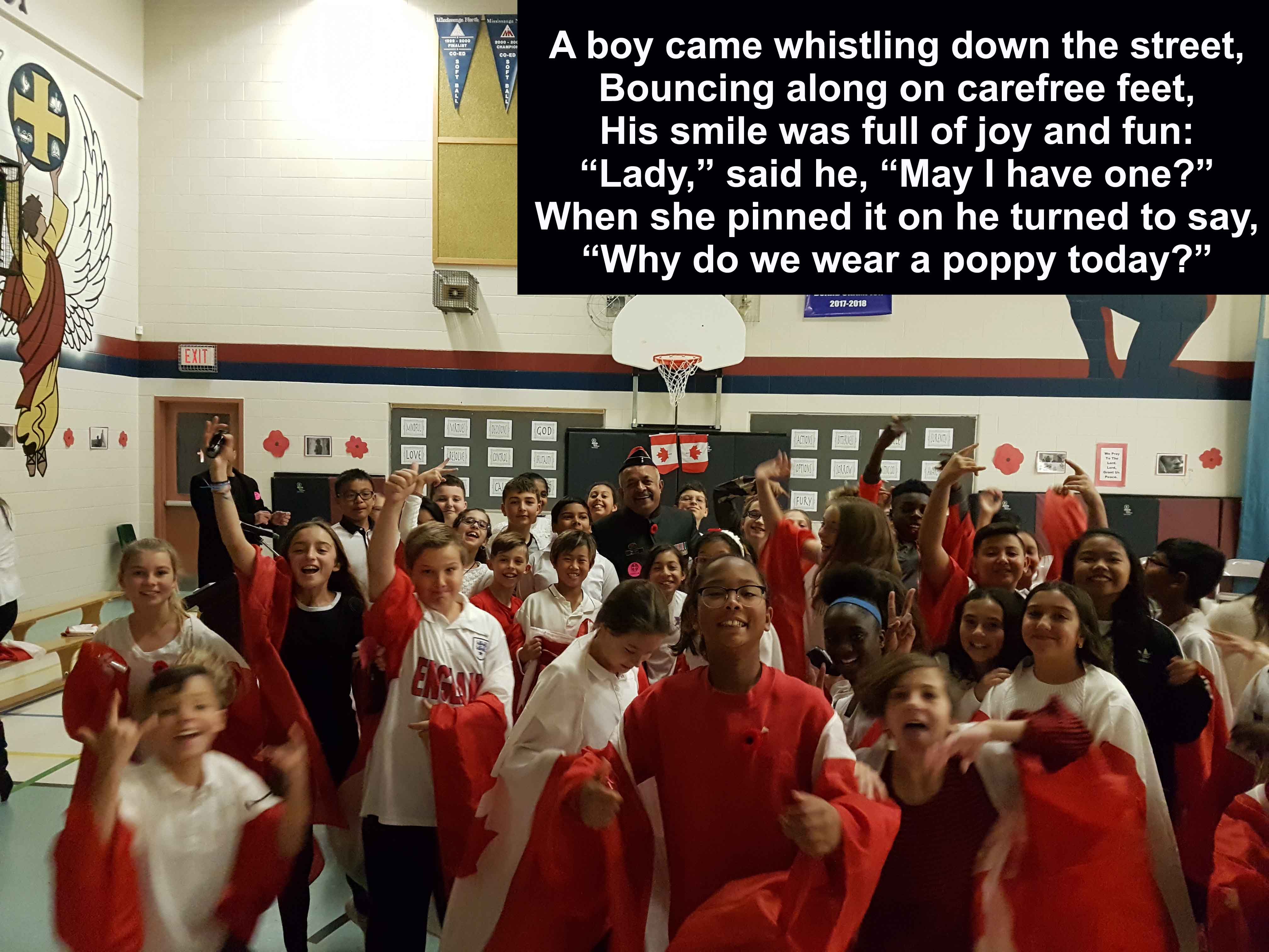


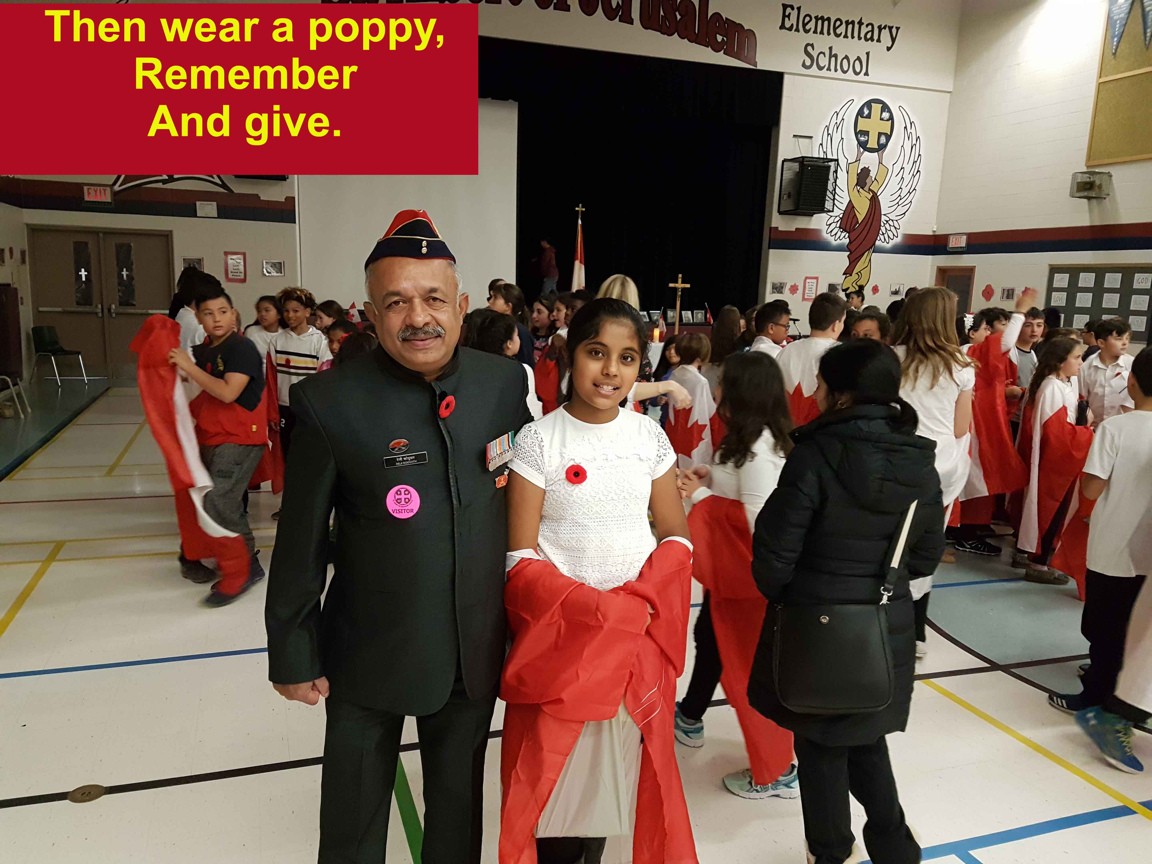
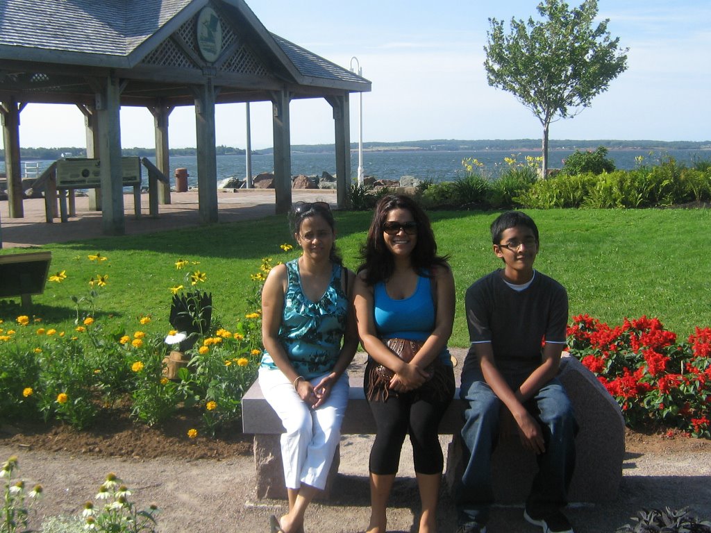


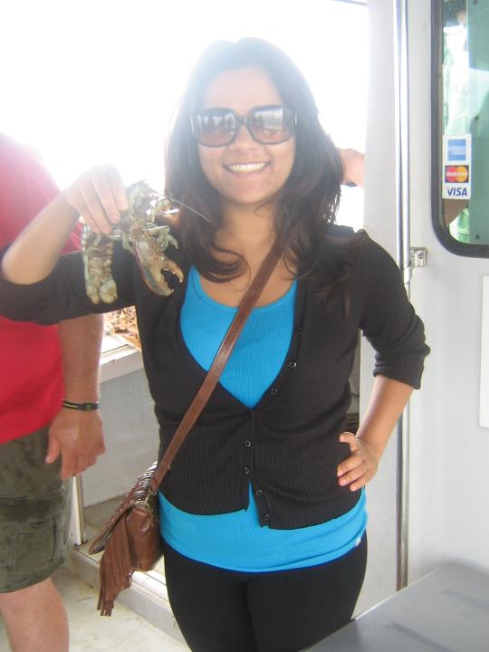
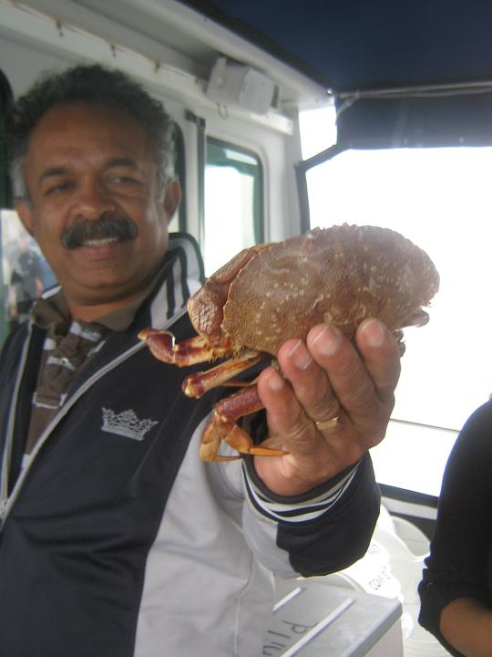


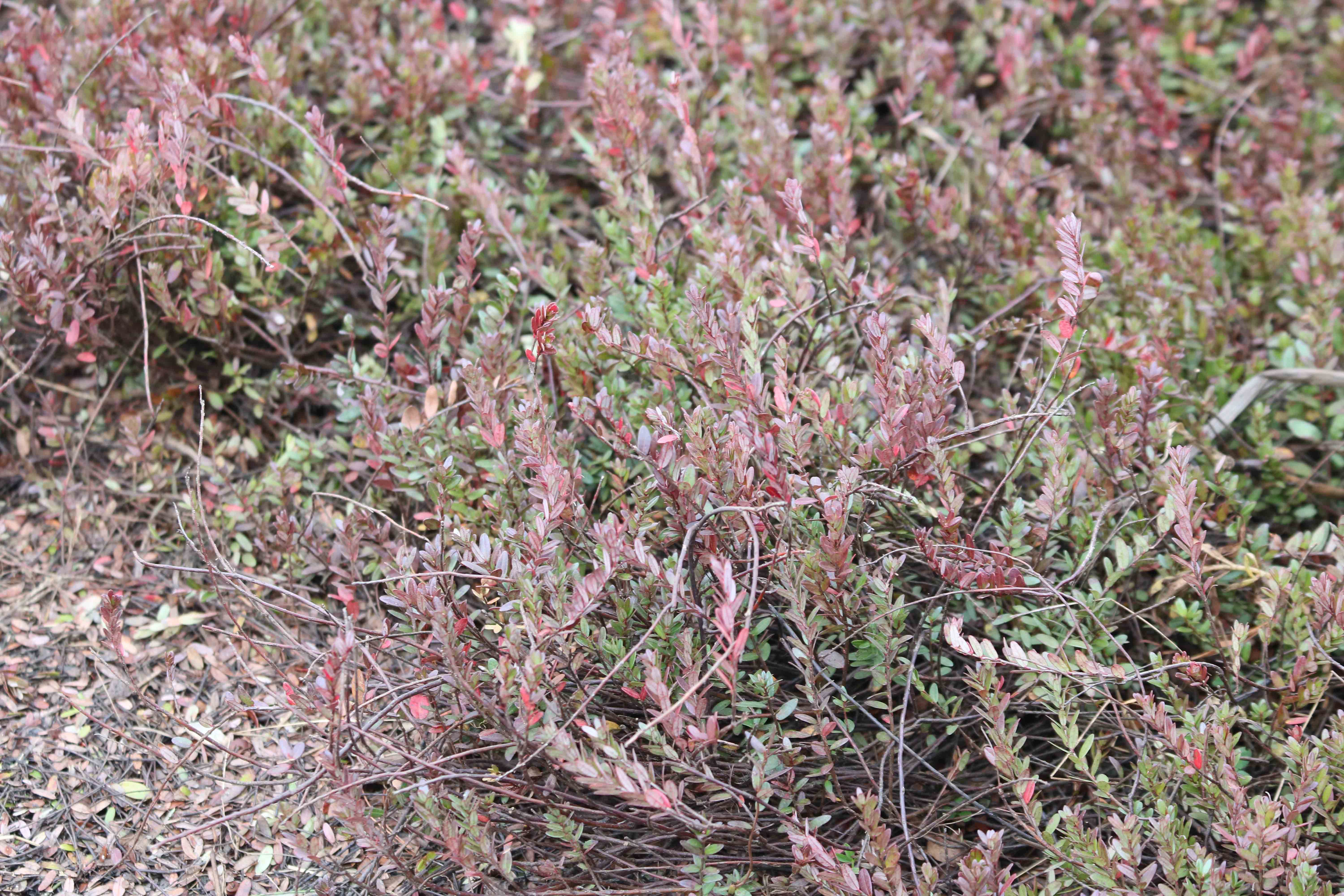

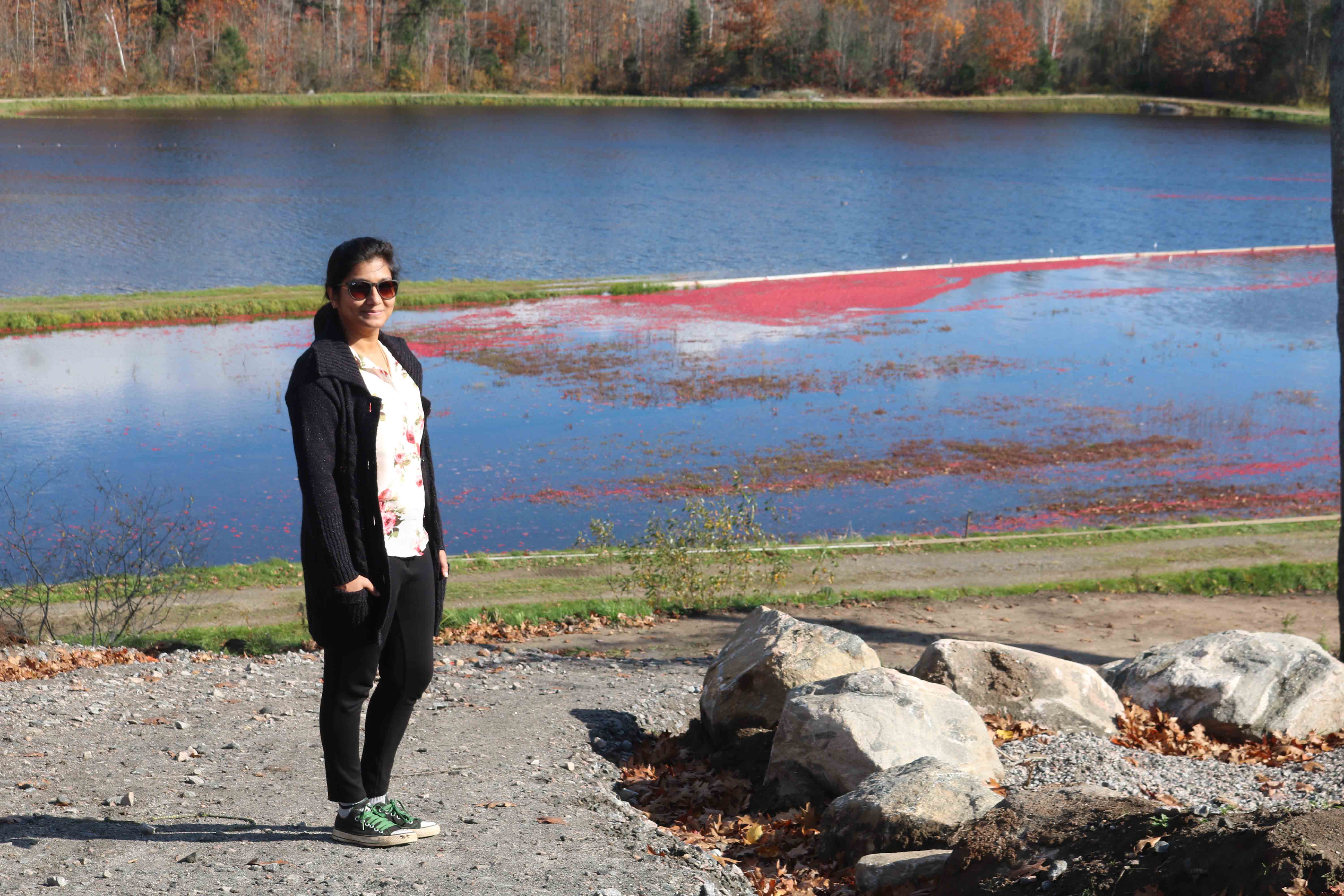


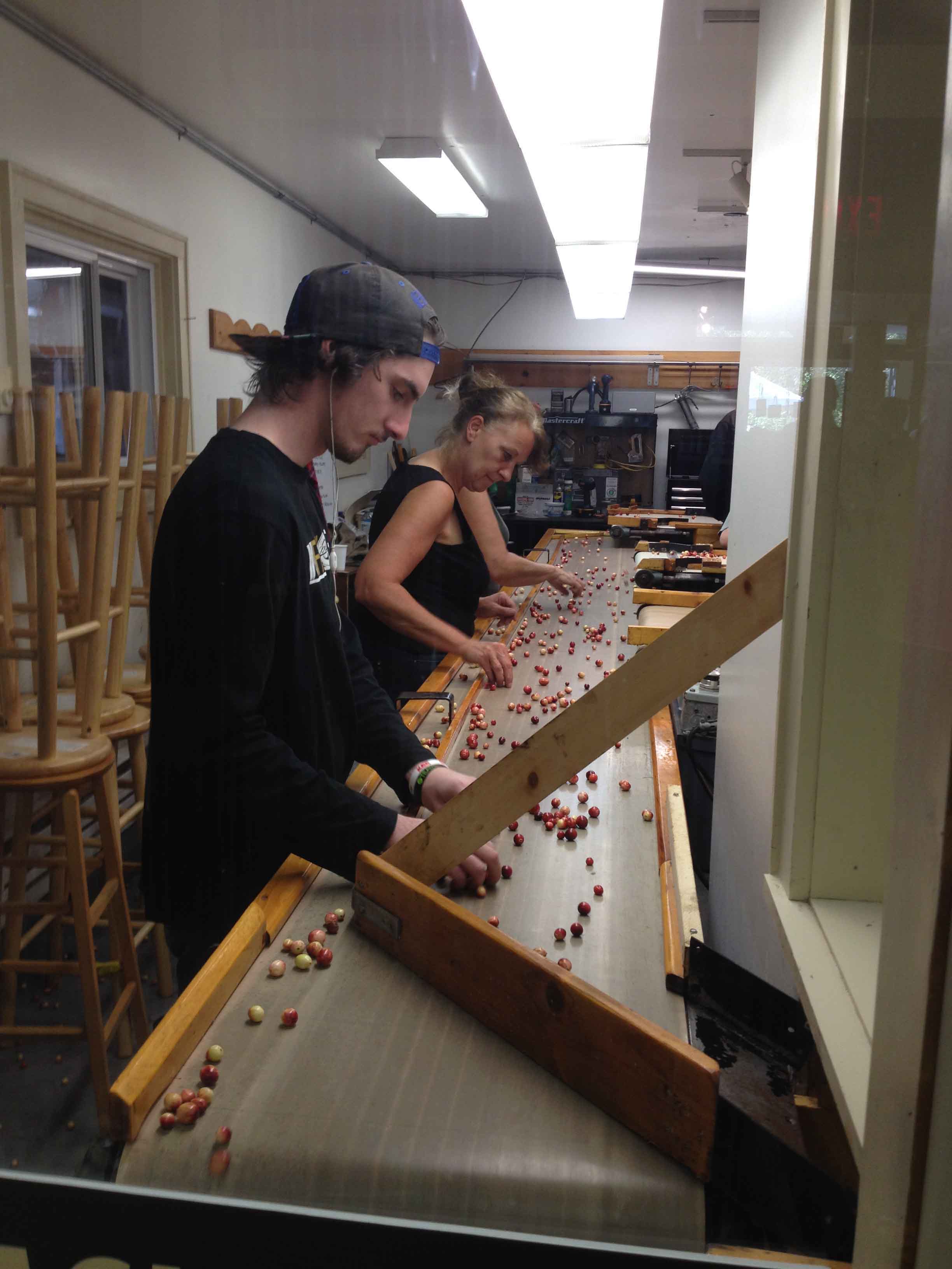


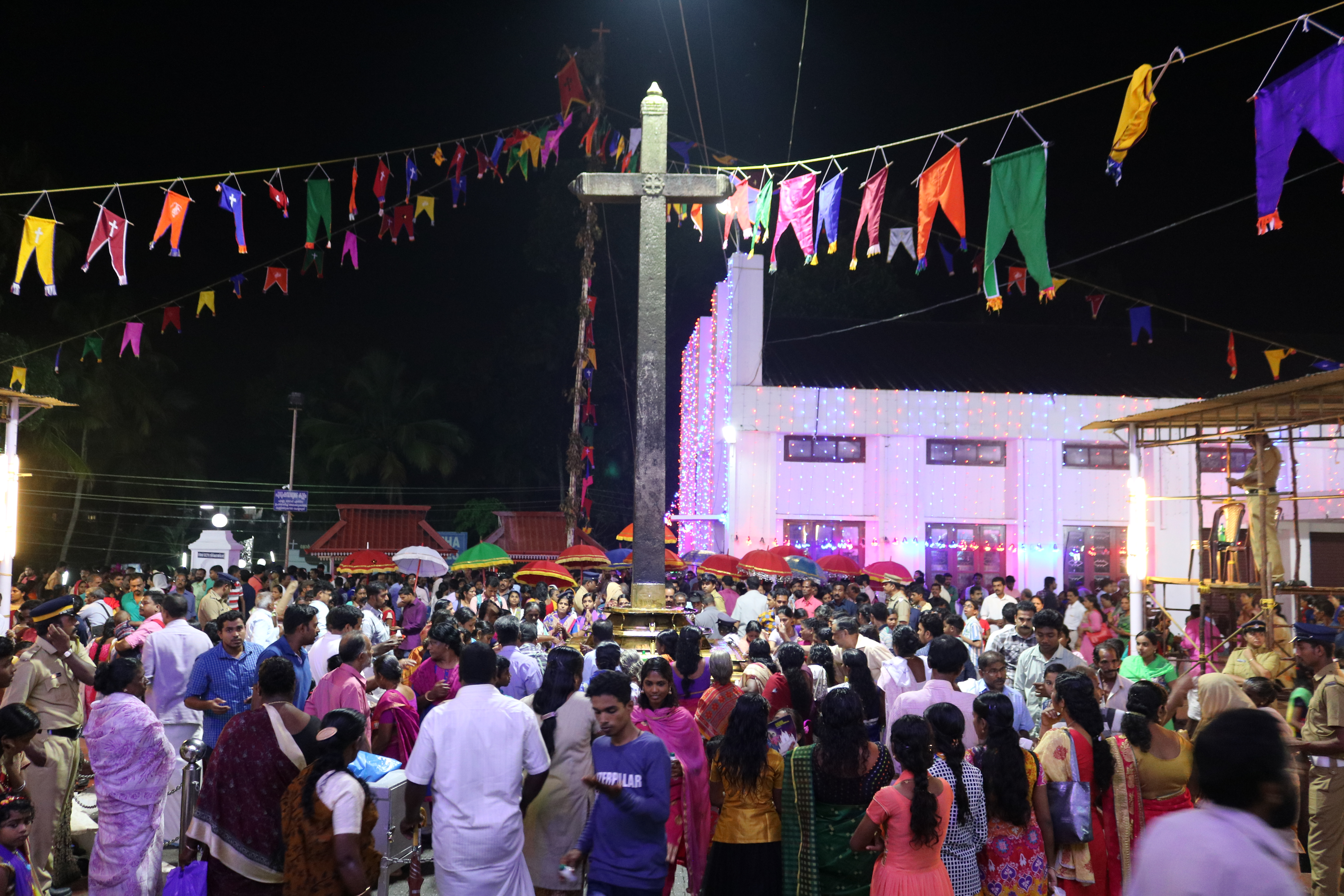


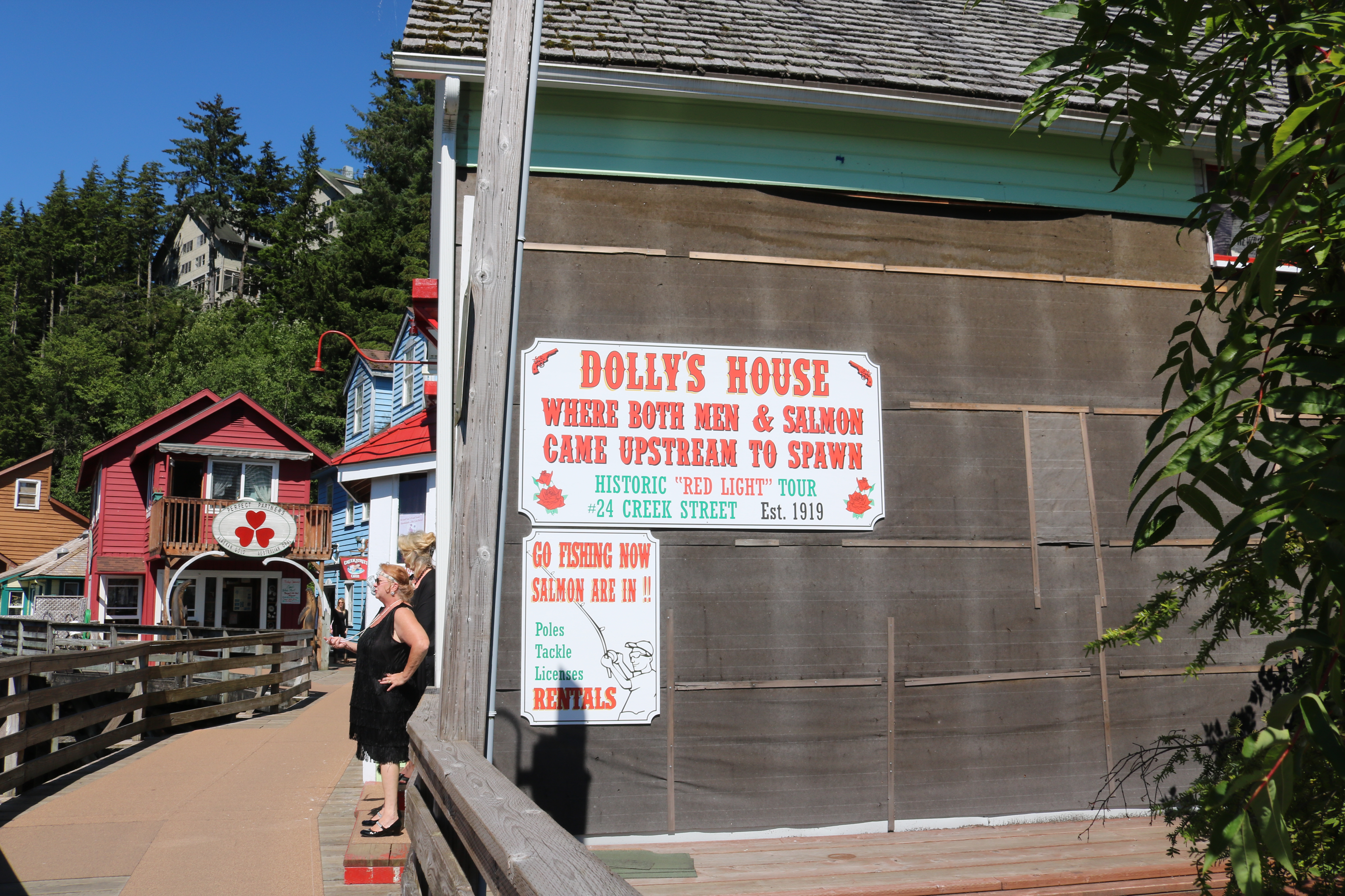


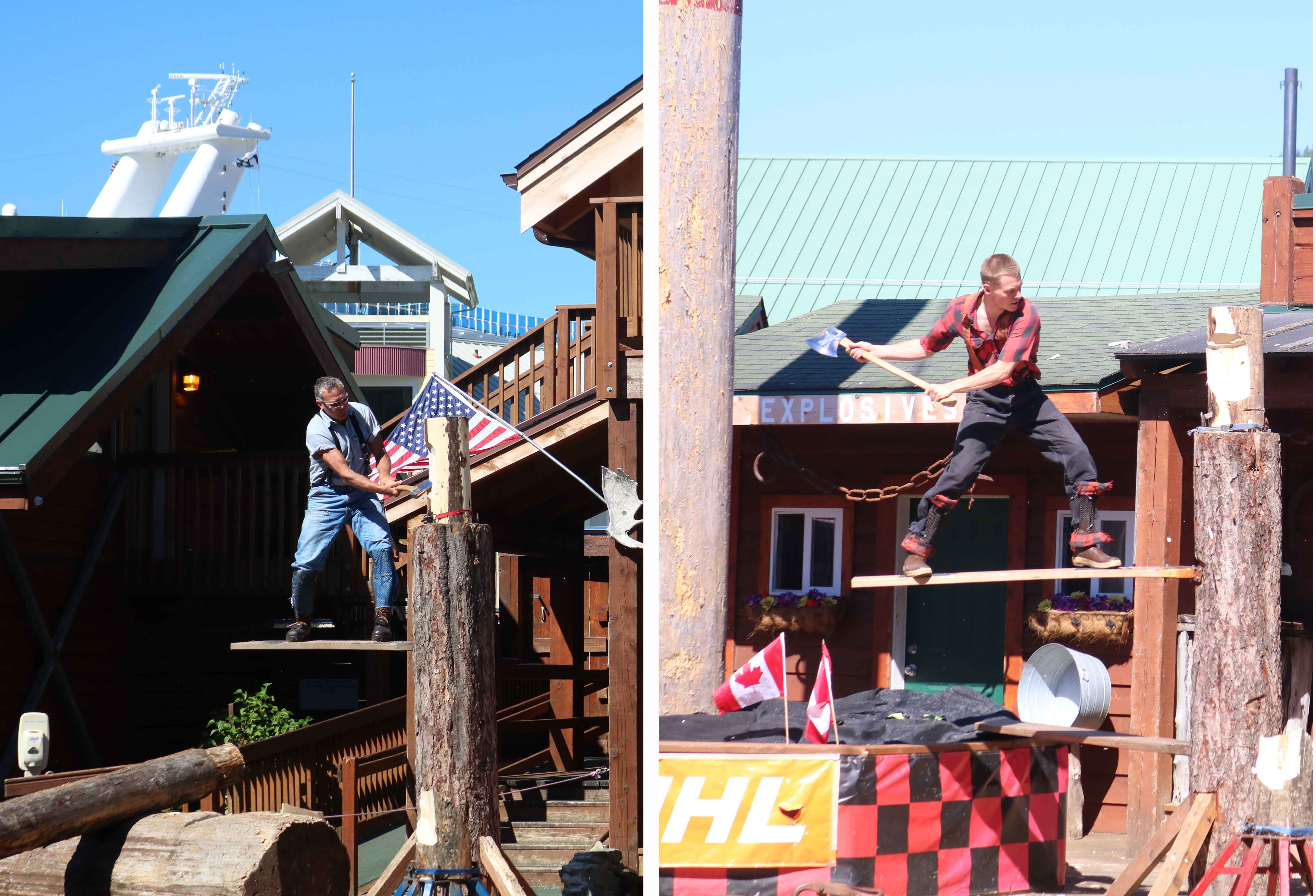
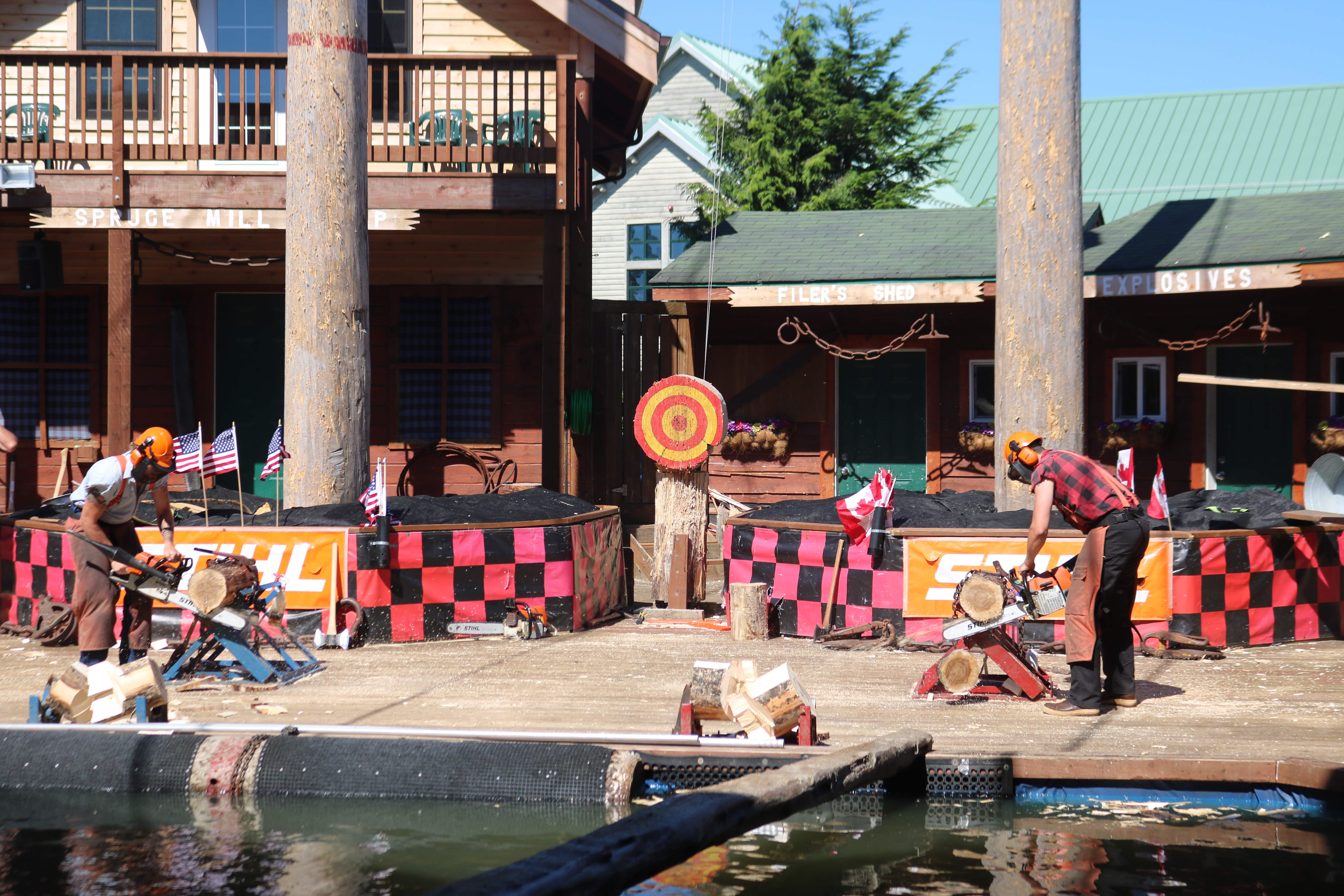
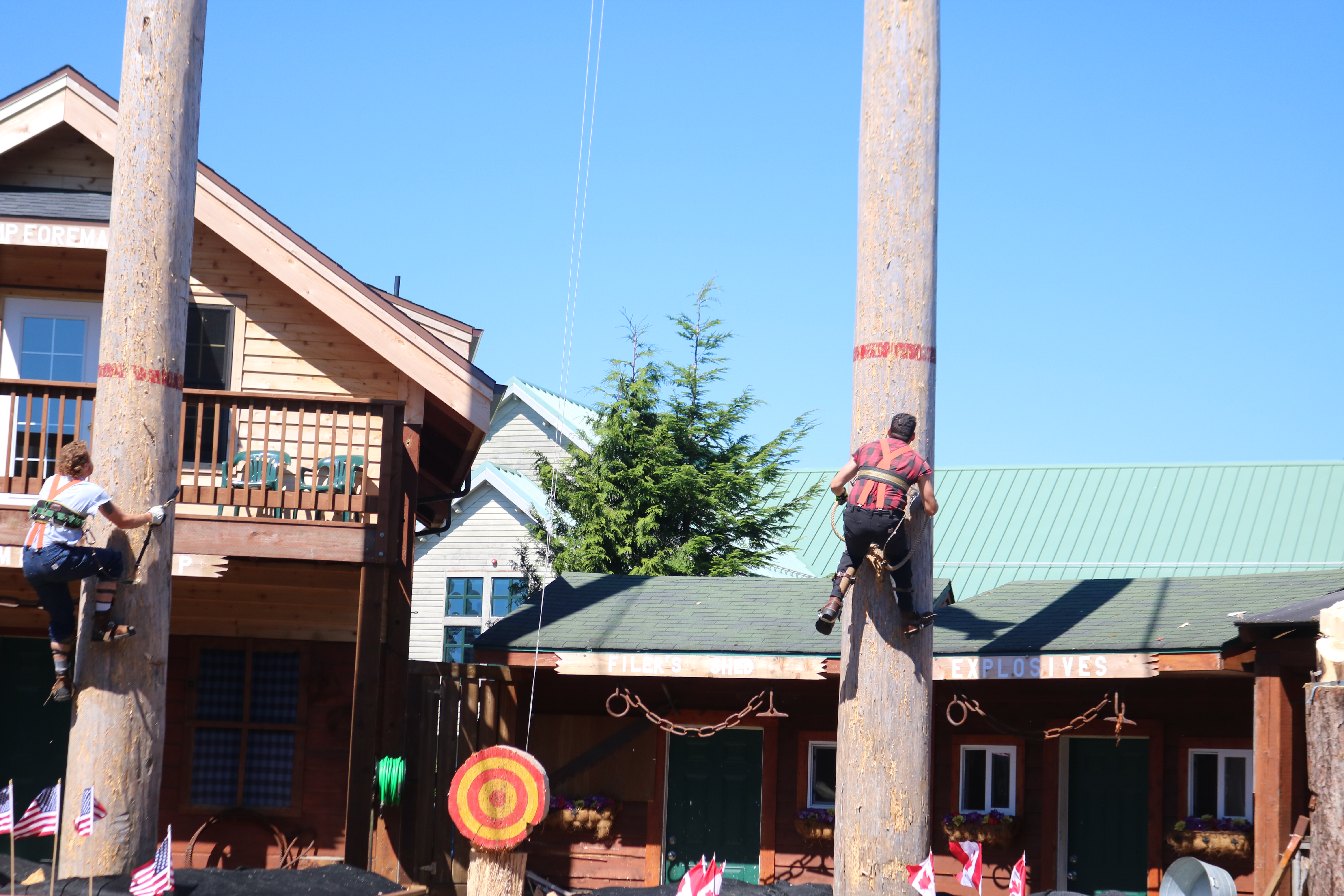


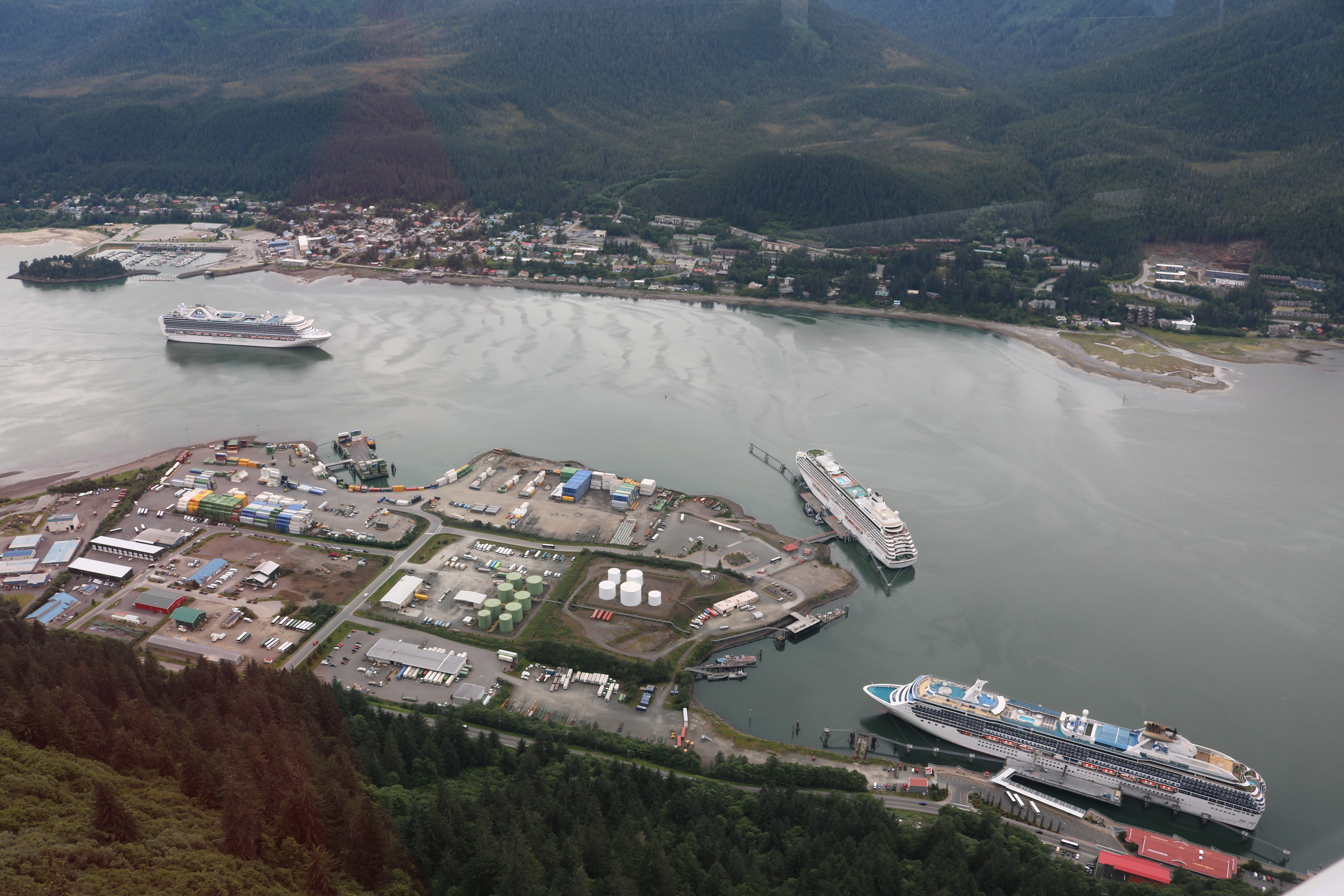


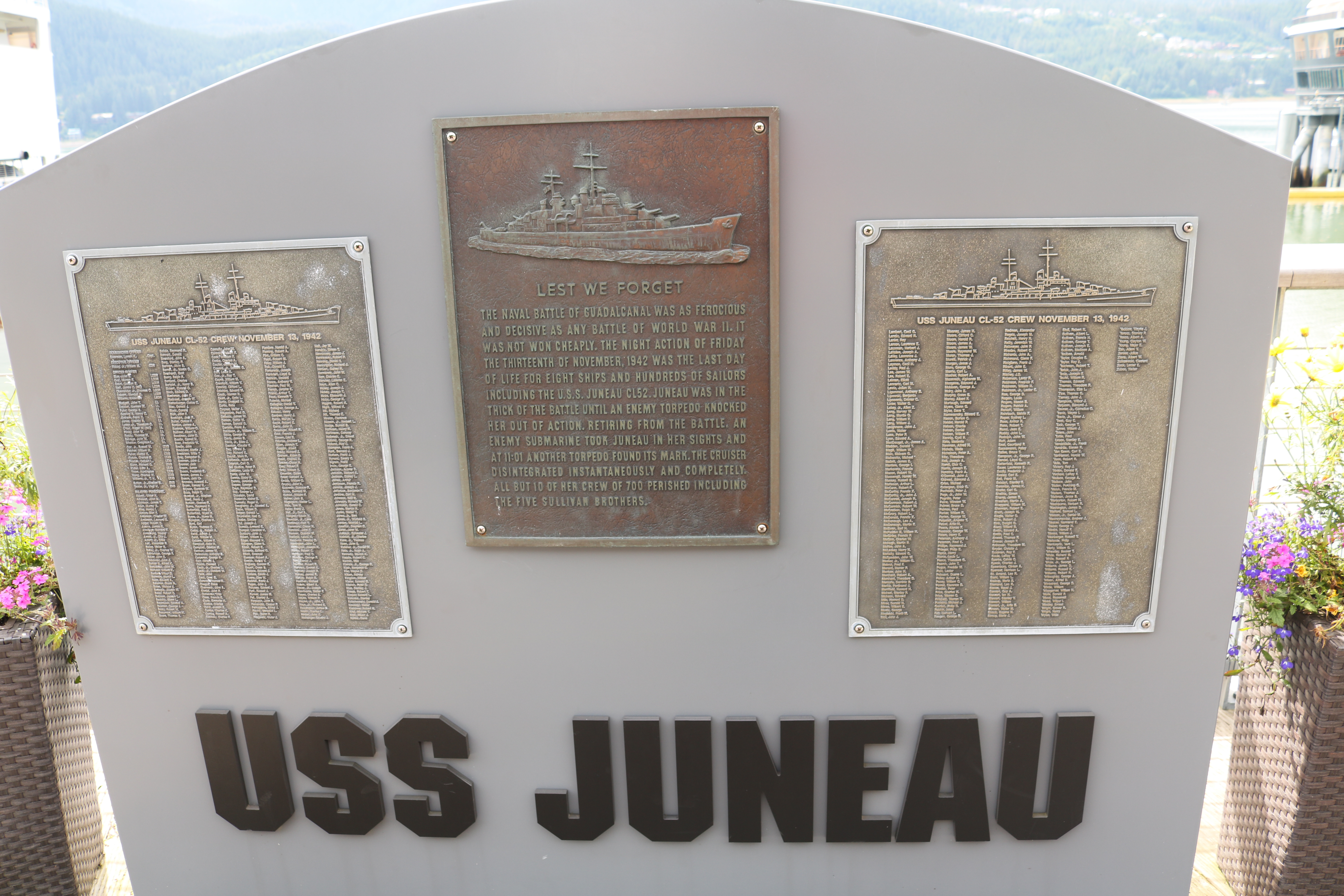

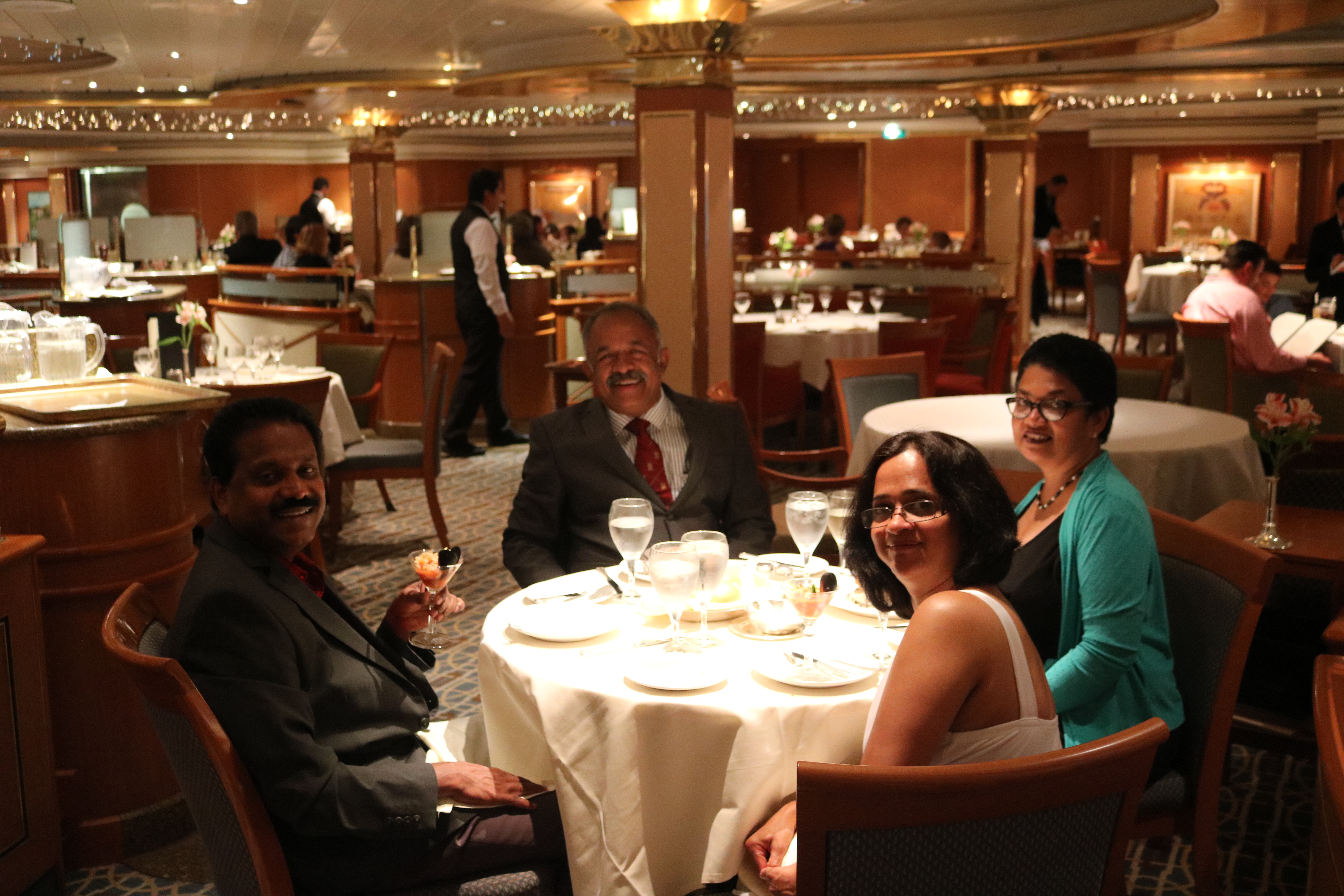


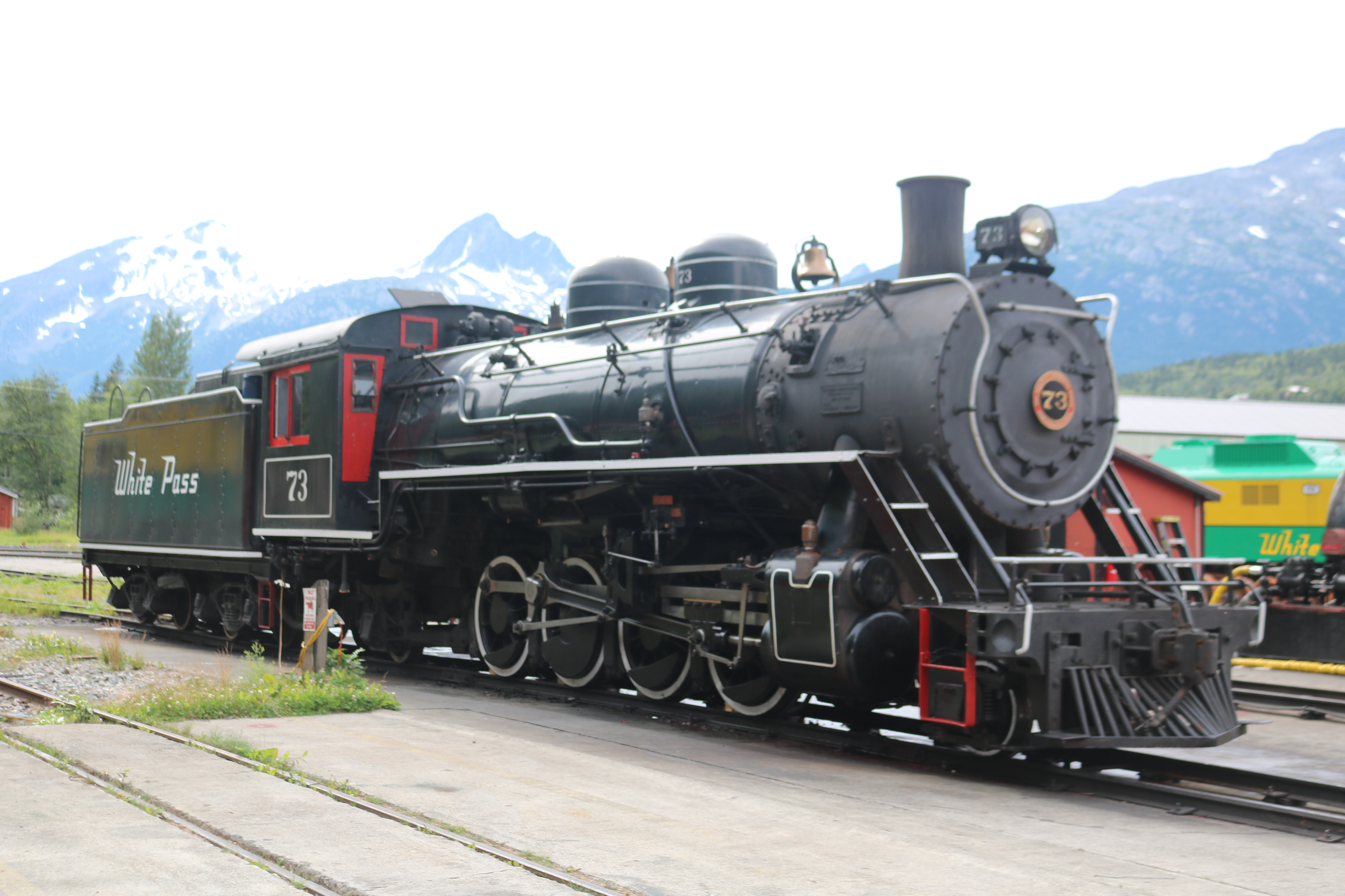


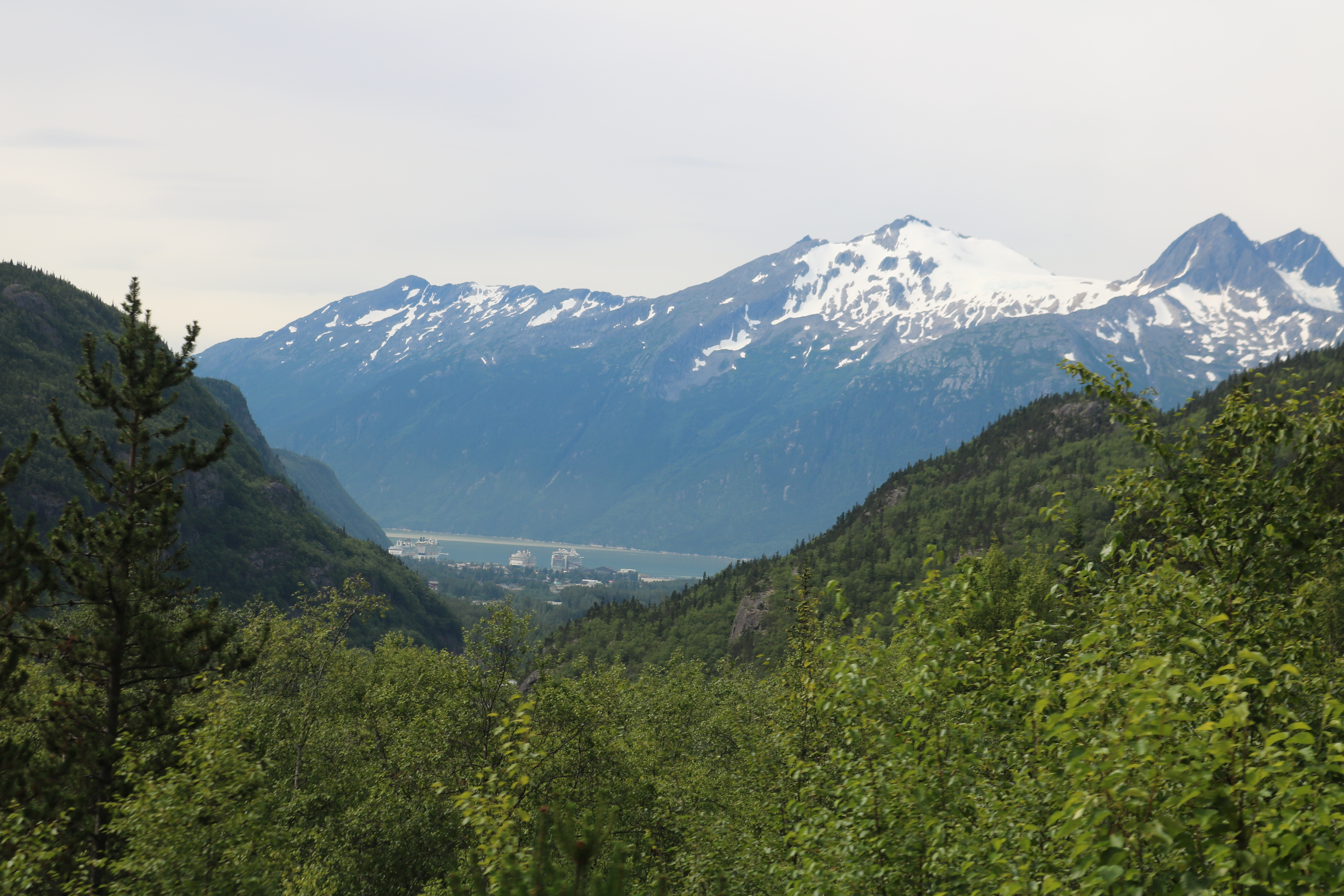
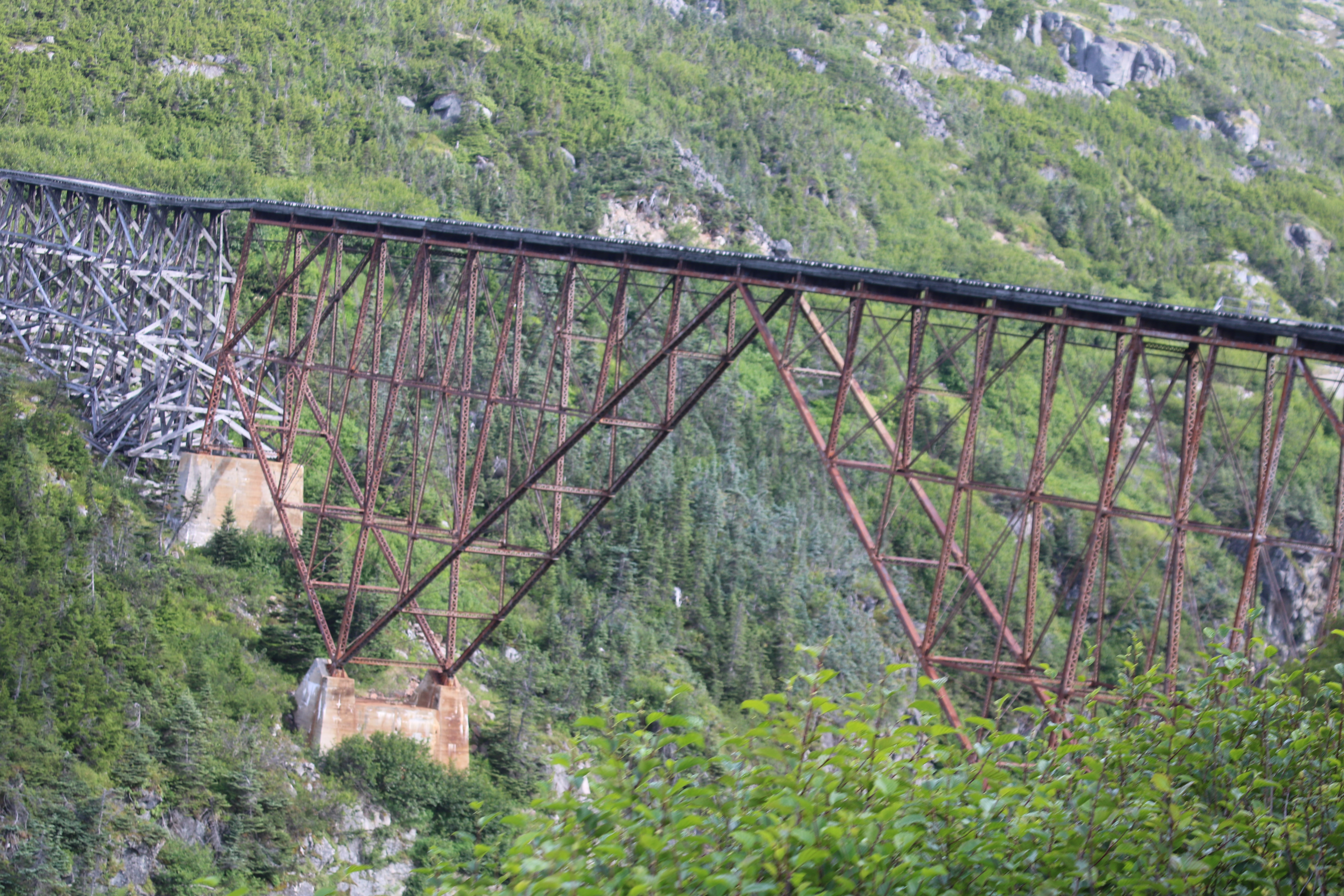


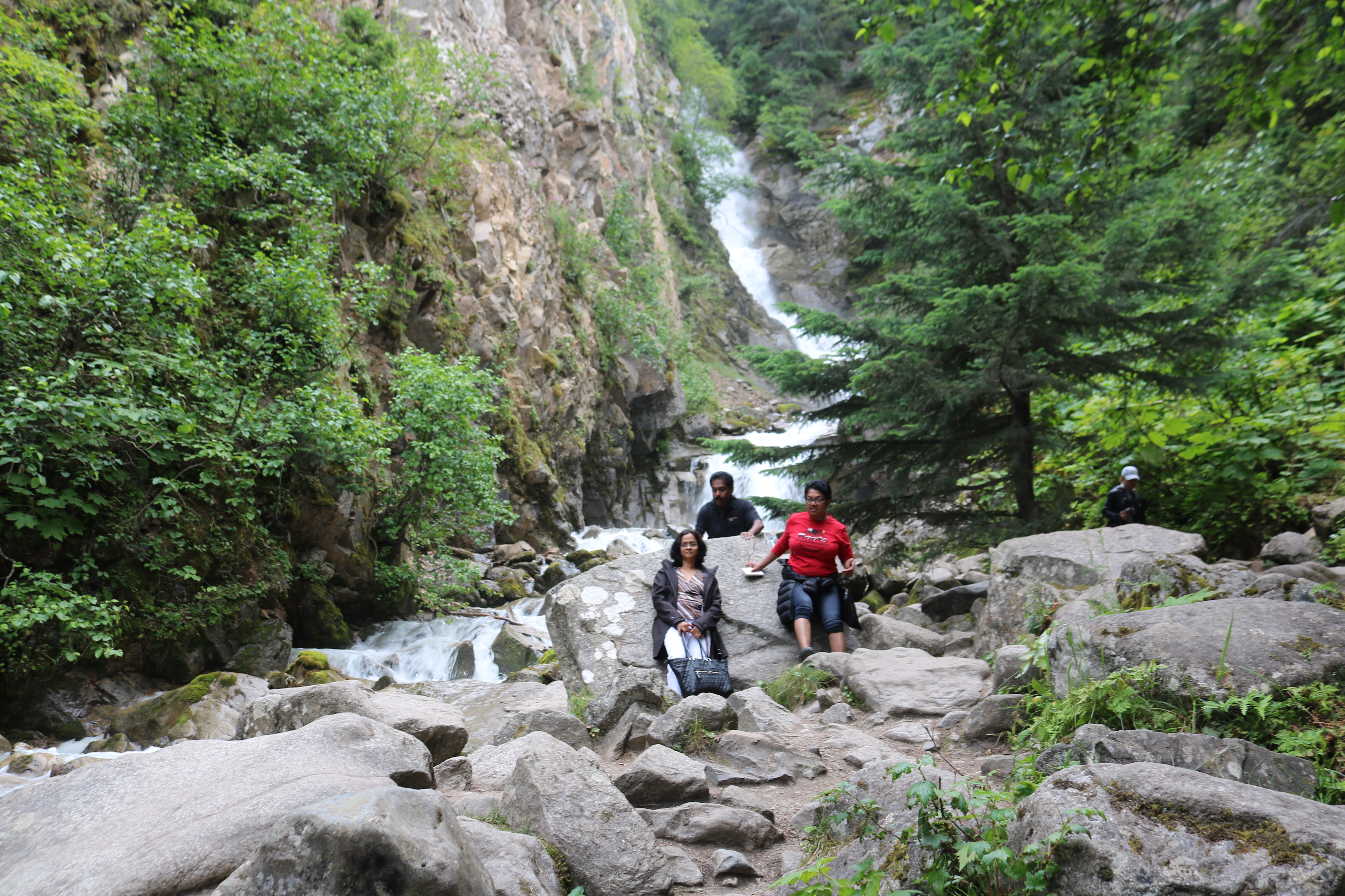


